Czech Corridor
Czech Corridor
The Polish Corridor is well known, which separated mainland Germany, Danzig free State and East Prussia as a result of Germany losing territory to Poland. What is not known, Czech corridor was proposed during the 1919 Paris peace talks. It was proposed to set aside a strip of territory to connect Czechoslovakia with the Kingdom of Slovenes, Croats and Serbs(Yugoslavia). The Czechs would've administered this territory. This territory would've been today's Austria's province of Burgenland, parts of Lower Austria and Hungarian counties of Moson, Sopron, Vas and Zala. It would've been 200 Kilometers and 80 kilometers wide. The population would've consisted of 662,000 Hungarians, 220,000 Slavs and 289,000 Germans. However this Czech corridor was rejected by the Paris peace talks.
Re: Czech Corridor
Frankly, Czechoslovakia would have looked a bit like Umberto Boccioni's 1913 statue Unique Forms of Continuity in Space (from a certain specific angle) if this proposal would have been approved:MMTB wrote:
https://en.wikipedia.org/wiki/Umberto_B ... ccioni.jpg

Re: Czech Corridor
Yes that's about right. If it did happen, I suppose it would've been renamed the Slovakian corridor as the Czechs and the Slovaks have gone their own way or Slovene/Slovak corridor.
Re: Czech Corridor
Or this corridor could have become its own independent state after the end of the Cold War, no?MMTB wrote:Yes that's about right. If it did happen, I suppose it would've been renamed the Slovakian corridor as the Czechs and the Slovaks have gone their own way or Slovene/Slovak corridor.
Re: Czech Corridor
It is possible. I wonder what population be in the majority. I assume the Hungarian majority and the sizable German population would've been expelled after the second world war. Therefore it would be mainly a Slovak country. Also name of this new country?

Re: Czech Corridor
I think population would be predominately Hungarian.MMTB wrote:It is possible. I wonder what population be in the majority. I assume the Hungarian majority and the sizable German population would've been expelled after the second world war. Therefore it would be mainly a Slovak country. Also name of this new country?
OTL majority of Hungarians stayed in Slovakia after WWII. Most of Hungarian expulsions were actually population exchanges with Hungary. Similar number of Slovaks from Hungary came to Slovakia as Hungarians went to Hungary. Some 41 000 Hungarians were internally transferred to Sudetenland.
They may offer lend to Czechs and Slovaks from Ukraine, Romania, Yugoslavia and Austria fro settling of course but would it help?
Unless some other method is used. But then if over 1 million Hungarians is living in Czechoslovakia after Cold War we may have few scenarios. Either Czechoslovakia will not fell apart as Slovaks will not want to end up with such a huge Hungarian minority, or after Czechoslovakia fell apart and with Meciar, who had nit best relations with Hungarians, Slovakia may go Yugoslavian way.
-
michael mills
- Member
- Posts: 9000
- Joined: 11 Mar 2002, 13:42
- Location: Sydney, Australia
Re: Czech Corridor
Last month I visited the Army Museum in Prague, which displayed the original map with the hand-drawn outline of the proposed Czechoslovak state, including the corridor to the territory of newly proclaimed Yugoslavia.
It was one of the documents presented to the United States Government in 1918 in support of Czechoslovak independence, and I think the outline was drawn by Masaryk himself.
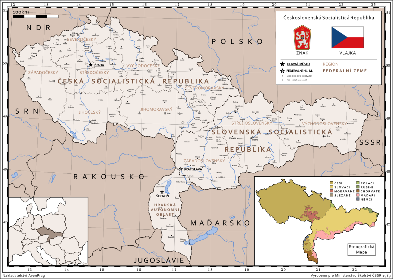
The map posted by MMTB shows post-1945 frontiers, not those of 1918. Does that mean that after 1945 the Czechoslovak Government again raised a claim to a to a corridor to Czechoslovakia.
The concept of a corridor to Yugoslavia carved out of the territory of the Kingdom of Hungary was not all that strange in the context of 1918, since at that time there was no entity called Slovakia, only Hungarian counties which had a Slovak element in their population. Thus, Slovakia was created by carving off the northern counties of Hungary, which also contained a substantial Magyar population.
In fact, the Slovakia that was created in 1918 was a lot larger than was justified on purely ethnic criteria, since the Czech nationalist leaders wanted the territory to be carved out of Hungary and joined to the Czech states of Bohemia and Moravia to have its southern border on the Danube. That meant incorporating territory along the southern border in which Slovaks were a minority.
Given that the new Slovakia was to a certain extent an artificial entity in that it was not truly ethnically based and had no historical validity, it would not have made much difference if even more territory with an ethnic Magyar majority had been carved out of Hungary in order to extend Slovakia to the south to have a border with Yugoslavia.
It should be noted that the inclusion of Bratislava in the new Slovakia was also entirely unjustified on ethnic grounds, since its population was mainly German and Magyar in 1918, and very few Slovaks lived there. Indeed, the very name Bratislava is entirely fictitious, since the city had never in history borne that name, and had always been known as Pozsony in Hungarian and Pressburg in German. Slavic-speakers had always called the city Prespurk, a slavonised version of its German name.
The most justifiable location of the capital of the new Slovakia, on ethnic, historical and geographical grounds, would have been Turciansky Svaty Martin, and indeed some elements of the Slovak Government are situated in that city today.
It was one of the documents presented to the United States Government in 1918 in support of Czechoslovak independence, and I think the outline was drawn by Masaryk himself.
The map posted by MMTB shows post-1945 frontiers, not those of 1918. Does that mean that after 1945 the Czechoslovak Government again raised a claim to a to a corridor to Czechoslovakia.
The concept of a corridor to Yugoslavia carved out of the territory of the Kingdom of Hungary was not all that strange in the context of 1918, since at that time there was no entity called Slovakia, only Hungarian counties which had a Slovak element in their population. Thus, Slovakia was created by carving off the northern counties of Hungary, which also contained a substantial Magyar population.
In fact, the Slovakia that was created in 1918 was a lot larger than was justified on purely ethnic criteria, since the Czech nationalist leaders wanted the territory to be carved out of Hungary and joined to the Czech states of Bohemia and Moravia to have its southern border on the Danube. That meant incorporating territory along the southern border in which Slovaks were a minority.
Given that the new Slovakia was to a certain extent an artificial entity in that it was not truly ethnically based and had no historical validity, it would not have made much difference if even more territory with an ethnic Magyar majority had been carved out of Hungary in order to extend Slovakia to the south to have a border with Yugoslavia.
It should be noted that the inclusion of Bratislava in the new Slovakia was also entirely unjustified on ethnic grounds, since its population was mainly German and Magyar in 1918, and very few Slovaks lived there. Indeed, the very name Bratislava is entirely fictitious, since the city had never in history borne that name, and had always been known as Pozsony in Hungarian and Pressburg in German. Slavic-speakers had always called the city Prespurk, a slavonised version of its German name.
The most justifiable location of the capital of the new Slovakia, on ethnic, historical and geographical grounds, would have been Turciansky Svaty Martin, and indeed some elements of the Slovak Government are situated in that city today.
Re: Czech Corridor
True. Interestingly Bratislava was basically surrounded by Slovak villages. To be honest, population was mostly German. On other side, it would probably be till now small provincial town with not much industry.michael mills wrote:It should be noted that the inclusion of Bratislava in the new Slovakia was also entirely unjustified on ethnic grounds, since its population was mainly German and Magyar in 1918, and very few Slovaks lived there. Indeed, the very name Bratislava is entirely fictitious, since the city had never in history borne that name, and had always been known as Pozsony in Hungarian and Pressburg in German. Slavic-speakers had always called the city Prespurk, a slavonised version of its German name