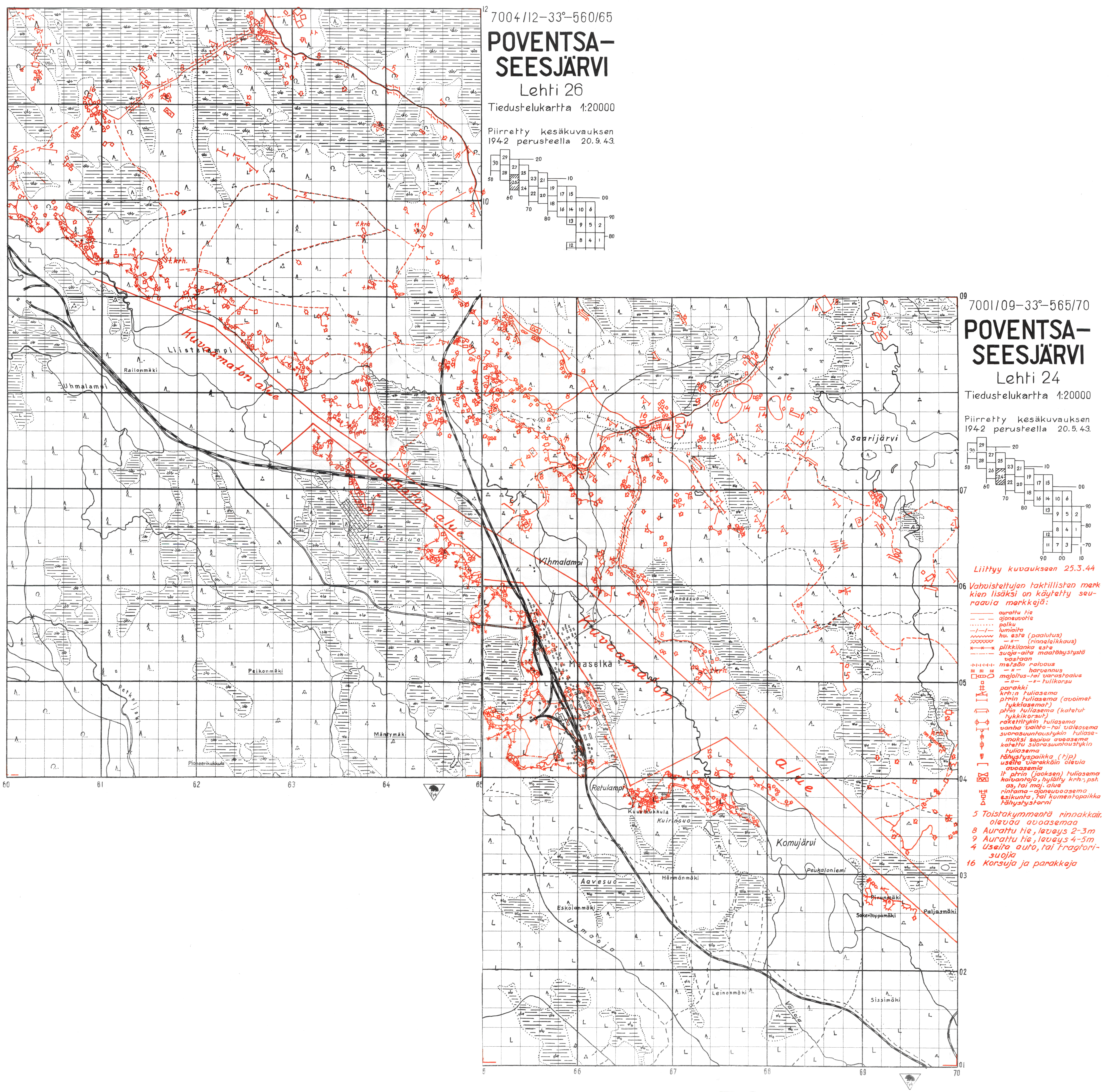
Here are complete set of 1:20 000 topographic maps made in 1943 and 1944 by Topografipataljoona. Apparently the scans are made from originals at the National Archives of Finland and/or National Defence University library.kuuskajaskari wrote: ↑02 Jul 2022, 09:12What is the easiest way to find these, as they say in Finnish "from the national school base"...
Maps
Re: Maps
-
kuuskajaskari
- Member
- Posts: 150
- Joined: 02 Nov 2010, 20:32
- Location: kakonkulma
Re: Maps
Hi, thank you very much.
I actually knew this link but couldn't remember. Now it's stored, not just in memory.
best regards Jukka
btw there`s much more, Rukajärvi etc.
I actually knew this link but couldn't remember. Now it's stored, not just in memory.
best regards Jukka
btw there`s much more, Rukajärvi etc.
Re: Maps
Hi
Could somebody help with H -squares used to report position during the continuation war.
At present I am writing about the war on the Hanko isthmus june-december 1941. Observation (target) position was referred with the letter H and a 5-digit number. I have a few references, but not enough to solve how the code was built. It also seems that it is not linear. Squares on consecutive rows do not end in the same digits. These H-squares were mostly used at sea, in in my case the water between Hanko and Hitis,
Some examples:
H 49459 Maltskär
H 49474 Ljusskär
H 49492 Tulludden, Hangö
H 49496 Rödskär
It would be great if somebody could advise on the algorithm, or provide a link to a map with the system. My guess is that I do not need a map of the Hanko area, any identifiable area with sufficient info to expand the square pattern will do.
Thanks
And btw, thanks for the info abouve on the maps, will be needed for the next project,JR24, where my granddad served from 1941.
Re: Maps
Hello out there.
I did manage to resolve the issue from a lot of separate reports.
It just took some three years.
Here are my results. Attached as a map.
It seems tar he system was abandoned after Russians left the Hanko area in early December 1941.
For further investigation the mentioned coordinate system seems to have been abandoned from beginning of 1942.
I am unable to upload the result because the file i too large (sic). Anybody interested can request it from me though.
Peter L
-
Seppo Koivisto
- Member
- Posts: 760
- Joined: 20 Nov 2006, 23:49
- Location: Finland
Re: Maps
You can find some information on the Finnish reporting map systems from these links.
https://www.flightforum.fi/topic/49298- ... nt-1003202
https://www.flightforum.fi/topic/49486-ruutukartta/
https://www.flightforum.fi/topic/49298- ... nt-1003202
https://www.flightforum.fi/topic/49486-ruutukartta/
Re: Maps
Gulf of Finland
- Linnoituspataljoona 4's gun positions between Toivola - Laivastoniemi - Toni - Hännilä - Inonniemi on 2 October 1941 (SPK 18112).
- Ibid on 5 October 1941 (SPK 18112).
- Ibid on 20 October 1941 (SPK 18112).
- Ibid on 11 November 1941 (SPK 18112).
- Linnoituspataljoona 4's gun positions between Lautaranta - Seivästö - Inonniemi on 15 November 1941 (SPK 18112).
- Ibid on 22 December 1941 (SPK 18112).
- Ibid on 2 February 1942 (SPK 18112).
- 1./ and 2./Linnoituspataljoona 4's positions between Seivästö and Vitikkala on 8 February 1942 (SPK 18112).
- 3./Linnoituspataljoona 4's and 34. Torjuntakomppania's positions between Vitikkala and Inonniemi on 10 February 1942 (SPK 18112).
- Linnoituspataljoona 4's positions between Seivästö and Inonniemi on 10 February 1942 (SPK 18112).
- Linnoituspataljoona 4's and 34. Torjuntakomppania's positions between Lautaranta - Seivästö - Ino in February 1942 (SPK 18112).
- 3./Linnoituspataljoona 4's positions in Inonniemi on 27 February 1942 (SPK 18112).
- Linnoituspataljoona 4's positions between Seivästö and Ino in March 1942 (SPK 18112).
- Coordinate grid between Uusikirkko, Seivästö and Ino, March 1942 (SPK 18112).
- Linnoituspataljoona 4's fortifications between Seivästö and Ino in September 1942 (SPK 18112).
- Linnoituspataljooan 4's gun positions between Seivästö and Ino on 7 October 1942 (SPK 18112).
- Linnoituspataljoona 4's positions around Valkeasaari / Aleksandrovka on 15 October 1942 (SPK 18112).
- Ibid on 5 November 1942 (SPK 18112).
- Ibid on 19 November 1942 (SPK 18112).
- Ibid on 2 December 1942 (SPK 18112).
Re: Maps
Hi,
Thanks for your kind information.
As mentioned, I write about the events on the Hanko peninsula in 1941. For long I was unable to solve the H squares used mainly in the Hilo (Hitis) area. The puzzle started to solve when processing the LLv 6 (Lentolaivue 6) diaries. There was references to H squares and island names, etc mainly in the gulf of Finland and on the Estonian coast. Plotting these on a map (Suomenlahden Ilmoituskartta ) solved the system. The square numbering is not linear.
There was not enough info on squares close to St Peterburg (Leningrad at the time) to solve those squares and squares w of Hitis had also too little info in LLv 6 diaries. Note anyhow that a new number series appear in the lower left.
In the LLv 6 diaries were also some interesting info on how the Germans proceeded in Estonia. As i could not find a suitable background map in the public domain, I made one. Below is a situation map for 24.8.1941.
Best regards,
Peter L
Thanks for your kind information.
As mentioned, I write about the events on the Hanko peninsula in 1941. For long I was unable to solve the H squares used mainly in the Hilo (Hitis) area. The puzzle started to solve when processing the LLv 6 (Lentolaivue 6) diaries. There was references to H squares and island names, etc mainly in the gulf of Finland and on the Estonian coast. Plotting these on a map (Suomenlahden Ilmoituskartta ) solved the system. The square numbering is not linear.
There was not enough info on squares close to St Peterburg (Leningrad at the time) to solve those squares and squares w of Hitis had also too little info in LLv 6 diaries. Note anyhow that a new number series appear in the lower left.
Peter L
Re: Maps
About Finnish VVJ and KKJ coordinate systems
The Finnish implementation of Gauss-Krüger projection (also known as Transverse Mercator projection) from 1922 to 1970 was called Helsinki or later Valtion vanha järjestelmä (VVJ) coordinate system. This was superseded by Kartastokoordinaattijärjestelmä (KKJ) that was used until 2005. Although VVJ and KKJ coordinates actually differ anywhere from a few up to ten metres, we can assume for our purposes they are the same.
Finnish VVJ and KKJ coordinate systems use prefix "p" (pohjoinen, "north") for northing, "i" (itä, "east") for easting and "k" (korkeus, altitude) for altitude coordinates. Northing equals the distance in metres from the equator and easting equals the distance in metres from one of the five central meridians east of Greenwich (21°, 24°, 27°, 30° and 33°). Points along the meridian are given value of 500000 in order to avoid negative values west of the meridian.
NN (normaali nolla, "normal zero") was the only vertical coordinate reference system used during the Winter War and probably the only one used during the Continuation War, although N43 system came into use in 1943. The mean sea level in NN system was a water level gauge on a bridge at Katajanokka district in Helsinki. The difference between NN and later N60 is between 0.04 and 0.4 metres in what is now Finland and between -0.05 and 0.06 metres in the Karelian Isthmus and Ladoga Karelia.
The pre-war Finnish 1:20 000 topographic maps depicting the Karelian Isthmus and Ladoga Karelia all use 30th meridian east (Zone 4 in KKJ) as their central meridian. However, the Finnish 1:20 000 topographic maps of East Karelia made between 1942 to 1944 all use the 33rd meridian east (Zone 5) instead. Unlike KKJ coordinates, VVJ does not include the zones in the actual coordinates and they are needed to be added to the beginning of the original VVJ easting (e.g. i=523836 in the 30th meridian east becomes i=4523836) before any transformation to another map projection can be done.
The Finnish war diaries often only record the approximate 1x1 km grid location by using only the first four of the northing (e.g. 6785) and the first three numbers of the easting (e.g. 523). For these cases, you will need to add number 500 to the end of both the northing and the easting to get the coordinates of the centre of the grid. In some cases, the diaries only record the the last five or six numbers of the northing and the easting and the last number(s) is seperated by a comma (e.g. p=3902,02 and i=7021,7). The solution is to add the first two numbers which can be usually deduced from the topographic maps of the region and to remove the comma.
After transforming VVJ to KKJ coordinates, you can transform KKJ coordinates into EUREF-FIN-GRS80 (which differs less than a metre from WGS 84 used by GPS and e.g. Google Maps) using Geodata portal Paikkatietoikkuna by National Land Survey of Finland. Select "in English", "Coordinate Transformation" and then use the following settings:
Input coordinate reference system information
Geodetic datum = KKJ
Coordinate system = Cartesian 2D
System of map projections = KKJ
Geodetic coordinate reference system = KKJ Zone 4 (for the 30th meridian) or KKJ Zone 5 (for the 33rd meridian)
Output coordinate reference system information
Geodetic datum = EUREF-FIN
Coordinate system = Geographic 2D
Geodetic coordinate reference system = EUREF-FIN-GRS80
Further reading: Suomen geodeettiset koordinaatistot ja niiden väliset muunnokset
Re: Maps
Converting some pre-war Soviet and wartime Finnish coordinate systems to Universal Transverse Mercator (UTM)
Soviet 1:25 000, 1:50 000 and 1:100 000 topographic maps produced during the 1930s in Europe use the Bessel spheroid in the Gauss-Krüger projection and Greenwich as the prime meridian. The pre-war Soviet coordinate system use prefix "x" for easting, "y" for northing and "z" for altitude coordinates. Northing equals the distance in metres from the equator and easting equals the distance in metres from one of the successive central meridian zones east of Greenwich occurring at 6° intervals to the east. Points along the central meridian of the zones are given value of 500 000 in order to avoid negative values west of the meridian. The mean sea level is the mean level of the Baltic Sea as measured at Kronstadt.
Soviet pre-war maps of the Karelian Isthmus and East Karelia use Zone 6 (30° to 36° E). Its central meridian is the half way between 30° and 36°, i.e. 33° east from Greenwich. The first number of the Soviet easting coordinate indicates the zone (e.g. x=6500 000). Coordinates to the east of the central meridian are numbered upward from 500 000 (e.g x=6500 001, 6500 002, 6500 003 etc.). Those to the west are numbered downward (e.g. x=6449 999, 6449 998, 6449 997 etc.).
The easting coordinates found from the Finnish war diaries are typically between 6350[000] and 6650[000] and northing coordinates are between 6700[000] and 7700[000]. The Finnish war diaries often only record the approximate 1x1 (in 1:50 000 maps) or 2x2 km (in 1:100 000 maps) grid location by using only the first four number of the northing and the easting. For example, x=6630 y=6874 would indicate a position 130 kilometres to the east of the 33rd meridian east and 6874 kilometres north of the equator when using the Bessel spheroid in the Gauss-Krüger projection. You will need to add number 500 to the end of both the northing and the easting to get the coordinates of the centre of the grid.
Maps produced by various Finnish Army Corps and based of aerial photographs (ilmakuvakartta or IK-pikakartta and tiedustelukartta or TT-kartta for short) typically used either standard pre-war Soviet coordinate system or a Finnish wartime coordinate system that uses simplified Soviet coordinate system. This shortened system was used by e.g. Karjalan Armeija and Maaselän Ryhmä in East Karelia during the Continuation War.
In this system, the first two and the last number are omitted and the final coordinates have two, three or four numbers depending of the accuracy needed. For example, x=6575 75[0] y=6997 84[0] located in Maaselkä region becomes p=9784 i=7575 and x=6572 50[0] y=6999 50[0] becomes p=9950 i=7250. The missing numbers of both northing and easting can be often deduced from other maps depicting the general region.
You can transform Soviet pre-war and wartime Finnish map coordinates into UTM coordinates using Coordinate Conversion and Transformation Tool (NCAT) by National Geodetic Survey. Select "Single Point Conversion", "Convert/Transform from: Horizontal", "Select the type of horizontal coordinate: UTM" and use the following settings:
Ellipsoid = Other (for international datums)
Radius in meters (a) = 6,377,397.00
Inverse of Flattening (1/f) = 299.152800000
Hemisphere = Northern
UTM zone = Soviet Zone 6 corresponds to UTM Zone 36 (N).
The Soviet and wartime Finnish coordinates needs to be multiplied with 0.9996 before converting them into UTM. This is so called scale factor, the Gauss-Krüger uses value of 1.0000. For easting, the first number indicating the zone also needs to be removed. For example, x=6468 000 first becomes x=468 000 and then 467 813 (468 000 x 0.9996).
For converting Finnish VVJ coordinate into UTM coordinates, use the following settings:
Ellipsoid = Other (for international datums)
Radius in meters (a) = 6,378,388.00
Inverse of Flattening (1/f) = 297.000000000
Hemisphere = Northern
UTM zone = Finnish VVJ Zone 5 corresponds to UTM Zone 36 (N). Likewise, Finnish VVJ Zone 3 corresponds to UTM Zone 35N.
The Finnish VVJ coordinates also needs to be multiplied with 0.9996 before converting them into UTM. There is no for corresponding zone in UTM for Finnish VVJ Zone 4. In such cases, you can use UTM Zone 35N and add 3 degrees to the computed easting. However, this will add tens of metres of error to the coordinates and often it will be better to use the Geodata portal Paikkatietoikkuna by National Land Survey of Finland if there are triangulation points available for the region.
Further reading:
Clifford J. Mugnier. 31 Mar 2023, Russia Federation from: Coordinate Systems of the World, Datums and Grids. CRC Press
Technical Manual TM 5-248, Foreign Maps, July 1946
Re: Maps
Map indices from the war diary of Päämaja's Topografinen osasto (SPK 20942):
- General overview of Russian topographic maps 1:50,000, 1:100,000 and 1:200,000 (Venäläisten topografikarttojen 1:50.000, 1:100.000 ja 1:200.000 yleissilmäyslehti. 1941).
- Index of German 1:100,000 maps of East Karelia (Saksalaisen 1:100 000 kartan lehtijako Itä-Karjalasta. 13 November 1941).
- Index of Russian 1:50,000 maps of Olonets (Aunuksen venäläisen kartan 1:50 000 lehtijako. December 1941).
- Index of Finnish 1:500,000 maps of East Karelia (Itä-Karjalan kartta 1:500 000. Lehtijako. 7 February 1942).
- Index of Finnish topographical maps of Petsamo. 1:100 000 and 1:200 000 (Petsamon topografisten karttojen lehtijako. 1:100000 ja 1:200000. 29 March 1942).
- Index of Russian 1:50,000 maps (Venäläisen 1:50 000 kartan lehtijako. 24 March 1942)
- Index of Russian 1:100,000 maps (Venäläisen 1:100 000 kartan lehtijako. 1942)
- Index of German 1:50,000 maps of East Karelia. (Truppenausgabe Rußland 1:50 000. 13 January 1944).
- Index of German 1:50,000 maps of Petsamo. (Saksalaiset kartat 1:50 000 Petsamon seutu. 29 February 1944).
- Index of Finnish 1:20,000 maps of Karelian Isthmus. (Kannaksen topografisten karttojen 1:20.000 lehtijako. 1 April 1944).
- Index of Finnish 1:20,000 maps of Ladoga Karelia. (Laatokan-Karjalan topografisten karttojen 1:20.000 lehtijako. 1 April 1944).
- Index of Finnish 1:100,000 maps of East Karelia. (Laatokan-Karjalan topografisten karttojen 1:20.000 lehtijako. 1 April 1944).
- Index of Finnish 1:20,000 and 1:100,000 topographic maps of Ladoga Karelia. (Laatokan Karjala. topografisten kartan 1:20 000 ja 1:100 000 lehtijako. 15 May 1944).
- Index of Finnish 1:20,000 aerial photograph maps of Southeast Finland. (Kaakkois-Suomi. Ilmakuvakartan 1:20 000 lehtijako. 1 July 1944).
- Index of Finnish 1:20,000 aerial photograph and topographic maps of Southeast Finland and East Karelia (Suomalaiset ilmakuva- ja topografiset kartat 1:20 000. Kaakkois Suomi ja Itä-Karjala. 1 August 1944).
- Index of Soviet 1:25,000 maps of Karelian Isthmus. 1944.