This thread is an attempt to conduct an operational study on the feasibility of a Japanese invasion of Oahu in December of 1941. I've posted it in the Japan at War section because, for the much of it, I'm trying to replicate various factors in such a military campaign rather than simply present a 'what if'. Since it's lengthy, the proposed operation (often referred to as Tinkerbell), consists of 20 different posts.
Post.................Subject
1.......................Index
1.......................Introduction
2.......................December Offensive
3.......................Modeling Oil consumption
4.......................Modeling Kido Butai aviation logistics
5.......................Shipping requirements
6.......................The bases of Hawaii
7.......................Coastal Defenses
8.......................Naval Attack Plan, Dec 7th-18th
9.......................Naval Order of Battle.
10.....................Japanese Air Operations
11.....................Reconnaissance
12.....................IJA amphibious warfare Doctrine
13.....................Amphibious assault characteristics of Oahu
14.....................Modeling Amphibious assaults
15.....................Oahu Invasion Plan
16.....................Naval Bombardment of Oahu
17.....................Operational Order
18.....................Conclusion
19.....................Modeling effects of artillery and aerial bombs
20.....................Modeling Aerial Attrition
Introduction
This thread deals with the question: Could the Japanese have taken Oahu? I think the answer is that they could have, though the enterprise by no means was a 'sure thing'. I will attempt to detail what a successful invasion of Oahu might have looked like, culminating in a draft operational order for an AH all-out IJN attack on Oahu for 7-9 December 1941.
Limitations in reconstructing an Operational Order/AH offensive against Hawaii.
Operational orders are/were written by professional officers with all forms of military doctrine, weapon/unit performance data, and logistic tables at their fingertips. One severe problem in modeling an attack on Oahu from 2007 is that much of this information by which a real IJN operational order would have been drafted is not available, and has to be simulated by way of reconstructing how crucial elements impacted on the execution of an assault (and therefore upon the drafting of the operational order that preceeded it). It can be taken as a matter of course that opinons will vary as to what should be the precise details of a simulation, for example, scaling the relative effects of various artillery shells. (And that such opinions will naturally be slanted towards the overall conclusion the opinionator wishes to reach about the viability, or lack thereof, of an invasion of Hawaii). Where modeling is used I explain why I reach my specific conclusions. The operational plan developed is based upon these models, Japanese doctrine, available historical forces, and a personal flair. It is not based on extraeous factors such as Japanese interservice politics (this thread is about the application of raw capability to a specific task, not detailing historical feuds and rivalries) Alterations to the models to accomodate new data which suggests the real world differed would naturally impact the way in which an operational order would be expressed. Thus it is noted that the procedure outlined in this thread may have resembled real history only so far as the models which drive it resemble real history. But in the overall sense, a Japanese attack on Oahu will probably have looked quite similiar to what is proposed here.
Why Hawaii?
There are numerous, well informed personalities that reject the option of an attack on Hawaii. One such opinion is to be found on the Combined Fleet website in a lengthy article which arrives at a seemingly pessimistic viewpoint,
"One is drawn inevitably, then, to the conclusion that even if the Japanese had wanted to, they didn't have the ability to undertake both a Hawaiian operation and the intricate series of attacks which they envisioned unleashing against the Southwest Pacific. They had to make a choice."
http://www.combinedfleet.com/pearlops.htm
The power to chose implies that there was the choice there to be made, and that had the Japanese chosen otherwise then Hawaii might have fallen. The question was one of sequence - when should an attack on Oahu have been attempted, and did the Japanese identify the proper order of operations when planning their Pacific War? Were the advantages of the initial move to the south so compelling that the historical decision, which delayed an attempt at Hawaii into 1942, was the correct one? The Kaigun website article quoted above grasps the strategic advantages of a move against Malaya and Java as quickly as possible, (they are the arguments made at the time in Tokyo). But what were the advantages of a thrust to the east at the start of the war? Here (and perhaps for the fear of discovery) the cited article failed to detect any. But these benefiets did exist:
1) It would have forced a dispersed and unready United States Navy to suddenly and unexpectedly fight against its will the elusive "Decisive Battle" under circumstances more unfavorable than anything ever contemplated at any point during the war. This was because the alternative - to be ejected from the Pacific Ocean - was militarily and politically impossible for Washington to accept.
2) Capturing Hawaii prevented USN interference of a serious nature in the Western Pacific until at least late 1943, and thereby would ease the logistic and military difficulties expected for Japan in an prolonged test of strength.
3) The fall of Oahu would have imposed an immediate series of logistic penalties upon the Allies that would have offset the difficulties accepted by the Japanese in seizing Hawaii.
4) Hawaii could have been used as a political bargaining chip, both against the United States (to avert a humanitarian crisis) as well as to undermine the determination of its allies to continue the war (they would be militarily isolated).
5) Even if the threat remained idled, the fact that the IJN controlled Hawaii and could in theory raid east from there with powerful carrier forces would have forced a dispersion of American resources to protect potential targets throughout the eastern Pacific and along the West Coast. Obviously, units so scattered to the four corners could not assist Australia, the Netherlands East Indies, or to directly attack Japan or her European allies.
6) The possession of Hawaii would force the USN to divide her remaining fleet between the Atlantic, Australia and the West Coast, allowing an IJN defending internal lines a superiority in one theater or the other until the productive capacity of the United States finally spoke otherwise in 1944.
7) A severe defeat in the Pacific might have led to Washington simply shutting down the theatre in favor of Europe,
"...Tokyo bungled badly by not taking Moresby in early 1942 when the operation would have been so easy. Without Moresby - particularly if Japanese moves into the South Pacific had forced reinforcement shipping far to the south - it is likely that Marshall and his supporters would have simply closed down the Southwest Pacific Theater completely."
Opinion cited, Fire in the Sky, pp42
These were compelling reasons to attack Hawaii first, for at Hawaii the Japanese could achieve a range of short and long term objectives that were otherwise unobtainable. Moving against Hawaii only later squandered Japan's most precious strategic advantage - the vacuum of military power in the eastern Pacific in December 1941 and the division of the critical American carrier force into penny packets throughout the world. When the Japanese later were drawn eastwards (as inalterable strategic circumstances made inevitable), the military equations were considerably less favorable than if the IJN had struck hard at Hawaii at the start of the war.
Difficulties inherent to attacking Oahu: the Rainbow Connection
"The Japanese strategic plan initially failed when she missed the opportunity of landing troops on Hawaii, capturing Oahu and the important bases there, and denying us a necessary focal point from which to launch operations in the Western Pacific."
General Marshall (Taken From Landing Operations, Vagts.)
Logistically and operationally, an invasion of Hawaii was a risky undertaking. Oahu itself was heavily fortified and with an army a garrison in excess of 40,000 men. This then meant that an invasion would by necessity be massive in scale - in excess of 500,000 tons of transports taken from a merchant marine already stretched beyond limit by other commitments. Small wonder that the Combined Fleet article states,
"In short, the hysteria surrounding a Japanese landing on Oahu must remain largely that: hysteria, grounded in the fears of a shaken public who were unfamiliar with the logistical realities of the Pacific War."
Operationally, any attack would rely upon the power of Japan's half-dozen fleet carriers to provide crucial air power. But these ships were such brittle instruments of power that any offensive against Hawaii could be defeated through simple bad luck. Even allowing for the possibility that the Battle of Midway exaggerated the vulnerability of Japanese flattops, the fact remained that one well placed bomb could knock a carrier out of the war for months - a period longer than it would take the United States to shift resources to Hawaii and squelch an attack.
Given the difficulties inherent to a large scale trans-oceanic coup de main, it should have been the case that pre-war American deployments would have eliminated any possibility of Japan seizing Oahu. But this was not so. While sufficient men and material were on hand to veto the island being stormed over the beaches, very little had been done with respect to preventing an indirect attack via the other islands of Hawaii. The Rainbow Five plan for defending Oahu contained two weaknesses in strategy which placed Oahu in danger:
1) The failure to allocate proper defenses for the outlying Hawaiian Islands to prevent Japan from securing the airfields on Kauai, Maui, Hawaii, Molokai and Lanai, which in conjunction with the carriers of the Japanese navy, could then dominate the airspace over Oahu.
2) The failure to stockpile sufficient supplies to permit the civilian population and garrison of Oahu (over 300,000 people) to withstand a siege conducted from the other islands.
These flaws were serious but not in and of themselves potentially fatal. It will be recalled that in the Combined Fleet article cited above,
<The Japanese> didn't have the ability to undertake both a Hawaiian operation and the intricate series of attacks which they envisioned unleashing against the Southwest Pacific.
This observation is true - there was not sufficient shipping to service the economy, supply the army in China and attack Hawaii, Malaya and the Philippines all at once. One of them had to go, and without an additional (severe) error in the entire Rainbow Five concept, there simply was not the resources available to Japan to have driven south while conducted the Oahu attack at the beggining of the war (which was the only point in time where Oahu might have been conquered).
The final Rainbow error was with respect to the defense of the Philippines. Here American objectives were not clearly linked to an overall war strategy,
The revised plan gave no indication of how long it should take the Navy to advance into the western Pacific and tacitly recognized the hopeless position of the American forces in the Philippines. Those forces retained the basic mission "to hold the entrance to MANILA BAY, in order to deny MANILA BAY to ORANGE [Japanese] naval forces," with little hope of reinforcement."
In the absense of numerous additional ports in Indochina and Formosa, there may have been some strategic penalty inflicted upon the Japanese by denying them the use of Manila. But Japan had access to plenty of bases by which a southern drive could be mounted without any need for more in the Philippines. It is tempting then to imagine Manila was made a defensive focal point of Rainbow Five not for any strategic reason but for the lack of better ideas.
For the Japanese, the purpose of the southern offensive was to secure Java and it's oil resources in a two prong drive: one advance into Malaya to seize Singapore and a second spearhead thrust down the Banda Sea towards Timor and Darwin. As it was the island of Davao (and not Luzon) that commanded the entrance to the Banda Sea, it was in fact poorly defended Mindanao (and not Manila) that was the strategic focal point of the Philippines Islands. But due to the priorities established in Rainbow Five, at Mindanao American defenses were virtually non-existant - meaning that the key to the entrance to the Banda Sea could be taken by Japan with little effort.
The failure to subordinate Luzon relative to Davao, in conjunction with the failure to properly defend Hawaii against seige, conspired to open the possibility of a Japanese conquest of Oahu. By taking Davao and Jolo on the cheap at the start of a war, the Japanese could afford to bypass Luzon entirely. This measure, along with other economies, could then have freed up sufficient shipping to have allowed an attempt at Oahu in December 1941 without comprimising the ultimate success of the southern drive. In 1942, an isolated Luzon could have been taken by Japan far more easily than any possible offensive into the Eastern Pacific would fare against the reinforced defenses expected there.
The invasion of Oahu, December 1941.
The invasion of Oahu, December 1941.
Last edited by glenn239 on 17 May 2007, 17:55, edited 1 time in total.
December Offensive
War aims were the subject of intensive study in the Japanese supreme command, resulting in four separate strategic alternatives being seriously discussed just prior to the war. Four basic options were identified (From The Japanese Thrust, Wigmore, pp110):
1. To capture the Netherlands East Indies first and then attack Malaya and the Philippines.
2. To carry out operations against the Philippines, Borneo, Java, Sumatra and Malaya in that order.
3. To carry out operations in the order of Malaya, Sumatra, Borneo, Java and the Philippines to delay for as long as possible the entry into the war of the United States.
4. To start operations against the Philippines and Malaya simultaneously and proceed southward promptly and at length assault Java from both east and west.
The army initially favored the third option, but it was dismissed on the belief that an unengaged United States Navy would reinforce the Philippines and strangle the lines of communication to the south. The navy wished to act on the basis of the second option, but it too was rejected because it was feared that the ultimate objectives (Sumatra, Java, Malaya) would be reinforced so as to then be impregnable. No. 4 eventually won the day as the basis for the offensive, and so the agreed ordering of strategic priorities became:
1) To secure the resources of South East Asia (Borneo and the Netherlands East Indies).
2) To eliminate all threats along the lines of communication between Japan and the Netherlands East Indies.
With these two missions achieve, then the navy then wished to accomplish a third task:
3) To destroy the fighting power of the main enemy (the United States Navy)
Having then achieved all of the above, then presumably the fourth and final war aim could be obtained:
4) To negotiate a successful conclusion to the war.
Strong differences of opinion existed between the army and the navy - specifically upon the importance of maintaining an offensive tempo in the Eastern Pacific. The army's viewpoint rejected the possibility of overstretch as a matter of course,
The operation against the United States, Britain, and the Netherlands planned by the Army Department of Imperial Headquarters was called the Southern Operation. As the name implies, it was limited to the invasion of key strategic areas in the Southern Area. The extract in the planning documents relating to the objective of stage two operations stated the following: "The strongholds of the United States, Britain, and then the Netherlands in eastern Asia will be destroyed, and key strategic locations in the Southern Area will be occupied and secured."
Knowing full well the long-term potential of the United States, the Navy declined to revert to the strategic defensive. Upon the completion of the 1st Phase objectives an emphasis was placed on subsequent operations to force the United States fleet to come to battle,
In contrast, the navy’s operational policy (within the navy, planning an operation was called "operational policy") against the United States, Britain, and the Netherlands clearly divided the operation into two stages: offensive campaigns in the Southern Area, and subsequent campaigns. An outline of operational leadership for both stages was clearly established, and contained the following:
Quickly attack and destroy enemy fleet and air strengths in the eastern Pacific. Occupy and secure key strategic locations in the southern region and establish a long-term and unassailable footing. In addition, attack and destroy the enemy fleet, ultimately crushing their fighting spirit.
On November 15th 1941 a working compromise between these viewpoints was established by the Imperial Headquarters in the Draft plan facilitating the end of war with the United States, Britain, the Netherlands, and Chiang Kai-shek. The navy's desire to engage US forces in a decisive battle was subordinated both chronologically and strategically to that of securing resources in South East Asia,
Quickly execute military operations and destroy US, British, and Dutch bases in east Asia and the south-west Pacific. In addition to adopting a superior strategic position, secure the important natural resources and main transport routes and work towards establishing a position of long-term self sufficiency.
At an appropriate time after the completion of various stages of the campaign, lure the main strength of the US fleet into a destructive battle.
The aims outlined in Japan's war of aggression unraveled in reverse order. They could not hope for a negotiated settlement to the war (objective 4) since they did not destroy the fighting power of the main enemy, (objective 3). Because of the fact that this military potential was not shattered, the lines of communication between Japan and her resources were eventually severed (objective 2), and when that occurred the primary purpose of the war in securing these territories (objective 1) was negated. The irretrievable error made by Imperial Headquarters was in failing to make the proper assessment as to the relative dangers posed by the Soviet Union and the United States to an aggressive Japan,
The Army Department’s strategy was to try and establish a long-term unassailable position from a base of largely predetermined occupied territories. The essential underlying policy was the completion of military preparations guarding against attack from the Soviet Union.
The strategic basis underpinning a Hawaii first strategy was that in most (if not all) foreseeable circumstances a struggle for survival would have occurred with the United States and not the Soviet Union, and that in such a conflict the likelihood of the intervention of the Soviet Union against Japan would be inversely proportional to the strength by which Japan was able to defend herself against American blows (ie, the bigger the thorn in the American side, the less inclined Stalin would be to pluck it. Not everyone in the world believed the Allies couldn't have attacked in France in 1943).
Conflicting Japanese war aims.
There was a tension inherent between the immediate objectives of securing the communications and resources in the south and the longer term need to cripple the United States military position in the Pacific and successfully conclude the war. By attacking first into Southeast Asia, the Japanese effectively surrendered any chance of preempting or preventing the arrival of powerful American Pacific reinforcements throughout the Eastern and South Pacific. Conversely, by taking Hawaii first the Japanese would have blocked the US from establishing a credible offensive position from which to counterattack.
It is proposed that the seizure of weakly held Jolo and Mindanao in the southern Philippines would have permitted Japan to continue her offensive against Java via the Banda Sea while bypassing Luzon. After the fall of Oahu, Luzon could then be taken at will. This implies a Hawaii first strategy was the optimal solution because Japan's real strategic interests in 1941 were as follows, in their order of importance:
1) To destroy the fighting power of the United States in the Pacific Theatre.
2) To secure the resources centers of Southeast Asia.
3) To eliminate all threats along the lines of communication between Japan and the Netherlands East Indies.
Altered December Offensive.
Japanese Merchant Fleet as of Pearl Harbor Day.
(From the USSBS, pp32, Vol 9)
Cargo ships.
20-100 tons - 742,935 tons
100-500 tons - 442,163 tons
500-1000 tons - Number: 264 - GRT: 198,036
1000-3000 tons - Number: 527 - GRT: 1,055,224
3000-6000 tons - Number: 486 - GRT: 2,330,577
6,000-10,000 tons - Number: 219 - GRT: 1,603,219
10,000+ tons - Number: 19 - GRT: 234,087
Total: 1,515 ships of over 500 tons.
(5,431,143 +742,935 + 442,163 GRT) = 6,616,241 GRT
Of this grand total, the Army mobilized 2.16 million tons to lift and supply it's forces in all theatres and the navy mobilized over 1,800,000 tons of all types. Of the army total, 1,350,000 tons was used to attack the Philippines and Malaya. The remaining balance of 810,000 tons was used to,
"supply for units on the Asian mainland, convoys to the South China Sea ports and sundry other missions employed the remaining tonnage."
Kaigun, 75
It has not proven possible to ascertain exactly the composition of these mobilizations, but the following give a rough idea. Caution: these totals are only roughly accurate in many cases.
Naval Merchant Mobilization
Type..................................Qty...........................Tonnage
Ammunition Ship..................3...............................16,637
Cargo ships........................18...............................78,977
Miscellaneous.....................13..............................55,485
Hospital Ships......................4...............................33,491
Minesweepers.....................75..............................19,829
Netlayers............................16..............................16,338
Oilers.................................37...............................330,228
Converting to oilier................1................................10,008
Avgas Ship..........................2................................9,492
Assault Transport................54...............................282,418
Repair ships........................3................................19,375
Submarine Tenders..............9................................75,510
Seaplane Tenders................6................................40,420
Aviation support ship............1................................17,272
Aircraft transport..................8................................50,355
Water tanker.......................3................................7,095
Collier.................................2...............................12,522
Auxiliary Carrier program......6...............................118,613
Auxiliary Cruiser program....10...............................72,414
Gunboats/Subchasers........110.............................167,866
The remainder of the IJN mobilization is yet to be accounted for.
Identified army transport shipping:
AP: 141 ships, 829,259 tons (1st Wave in Southern Operation and all waves of Philippines operation as well as Guam)
AP: ? ships, 485,000 tons (Malaya 2nd Wave operations)*
AP: ? ships of about 775,000 tons (supply China and Korea and misc. army vessels)
(* - Malaya follow-on convoy information is difficult to uncover. It is possible that the bulk of the 485,000 tons quoted was employed in transporting forces to Saigon just before the war, and not in the actual attack itself.)
Total IJA: 2,089,259
Total IJN: 1,434,345
Total IJN/IJA mobilization: about 4,000,000 tons
Total accounted for: 3,523,604
Total yet unaccounted for: about 475,000 tons
The majority of merchant vessels mobilized were used as assault transports (AP's) to haul troops. AP's were employed to attack the following targets in December
1941 looked something like this:
Operation....IJA Ships.........Tons.........IJN Ships......Tons.........Total....
Thailand.............1..............6,650..............0...............0.............6,650
Kra (Malaya).......7.............46,453.............0...............0...........46,453
Singora (Mal).....11.............84,877............0...............0............84,877
Patani (Mal)........6.............47,781.............0...............0............47,781
Kota Bharu(Mal)..3.............26,751.............0...............0............26,751
Mal (2nd Wave)...?........... .485,000*..........0...............0.........485,000*
Aparri (Phi).........7.............37,694.............0...............0............37,694
Vigan (Phi).........5.............28,049.............0...............0............28,049
Legaspi..............4.............28,737.............2............9,886.........38,623
Borneo...............6.............27,143.............3...........20,202........47,345
Davao.................7.............36,104.............7...........44,795........80,899
Lingayen(Phi).....69............379,457...........0...............0...........379,457
Lamon (Phi).......20............111,972...........4............23,366......111,972
Gilbert Isl............0.................0................4............31,029........31,029
Wake Isl.............0.................0.................2...........17,034........17,034
Guam.................0.................0.................8...........36,969........36,969
* - tonnage of Malay 2nd wave inferred from known tonnage devoted to first wave and known total tonnage devoted to Malay campaign.
Infantry units employed
Malaya:.............5th I.D., 18th I.D, Guards Division. (25th Army)
Philippines:......48th I.D., 16th I.D., 65th Brigade (14th Army)
Burma:..............33rd I.D., 55th I.D. (15th Army)
Hong Kong:......38th Division (South Expeditionary Army)
Guam:...............South Seas Detachment (from 55th Division)
Wake:...............Maizuru SNLF
Davao:..............Sakaguchi / Miura Detachments
Divisions in reserve or entering reserve at start:
7th I.D. (Eastern District, Hokkaido, Japan), Crack unit.
52nd, 53rd (Central District), Japan - 2nd rate or garrison formations
21st I.D. (Southern Expeditionary Army), Shanghai, China. Average.
56th Division (25th Army), Kyushu, Japan. Perhaps below average.
2nd I.D. (16th Army), Honshu, Japan. Crack unit.
4th I.D. (Independent, Osaka, Japan). Average.
In the weeks and months to follow, subsequent offensives were conducted by various forces in conquering the islands of the Malay Barrier:
Unit..............Date.................Transports.........Positions taken
Group 1...Dec to Feb 9th........47,200..........Menado, Kendar, Macassar
Group 2...Jan to Feb 20th......100,300.........Ambon, Timor
Group 3...Jan-Feb 10th...........94,400.........Balikpapan/Tarakan/Band
Group 4..........Feb.................100,000........Palembang
Group 5..........Mar.................572,300........Batavia, Surabaya
* - Bandermason
Infantry Units Employed:
Group.......Units........................................................Men
Group 1....Sasebo, Yokosuka SNLF..........................2,120
Group 2....Kure 1st/3rd SNLF, Elements 38th Div.......7,120
Group 3....Kure 2nd SNLF, 56th Regimental Grp........6,500
Group 4....Elements, 38th Div, Yokosuka Para............???
Group 5....Elements, 48th, 2nd, 38th Division..............???
Note on follow-up wave estimates: I've found only sketchy information concerning the composition of the follow-up waves (Jan 11th to March 1st). The average transport in December 1941 weighed in at about 5,900 tons. In most cases, the number of transports employed in a particular group is exactly or approximately know. I've simply multiplied this total x 5,900 to come up with the tonnage estimate.
Summary of army assault transport usage in Southern drive.
December 1941: 1,350,000
January: 241,900 (plus tonnage still supplying Malaya/Philippines)
February: 341,900 (plus tonnage still supplying Malaya/Philippines)
March: 572,300 (plus tonnage still supplying Philippines)
Alternative Offensive.
An AH attack emphasizing Hawaii exploits the fact that some of the original targets for the historical December invasion were so far from friendly American bases that their loss to the Allied cause was inevitable. These are bypassed: Luzon, Guam, Wake Island.
Cancelled invasions:
Luzon: 111 transports for 619,161 tons
Guam: 8 transports for 36,969 tons
Wake: 2 transports for 17,934 tons
Gilberts: 4 transports for 31,029 tons
Total freed shipping: 125 ships for 705,093 tons.
Added to this total is the cancellation of the Armed Merchant Program, listed above amongst the mobilized shipping of the IJN, plus the employment of the following stranded German merchantmen
http://www.wlb-stuttgart.de/seekrieg/ve ... 1942-2.htm
Scharnhorst of (18,184 tons).
Teizui Maru 8,428 brt (taken over by Japanese on Nov. 2nd 1942)
Havenstein (7,973 tons) sold to Japan 1942 as Teisho Maru
Quito (1.230 tons) sold later to Japan as Teifuku Maru
RC Rickmers (5,198 tons) sold later as Teishu Maru
Winnetou (5,113 tons) sold later as Teikon Maru
Total additional vessels:
72,414 (cancelled auxiliary cruiser program)
46,126 (purchases of stranded German vessels)
Total: 118,540 tons
A few more ships are available to rob from naval programs, if necessary:
Hospital ships (4) - 33,491
Submarine tenders: Rio de Janeiro of 9,627 tons and Nagoya of 6,071 tons were being employed as sub tenders at bases the Home Islands. Being in home ports, other arrangements could have been made at these locations without impairing combat efficiency.
After this, the last major source of transports for Hawaii was either China or the civilian pool of 2.66 million tons. But China had already been thinned out, and tapping the civilian fleet would have repercussions on the Japanese economy,
"The Cabinet Planning Board calculated before the war that the civilian economy required 3 million tons of merchant shipping to continue to functioning. Coal, transportation would occupy 1.8 million tons, while the movement of agricultural products and supplies (450,000 tons) and steelmaking materials (300,000 tons) would absorb most of the rest. Any drop below the 3 million ton minimum would threaten serious disruption of the economy. Government studies predicted that if Japanese industry could call on only 2.5 million tons, the availability of resources considered to be of secondary importance (coal, salt, fertilizers, soybeans, bricks, cotton and various ores) would fall by one-fifth, and many other items would become even scarcer. A further loss to 1,500,000 tons would mean a 20 percent curtailment of steel and rice production, a 60-percent drop in the second(ary) items, and a virtual cessation of most other imports."
The Japanese Merchant Fleet in World War II, 34-35
"Later studies predicted that the planned requisitioning (2.5 million tons) would mean a one-quarter drop in steel production and about a 15-percent fall-for other products. A month before Pearl Harbor, the Cabinet Planning Board confirmed these figures, but the board believed employment of sailing ships with auxiliary engines, greater utilization of iron foundries serviced by railroads, consumption of stockpiles, and collection of more scrap iron could compensate for lost shipping."
Ibid, pp76
In the event, the total military mobilization exceeded the 2.5 million tons envisioned by a considerable margin and the 2.66 million tons remaining under civilian control was short of the 3 million tons Japanese planners thought necessary to maintain the economy at an acceptable standard. In fact, of the 2.66 million tons left to civil sector, a full 1/3rd - 840,000 tons - were passenger vessels "ill-suited" for cargo transportation and therefore of little to no use in supplying raw materials. Studies suggest that the actual tonnage of useful vessels in the civilian pool was less these passenger ships - the real pool was about 1.6 million tons (as per USSBS, Vol 9). The rest (840,000 tons) were of next to no utility (Japanese Merchant Fleet, pp75). These passenger ships are therefore available to the military as troop transports.
Summary:
Grand total of shipping freed up from cancelled invasions: 705,093
Plus cancellation of aux. cruiser program: 72,414
Plus purchase of German ships: 46,126
Total: 823,633 tons
Plus 2 sub tenders and 1 hospital ship: about 24,000 tons.
Plus elements of civilian pool passenger ships of little use to economy available as troopships: 840,000 tons.
Total potential shipping available for alternative offensive: 847,000 tons + elements of an additional 840,000 tons.
AH Offensive:
Phase 1 Objectives
Objective: Luzon.
Comments: Luzon is to be bypassed. Initial attacks in the Philippines are limited to destroying defending air power and securing strategic positions to blockade Luzon. Once achieved, 23rd Naval Air Flotilla aircraft will commence transfer to the Marshall Islands via air ferry, aircraft transports, and light carriers.
Objective: Neutralization of American airpower (IJN aircraft)
Transfer to forward locations to secure blockade of Luzon (IJA aircraft)
Forces employed:
Type..........Code Name.......Qty..........Parent Formation
Bomber........Nell.................48............21st Air Flotilla
Recon...........Mavis..............6.............21st Air Flotilla
Bomber........Betty...............37...........21st Air Flotilla
Fighter..........Zero..............107...........23rd Air Flotilla
Fighter..........Claude...........13............23rd Air Flotilla
Bomber........Betty...............72............23rd Air Flotilla
Attack...........Misc. Types...92............Southern Expeditionary Army
Bomber........Sally...............18............Southern Expeditionary Army
Fighter..........Nate...............72............Southern Expeditionary Army
Outline: 21st and 23rd AF will attack Luzon from Formosa. Elements of SEA air forces will stage to captured bases in Mindanao, etc., as these become available. Elements of SEA air brigades may be based at Palau, etc., to facilitate this objective.
Objective: Mindanao and Jolo.
Comment: These islands are well situated both to act as forward bases, both for a southern drive into the Banda Sea and to blockade Luzon. Because Luzon is bypassed, the Davao offensive must receive additional resources over the historical commitment to safeguard the blockade. Naval forces earmarked are significantly stronger than the US Asiatic Fleet.
Aircraft
Embarked on Ryujo
16 x A5M4
18 x B5N1 (ahistorical replacement for B5N2)
Land Based assets:
Type..........Code Name......Qty.........Parent Formation
Fighter...........Claude..........37..........21st Air Flotilla (Kure)
Recon............Mavis...........20..........21st Air Flotilla
Bomber..........Nell..............20..........21st Air Flotilla
Ships:
Type............................Qty
Destroyer......................14
Cruiser, Heavy...............2
Cruiser, Light.................1
Seaplane tender.............3
Carrier (Ryujo)................1
PM................................1
Oiler..............................3
AM................................6
CM................................2
AVT...............................1
Assault Transport.......20 (120,000 tons)
Major Army Formations: 65th Brigade, elements 4th I.D (if necessary).
Outline: Earmarked forces are concentrated at Palau and will invade Mindanao via Davao. From these captured positions, follow-up operations will drive in both to the north and south. Operations to the north will be covered by land based air. The Ryujo group will provide cover for ops to the south (where outside the range of 21st A.F. elements). 4th I.D. is designated a reserve formation for Malaya, Davao, and Hawaii.
Objective: Malaya/Borneo.
Comments: No change from historical objectives. Minor and moderately detrimental alterations of OOB. 22nd Air Flotilla is reduced with other Army and Navy units employed to make up the difference. Battleships Ise and Hyuga take the place of two battlecruisers diverted to Hawaiian waters. Reserve division (56th) historically not needed for Malaya, is allocated as a reserve formation for either Malaya or Hawaii.
Air units
Type........Code Name...........Qty...........Parent Formation
Bomber.......Nell...................111..........22nd Naval Air Flotilla
Fighter.........Claude...............11...........22nd Naval Air Flotilla
Bomber.......Sally...................54...........2nd Army Air Force Brigade
Bomber.......Sally..................124.........Southern Expeditionary Force
Attack..........Misc. Types......153.........Southern Expeditionary Force
Fighter.........Nate..................156.........Southern Expeditionary Force
Fighter.........Oscar.................39.........Southern Expeditionary Force
Fighter.........Tojo.....................9..........Southern Expeditionary Force
Ships.
Type.............................Qty
Battleship.......................2
Cruiser, Heavy.................6
Cruiser, Light...................7
Destroyer.......................29
Oiler...............................4
AE................................1
AM................................6
AT.................................1
AV................................3
CM...............................1
ACO.............................1
Assault Transport..........36 (259,857)
2nd Wave:........................(485,000)
Army units: Guards Division, 5th Division, 18th Division
Army unit, in reserve, Japan: 56th Division, 4th Division.
The absense of all Zeros from the Malaya campaign places greater emphasis on the early capture of bases in northern Malaya to operate short ranged Army fighters.
Objective: Burma
Comments: This offensive is not important enough, such that it could be postponed if necessary. The only crucial mission in Burma was to screen the flank of forces advancing in Malaya.
Air Units: Drawn from Army Formosan and Malayan OOB.
Naval Units: None.
Army Units: 33rd Division, elements of 55th Division.
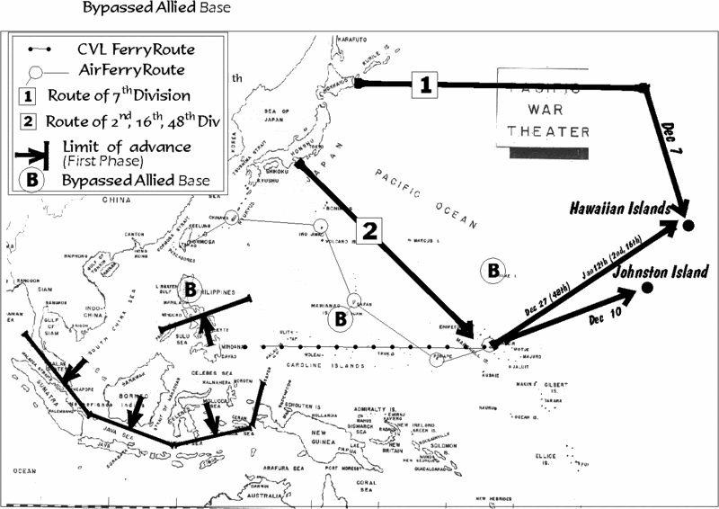
Objective: Johnston Island.
Comments: Johnston lays astride the route of communications from Hawaii to the Marshall Islands. It's capture is necessary to deny the use of the base to Allied forces, and to provide air cover for advancing transports and naval forces moving to and from Hawaii. A small task force including a light carrier is earmarked to depart the Marshalls on December 7th and capture Johnston Island on December 12th.
Air Units:
Embarked on Zuiho:
(24 + 6 aircraft)
Embarked on Hosho:
(15 + 6 aircraft)
Plus elements of 22nd and 24th Air Flotillas in support as required.
Ships
Type........................Qty
Destroyer..................14
Cruiser, heavy.............1
Cruiser, light...............1
Carrier........................2 (Zuiho, Hosho)
Oiler..........................8
Transports..................3 (25,470 tons, Johnston Island Occupation Force)
Transports.................18 (155,238 tons, Hawaiian Islands inv force)
Army Formation: South Seas Force.
Additional units: Accompanying the Zuiho task force or sailing independently are elements of the Maui Base Force (element no. 2). These are a host of light vessels necessary for operations in Hawaiian waters.
Outline: On December 10th, the Zuiho group will attack and capture Johnston Island. A seaplane base will be immediately established there. The Zuiho group will then stand ready to support second phase operations at Hawaii.
Objective: Hawaiian Islands.
Comments: The initial operation is tasked to defeat local naval forces, establish bases on the outlying islands and to secure air superiority. A follow-up attack at the end of December will reinforce the outlying bases, destroy any revived American air and naval presence at Oahu, and conduct the initial invasion of Oahu itself. A third wave will make another attack upon Oahu towards the end of January 1942. If necessary, a fourth wave consisting of the 56th, 21st, or elements of the 4th division are available for February if the issue remains in doubt.
Naval Forces (Naval Battle)
Type................................Qty
Fleet Carrier......................6
Battleship.........................8
Cruiser, Heavy..................8
Cruiser. Light....................7
Seaplane Carrier...............2
Destroyers.......................24
Air Units: As embarked on Akagi, Kaga, Hiryu, Soryu, Zuikaku, Shokaku.
(420 + 36 aircraft)
Supply Unit (retiring):
Oiler.................................12
Destroyer...........................2
Invasion Forces (Kauai Landing)
Type.................................Qty
Cruiser, Heavy....................1
Cruiser, Light......................1
Seaplane Carrier.................1
Destroyers.........................8
Transports.........................11
Submarine.........................3
Air Units, reinforcements, available in Marshall Islands:
Type.........Code Name..............Qty..................Parent Formation
Recon..........Mavis.....................32...................24th Air Flotilla.
Bomber........Nell........................36...................24th Air Flotilla
Bomber........Betty.......................1....................24th Air Flotilla
Fighter.........Claude....................32...................24th Air Flotilla*(3)
Bomber........Betty......................36...................22nd Air Flotilla
Fighter.........Zero.........................7...................22nd Air Flotilla*(2)
Bomber........B5N2 Kate..............18....................Ryujo Air Group
Bomber........Val.........................12...................Yokosuka Air Group
Bomber........B5N1......................12...................Tateyama Air Group
Fighter.........Claude....................16...................Yokosuka Air Group*(1)
Obsolete......B4Y1.......................8.....................From Hosho Air Group
Notes:
1) 24 x B5N1 of Yokosuka Air Group embarked on carriers.
2) 18 x A6M2 Zero of 22nd Air Flotilla embarked on carriers.
3) 3 x A5M4 of 24th Air Flotilla aboard Hosho.
Air Units, reinforcements, available later in December.
Type.............Code Name.....Qty...........Parent Formation.....Original Objective
Fighter.............Zero..............107...........23rd Air Flotilla.............Luzon
Bomber...........Betty..............72............23rd Air Flotilla.............Luzon
(Betty bombers will transfer to the Marshalls via air staging. Zero fighters will be shuttled via carriers Hosho and Zuiho and aircraft transports).
Land units:
Phase 1: 7th Infantry Division (reinforced).
Phase 2: 48th Infantry Division (reinforced), 1st Artillery Brigade (reinforced), elements of 4th and 7th Tank Regiments*.
Phase 3: 2nd Infantry Division (reinforced), 16th Infantry Division (reinforced), elements of 4th and 7th Tank Regiments*.
Also available if needed (in strategic reserve): 4th ID, 56th ID, 21st ID.
* - These tank regiments consisted of 52xType 95, 34xType 89 and 2xType 97. Historically all committed to Luzon.
http://www3.plala.or.jp/takihome/history.htm
In Japanese waters. To arrive in the Marshall Islands for phase II:
Ships
Type....................................Qty
Destroyers............................6
Assault Transports................52
1st Artillery, 16th, 48th, Division. (all reinforced) Also supplies.
Ships.............................Qty
Destroyers.......................6 (same escort unit as 48th ID)
Transports......................24
2nd I.D. and supplies.
Summary of Historical vs. AH Japanese shipping allocations.
Operation................... Historical.........................AH
China/Korea.................707,658......................707658
Thailand..........................6,650.........................6,650
Kra (Malaya)..................46,453.......................46,453
Singora (Mal).................84,877........................84,877
Patani (Mal)..................47,781.........................47,781
Kota Bharu(Mal)............26,751........................26,751
Mal (2nd Wave)...........485,000.......................485,000
Aparri (Phi)...................37,694..............................0
Vigan (Phi)...................28,049..............................0
Legaspi........................38,623..............................0
Borneo..........................47,345.............................0
Davao...........................80,899.......................120,000
Lingayen(Phi)..............379,457.............................0
Lamon (Phi)................111,972..............................0
Gilbert Isl......................31,029..............................0
Wake Isl.......................17,034..............................0
Guam...........................36,969..............................0
IJN Aux Cruisers............72,414.............................0
Hospital Ships...............33,491.........................33,491
Sub Tenders.................75,510..........................59,812
Gunboats....................167,866........................167,866
IJN, all others.............1,498,176...................1,498,176
Economy, Cargo........1,714,543....................1,714,543
Economy, Pass............840,000......................840,000
Purchased, Germany.........0...........................(46,126)
Maui Occupation Force......0............................48,342
Molokai Occ. Force...........0.............................17,220
Johnston Island Force........0.............................12,718
Johnston Seaplane B.........0.............................12.752
Hawaii Occupation For.......0.............................50,967
Kauai Occupation For........0.............................33,609
Puunene Air base..............0.............................31,694
Kauai Air base...................0.............................14,523
Hawaii Air base.................0..............................14,304
Puunene Air, Phase II........0................................7,189
Construction units.............0..............................19,954
Maui Naval Base...............0...............................28,081
Water unit........................0................................2,043
16th, 48th ID.....................0.............................199,012
1st Artillery Regiment........0..............................87,436
Diahatsu Unit....................0..............................18,000
Air Ops Supplies, Jan........0..............................14,692
Haw Food supplies, Jan.....0...............................4,496*
2nd Infantry Division...........0..............................94,681
1st Artillery Resupply.........0..............................19,391
16th, 48th ID Resupply.......0..............................25,000
Unallocated shipping..........0..............................67,205
Total............................6,616,241...................6,616,241
* - does not include food for 1st Art, 2nd, 16th or 48th ID.
Summary of Historical vs. AH allocation of major combat units.
Carriers
Type.......Location..........Historical.........AH
CV..........Hawaii..................6.................6
CVL........Johnston...............0.................2
CVL........Mindanao..............1.................1
CVL........Japan...................2.................0
Total...................................9.................9
Seaplane Tender.............Hist................AH
Japan................................1..................1
Malaya..............................4..................3
Philippines.........................3..................3
Guam................................1..................0
Gilberts..............................1..................0
Hawaii................................0..................3
Total..................................10...............10
Battleships
Area.................................Hist................AH
Japan.................................7....................0
Malaya...............................2....................2
Hawaii................................2....................9
Total...................................11.................11
(includes Yamato serving in a limited combat capacity, actually commissioned Dec 15th, 1941),
Construction had been accelerated early in 1941 when the imminence of war in the Pacific became apparent....the accelerated construction resulted in no problems or operational difficulties. Her trials in October 1941 were a great success, and a speed of 27.4 knots was realized....
Battleships, Garzke, pp54)
Heavy Cruisers.
Area...................................Hist...............AH
Malaya.................................7...................6
Hawaii.................................2....................9
Johnston..............................0....................1
Philippines...........................5....................2
Guam..................................4....................0
Total...................................18..................18
Light Cruisers.
Area..................................Hist..................AH
China...................................1.....................1
Hawaii..................................1.....................7
Johnston...............................0....................1
Japan...................................4....................1
Marshalls..............................1....................0
Malaya.................................4.....................7
Philippines............................5....................1
Wake...................................3.....................0
Total....................................19...................19
Destroyers.
Area...........Hist.................Alternative
China............3..........................3
Guam...........4..........................0
Hawaii...........9.........................34
Japan...........25........................13
Midway.........2..........................0
Phil..............30........................14
Air Rescue....3..........................0
Malaya.........24........................24
Borneo..........5..........................5
Marshall........8..........................0
Johnston.......0.........................14
48th/16th.......0..........................6
Total............113......................113
Initial Resource Allocations by Base, oil, bombs, torpedoes and Avgas.
(From PHA, Vol 13, page 459)
Base..........Oil.......Coal......Avgas*.....800/500kg.....250kg......60kg
Saipan.....12,000..10,000.....7,500...........30.............300.........830
Kwaj............0..........0.........5,500...........81.............210........1,950
Wotje..........0..........0.........2,500...........237.............0..........1,950
Jaluit...........0..........0.........2,500...........210.............0............660
Truk..........2000.....5000......2,700............0.............750.........2,500
Palau.......11,500...6000......6,000...........246...........590.........3,380
Saigon(IJN)...0.........0.........12,000.........320..........6,000......42,000
Saigon(IJA....0.........0.........28,500.........370.........10,300.....72,000**
Formosa(IJN).0........0.........15,400.........300..........5,500......38,500**
Formoas(IJA).0........0..........7,100..........55............2,655......18,585**
* - Avgas totals are in Kiloliters.
** - Saigon (IJA), Formosa (IJN), Formosa (IJA) are estimated totals based on actual OOB and allocations to Saigon (IJN). All other figures in table are actual historical totals.
AH requirements for Tinkerbell:
Base............Oil..........Coal......Avgas*....800/500......250kg......60kg
Kido Butai......X.............X.........3,410.........606*........1,680......2,640
Hawaii(Dec).1,000..........0.........8,033.......144***.......5,278......5,238
Hawaii(Jan)..1,000..........0.......12,140.......144***.......8,808......6,192
* - 250kg bombs can substitute for heavier bombs at a rate of about 2:1, if not enough available.
** - Torpedoes at 2 per plane for bases.
*** - These totals could stand to be tripled in each case, due to extent of fortification of Oahu.
War aims were the subject of intensive study in the Japanese supreme command, resulting in four separate strategic alternatives being seriously discussed just prior to the war. Four basic options were identified (From The Japanese Thrust, Wigmore, pp110):
1. To capture the Netherlands East Indies first and then attack Malaya and the Philippines.
2. To carry out operations against the Philippines, Borneo, Java, Sumatra and Malaya in that order.
3. To carry out operations in the order of Malaya, Sumatra, Borneo, Java and the Philippines to delay for as long as possible the entry into the war of the United States.
4. To start operations against the Philippines and Malaya simultaneously and proceed southward promptly and at length assault Java from both east and west.
The army initially favored the third option, but it was dismissed on the belief that an unengaged United States Navy would reinforce the Philippines and strangle the lines of communication to the south. The navy wished to act on the basis of the second option, but it too was rejected because it was feared that the ultimate objectives (Sumatra, Java, Malaya) would be reinforced so as to then be impregnable. No. 4 eventually won the day as the basis for the offensive, and so the agreed ordering of strategic priorities became:
1) To secure the resources of South East Asia (Borneo and the Netherlands East Indies).
2) To eliminate all threats along the lines of communication between Japan and the Netherlands East Indies.
With these two missions achieve, then the navy then wished to accomplish a third task:
3) To destroy the fighting power of the main enemy (the United States Navy)
Having then achieved all of the above, then presumably the fourth and final war aim could be obtained:
4) To negotiate a successful conclusion to the war.
Strong differences of opinion existed between the army and the navy - specifically upon the importance of maintaining an offensive tempo in the Eastern Pacific. The army's viewpoint rejected the possibility of overstretch as a matter of course,
The operation against the United States, Britain, and the Netherlands planned by the Army Department of Imperial Headquarters was called the Southern Operation. As the name implies, it was limited to the invasion of key strategic areas in the Southern Area. The extract in the planning documents relating to the objective of stage two operations stated the following: "The strongholds of the United States, Britain, and then the Netherlands in eastern Asia will be destroyed, and key strategic locations in the Southern Area will be occupied and secured."
Knowing full well the long-term potential of the United States, the Navy declined to revert to the strategic defensive. Upon the completion of the 1st Phase objectives an emphasis was placed on subsequent operations to force the United States fleet to come to battle,
In contrast, the navy’s operational policy (within the navy, planning an operation was called "operational policy") against the United States, Britain, and the Netherlands clearly divided the operation into two stages: offensive campaigns in the Southern Area, and subsequent campaigns. An outline of operational leadership for both stages was clearly established, and contained the following:
Quickly attack and destroy enemy fleet and air strengths in the eastern Pacific. Occupy and secure key strategic locations in the southern region and establish a long-term and unassailable footing. In addition, attack and destroy the enemy fleet, ultimately crushing their fighting spirit.
On November 15th 1941 a working compromise between these viewpoints was established by the Imperial Headquarters in the Draft plan facilitating the end of war with the United States, Britain, the Netherlands, and Chiang Kai-shek. The navy's desire to engage US forces in a decisive battle was subordinated both chronologically and strategically to that of securing resources in South East Asia,
Quickly execute military operations and destroy US, British, and Dutch bases in east Asia and the south-west Pacific. In addition to adopting a superior strategic position, secure the important natural resources and main transport routes and work towards establishing a position of long-term self sufficiency.
At an appropriate time after the completion of various stages of the campaign, lure the main strength of the US fleet into a destructive battle.
The aims outlined in Japan's war of aggression unraveled in reverse order. They could not hope for a negotiated settlement to the war (objective 4) since they did not destroy the fighting power of the main enemy, (objective 3). Because of the fact that this military potential was not shattered, the lines of communication between Japan and her resources were eventually severed (objective 2), and when that occurred the primary purpose of the war in securing these territories (objective 1) was negated. The irretrievable error made by Imperial Headquarters was in failing to make the proper assessment as to the relative dangers posed by the Soviet Union and the United States to an aggressive Japan,
The Army Department’s strategy was to try and establish a long-term unassailable position from a base of largely predetermined occupied territories. The essential underlying policy was the completion of military preparations guarding against attack from the Soviet Union.
The strategic basis underpinning a Hawaii first strategy was that in most (if not all) foreseeable circumstances a struggle for survival would have occurred with the United States and not the Soviet Union, and that in such a conflict the likelihood of the intervention of the Soviet Union against Japan would be inversely proportional to the strength by which Japan was able to defend herself against American blows (ie, the bigger the thorn in the American side, the less inclined Stalin would be to pluck it. Not everyone in the world believed the Allies couldn't have attacked in France in 1943).
Conflicting Japanese war aims.
There was a tension inherent between the immediate objectives of securing the communications and resources in the south and the longer term need to cripple the United States military position in the Pacific and successfully conclude the war. By attacking first into Southeast Asia, the Japanese effectively surrendered any chance of preempting or preventing the arrival of powerful American Pacific reinforcements throughout the Eastern and South Pacific. Conversely, by taking Hawaii first the Japanese would have blocked the US from establishing a credible offensive position from which to counterattack.
It is proposed that the seizure of weakly held Jolo and Mindanao in the southern Philippines would have permitted Japan to continue her offensive against Java via the Banda Sea while bypassing Luzon. After the fall of Oahu, Luzon could then be taken at will. This implies a Hawaii first strategy was the optimal solution because Japan's real strategic interests in 1941 were as follows, in their order of importance:
1) To destroy the fighting power of the United States in the Pacific Theatre.
2) To secure the resources centers of Southeast Asia.
3) To eliminate all threats along the lines of communication between Japan and the Netherlands East Indies.
Altered December Offensive.
Japanese Merchant Fleet as of Pearl Harbor Day.
(From the USSBS, pp32, Vol 9)
Cargo ships.
20-100 tons - 742,935 tons
100-500 tons - 442,163 tons
500-1000 tons - Number: 264 - GRT: 198,036
1000-3000 tons - Number: 527 - GRT: 1,055,224
3000-6000 tons - Number: 486 - GRT: 2,330,577
6,000-10,000 tons - Number: 219 - GRT: 1,603,219
10,000+ tons - Number: 19 - GRT: 234,087
Total: 1,515 ships of over 500 tons.
(5,431,143 +742,935 + 442,163 GRT) = 6,616,241 GRT
Of this grand total, the Army mobilized 2.16 million tons to lift and supply it's forces in all theatres and the navy mobilized over 1,800,000 tons of all types. Of the army total, 1,350,000 tons was used to attack the Philippines and Malaya. The remaining balance of 810,000 tons was used to,
"supply for units on the Asian mainland, convoys to the South China Sea ports and sundry other missions employed the remaining tonnage."
Kaigun, 75
It has not proven possible to ascertain exactly the composition of these mobilizations, but the following give a rough idea. Caution: these totals are only roughly accurate in many cases.
Naval Merchant Mobilization
Type..................................Qty...........................Tonnage
Ammunition Ship..................3...............................16,637
Cargo ships........................18...............................78,977
Miscellaneous.....................13..............................55,485
Hospital Ships......................4...............................33,491
Minesweepers.....................75..............................19,829
Netlayers............................16..............................16,338
Oilers.................................37...............................330,228
Converting to oilier................1................................10,008
Avgas Ship..........................2................................9,492
Assault Transport................54...............................282,418
Repair ships........................3................................19,375
Submarine Tenders..............9................................75,510
Seaplane Tenders................6................................40,420
Aviation support ship............1................................17,272
Aircraft transport..................8................................50,355
Water tanker.......................3................................7,095
Collier.................................2...............................12,522
Auxiliary Carrier program......6...............................118,613
Auxiliary Cruiser program....10...............................72,414
Gunboats/Subchasers........110.............................167,866
The remainder of the IJN mobilization is yet to be accounted for.
Identified army transport shipping:
AP: 141 ships, 829,259 tons (1st Wave in Southern Operation and all waves of Philippines operation as well as Guam)
AP: ? ships, 485,000 tons (Malaya 2nd Wave operations)*
AP: ? ships of about 775,000 tons (supply China and Korea and misc. army vessels)
(* - Malaya follow-on convoy information is difficult to uncover. It is possible that the bulk of the 485,000 tons quoted was employed in transporting forces to Saigon just before the war, and not in the actual attack itself.)
Total IJA: 2,089,259
Total IJN: 1,434,345
Total IJN/IJA mobilization: about 4,000,000 tons
Total accounted for: 3,523,604
Total yet unaccounted for: about 475,000 tons
The majority of merchant vessels mobilized were used as assault transports (AP's) to haul troops. AP's were employed to attack the following targets in December
1941 looked something like this:
Operation....IJA Ships.........Tons.........IJN Ships......Tons.........Total....
Thailand.............1..............6,650..............0...............0.............6,650
Kra (Malaya).......7.............46,453.............0...............0...........46,453
Singora (Mal).....11.............84,877............0...............0............84,877
Patani (Mal)........6.............47,781.............0...............0............47,781
Kota Bharu(Mal)..3.............26,751.............0...............0............26,751
Mal (2nd Wave)...?........... .485,000*..........0...............0.........485,000*
Aparri (Phi).........7.............37,694.............0...............0............37,694
Vigan (Phi).........5.............28,049.............0...............0............28,049
Legaspi..............4.............28,737.............2............9,886.........38,623
Borneo...............6.............27,143.............3...........20,202........47,345
Davao.................7.............36,104.............7...........44,795........80,899
Lingayen(Phi).....69............379,457...........0...............0...........379,457
Lamon (Phi).......20............111,972...........4............23,366......111,972
Gilbert Isl............0.................0................4............31,029........31,029
Wake Isl.............0.................0.................2...........17,034........17,034
Guam.................0.................0.................8...........36,969........36,969
* - tonnage of Malay 2nd wave inferred from known tonnage devoted to first wave and known total tonnage devoted to Malay campaign.
Infantry units employed
Malaya:.............5th I.D., 18th I.D, Guards Division. (25th Army)
Philippines:......48th I.D., 16th I.D., 65th Brigade (14th Army)
Burma:..............33rd I.D., 55th I.D. (15th Army)
Hong Kong:......38th Division (South Expeditionary Army)
Guam:...............South Seas Detachment (from 55th Division)
Wake:...............Maizuru SNLF
Davao:..............Sakaguchi / Miura Detachments
Divisions in reserve or entering reserve at start:
7th I.D. (Eastern District, Hokkaido, Japan), Crack unit.
52nd, 53rd (Central District), Japan - 2nd rate or garrison formations
21st I.D. (Southern Expeditionary Army), Shanghai, China. Average.
56th Division (25th Army), Kyushu, Japan. Perhaps below average.
2nd I.D. (16th Army), Honshu, Japan. Crack unit.
4th I.D. (Independent, Osaka, Japan). Average.
In the weeks and months to follow, subsequent offensives were conducted by various forces in conquering the islands of the Malay Barrier:
Unit..............Date.................Transports.........Positions taken
Group 1...Dec to Feb 9th........47,200..........Menado, Kendar, Macassar
Group 2...Jan to Feb 20th......100,300.........Ambon, Timor
Group 3...Jan-Feb 10th...........94,400.........Balikpapan/Tarakan/Band
Group 4..........Feb.................100,000........Palembang
Group 5..........Mar.................572,300........Batavia, Surabaya
* - Bandermason
Infantry Units Employed:
Group.......Units........................................................Men
Group 1....Sasebo, Yokosuka SNLF..........................2,120
Group 2....Kure 1st/3rd SNLF, Elements 38th Div.......7,120
Group 3....Kure 2nd SNLF, 56th Regimental Grp........6,500
Group 4....Elements, 38th Div, Yokosuka Para............???
Group 5....Elements, 48th, 2nd, 38th Division..............???
Note on follow-up wave estimates: I've found only sketchy information concerning the composition of the follow-up waves (Jan 11th to March 1st). The average transport in December 1941 weighed in at about 5,900 tons. In most cases, the number of transports employed in a particular group is exactly or approximately know. I've simply multiplied this total x 5,900 to come up with the tonnage estimate.
Summary of army assault transport usage in Southern drive.
December 1941: 1,350,000
January: 241,900 (plus tonnage still supplying Malaya/Philippines)
February: 341,900 (plus tonnage still supplying Malaya/Philippines)
March: 572,300 (plus tonnage still supplying Philippines)
Alternative Offensive.
An AH attack emphasizing Hawaii exploits the fact that some of the original targets for the historical December invasion were so far from friendly American bases that their loss to the Allied cause was inevitable. These are bypassed: Luzon, Guam, Wake Island.
Cancelled invasions:
Luzon: 111 transports for 619,161 tons
Guam: 8 transports for 36,969 tons
Wake: 2 transports for 17,934 tons
Gilberts: 4 transports for 31,029 tons
Total freed shipping: 125 ships for 705,093 tons.
Added to this total is the cancellation of the Armed Merchant Program, listed above amongst the mobilized shipping of the IJN, plus the employment of the following stranded German merchantmen
http://www.wlb-stuttgart.de/seekrieg/ve ... 1942-2.htm
Scharnhorst of (18,184 tons).
Teizui Maru 8,428 brt (taken over by Japanese on Nov. 2nd 1942)
Havenstein (7,973 tons) sold to Japan 1942 as Teisho Maru
Quito (1.230 tons) sold later to Japan as Teifuku Maru
RC Rickmers (5,198 tons) sold later as Teishu Maru
Winnetou (5,113 tons) sold later as Teikon Maru
Total additional vessels:
72,414 (cancelled auxiliary cruiser program)
46,126 (purchases of stranded German vessels)
Total: 118,540 tons
A few more ships are available to rob from naval programs, if necessary:
Hospital ships (4) - 33,491
Submarine tenders: Rio de Janeiro of 9,627 tons and Nagoya of 6,071 tons were being employed as sub tenders at bases the Home Islands. Being in home ports, other arrangements could have been made at these locations without impairing combat efficiency.
After this, the last major source of transports for Hawaii was either China or the civilian pool of 2.66 million tons. But China had already been thinned out, and tapping the civilian fleet would have repercussions on the Japanese economy,
"The Cabinet Planning Board calculated before the war that the civilian economy required 3 million tons of merchant shipping to continue to functioning. Coal, transportation would occupy 1.8 million tons, while the movement of agricultural products and supplies (450,000 tons) and steelmaking materials (300,000 tons) would absorb most of the rest. Any drop below the 3 million ton minimum would threaten serious disruption of the economy. Government studies predicted that if Japanese industry could call on only 2.5 million tons, the availability of resources considered to be of secondary importance (coal, salt, fertilizers, soybeans, bricks, cotton and various ores) would fall by one-fifth, and many other items would become even scarcer. A further loss to 1,500,000 tons would mean a 20 percent curtailment of steel and rice production, a 60-percent drop in the second(ary) items, and a virtual cessation of most other imports."
The Japanese Merchant Fleet in World War II, 34-35
"Later studies predicted that the planned requisitioning (2.5 million tons) would mean a one-quarter drop in steel production and about a 15-percent fall-for other products. A month before Pearl Harbor, the Cabinet Planning Board confirmed these figures, but the board believed employment of sailing ships with auxiliary engines, greater utilization of iron foundries serviced by railroads, consumption of stockpiles, and collection of more scrap iron could compensate for lost shipping."
Ibid, pp76
In the event, the total military mobilization exceeded the 2.5 million tons envisioned by a considerable margin and the 2.66 million tons remaining under civilian control was short of the 3 million tons Japanese planners thought necessary to maintain the economy at an acceptable standard. In fact, of the 2.66 million tons left to civil sector, a full 1/3rd - 840,000 tons - were passenger vessels "ill-suited" for cargo transportation and therefore of little to no use in supplying raw materials. Studies suggest that the actual tonnage of useful vessels in the civilian pool was less these passenger ships - the real pool was about 1.6 million tons (as per USSBS, Vol 9). The rest (840,000 tons) were of next to no utility (Japanese Merchant Fleet, pp75). These passenger ships are therefore available to the military as troop transports.
Summary:
Grand total of shipping freed up from cancelled invasions: 705,093
Plus cancellation of aux. cruiser program: 72,414
Plus purchase of German ships: 46,126
Total: 823,633 tons
Plus 2 sub tenders and 1 hospital ship: about 24,000 tons.
Plus elements of civilian pool passenger ships of little use to economy available as troopships: 840,000 tons.
Total potential shipping available for alternative offensive: 847,000 tons + elements of an additional 840,000 tons.
AH Offensive:
Phase 1 Objectives
Objective: Luzon.
Comments: Luzon is to be bypassed. Initial attacks in the Philippines are limited to destroying defending air power and securing strategic positions to blockade Luzon. Once achieved, 23rd Naval Air Flotilla aircraft will commence transfer to the Marshall Islands via air ferry, aircraft transports, and light carriers.
Objective: Neutralization of American airpower (IJN aircraft)
Transfer to forward locations to secure blockade of Luzon (IJA aircraft)
Forces employed:
Type..........Code Name.......Qty..........Parent Formation
Bomber........Nell.................48............21st Air Flotilla
Recon...........Mavis..............6.............21st Air Flotilla
Bomber........Betty...............37...........21st Air Flotilla
Fighter..........Zero..............107...........23rd Air Flotilla
Fighter..........Claude...........13............23rd Air Flotilla
Bomber........Betty...............72............23rd Air Flotilla
Attack...........Misc. Types...92............Southern Expeditionary Army
Bomber........Sally...............18............Southern Expeditionary Army
Fighter..........Nate...............72............Southern Expeditionary Army
Outline: 21st and 23rd AF will attack Luzon from Formosa. Elements of SEA air forces will stage to captured bases in Mindanao, etc., as these become available. Elements of SEA air brigades may be based at Palau, etc., to facilitate this objective.
Objective: Mindanao and Jolo.
Comment: These islands are well situated both to act as forward bases, both for a southern drive into the Banda Sea and to blockade Luzon. Because Luzon is bypassed, the Davao offensive must receive additional resources over the historical commitment to safeguard the blockade. Naval forces earmarked are significantly stronger than the US Asiatic Fleet.
Aircraft
Embarked on Ryujo
16 x A5M4
18 x B5N1 (ahistorical replacement for B5N2)
Land Based assets:
Type..........Code Name......Qty.........Parent Formation
Fighter...........Claude..........37..........21st Air Flotilla (Kure)
Recon............Mavis...........20..........21st Air Flotilla
Bomber..........Nell..............20..........21st Air Flotilla
Ships:
Type............................Qty
Destroyer......................14
Cruiser, Heavy...............2
Cruiser, Light.................1
Seaplane tender.............3
Carrier (Ryujo)................1
PM................................1
Oiler..............................3
AM................................6
CM................................2
AVT...............................1
Assault Transport.......20 (120,000 tons)
Major Army Formations: 65th Brigade, elements 4th I.D (if necessary).
Outline: Earmarked forces are concentrated at Palau and will invade Mindanao via Davao. From these captured positions, follow-up operations will drive in both to the north and south. Operations to the north will be covered by land based air. The Ryujo group will provide cover for ops to the south (where outside the range of 21st A.F. elements). 4th I.D. is designated a reserve formation for Malaya, Davao, and Hawaii.
Objective: Malaya/Borneo.
Comments: No change from historical objectives. Minor and moderately detrimental alterations of OOB. 22nd Air Flotilla is reduced with other Army and Navy units employed to make up the difference. Battleships Ise and Hyuga take the place of two battlecruisers diverted to Hawaiian waters. Reserve division (56th) historically not needed for Malaya, is allocated as a reserve formation for either Malaya or Hawaii.
Air units
Type........Code Name...........Qty...........Parent Formation
Bomber.......Nell...................111..........22nd Naval Air Flotilla
Fighter.........Claude...............11...........22nd Naval Air Flotilla
Bomber.......Sally...................54...........2nd Army Air Force Brigade
Bomber.......Sally..................124.........Southern Expeditionary Force
Attack..........Misc. Types......153.........Southern Expeditionary Force
Fighter.........Nate..................156.........Southern Expeditionary Force
Fighter.........Oscar.................39.........Southern Expeditionary Force
Fighter.........Tojo.....................9..........Southern Expeditionary Force
Ships.
Type.............................Qty
Battleship.......................2
Cruiser, Heavy.................6
Cruiser, Light...................7
Destroyer.......................29
Oiler...............................4
AE................................1
AM................................6
AT.................................1
AV................................3
CM...............................1
ACO.............................1
Assault Transport..........36 (259,857)
2nd Wave:........................(485,000)
Army units: Guards Division, 5th Division, 18th Division
Army unit, in reserve, Japan: 56th Division, 4th Division.
The absense of all Zeros from the Malaya campaign places greater emphasis on the early capture of bases in northern Malaya to operate short ranged Army fighters.
Objective: Burma
Comments: This offensive is not important enough, such that it could be postponed if necessary. The only crucial mission in Burma was to screen the flank of forces advancing in Malaya.
Air Units: Drawn from Army Formosan and Malayan OOB.
Naval Units: None.
Army Units: 33rd Division, elements of 55th Division.
Objective: Johnston Island.
Comments: Johnston lays astride the route of communications from Hawaii to the Marshall Islands. It's capture is necessary to deny the use of the base to Allied forces, and to provide air cover for advancing transports and naval forces moving to and from Hawaii. A small task force including a light carrier is earmarked to depart the Marshalls on December 7th and capture Johnston Island on December 12th.
Air Units:
Embarked on Zuiho:
(24 + 6 aircraft)
Embarked on Hosho:
(15 + 6 aircraft)
Plus elements of 22nd and 24th Air Flotillas in support as required.
Ships
Type........................Qty
Destroyer..................14
Cruiser, heavy.............1
Cruiser, light...............1
Carrier........................2 (Zuiho, Hosho)
Oiler..........................8
Transports..................3 (25,470 tons, Johnston Island Occupation Force)
Transports.................18 (155,238 tons, Hawaiian Islands inv force)
Army Formation: South Seas Force.
Additional units: Accompanying the Zuiho task force or sailing independently are elements of the Maui Base Force (element no. 2). These are a host of light vessels necessary for operations in Hawaiian waters.
Outline: On December 10th, the Zuiho group will attack and capture Johnston Island. A seaplane base will be immediately established there. The Zuiho group will then stand ready to support second phase operations at Hawaii.
Objective: Hawaiian Islands.
Comments: The initial operation is tasked to defeat local naval forces, establish bases on the outlying islands and to secure air superiority. A follow-up attack at the end of December will reinforce the outlying bases, destroy any revived American air and naval presence at Oahu, and conduct the initial invasion of Oahu itself. A third wave will make another attack upon Oahu towards the end of January 1942. If necessary, a fourth wave consisting of the 56th, 21st, or elements of the 4th division are available for February if the issue remains in doubt.
Naval Forces (Naval Battle)
Type................................Qty
Fleet Carrier......................6
Battleship.........................8
Cruiser, Heavy..................8
Cruiser. Light....................7
Seaplane Carrier...............2
Destroyers.......................24
Air Units: As embarked on Akagi, Kaga, Hiryu, Soryu, Zuikaku, Shokaku.
(420 + 36 aircraft)
Supply Unit (retiring):
Oiler.................................12
Destroyer...........................2
Invasion Forces (Kauai Landing)
Type.................................Qty
Cruiser, Heavy....................1
Cruiser, Light......................1
Seaplane Carrier.................1
Destroyers.........................8
Transports.........................11
Submarine.........................3
Air Units, reinforcements, available in Marshall Islands:
Type.........Code Name..............Qty..................Parent Formation
Recon..........Mavis.....................32...................24th Air Flotilla.
Bomber........Nell........................36...................24th Air Flotilla
Bomber........Betty.......................1....................24th Air Flotilla
Fighter.........Claude....................32...................24th Air Flotilla*(3)
Bomber........Betty......................36...................22nd Air Flotilla
Fighter.........Zero.........................7...................22nd Air Flotilla*(2)
Bomber........B5N2 Kate..............18....................Ryujo Air Group
Bomber........Val.........................12...................Yokosuka Air Group
Bomber........B5N1......................12...................Tateyama Air Group
Fighter.........Claude....................16...................Yokosuka Air Group*(1)
Obsolete......B4Y1.......................8.....................From Hosho Air Group
Notes:
1) 24 x B5N1 of Yokosuka Air Group embarked on carriers.
2) 18 x A6M2 Zero of 22nd Air Flotilla embarked on carriers.
3) 3 x A5M4 of 24th Air Flotilla aboard Hosho.
Air Units, reinforcements, available later in December.
Type.............Code Name.....Qty...........Parent Formation.....Original Objective
Fighter.............Zero..............107...........23rd Air Flotilla.............Luzon
Bomber...........Betty..............72............23rd Air Flotilla.............Luzon
(Betty bombers will transfer to the Marshalls via air staging. Zero fighters will be shuttled via carriers Hosho and Zuiho and aircraft transports).
Land units:
Phase 1: 7th Infantry Division (reinforced).
Phase 2: 48th Infantry Division (reinforced), 1st Artillery Brigade (reinforced), elements of 4th and 7th Tank Regiments*.
Phase 3: 2nd Infantry Division (reinforced), 16th Infantry Division (reinforced), elements of 4th and 7th Tank Regiments*.
Also available if needed (in strategic reserve): 4th ID, 56th ID, 21st ID.
* - These tank regiments consisted of 52xType 95, 34xType 89 and 2xType 97. Historically all committed to Luzon.
http://www3.plala.or.jp/takihome/history.htm
In Japanese waters. To arrive in the Marshall Islands for phase II:
Ships
Type....................................Qty
Destroyers............................6
Assault Transports................52
1st Artillery, 16th, 48th, Division. (all reinforced) Also supplies.
Ships.............................Qty
Destroyers.......................6 (same escort unit as 48th ID)
Transports......................24
2nd I.D. and supplies.
Summary of Historical vs. AH Japanese shipping allocations.
Operation................... Historical.........................AH
China/Korea.................707,658......................707658
Thailand..........................6,650.........................6,650
Kra (Malaya)..................46,453.......................46,453
Singora (Mal).................84,877........................84,877
Patani (Mal)..................47,781.........................47,781
Kota Bharu(Mal)............26,751........................26,751
Mal (2nd Wave)...........485,000.......................485,000
Aparri (Phi)...................37,694..............................0
Vigan (Phi)...................28,049..............................0
Legaspi........................38,623..............................0
Borneo..........................47,345.............................0
Davao...........................80,899.......................120,000
Lingayen(Phi)..............379,457.............................0
Lamon (Phi)................111,972..............................0
Gilbert Isl......................31,029..............................0
Wake Isl.......................17,034..............................0
Guam...........................36,969..............................0
IJN Aux Cruisers............72,414.............................0
Hospital Ships...............33,491.........................33,491
Sub Tenders.................75,510..........................59,812
Gunboats....................167,866........................167,866
IJN, all others.............1,498,176...................1,498,176
Economy, Cargo........1,714,543....................1,714,543
Economy, Pass............840,000......................840,000
Purchased, Germany.........0...........................(46,126)
Maui Occupation Force......0............................48,342
Molokai Occ. Force...........0.............................17,220
Johnston Island Force........0.............................12,718
Johnston Seaplane B.........0.............................12.752
Hawaii Occupation For.......0.............................50,967
Kauai Occupation For........0.............................33,609
Puunene Air base..............0.............................31,694
Kauai Air base...................0.............................14,523
Hawaii Air base.................0..............................14,304
Puunene Air, Phase II........0................................7,189
Construction units.............0..............................19,954
Maui Naval Base...............0...............................28,081
Water unit........................0................................2,043
16th, 48th ID.....................0.............................199,012
1st Artillery Regiment........0..............................87,436
Diahatsu Unit....................0..............................18,000
Air Ops Supplies, Jan........0..............................14,692
Haw Food supplies, Jan.....0...............................4,496*
2nd Infantry Division...........0..............................94,681
1st Artillery Resupply.........0..............................19,391
16th, 48th ID Resupply.......0..............................25,000
Unallocated shipping..........0..............................67,205
Total............................6,616,241...................6,616,241
* - does not include food for 1st Art, 2nd, 16th or 48th ID.
Summary of Historical vs. AH allocation of major combat units.
Carriers
Type.......Location..........Historical.........AH
CV..........Hawaii..................6.................6
CVL........Johnston...............0.................2
CVL........Mindanao..............1.................1
CVL........Japan...................2.................0
Total...................................9.................9
Seaplane Tender.............Hist................AH
Japan................................1..................1
Malaya..............................4..................3
Philippines.........................3..................3
Guam................................1..................0
Gilberts..............................1..................0
Hawaii................................0..................3
Total..................................10...............10
Battleships
Area.................................Hist................AH
Japan.................................7....................0
Malaya...............................2....................2
Hawaii................................2....................9
Total...................................11.................11
(includes Yamato serving in a limited combat capacity, actually commissioned Dec 15th, 1941),
Construction had been accelerated early in 1941 when the imminence of war in the Pacific became apparent....the accelerated construction resulted in no problems or operational difficulties. Her trials in October 1941 were a great success, and a speed of 27.4 knots was realized....
Battleships, Garzke, pp54)
Heavy Cruisers.
Area...................................Hist...............AH
Malaya.................................7...................6
Hawaii.................................2....................9
Johnston..............................0....................1
Philippines...........................5....................2
Guam..................................4....................0
Total...................................18..................18
Light Cruisers.
Area..................................Hist..................AH
China...................................1.....................1
Hawaii..................................1.....................7
Johnston...............................0....................1
Japan...................................4....................1
Marshalls..............................1....................0
Malaya.................................4.....................7
Philippines............................5....................1
Wake...................................3.....................0
Total....................................19...................19
Destroyers.
Area...........Hist.................Alternative
China............3..........................3
Guam...........4..........................0
Hawaii...........9.........................34
Japan...........25........................13
Midway.........2..........................0
Phil..............30........................14
Air Rescue....3..........................0
Malaya.........24........................24
Borneo..........5..........................5
Marshall........8..........................0
Johnston.......0.........................14
48th/16th.......0..........................6
Total............113......................113
Initial Resource Allocations by Base, oil, bombs, torpedoes and Avgas.
(From PHA, Vol 13, page 459)
Base..........Oil.......Coal......Avgas*.....800/500kg.....250kg......60kg
Saipan.....12,000..10,000.....7,500...........30.............300.........830
Kwaj............0..........0.........5,500...........81.............210........1,950
Wotje..........0..........0.........2,500...........237.............0..........1,950
Jaluit...........0..........0.........2,500...........210.............0............660
Truk..........2000.....5000......2,700............0.............750.........2,500
Palau.......11,500...6000......6,000...........246...........590.........3,380
Saigon(IJN)...0.........0.........12,000.........320..........6,000......42,000
Saigon(IJA....0.........0.........28,500.........370.........10,300.....72,000**
Formosa(IJN).0........0.........15,400.........300..........5,500......38,500**
Formoas(IJA).0........0..........7,100..........55............2,655......18,585**
* - Avgas totals are in Kiloliters.
** - Saigon (IJA), Formosa (IJN), Formosa (IJA) are estimated totals based on actual OOB and allocations to Saigon (IJN). All other figures in table are actual historical totals.
AH requirements for Tinkerbell:
Base............Oil..........Coal......Avgas*....800/500......250kg......60kg
Kido Butai......X.............X.........3,410.........606*........1,680......2,640
Hawaii(Dec).1,000..........0.........8,033.......144***.......5,278......5,238
Hawaii(Jan)..1,000..........0.......12,140.......144***.......8,808......6,192
* - 250kg bombs can substitute for heavier bombs at a rate of about 2:1, if not enough available.
** - Torpedoes at 2 per plane for bases.
*** - These totals could stand to be tripled in each case, due to extent of fortification of Oahu.
Because of the oil embargo emposed upon Japan in 1941, when the war started very little of her tanker fleet was being used in the regular capacity of importing oil to the Home Islands from overseas. During all of 1943 and 1944, only 20,000 tons of the Japanese tanker fleet was occupied with the domestic oil economy (United States Strategic Bombing Survey, Vol 9 pp118). The bulk of the home fleet - 336,984 tons of tankers and 65,000 tons of ships either needing repair or being converted to tankers, were,
"In the early months of the war during the period of conquest and subsequent rehabilitation, the oil import program was quiesecent. Except for the considerable tonnage servicing the fleet, Japan's tankers were idle."
USSBS, Vol 9, pp102.
Nor, until the fields in Borneo and Java were producing crude, would Japan's tankers have a more important task than military operations. December-January 1941 represented a unique period in the war in which an unusually high amount of tanker logistic support could be devoted to fleet operations, because civilian oil importation was at a virtual standstill.
"Requisitioning of tankers was not as damaging to the economy as the comandeering of other cargo types."
The Japanese Merchant Fleet in World War Two, pp79
Available Japanese oilers, vessels that were converted to oilers, or could be converted back quickly to oiling were
Name..................GRT..............Oil Cap.............Historical
Genyo.................10,109............12,636.............3rd Fleet
Sata*....................14,050.............8,000.............3rd Naval District
Nissan..................6,800.............8,500..............5th Fleet
Ondo*...................14,050............8,000...............6th Fleet
Juko.......................478................598...............China
Arima...................7,389.............9,236..............Converted
Azuma.................6,646.............8,308..............Converted
Kirishima..............5,840.............7,300..............Converted
Koryu...................6,680.............8,350..............Converted
Kozui...................7,072.............8,840..............Converted
Kumagawa...........7,508.............9,385..............Converted
Matsumato...........7,024.............8,780..............Converted
Tennan.................5,407.............6,759..............Converted
Terukawa..............6,433.............8,041..............Converted
Yamzuru...............3,651............4,564...............Converted
Tonan #3.............19,262...........24,078..............Converted
Toen.....................5,232.............6,540..............Guam
Koryu.....................974..............1,218..............Indochina
Kurosio................10,383...........12,978.............Indochina
Naroto*.................14,050.............8,000.............Indochina
San Clemente........7,335............9,169..............Indochina
Teiyo.....................9,850...........12,312.............Indochina
Akebono..............10,216...........12,770.............Main Body
Erimo*..................14,050............8,000..............Main Body
Goyo.....................5,950............7,438..............Main Body
Hishi #2..................856..............1,070..............Main Body
Kyoei....................1,192.............1,490.............Main Body
Kyoei #2................1,192.............1,490.............Main Body
Nitiei...................10,020.............12,525............Main Body
Tsurumi*...............14,050..............8,000............Main Body
Kazyo #2...............8,637...........10,796..............Marshalls
Toa.....................10,052............12,565.............Marshalls
Shiriya.................14,050.............8,000.............Midway
Kenyo..................10,024...........12,530.............Pearl
Kokuyo................10,027...........12,565.............Pearl
Kyokuto...............10,052...........12,565.............Pearl
Nippon...................9,974...........12,467.............Pearl
Sinkoku...............10,020............12,525............Pearl
Toei.....................10,023...........12,529.............Pearl
Toho......................9,987...........12,483.............Pearl
Hayatomo*............14,050..............8,000............Philippines
Kamoi*..................17,272...........14,000.............Truk
Atatuki.................10,216...........12,770.............Idle
Choko....................1,974............2,468..............Idle
Eiyo.......................8,674..........10,843..............Idle
Fujisan...................9,524..........11,905..............Idle
Hokki.....................5,601............7,001..............Idle
Hoyo......................8,692..........10,865..............Idle
Iro*........................14,050............8,000..............Idle
Itsukisima............10,008...........12,510..............Idle
Kaijo......................3,200............4,000..............Idle
Kenrei......................867.............1,084..............Idle
Kiyo.......................7,240............9,050..............Idle
Koryo.......................589..............736...............Idle
Kyoei #3.................1192.............1490..............Idle
Kyokuyo..............17,549............21,936.............Whaler
Manzyu................6,515..............8,144..............Idle
Mitu.....................6,025...............7,531.............Idle
Nisshin................16,801............21,001.............Whaler
Nisshin #2............17,579............21,974............Whaler
Nissho.................10,526............13,157............Idle
Ogura #1...............7,270...............9,088............Idle
Ogura #2...............7,311...............9,139............Idle
Ogura #3...............7,350...............9,188............Idle
Omurosan.............9,205.............11,506............Idle
Otowasan.............9,205..............11,506............Idle
Rikko...................9,182..............11,478............Idle
San Diego............7,269................9,086............Idle
San Louis.............7,269................9,086............Idle
San Pedro.............7,269...............9,086............Idle
San Ramon...........7,309...............9,136............Idle
Shiretoko*.............14,050..............8,000............Idle
Syoyo...................7,499..............9,374............Idle
Tatekawa.............10,152.............12,690...........Idle
Tatibana................6,515...............8,144...........Idle
Tonan.....................9,866................11,839.....Whaler
Tonan 2................19,262.............23,114........Whaler
Yoshida................2,920................3,650...........Idle
Zuiyo....................7,368................9,210...........Idle
* - Fleet oiler
Totals: 681,010 tons w/ 754,181 tons capacity (estimated)
Notes
Fujisan also Hujisan
Atatuki also Akatuki
Nissho also Nyssho
San Louis also San Luis
Itsukisima also Itukusima
Hayatomo also Hayamoto
Kaizyo is Kaijo #2
Manzyu is Manju
Naruto is Noroto
Nitiei is Nichiei
Sinkoku is Shinkoku.
This reconciles with the USSBS as follows.
"Missing" means that the list above is missing tankers identified in the USSBS:
Tankers
500-1000 tons
Number: 20 GRT: 12,770
Identified: 5 for 3764 GRT
Missing: 15 for 9006 tons
1000-3000 tons
Number: 10 for 15,740 GRT
Identified: 5 for 8470 GRT
Missing from list: 5 for 7270
3000-6000 tons
Number: 13 for 61,379 tons
Identified: 5 for 23,634 tons
Missing from list: 7 for 37,745 tons
6000-10000 tons
Number: 32 for 253,458 tons
Identified: 28 for 223,672 tons
Missing from list 4 for 29,786 tons
10000 tons and up
Number: 19 for 232,117 tons
Identified: 19 for 232,281 tons
Missing: None
Some of the following ships were probably converted to tankers before the war:
Kirishima........5,840
Azuma...........6,646
Tennan...........5,407
Terukawa........6,433
Arima.............7,389
Koryu.............6,680
Kozui.............7,072
Kyokuyo........17,549
Nisshin..........16,801
Nisshin #2......17,579
Tonan.............9,866
Tonan 2..........19,262
45,467 (dry bulk conversions)
81,057 (Whalers)
Calculating oil capacities.
Data for Genyo Maru is as follows (from the 1939 Merchant registry courtesy of WD Martin and from the following website):
http://www.combinedfleet.com/Genyo_c.htm
Oil capacity: 12,031
GRT: 10,109
Deadweight: 14,500
Oil capacity for tanker fleet is calculated approximatley as:
Oil capacity = GRT*1.2
Exceptions: Fleet oilers Noroto Class (8,000 tons capacity) and Kamoi (14,050 tons capacity).
Tanker allocations on December 7th, 1941 Historical/Alternative:
Application............Historical....................Alternative
Navy Logistics..........45,009........................45,009
China.......................478..............................478
Hawaii, Phase I........84,157.........................88,732
Hawaii, Phase II...........0............................114,335
Hawaii, Phase IV..........0.............................36,710
Philippines...............47,844.........................25,000
Malaya....................42,592.........................42,592
Main Body...............57,526.............................0
Marshall Isl..............18,689.........................18,689
Truk........................17,272.........................17,272
Guam.......................5,232.............................0
Active, Home Isl.......20,000.........................20,000
Idle, Home Isl..........267,616.......................131,517
Conversions.............45,467.........................45,467
Johnston Island............0.............................14,050
Total.......................651,882.......................651,882
Note that beyond the forces pertinent to the the thread no attempt has been made to reconsile the available tankers with the tonnage allocations made above, other than to ensure that the tonnage figures balance. Military tankers are included but no "missing" tankers (from USSBS) are tallied.
Re: Merchant conversions of civilian tankers.
Actual number converted, December 1941: 8(+1 almost ready)
Required for first phase of proposed Hawaiian Operation:19
While in theory the AH operation could go forward using the existing 8 merchant conversions plus the military tankers, in actual fact the later ships of the civilian Japanese tanker fleet were so much superior over their older navy counterparts (speed, capacity) that it would have been highly desireable to use auxiliares in the attack. In order to operate as a fleet oiler, civilian merchant ships needed to undergo conversion to the role, with the nessary equipment such as transfer pumps, hoses and reels, a light A.A. armament, etc. being added. Genyo Maru's conversion time took about 3 weeks:
http://www.combinedfleet.com/Genyo_t.htm
15-19 fleet conversions required and additional 21-33 weeks of shipyard time for the tankers to be employed, over and above the historical commitment made to such conversions.
Oil burn charts.
Trial oil consumption statistics for most IJN warships can be found in Imperial Japanese Navy. Operational expenditures were invariably higher for all vessels than in trial runs. Initial estimates for converting from trial tons/day burn rate to real tons/day burn for all ships was done using the chart entitled "Radius of action of the Pearl Harbor Task Force and Midway Neutralization Units" on Page 416 of Prange's AT DAWN WE SLEPT. Using this information, daily consumption would be:
At 14kts:
Ship.........Oil capacity....Tons per day
Kaga............7500..............356
Akagi...........5770...............274
Shokaku......5000...............227
Hiryu............3700...............211
Soryu...........3400...............194
Yamato........6200...............284
Nagato.........5511...............325
Ise................5229..............325
Hiei..............6230...............283
CA...............2000...............110
Chitose........2679...............110
CL's............1000.................77
DD's.............500.................46
Power settings are:
14kt: 15% power
18kt: 21% power (14kt burn figure*21/15)
24kt: 50% power (14kt burn figure*50/15)
Using Shokaku as an example, Prange records:
Trial range: 18kt for 9700nm
Actual range: 18kt for 6800nm
Capacity: 5000t
Formula to calculate tons burned per day for Shokaku Class at 14kt is:
5000/(6800*(21/15)/(18/14))/14)*24 = 227 tons per day (14kt), 318 (18kt) and 757 tons (24kt)
Trial range figures, by comparison, would give a figure of 159 tons @ 14kt. 223 at 18kt and 530 at 24kt.
Historical data.
There are two fuel logs available for the Hawaiian Op; Zuikaku's and Akigumo's.
The Zuikaku types' radius of action proved sufficient for that kind of
operation. At the time <5th Carrier> left Hitokappu Bay on 26 Nov. they had
approximately 5,500 tons fuel. On 29th Nov. approximately 350 tons was
refueled from a tanker, and on the 24th when she got back to Kure she still
had approximately 1,700 tons of fuel.
Oil consumption for Akigumo from Hitokappu Bay to Hiroshima Bay was 1,246 tons (1,079 tons for the attack and return to Hiroshima Bay)
Pearl Harbor Papers, pp209 and 236
Oil consumption:
Ship........By Prange's Figures........By Trial Info.........Actual*
Zuikaku.........7,643............................5,353..............4,150
Akigumo.......1,548............................1,078..............1,079
(* - assumes 27 days at 14kt and 2 days at 24kt)
I will estimate burn at a rate 15% higher than trial figures. I do not anticipate that allocations would be insufficient for a campaign, since ship attrition would have reduced total demand (and created additional supply)
Oil overcapacity on combat vessels.
As per Prange's At Dawn We Slept, the following ships were modified to carry more oil than normal.
Ship......Overcapacity
Akagi..........1450t
Hiryu............700t
Soryu...........700t
Tone............580t
CL's.................0t
DD's................0t
Lighter ships (CL's and DD's) were not overfilled with oil for fear of their structural integrity. Others (Kaga, Shokaku) were not overfilled because they were deemed able to carry enough as it was.
Overcapcity loads assumed for the the AH attack are:
Kaga: 800t
Akagi: 1450t
Shokaku/Zuikaku: 1000t
Hiryu/Soryu: 700t
Yamato: 1000t
Nagato: 1000t
Fuso: 1000t
Hiei: 1000t
CA's: 580t
CL's: 0t
DD's: 0t
Chitose: 580t
Oiler transfers at sea.
Vol 13, page 658 of the Congressional Pearl Harbor hearings gives insight into Japanese tanker at-sea refueling rates in December 1941,
"Oil recieved by ships per hour and the rate of supply to small ships from
large ships is insufficient."
Zuikaku - 1942 tons / 12 hours = 160 tons/hr
Kongo/Haruna = 160 tons/hour
DD (from alongside oiler or BB(?) ) = 110 tons per hour.
At 160 tons per hour, a tanker would need over 2 days to transfer 8,000 tons. Therefore no allowance will be made for the possibility of tankers transfering oil amongst themselves while at sea. This function will be restricted to when in harbor.
Operational data for at sea transfers to Akigumo during Pearl Op are:
TT = tons of oil transfered.
Dur = Duration of transfer in minutes
T/H = Tons of oil transfered per hour
W = Wind speed min/max noted for that day in knots
Sw = Swells noted (L=large, C=Calm, D=Decreasing
* - Denotes when astern refueling was employed, when known
Date.......TT...Dur.....T/H........W........Sw.......Roll
27-Nov...30....45......40......10/14.......L.........30
28-Nov*...?.....?.........?.......24/30......D..........?
29-Nov*...?.....?.........?..........?.........C.........10
1-Dec......40...40.......60.....24/26......L..........35
2-Dec......28...28.......60.....26/28......L........."Severe"
3-Dec...Fueling Impossible...35.....................47
4-Dec...Fueling Impossible....37....................45
5-Dec......95....35......162.......10........C..........?
6-Dec.....10.....30.......20.......20......................?
7-Dec......20....30.......40.......18.........D........"Calmer"
9-Dec.....250...90......166..................."Rough"......
15-Dec...150...30......300..................."Poor"........
Total Oilings: 18
Alongside method (daylight): 11 times
Alongside (night time): 3
Astern (daylight): 4
Third Bat Sqd.
December 2nd
Hiei: 354 tons (7 hours = 50 tons/hr)
Kirishima: 469 tons (7 hours = 67 tons/hr)
Destroyer refueling via battleships and Aircraft carriers.
Log of the 1st Destroyer Squadron
From CO of Task Force, 5 Dec, to Task Force, recieved 0815 5 Dec (signal). Task Force Signal Order No. 19
Paragraph 3: In case the rendezvous with the 1st Supply Group could not be made, it is planned that destroyers in guard missions be refueled from carriers and Abikuma and Tanikaze from the Third Battleship Division.
Conclusions.
Japanese at-sea refueling doctrine and training was superior to that of the USN during December 1941. In the same seas and at about the same time that Akigumo was refueling on the 9th for 250 tons the USN was proving incapable of the same feat,
It was hoped that Lexington might be able to refuel from a tanker. Well,
the tanker was then down in the direction of the Lexington group....in hopes
that they could be ready again to move out towards Wake...It took them -
they waited four days before they could get any weather to fuel any ship,
and finally the Chicago was able to get some fuel, but the weather
conditions were so bad they did not dare to attempt it with the
carrier....Congressional Hearings, Vol 22 page 548
For the purpose of this thread's operational order, the following characteristics of Japanese oiling methods are considered to be valid:
1) All ships can refuel at a rate of 150 tons/hour in good weather at sea. Rate for in-harbor transfer is assumed to be 200 tons/hour.
2) Destroyers can refuel at rates up to 60 tons/hour in winds up to 25-28kt.
3) Tankers can service only one ship at a time. Tankers will not interchange fuel amongst themselves except in harbor.
4) Battleships, cruisers and carriers can be called upon to refuel light cruisers and destroyers when necessary.
Oil consumption summary for Tinkerbell
Transit: To Dec 6th.
Northern Group - 56,315 tons.
Tankers available: 8 (over 80,000 tons aboard)
Transfer rates required:
27 tons/hr per tanker on average or
36 tons/hr per tanker if supplying only 18hr per day or
21.7 tons/hr per tanker on average if not supply Yamato, Nagato, Mutsu, Fuso, Yamashiro
Phase I: Dec 6th-10th
Unit..................Capacity......Burned........Remaining
Kido Butai..........42,970.........16,062..........26,908
Cover Force........79,380.........25,186..........54,194
Other units..........18,297.........5,034...........13,263
Johnston...............................10,033...(from Japan)
Total Burn: 56,315
Destroyer Fuel Consumption Dec 6th-10th
Unit.............Predicted usage per destroyer
Kido Butai...........310 tons
Main Body...........253 tons
Hawaii Unit...........251 tons
Others.................198-202 tons
Phase II (Dec 10th to return to Marshalls)
Unit.............................Consumption
Kido Butai........................32,613
Distant Cover Force..........23,365
Main Body (retiring)............6,992
Invasion Units...................13,492
Oiler Unit..............................666
Total Usage......................77,128 tons
Phase III (invasion of 16th and 48th ID)
+100,195 (on board ships, Dec 10th)
- 77,128 (Burned, Dec 10th - Dec 22nd)
+139,660 (aboard tankers, Dec 10th)
168,518 (total fuel available, Dec 22nd)
+99,067 (arriving Tanker Train #1, Dec 22nd)
-170,000 (required, Phase III)
97,585 - Surplus of available oil over requirement, end of Phase III
Phase IV (invasion of 2nd ID)
97,585 (on ships, at start)
+96,180 (Tanker Train 2, returning January 9th)
+44,052 (Tanker Train 3, by January 9th if necessary)
-170,000 (required, Phase IV)
67,817 - Surplus of available oil over requirement, end of Phase IV
Notes:
Carriers took not more than 10 minutes to achieve the speed necessary for aircraft takeoff. At 5:50 AM on December 7th Nagumo ordered his carriers to 24kt and at 6:00 he began launching. (Target: Pearl Harbor. Michael Slackman, pp72)
Phase IV: If more oil had been used than anticipated, Phase IV could be delayed until oil reserves were replenished. It would take about 18 days for a 14kt tanker to do a round trip from the Marshalls to Japan - 6 days home, 6 days back and perhaps 6 days in Japan.
(4) Modelling carrier aviation stores
Fuel capacity for each aircraft type aboard Japanese fleet carriers:
Zero: 156 gallons per sortie (excludes drop tank)
Val: 285 gallons per sortie
Kate: 306 gallons per sortie
For the purpose of determining carrier stamina, all aircraft are budgeted to burn 90% of their fuel per sortie. Zeros will use 140 gallons per flight, Vals 257 gallons and Kates 276.
Predicting total consumption is difficult since there are many variables with respect to number of sorties and aircraft attrition. I will assume 10% attrition on December 7th and 8th, 5% on the 9th and 0% on the 10th and later. Tinkerbell calls for a 3 day decisive battle, breaking between the 9th and the 14th, when Kido Butai returns to cover the landings at Maui and Hawaii. For the purpose of logistics, no attrition will be projected for this second phase.
Flight Schedule:
On Dec 7th and 8th all carriers will fly all aircraft on board twice. Additionally on the 8th there will be 18 fighter sorties from Kido Butai to Barking Sands.
On Dec 9th all carriers will fly their attack aircraft once and their fighters 1.3 times.
For Dec 10th, 11th, 12th, 13th Yamaguchi will fly 36 fighter sorties and 8 ASW sorties daily.
On the 14th, the STRIKE FORCE will fly all aircraft twice.
On the 15th and 15th, aircraft sortie rates are specified by carrier. In addition, embarked aircraft will fly to Maui and Hawaii from the carriers.
Carrier..............................Avgas Capacity (US gallons)
Shokaku Class.....................165,000
Hiryu/Soryu..........................134,000
Akagi...................................150,000
Kaga....................................154,000
(Avgas other than Shokaku Class from Shattered Sword, pg 477)
http://www.combinedfleet.com/kojinshavolume6.pdf
(Unryu on pg 55 subs for Hiryu/Soryu)
Kido Butai stores:
Carrier......Torp.....800kg...500kg.....250kg......60kg...30kg........A/S
Shokaku....45........60.........60.........312.........512.....48...........477
Hiryu..........36.......36.........36.........240.........360....140..........348
Akagi.........40.......55.........55..........284........466.....40...........434
Kaga..........42.......56.........56..........292........480.....42...........446
A/S = Attack sorties are the total number of bomber flights available for each carrier, each with one of the following sortie loadouts:
Val: 1 x 250lbs bomb per flight
Kate: 1 x Torpedo, or 1 x 800kg bomb, or 1 x 500 kg bomb, or 1 x 250 kg bomb and 6 x 60kg bomb per flight.
1) Hiryu/Soryu derived from Unryu.
2) Akagi/Kaga bomb capacity estimated by using the Shokaku Class figures and adjusting for differences in Avgas capacity (it being supposed that the IJN would have a doctrine specifying avgas and ordinance ratios on fleet carriers).
3) Since there was a shortage of 800kg bombs in December 1941, it is possible that more 250kg bombs and less 500/800kg bombs would be carried aboard Kido Butai's ships.
Carrier status with specified assumptions: Avgas and attack sorties remaining at end of day.
Carrier.............Date Ending.......Avgas.......Attack Sorties
Shokaku.............Dec 7th.........140,637.........369
Shokaku.............Dec 8th.........118,242.........272
Shokaku.............Dec 9th.........104,544.........228
Shokaku.........Dec 10th-13th......99,712.........228
Shokaku.............Dec 14th.........79,978.........144(84)
Shokaku.............Dec 15th.........60,244.........78(66)
Shokaku.............Dec 16th.........45,796.........45(33)
Hiryu/Soryu........Dec 7th...........115,658.......276
Hiryu/Soryu........Dec 8th.............98,682.......211
Hiryu/Soryu........Dec 9th.............87,849.......182
Hiryu/Soryu....Dec 10th-13th........83,017.......182
Hiryu/Soryu........Dec 14th...........68,160.......126(56)
Hiryu/Soryu........Dec 15th...........53,303.......70(56)
Hiryu/Soryu........Dec 16th...........41,720.......42(28)
Akagi.................Dec 7th.............126,690.......344
Akagi.................Dec 8th.............105,243.......263
Akagi.................Dec 9th...............92,398.......226
Akagi.............Dec 10th-13th..........87,566.......226
Akagi.................Dec 14th.............68,685.......154(72)
Akagi.................Dec 15th.............49,804........82(72)
Akagi.................Dec 16th.............36,209........46(36)
Kaga..................Dec 7th.............128,377........338
Kaga..................Dec 8th.............104,848........241
Kaga..................Dec 9th..............90,130.........197
Kaga..............Dec 10th-13th.........85,279.........197
Kaga..................Dec 14th............64,543.........133(64)
Kaga..................Dec 15th............43,789..........83(50)
Kaga..................Dec 16th............28,320..........55(28)
Fighter/Strike sorties by source and date.
Date........2nd............1st...............5th.......6th.....Kau.......Total
7th........102/144.....108/198.......72/216.......0.......0.........282/558
8th..........92/130......98/178........65/194......0........0.........255/502
9th..........55/58.......56/81...........38/88........0......18/0.....149/227
10th........12/0..........12/0............12/0.........0......18/18.....18/18
11th........12/0..........12/0............12/0.................18/18.....18/18
12th........12/0..........12/0............12/0.................18/18.....18/18
13th........12/0..........12/0............12/0.................18/18.....18/18
14th........82/112.......87/136......58/168....54/24...18/18.....299/458
15th........82/108.......87/122......58/132....54/24...18/18.....299/404
16th........55/56.........57/64.........38/66......0/0.....18/18.....168/204
17th...........0...............0...............0...........0.......48/72......48/72
Five days of intensive fighting represent the maximum effort available to Kido Butai. Tinkerbell is designed around this limitation by scheduling the initial invasions east and west of Oahu at intervals, and of 2 1/2 days duration. An alteration in Kido Butai's endurance capabilities from the specified 5 days would be reflected in alterations to the operational order. If, for example, Yamaguchi was only able to provide 4 days of intensive operations, then the disadvantages of the Maui attack axis would be accepted, and the initial invasion would be at Maui, Molokai and Hawaii from the North Pacific, with Kauai being left in American hands until the end of December.
(5) Shipping requirements
In the past there has been disagreement about how much shipping was required to lift this or that IJA division. Estimates on how much tonnage were required ranged by 300%. Tinkerbell proposes a method to calculate/predict shipping costs.
The USMC 1944 logistics manual is here.
http://www.ibiblio.org/hyperwar/...index.html
The TO&E for a Marine division is broken out, along with the lift requirement of each item in the division both by weight and by volume. In examining the totals, it is instantly apparent that the limiting factor which determined the holding capacity of each transport vessel was not the weight of a division's equipment, but the cubic volume of the material loaded onboard. Buried in the information here,
http://www.ibiblio.org/hyperwar/...html#page9
is the total cubic feet volume of a Marine division's Table of Organisation and Equipment - 1,718,402 cubic feet.
The lift requirements for the IJA force will be calculated in the same manner - by cubic volume only - save that it is necessary to also predict space for men, horses, support and supplies.
Merchant ships are measured in gross registered tons and by net registered tons. GRT is the total volume of a vessel measure in cubic feet divided by 100. (A 6,000 ton ship = 600,000 cubic feet enclosed inside the hull). NRT is a measure of the amount of space onboard a vessel that was available for hauling cargo. This was GRT minus all space nessary to operate the ship (crew space, decks, bulkheads, fuel supply, engines, etc). NRT varies from ship to ship and is impossible to predict with accuracy. For the purpose of the thread, Japanese ships are assumed to be a uniform .5 NRT to 1 GRT for all vessels. (A 6,000 ton maru of 600,000 cubic feet is assumed to have an NRT shipping capacity of 300,000 cubic feet).
For transports designated as making assault landings, the NRT value per ship is halved to .25 NRT per GRT. (Assault landing mode is used for most shipping in Tinkerbell). For transports making rapid assault landing, the NRT ratio is reduced below this .25/1 mark, so that the forces embarked can be unloaded much more rapidly then normally possible.
Cubic area of IJA material
Calculating the shipping required to lift a formation was done by selecting similiar USMC equipment and using the logistics information provided in the field manual for the Japanese instead. Thus, a 75mm gun is used for a 75mm gun. An LMG is a .30 calibre MMG. An HMG is a .50 caliber machine gun, etc. Note that in all cases, the impact of an item upon shipping is measured by its cubic volume, never by its weight.
A number of additional issues arise with this technique:
1) Space requirements per man.
IJA doctrine varied throughout the war on exactly how much space was to be devoted to each man on a ship. Evidence from the Malaya operations suggests bogusly homo levels of overcrowding,
"Everyone had to submit with patience to the utmost resriction of space, even so far as the allotment of three men to a mat (6 feet by 3 feet)"
Singapore, the Japanese version, pp68
3' x 6' x 7' (deck height) = 42 cubic feet/man.
The Japanese Merchant Marine in World War II (pp36) gives an estimate ranging from 3 tons per man, plus all a unit's equipment, for a port to port transfer up to 5 tons per man (and all equipment) for a unit on a long voyage into the tropics. Using the assumed NRT value of .5 per ton, then a 5,000 ton ship (250,000 cubic feet) would devote 150 cubic feet per man (for him, all his supplies, and all his unit's equipment) for a port-to-port lift. For a long-range lift into the steaming Solomons, 250 cubic feet per man was set aside for him and the unit's TO&E.
I assume in my shipping calcuations that an IJA soldier required 162 or more cubic feet of space for himself and his share of his unit's equipment and supplies for port to port transfers. 70 of this is personal space, 22 cubic feet per man for what the USMC called "Baggage, Office, Mess, Camp and Special Equipment not listed in T/O" (USMC allowed 33 cubic feet per man to this purpose), and the remainder (70 cubic feet or more per man) for supplies, weapons, transportation, etc. For assault landings, this total rises to 324 cubic feet per man.
It appears that IJA merchant ships did not in all instances carry enough water to satisfy potential requirements. Transports in this scenario could spend as much as two weeks away from a friendly base. It is assumed that any transport travelling to Hawaii via the Marshall Islands will require, over and above the supply carried on board, an extra 14 day supply for all horses and men. Horses are assumed to need 5 gallons per day (1 cubic foot w/broken stowage) and men .5 gallons.
"Water is your saviour. The supply of water carried in the limited water-tanks of a transport ship is small, and if you use the water as you would use it on land it will soon be exhausted....everyone, from staff officers on downwards, must practice the most careful economy."
IJA soldier information pamphlet
Tinkerbell has about 61,000 men travelling to Johnston Island and Hawaii via the Marshall Islands. The specified water requirement at 4.5 gallons per cubic foot requires 2,043 tons to supply the forces' water.
2) Gasoline.
One cubic foot = 7.43 US gallons. However, since this would be stowed in containers, as per USMC doctrine.
http://www.ibiblio.org/hyperwar/USN/ref ... index.html
" Broken stowage is lost space between items of cargo, around stanchions, against bulkheads, and between the cargo and deck above."
Broken stowage applies both because liquids are in barrels and because gas is sufficiently volatile that an allowance has to be made for wastage due to enemy action. Gas therefore is assumed at 5 gallons per cubic foot. Other lubricants (oil, grease, etc) are assumed to require an additional 10% (estimated via the USMC logistics manual). "Gas" covers these too, at a sum net final value after stowage, wastage, and lubricants of 4.5 gallons per cubic foot.
3) Ammunition.
Cubic volume allowed per gun, round of ammunition and arbtrary unit of fire quantities. Round volume based from USMC logistics data on munitions sleds. Note the exponential increase in shipping costs budgeted as gun calibre approaches 240mm:
37mm AT/AA: 218 / .154 / 2,000
50mm knee mortar: .8 / .22 / 750
60mm mortar 5 / .317 / 750
81mm 8 / .82 / 750
70mm - treated as 75mm
75mm 325 / .82 / 1,000
105mm 807 / 1.87 / 1,000
150mm (1936) 899/ 5.42 / 1,000
150mm (1929) 2265 / 5.42 / 1,000
240mm 8263 / 20.65 / 500
3) Food
Dimensional data for packed US "K" ration here
users.skynet.be/jeeper/page34.html
= .11 cubic feet.
Since more than just food is necessary to keep a man fighting, the total volume is boosted to .14 cubic feet per man for daily requirements.
4) Tanks.
Japanese tanks are assumed to occupy 988 cubic feet. No baggage (spares) are budgeted - it is assumed that all necessary parts are carried on, inside or under the tank while aboard ship.
5) Construction and support.
An allowance is made for construction materials and vehicles, and support equipment vs. the USMC TO&E . (These would be shoe/textile repair equipment, water purification and distillation, portable generators, concrete mixers, concrete mix, bulldozers, etc.) This is particularily true for the three construction units.
6) Trucks.
Trucks are 1501 cubic feet (picked from the numerous trucks in the USMC tables). No allowance is made for combat storage inside the trucks. (Exception, allowance will be made when landing trucks via Dai Hatsu). For calculating the size (in truck loads) of various invasion groups, trucks are assumed to move 100 cubic feet, plus 100 more by trailer, for a total of 200 cubic feet of material per truck per trip.
7) Horses.
"Never forget that in the dark and steaming lower decks of the ship, with no murmur of complaint at the unfairness of their treatment, the Army horses are suffering in patience. On a voyage through the tropics it is essential for horses to have good ventilation, fresh drinking water and clean stalls. As the voyage stretches on horses and men alike suffer from fatigue, but remember that however exhausted you yourselves may feel the horses will have reached a stage of exhaustion even more distressing. Treat them with kindness and sympathy.
Fresh air and cold water are no less essential to horses than to men on a tropical voyage. Moreover, men can walk about on the open decks, but horses grow weak because they cannot be given proper exercise. It is helpful, therefore, to make them move backwards and forwards in their stalls."
IJA soldier information pamphlet.
A description of shipping horses by sea
http://www.outwatersmilitia.com/news3.html
Food requirements are assumed at 19lbs per day (Oats 4 lbs, hay 15lbs). It is assumed that horses must have some hay, because an all-oats diet can cause certain diseases which must be avoided. (Although I wonder whether or not more oats can be used to cut down on hay volume).
Oats are assumed to have the same density as K rations (and from what I gather, many of the victims of K rations would swear that they tasted the same too). Cubic volume of hay is here.
http://www.uwex.edu/ces/crops/uwforage/ ... -12-04.ppt
Food allocation: Each horse is given 1.38 cubic feet per day for food and medicines.
190 cubic feet per horse (about 3' x 8' x 8') is allocated for each horse for personal space on the ship. In addition, 22 cubic feet per horse is given to horse equipment and baggage, and housing structure necessary for the voyage. Horse carts are calculated 60 cubic feet each (40 for the cart and 20 for broken stowage, as per the USMC formula), and additional water requirements as specified elsewhere. One cart is assumed necessary for about every two horses.
Note that these requirements are so stringent that horses play little to no part in an Oahu operation. When invading Hawaii, leave the horses at home...
Calculating IJA shipping requirements.
The TO&E of a typical IJA triangular division (reinforced) is here
ibiblio.org/hyperwar/Japa.../hb-17.jpg
24,600 men
7,930 Horses
3,500 Horse carts (assumed)
411 LMG's
453 50mm knee mortars
78 A/T rifles
114 x HMG's
18 x 37mm A.A.
72 x 70 or 75 mm gun
12 x 105 mm gun
7 Tanks
284 trucks.
15 cars.
Food supplies: 2 months.
Units of fire: 2
Supplies: gasoline, lubricants: 2 months
Summary: Cubic Feet / % of total lift
Using the USMC tables and the assumptions described above, the shipping costs for the reinforced IJA division at the link above are:
Men and Baggage: 2,263,200 cubic feet. = 40%
Horses, baggage and equipment: 1,732,560 cubic feet = 30.7%
Tanks: 7,091 cubic feet = Negligible
Divisional weapons: 42,332 cubic feet = 1%
Vehicles: 328,099 cubic feet = 4.9%
Support and construction: 21,066 cubic feet = negligible
Ammunition: 354,295 cubic feet = 6.3%
Food (Horses and men): 863,244 cubic feet = 15.3%
Gasoline and lubricants: 39,973 cubic feet = 1%
Total cubic volume: 5,651,861 cubic feet.
Shipping required @ 30 cubic feet per ship ton = 188,395 tons.
Note the tremendous impact of horses upon shipping. In addition to the 30.7% of grand total needed for the horses and their equipment, most of the food stowed (76%) was also for horses - a stunning 42% (79,333 tons) of the total divisional lift was needed just for the 7,930 horses, their food for 2 months and equipment. (About 10 shipping tons per horse vs. 3-5 tons per man). The only way to decrease this burden entailed some risk - either to reduce the amount of food embarked or increase the ratio of oats to hay in the animal's diet (at the cost of increased rates of sickness).
Calculating air operations shipping requirements.
Air ops shipping requirements are budgeted per plane, per sortie and per base.
Manpower allocation per plane
Val - 8
Kate - 9
Zero - 5
Seaplane (single engine) - 8
Mavis seaplane - 20
Twin Engine Bomber (Betty) - 16 (Nells are counted as Bettys in Tinkerbell)
Bombs allocated (Per sortie, in cubic feet)
Val - 15
Kate - 17
Zero - 2
Seaplane - 2
Mavis - 13
Betty - 26 each
Baggage (Extra equipment and spare parts stowed, per plane, cubic feet)
Val - 50
Kate - 50
Zero - 40
Seaplane - 40
Mavis - 200
Betty - 150
Torpedo reserve (per plane @ 61 cubic feet per torpedo)
Kate - 2
Betty - 2
800kg bomb reserve (per plane @ 21 cubic feet per bomb)
Kate - 6
Gas requirements are calculated by sortie for ammunition and lubricants. Flights are considered to consume only about 2/3rd's of a full load of gasoline for logistic purposes.
Val: 228 gallons = 51 cubic feet
Kate: 244 gallons = 54 cubic feet
Zero: 115 gallons = 26 cubic feet
Seaplane (single engine): 200 gallons = 44 cubic feet
Mavis H6K seaplane: 1,475 gallons = 328 cubic feet
Betty: 647 gallons = 144 cubic feet
Ammunition.
Each aircraft is allocated the following volume of mg/cannon ammo per sortie:
Val: 400 MG = .6 cubic feet
Kate: 400 MG = . 6 cubic feet
Zero: 400 MG / 120 cannon = 9 cubic feet.
Seaplane: 50 MG = .08 cubic feet
Mavis: 75 MG = .11 cubic feet
Betty: 200 MG / 50 cannon = 3.8 cubic feet
Airbases:
On top of all costs listed above, each airbase additionally requires:
525 men
10 tucks
5 cars
6 LMG w/ one unit of fire each.
Construction material and equipment (Cement mixers, water pump, 2 bulldozers, 6 generators, 3 water purification units)
(1) A.A. unit of 4 x 3" A.A. guns, 4 x MMG, 10 x truck, 400 men, 60 days food, 1 Unit of fire
(1) A.A. unit of 6 x 37mm A.A. guns, 10 x HMG, all w/ 1 unit of fire, 3 trucks.
3 water purification units.
Additional transportation elements are attached to air bases on a per-case basis (total transportation units added are specified in airbase lift details). A transportation unit consists of 5 x 1 ton trucks, 5 x 1 ton trailers, 20 men, 60 days food and 3 months gas.
(6) The bases of Hawaii
Maj. Gen. Charles D. Herron, after "taking stock" of his local outlook, informally commented to General Marshall that he would not "want to be given the job of cracking the nut" which Oahu presented to any would-be invader, because of its "encircling reefs and two coasts protected by very difficult small mountain ranges and the south shore very heavily armed [and therefore with the] prospect of fighting an entrenched division all the way across after a landing on the north shore."
American planning was predicated upon the assumption that Oahu would be used as the fleet's major forward base in a war against Japan. It was the only national territory of the United States situated so as to be both able to participate in a Pacific War, sizeable enough to accommodate major military installations, and close enough to the United States to be defendable. With it, the United States retained the ability to project power into the waters of the western Pacific without undue concern for national security along the California seaboard. Without Oahu, an effective defense by US forces of the Malay barrier or the Philippines was neighbors to the impossible. Efforts to reinforce Australia would be made more difficult and the resources needed to do so, by necessity, would be dispersed to other tasks; for the cities and bases stretching from Alaska to Mexico would then be vulnerable to carrier raids originating from Hawaii.
The strategic focal point, the seizure of which by Japan would seal off the Western Pacific from the interference of her deadliest enemy, was a small diamond shaped island swept by the trade winds of the Central Pacific. Oahu is dominated by two mountain ranges, one on each of the eastern and western coasts. Between them was the coastal plain of the south shore upon which most of the military bases were constructed. This plain extended through to the north shore, constricted by mountains to a narrow bottleneck near Wheeler Field. Immediate access to the crucial areas on the central plain was blocked in all directions - to the east and west by very difficult mountain ranges. Barring the way on the north/south axis were two lavishly supplied triangular infantry divisions backed by a strong contingent of coastal artillery. With the airbases on Oahu so secured, it was small wonder that Oahu seemed invulnerable,
"An attack in force against Oahu necessitates an air superiority that can only be had by the establishment of land-based air within striking distance of Oahu. This can only be accomplished successfully within the Hawaiian group and with the defenses <on hand it was not believed to be possible>"....If the Fleet is in the Pacific and free to act, Oahu will be, with the completion of the existing defense project, secure against any attacks that may be launched against it. It is only in the case that the Fleet is not present or free to act that the security of the Hawaiian Islands can be seriously threatened."
Methods of attack.
Oahu could be taken by storm, surprise or by seige
Option 1: By Storm:
An all-out assault on Oahu within days of the start of the war was one possibility. A rough outline might see about 80 transports make the journey across the North Pacific with two reinforced IJA divisions embarked. After the initial attacks created the proper conditions for an assault, the force would land on or about December 10th-11th in an attempt to storm the base. Irrespective of other difficulties, this approached is ruled out for the following reasons:
1) Such a force (at least 475,000 tons of shipping) would have employed so many transports that it would prove impossible to have the invasion convoy keep pace with the navy ships. This in turn meant that an attack on Pearl Harbor would be dispatched in two waves, with the slow cruising (9kt) invasion convoy leaving various Japanese ports before the faster (14kt) military vessels.
2) While the chances were good that a landing could occur, it was always possible that weather conditions might hamper or cancel an invasion.
3) The more ships sent in more groups from more ports, the likelier that something would attract American attention. (Though, it must be confessed, the American mindset in December 1941 was so complacent that even Godzilla wearing neon underwear might not have attracted notice).
4) The defenses of Oahu were strong enough that, if alerted, they could prevent any assault from carrying the south shore. No other coast could quickly gain access to the naval base. An invasion force would in all probability be stranded under a hostile air umbrella without having carried the naval base or key airbases.
5) An early attack would require at least 2 reinforced divisions and a huge amount of shipping. If the military situation did not develop as expected, this effort would at best have wasted scarce resources on an useless trans-oceanic excursion, and at worst might actually see the annihilation of important IJA units plus numerous transports.
6) Logistic considerations prevented an assurance that the IJN could stay near Hawaii for long enough to support an invasion throughout the decisive phase.
Option 2: By Surprise.
A second alternative would be to speed up the landing schedule to take advantage of the element of surprise. Here the initial assaults will come as early as possible in order to allow the attackers to storm the strong northern and/or southern beach defenses before the US Army was properly alerted to the danger. The enclave established would be reinforced by the main invasion group as soon as the fleet had defeated the USN and cleared its approach. Since the initial landing will have already destroyed the main coastal defenses (at least in theory), then the followup forces could storm Pearl Harbor directly from the southern shore.
In this scenario, the entire chronology of the attack is overturned. Due to considerable difficulties in timing the approach of a landing force and syncronising it to the minute with an air attack, in all probability the initial landing would proceed the air raid. During the night of December 6th/7th (towards dawn), Japanese SNLF landing boats (old destroyers converted to troop transports) as well as a large body of other civilian transport ships would arrive off Oahu and beach themselves on the south or north shore shore. This force must be of sufficient size that the debarked units could hold out for several days without any reinforcement. Perhaps an 8,000 man force without much in the way of transportation or rear area equipment on 60,000 tons of sacrificial transports - more than necessary to faciliate rapid debarkation.
Simultaneously, a strong IJN surface task group would commence the war with a comprehensive pre-dawn bombardment of the airbases and other defensive installations followed up by major air strikes at dawn. If the battle was successful, then the coastal defenses on the south shore would be destroyed by storm before 7am on the 7th, and a large transport group could then approach and disembark the main landing force a number of days later, after the USN was driven away.
The particular attraction to this method is that of the question of Schofield Barracks. At 7am on December 7th, over 20,000 men of the garrision divisions were confined to a 490,000 square yard area north of Wheeler Field. Even as few as 8 or 9 IJN 8" cruisers could, in as little as 40 minutes, saturate this size of target to a density of over 400 x British 25 Pounder shell equivelents per 100x100 square yard area of the target. This level of firepower approaches the military definition of annihilation, which in turn would mean two reinforced IJA divisions could subsequently carry the island.
This approach is ruled out for the following reasons:
1) The entire plan requires a 1960's or 1970's level of coordination and communications amongst attacking units.
2) The employment of surface forces in proximity to Oahu prior to dawn on the 7th risked alerting Oahu, and thereby increased the chances Kido Butai and other fleet units might be overwelmed.
3) While a sudden mass surface bombardment could be devastating, the weather near Oahu is too unpredictable (cloud cover and sea state) to assure that an attacking naval force could accurately deliver sufficient ordnanace onto the proper targets on any particular night, or that air attacks at dawn would be effective. (It would have to be clear skies over key bases such as Schofield Barracks). Indeed, from the Pearl Harbor Papers, page 37 it was noted that cloud cover over Oahu on the morning of the 7th was so thick that only a small part of the island could be seen. Such weather would probably have scuppered the possibility of an effective bombardment.
4) Providing an adequate surface bombardment would be difficult while reserving both the time and ammunition necessary to combat the USN.
5) Exposing powerful surface forces against a target still with yet-intact air defenses was in violation of Japanese naval practice.
6) Even if the surprise attack functioned properly and destroyed the coastal defenses and some ammunition dumps, unless the defending divisions were devastated by the initial artillery and air bombardment the attacking force probably could not secure the naval base prior to the point where the navy must withdraw. If so, then the entire attacking IJA force (at least two crack divisions) would almost certainly be wasted or annihilated.
7) The necessity of surprise raiding a large force (say 8,000 men) that could run into immediate deep trouble might create a situation whereby the main invasion element would either be risked prematurely to avoid the initial invasion force's destruction.
8) It would be unsound to force Kido Butai to split attention between defeating the USN, the USAAF, and supporting a large landing force.
9) This option also requires a massive pre-war transoceanic assault force, with the disadvantage listed above.
10) Any transport force approaching Oahu with the aim of hitting the south shore would have to close to within less than 200 NM of Oahu during the evening of December 6th.
Option 3: By Seige.
By process of elimination then, this Oahu operation will proceed by way of siege. A blockade of Oahu would initially bypass Oahu itself and land strong forces onto the other islands in the Hawaiian Chain to seize ports and airbases by which Oahu could be strangled and bombarded. This strategy, though abandoning any possibility of testing (and therefore defeating) Oahu's defenses early on, eliminates most of the problems associated with storming an island fortress.
Food stocks, Hawaii.
A seige seeks to place pressure upon a defender by forcing the exhaustion of crucial supplies. In the case of Oahu, this meant first and foremost the foodstuffs necessary to sustain the population and garrison of the island. Because of its large population, Oahu in particular and Hawaii in general only provided a small portion of its own foodstuffs. This danger prompted a crash inventory in the days after the attack,
Oahu food inventory of December ninth shows thirty seven days of essential foods on hand for two hundred fifty five thousand civilian population...Thirteen days rice, eighteen days potatoes and onions are most serious deficiences. 113,000 head of cattle equal to 152 days reserve supply for all civilians in territory, 12,000 head swine equal to 10 days reserve suply for all civilians....
PHA, Vol 30, pg2616
The population of Oahu was higher than the 255,000 suggested above:
Census info from July 1941 (pg 1311, vol 21, 22 or 24, PHA)
Oahu:
City of Honolulu.........200,158
County of Honolulu.....110,345
Hawaii
City of Hilo...................22,667
County of Hawaii..........45,731
Others
Kalawao............................464
County of Kauai.................33,479
County of Maui..................52,495
Total - 465,339
A considerable number of non-citizens (who also would have to be fed) were also present:
Ethnicity...........Citizens......Non citizens..........Total
Hawaiian..........14,246....................................14,246
Part Hawaiian...52,445....................................52,445
Puerto Rican.....8,460.....................................8,460
Caucasian.......139,299............2,328..............141,627
Chinese...........24,886.............4,351...............29,237
Japanese.........124,351..........35,183..............159,534
Korean.............4,628..............2,253.................6,881
Filipino.............18,050...........34,010...............52,060
Other..................832................17.....................849
Total: 465,339
Additional resistance to seige was available by way of livestock.
Census info from Census of Agriculture, Outlying Possessions, 1940 County
Table VIII and IX, pp80
Animal.....Hawaii......Oahu.....Kauai....Ma/La/Mo.....Weight
Horse.......5,361........658.......2,097......1,928..........1,100
Mules.......2,437........699........721.........634.............300
Cattle.......82,398....12,523....13,656.....29,961........1,200
Hogs........4,098......22,302.....1,135......4,149...........200
Sheep*.....11,636.....3,205......3,497......7,722...........175
Goats.........675.........29...........36...........25.............80
Chickens..64,973...139,287....26,144....42,186...........5
Turkeys......739........449.........144.........358.............15
Ducks........604.......2,308........954.........848..............7
(Ma/La/Mo = Maui, Lanai, Molokai)
Animal Person Days.
(Days per animal is the number of days one animal can sustain one person)
Animal.........Hawaii...........Oahu............Kauai...........Ma/L/Mol........D/A*
Horse........1,410,390.......173,109.........551,686.........507,225...........263
Mule............174,855........50,153...........51,732...........45,490.............72
Cattle.......23,648,226.....3,594,101......3,919,272.......8,598,807.........287
Hog.............196,021......1,066,779........54,291...........198,461............48
Sheep**........487,015.......134,169.........146,366.........323,224............42
Goats............12,915...........555..............689.................478..............19
Chicken.........77,697........166,564.........31,264............50,447.............1
Turkey............2,651...........1,611.............517...............1,284.............4
Ducks............1,011...........3,864............1,597..............1,420.............2
** - Estimates for all except Hawaii. Total sheep count for all islands is correct
* - D/A is the number of estimated days one animal could sustain one person.
Total Person-Days for all livestocks:
Hawaii: 26,010,781
Oahu: 5,190,904
Kauai: 4,757,412
Maui, Lanai, Molokai:9,726,836
To the total food inventory must be added stock on hand at civilian dwellings,
PHA, Vol 22, page 80. "M-Day" food bill urged householders to stock canned
food. It is estimated that this effort increased
available supplies by "more than" 20%.
Livestock reserves, Summary in days of supplies
Island.......Population.......Total Reserves.....Total days for all islands
Hawaii.........68,398...............380.29....................55.90
Oahu..........310,503...............16.72....................11.16
Kauai..........33,479...............142,10....................10.22
Ma/Mo/La....52,959...............183.67....................20.90
Total: ........465,339............................................98.18
Oahu food reserves, December 1941.
Source................Man days
Civilian................11,930,767
Livestock..............5,191,610
Navy Reserve........5,000,000 (verified)
Army Reserve.......5,000,000 (estimate)
Total Man days: 27,122,377
Population
Civilian.....310,503
Army..........41,669
Marine..........3,893
Navy...........35,000 (estimate)
Total days food on hand, all sources, Oahu, December 9th 1941: about 69.35 days (minimum).
Conclusion: Unless some other pressure manifested itself, Oahu had sufficient resources to hold out until at least mid-February 1942.
Summary of Hawaiian Air Bases.
Any seige of Oahu would require the capture of air bases to secure control of the sea routes to and from Pearl Harbor.
http://www.ibiblio.org/pha/pha/congress/app-f.html#490
http://www.ibiblio.org/pha/pha/misc/martin_1.html
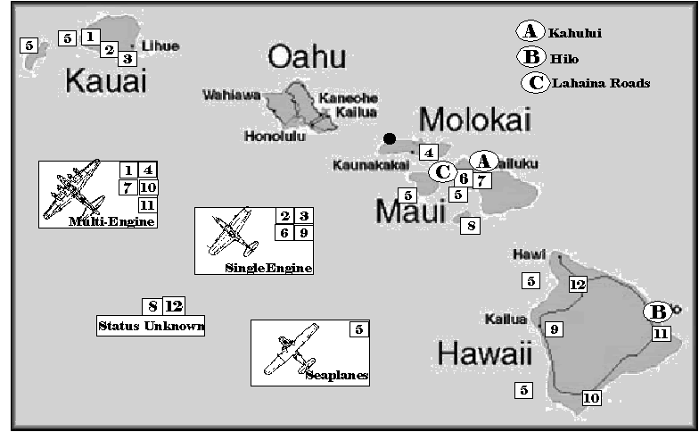
To besiege Oahu, the Japanese would have required bases on the other islands to establish air superiority while at the same time knocking out American installations such that the process could not be disrupted from Oahu. On the other islands there were numerous fields that the Japanese could have exploited to this end, but in most cases these were cruder facilities than what was on Oahu,
Provision has been made for a number of emergency fields upon the variousislands but no provision has been made for dispersion of the planes in the
vicinity of fields and other protection by either camouflage or by bunkers....The bombers can make use of the landing fields on other islands but it will be necessary to make provisions for their dispersion in the vicinity of those fields PHA - Vol 30, 2524
Because land based airpower was dependent in part upon the quality and communcations of available bases, Oahu's infastructure would have required severe bombardments to reduce them to a point where the more primative outlying airfields could then maintain an equal or greater tempo of operations. And while these other fields were available for immediate use, the invaders would have needed to complete the task of finishing dispersed revetments for their aircraft using thier own troops and/or employing locals as additional labor.
An attacking force had two basic options, either to concentrate their resources at a few bases in order to coordinate offensive activity over Oahu, or to disperse aircraft widely to safeguard them against counterattack. IMO, the proper procedure would depend especially upon the potential presence of USN fleet carriers. The stronger and more immediate this threat, the greater the need to disperse forces throughout the entire available airbase network. As the likelyhood of counterattack receded, then factors permitting the most favorable operational tempo would take precedence.
Maui
# 5 - Lahiana Roads (seaplane base)
Probably many areas on the lee side of Maui (southwest), on the west coast of the Big Island, of Kauai and other islands, would be capable of supporting seaplane tenders or land based seaplane operations. As time went on these facilities would evolve into bases, but during the initial attack the need to maintain reconaisance coverage would have shut out all other considerations. Bases marked "5" on the map are all prospective seaplane operating areas for the initial attack, assuming the normal east-west prevailing winds.
# 6 - Puunene (Lahaina Roads) Naval Air Station.
Estimated capacity: About 70 aircraft, including twin engine bombers.
http://www.ww2pacific.com/aaf41.html
http://www.airfields-freeman.com/HI/Air ... I_Maui.htm
Aircraft, December 7th: 4 x JRB2, 4 x BT-1, 2 x utility
This field consisted of runways, a warming-up platform, and a CAA Territorial landing field. Puunene provided facilities for Utility Squadron Three, and more importantly, was capable of sustaining the semi-permenant operation of an entire carrier air group. Throughout 1941 the runway was being widened and lengthened; it was 3,500 feet by December 7th 1941. After the attack, a squadron of B-17's was stationed at Puunene which means that this facility ranked as the most imporant potential Betty bomber base in the Hawaii Territory.
(Information from The Annual Report of the C in C, June 30, 1941. Vol33 no.1267, PHA and testimony of General Short, Vol 22 page 64)
#7 - Maalaea naval emergency landing field.
http://www.ibiblio.org/pha/pha/congress/app-f.html#490
Estimated capacity: About 10-20 single engine aircraft.
Not much is available concerning Maalaea Field, which suggests it wasn't that important from a military perspective. Hence it would probably serve only as a satellite field for a small number of single engine aircraft unless more intensively developed.
Molokai
#4 - Homestead Field Naval Air Base,
http://www.ibiblio.org/pha/pha/congress/app-f.html#490
Capacity: About 70 aircraft including twin engine.
Homestead Field does not appear as if it were as advanced a facility as the NAS on Maui (Short does not mention B-17's being dispersed to Molokai, for example). The Annual Report of the C in C (June 1941, PHA Vol 33 page 1267) notes that Homestead had "limited facilites for day to day operation of one carrier air group" . Throughout 1941 efforts were made to expand the facility.
Kauai:
#1 - Barking Sands
Estimated Capacity: 50+ aircraft including twin engine.
Anticipated complement of B-17 squadrons: 2 (Vol 17, PHA, 3431)
http://www.ibiblio.org/pha/pha/misc/martin_1.html
Construction at Barking Sands for 450,000 gallons gas storage in 9 x 50,000 gallon tanks was underway in June 1941. It does not appear to have been completed by December, suggesting that Canadian government union rules have at least one historical precident. I know that Barking Sands was not yet paved at the time of the attack, but I've lost the &*(^@$# reference. Vol 39 of the PHA, pg 200 notes "there was only one runway in the entire Department from which a B17 could take off, and that was at Hickham Field." Since Wheeler Field (for example) was indeed long enough for a B-17 to take off from, this might be a reference to paved surfaces being necessary for heavy aircraft to use. We had only one field that really was satisfactory for the largest bombers and that was Hickam. - vol 22, pg 64. There is no evidence I'm aware of that the lighter IJN bombers (Betty, Nell) could not have used Barking Sands as it existed in December 1941, thus this base is the primary target for capture on Kauai.
#3 - Burns Field
Estimated capacity: Less than 20 single engine aircraft.
http://www.ibiblio.org/pha/pha/misc/martin_1.html
http://www.airfields-freeman.com/HI/Air ... _Kauai.htm
Not much mention of this field.
#2 - Mana Airfield Military Reservation.
Estimated capacity: About 10 single engine aircraft.
http://www.airfields-freeman.com/HI/Air ... _Kauai.htm
The least important aerial installation on Kauai. Might be useful as a dispersal strip for a small number of planes.
Hawaii
#9 - Kona Municipal Airport
Estimated capacity: 15-20 single engine aircraft.
http://www.airfields-freeman.com/HI/Air ... Hawaii.htm
Another small site adequate as a single engine dispersal strip.
#10 - Morse Field
Estimated Capacity: About 50+ aircraft. Morse field was scheduled to operate 2 B-17 squadrons (PHA Vol 17, 3431) and construction work was continuing to that end when the war began.
http://www.ibiblio.org/pha/pha/misc/martin_1.html
http://www.geocities.com/hahinc/SouthPoint.html
Morse Field was also scheduled for a 450,000 gallon gas capacity. Status of project unknown.
#11 - Hilo Municipal Airport
Estimated Capacity: About 20 twin engine aircraft. Hilo was scheduled for a tank farm capable of supplying the 1 B-17 bomber squadron planned for operation there.
http://www.ibiblio.org/pha/pha/misc/martin_1.html
#12 Parker Ranch
1 B-17 squadron was to be based at this facility. Status of this project unknown.
Lanai
#8
http://www.ibiblio.org/pha/pha/misc/martin_1.html
Status of this base unknown in 1941.
Oahu
Hickam Field
Primary bomber base for USAAF in Hawaiian Islands. Hickam was also the main Army maintenence and supply center. (Vol 31, 2499) Some (not all) of its gasoline supply was located underground. This storage was not bombproof, but it was more than splinterproof. At Hickam there was an aqua system which contained underground gasoline (Vol 22, page 67). This system was vulnerable, and in the event, was knocked out by enemy action,
...repair the broken water main at Hickam, which was serious because we used this aqua system to flow the gasoline on water on all airfields, so without
the air pressure we had to use hand pumps, and that means that effects a great deal of difference as well as the fire hazard that existed at that
time. They made most of the repairs at night and they got to it quickly....vol 22, 64
The aircraft repair facilities on Hickam were too much concentrated before the attack,
At present all shop and repair facilites for the repair of aircraft of the Hawaiian AIr Depot are crowded into a small area at Hickam Field. This area
is located close to the entrance channel of Pearl Harbor which is a perfect landmark even during blackouts. Concealment or confusion as to the purpose of this installation by any camouflage is impracticable by any means known to this headquarters. In any attack or raid on this island, it is not only probable, but almost unavoidable that the Depot would be put out of action.
PHA, Vol 30, 2530
and,
At present the only repair facilities for the bombers are in buildings on Hickam Field which would undoubtedly be attacked by any surprise raid. Up to the time that we make runways for dispersion of planes on all the fields surprise enemy raids would be extremely serious. PHA, 30, 2525
Hickam Field: Total area of infastructure: 731,000 yards.
Air park (Dec 7th 1941): 666 x157 (Yards)
http://the.honoluluadvertiser.com/speci ... truck.html
Aircraft: 12 x B-17
33 x B-18
12 x A-20
Status, Hickam, 12 December 1941.
By Dept vs. 7:45 AM December 7th.
Adminsitration..............100%
Plant Maintenence........100%
Armament section.........100%
Engine Repair Branch....50%
Aero Repair..................200%
Sheet Metal..................50%
Machine Shop...............30%
Fabric..........................200%
Instrument repair............50%
Refinishing...................100%
It is expected that with the resumption of power, production of the entire plant will exceed previous levels within the week.
(PHA, vol23, 1974)
Wheeler Field.
Primary USAAF fighter base in Hawaiian Islands. Also a maintenence and supply center
Special fortification:
During the summer General Short by using troop labor managed to construct 85 bunkers at Wheeler Field; but under the alert of 27 November planes were ordered to be bunched not dispersed, and the bunkers therefore were not put to use.
In addition, Wheeler's proximity to rough mountainous terrain could have been exploited to better fortify this airbase during any protracted campaign, which might have eventually made it the toughest field in all of Hawaii. Plans to this effect were being considered before the war.
Infastructure area: 540,000 yards sq.
Air Park, Dec 7th: 548 x 724
Aircraft: 87 x P-40
53 x P26 and P36
Kanoehe Naval Air Station.
Major seaplane base, secondary only to Ford Island NAS. Kanoehe's communications with the rest of the island were primative. During 1940 a sea channel had been completed that permitted deepwater vessels to sail into Kanoehe Bay and unload at pierside.
Infastructure area: 202,500 yards sq.
Aircraft: 36 x PBY Catalina
Ford Island.
Primary seaplane base, presumably with extensive maintenence facilities and supplies. Also probably an important carrier airwing support facility. Ford Island is divided into two target zones of infastructure, North and South, divided by the massive air strip in the center
Total area of infastructure
(North): 236,000 yards sq.
(South): 334,000 yards sq.
Limitations to Ford NAS noted here,
The overall situation in the Hawaiian area, however, remains far from satisfactory. As has frequently been stated, it is an unsound and
potentially dangerous situation for the Pacific Fleet aircraft, other than patrol planes, to have to be overhauled almost entirely on the mainland as a
result of current overhaul facilities at NAS, Pearl Harbor being limited to the amount necessary for patrol plane overhaul. (Vol 33,PHA 1267) annual
reportof the cinc, 30 June 1941
Aircraft:
36 x PBY Catalina
F4F x 4
SBD x 3
Mis. x 29
(NAS OOB from PHA Vol 12, pg 351-352 and 357-358)
Ewa Field.
Naval air station with all Marine and Navy single engine combat aircraft, their supplies, reserve aircraft, carrier base support, and at least some maintenence facilities.
Specifications: 390,000 yards sq.
Air Park Dec 7th: 333 x 450
Aircraft: 11 x F4F
9 x SB2U
25 x SBD
7 x Misc.
Heliewa Field.
Dispersal air strip of secondary importance
Aircraft:13 x P-40
2 x P-36
2 x P-26
Bellows Field.
Dispersal air strip of secondary importance.
Aircraft:12 x P-40
4 x P-26
Other bases Near Hawaii
Johnston Island - Seaplane base
Marine Garrison: 160
5" guns: 2
3" - 4
50 cal - 6
30 cal -10
"This station is currently due for completion about January 1942. It is usable at present by one squadron with tender. ...The NAS, Johnston Island, is scheduled for commissioning on August 15, 1941. Annual Report of the C in C, June 30, 1941. Vol33 no.1267, PHA
Palmyra - seaplane base
Marine garrison: 154 men, 4 x 5", 4 x 3", 8 x 50 Cal MG, 10 x 30 cal MG
Midway - Seaplane base with airfield nearing completion.
Marine garrison: 798 men, 7" x 4, 6 x 5" guns, 12 x 3", 30 x 50 cal, 30 x 30cal
10? x PBY
Wake - Seaplane base. Marine garrison of 454 men, 6 x 5", 12 x 3", 18 x 50 cal, 30 x 30 cal.
12 ? x F4F
Seaplane base with air strip under construction.
This station is currently due for completion about January 1942. It is usable at present by 6 VPB with tender. Landplane runway is being provided. Annual Report of the C in C, June 30, 1941. Vol33 no.1267, PHA
Samoa
613 men, 4 x 6", 6 x 3", 18 x 50 Cal, 30 x 30 cal.
Vol 19, 3983
Ports:
Hilo (Big Island)
Like all ports in Hawaii except Pearl Harbor, Hilo suffered from being open to submarine attack from the sea,
There is a harbor down at Hilo which would take a couple of battleships and a number of smaller craft....we stopped the practice of anchoring in any of
those open roadsteads or in the harbor at Hilo, which is only partially protected by breakwater and subject to submarine attack. Vol 22, 431
Any use of this harbor would require anti-torpedo nets and anti-submarine minefields. Hilo had a naval radio station. (Another was located on Oahu, west coast, at Lualualei and another at Heeia. Wahiawa and Wailupe had radio recieving stations.)
Maui
North shore, at Kahului. Another small facility of little military usage,
Destoyers can go inside of Kahului...."open roadstead" vol 22, 431
Lahaina Roads,
This was the second USN fleet anchorage in the Hawaiian Islands, capable of sheltering the entire fleet. As the only alternative to Pearl Harbor outside Oahu, Lahaina would have functioned as the primary harbor facility for a Japanese invasion. There was, however, the serious disadvantage of Lahiana being open to the sea,
The anchorage at Lahaina is absolutely open, and studies were made several years ago to mine Lahaina to the extent necessary to make it unsafe for
submarines to come in there, and a great many plans were laid along that line. There are very swift currents over there, and it was finally decided
that if we put mines in the number necessary to protect that harbor there was an enormous area to mine and that we would destroy more of our own ships than we did of the enemy, due to mines breaking loose in those swift currents, certainly after a short time, and that project was entirely abandoned. - vol 22, 431
Since a Japanese attack was a shorter term prospect than this, the strategy of defensive anti-submarine mining and netting would have been adapted to screen at least smaller sections from submarine attack.
Honolulu.
Honolulu, like all the other ports except Kanoehe and Pearl, was vulnerable to submarine attack. It's usefulness to the defenders was negligible so long as Pearl Harbor itself was at least partially operational. If Pearl were to cease functioning then Honolulu might yet act as the final supply link for shipments from the West Coast of the United States. For the Japanese, Honolulu could serve little purpose as a port. The only objective to be achieved was in denying it to the Americans.
Pearl Harbor.
http://plasma.nationalgeographic.com/pe ... meset.html
Marines:
Station troops - 896. Defense battalions - 1,890
Guns: 5" x 10, 3" x 12, 50 Cal x 58, 30 Cal x 40
Pearl was experiencing a boom brought about by global uncertainty, with much of the Dec 1941 infastructure at Pearl Harbor having been built after 1938. Major installations in operation were, at the Navy Yard, Pearl Harbor: one battleship dock, built in 1928; one battleship dock, under construction; one floating dry-dock, 18,000 tons; one large repair basin, supporting industrial establishments for repairs to anything afloat; one fuel depot with two tank farms above ground; one submarine base with all services for war conditions; one section base, inshore patrol and harbor entrance control post; and, the administrative office of the Fourteenth Naval District which was inside the navy yard.
The spacious harbor, consisting of several lochs and channels, is connected to the open sea by a narrow channel 375 yards wide, 3,500 yards long and a minimum depth of 45' in the channel and about 40' at the berths. Two anti-submarine nets guarded this entrance. A channel had been dredged to the dry dock 45 feet deep for damaged vessels. It is assumed that the United States Navy would be able to keep this windpipe open, and that any special attempts by the Japanese to block the entrance to Pearl either by sinking ships or by mining would be negated by the defenses, just so long as the United States had physical control of the landward approaches to the harbor entrance.
Seachannel and aerial mines.
One potential tactic might have been to seed the channel with aerial mines as part of an overall attack strategy. Doing so might have sunk a ship in the channel, or bottled the fleet in harbor at a point in time when this wasn't to be desired. Nonetheless, aerial mines are ignored in this thread because this link,
http://www.fischer-tropsch.org/primary_ ... 0-01-2.pdf
is clear that no such weapon existed in the Japanese inventory at the time.
The features of Pearl Harbor are a set of targets, each with specific characteristics.
Battleship Row.
In this scenario, Battleship Row is defined as the line of intact surviving vessels moored on the shoreward side of the battleship pairs, ships unable to get underway due to the sinking of vessels around them. These may include any of Maryland, Tennessee and Arizona. It is assumed that these vessels can and will be netted into the coastal defense system within 7 days of the start of the war.
Naval Station.
There were serious consequences for the United States Navy should Pearl Harbor Naval Station have been damaged or degraded,
But even assuming that the form of attack that was made had been pursued vigorously against our oil supply, which was all above ground, against our
drydocks, repair shops, barracks and other facilities, storehouses, I feel that insofar as the prosecution of the war was concerned, that we would have
been very much worse hurt than we were by the attack on capital ships.... From Vol 26, 101
Location: South of Battleship Row with the northwest corner of the NS being defined by USS Pennsylvania in dry dock and the USS Bagley in the southeastern. The bulk of the Navy's warehouses, repair facilities, docks - everything needed to maintain a fleet - was kept here.
Target characteristics: About 822,000 square yards.
Target types: Buildings, supplies, infastructure, ships, docks, concrete and paved surfaces.
Not present: The Navy's ammunition storage was located on the west side of the island at Lualualei, along with radio transmitting station.
The implications for the defenders of damage or destruction to the naval station were severe,
We had one drydock with a battleship in it, and two destroyers on December 7th., If the caisson had been breached, the dock would have been partially destroyed and the ships in it would have been wrecked; a serious casualty would have been the loss of our machine ships and the tools, our storehouses with the spare parts, spare torpedoes, storehouses with our food supply for 50,000 men for 100 days and all the various elements that went to make up the requirements of the base. An attack on the ammunition depot at Lualualei certainly would have destroyed our radio transmitting stations which were located there and might have destroyed some of the ammunition storage.
Vol 33 - 1269-1271
Cinpac HQ and Submarine base.
To the east of the Southeast Loch; a smaller target roughly defined by Pelias in the north and Merry Point/Castor in the south. This area housed two prime targets: command and control facilities for the 14th Naval District and the submarine base.
Target area: 180,000 yards sq.
Target types: Building, supplies, equipment, infastructure, submarines, ships.
Oil storage tanks.
The administrative command at Pearl ran two tank fields. But for targeting purposes, there were actually four different fields, not including a few oil tanks placed slightly outside the main groupings:
A) Tank Field 1, by Naval Hospital.
B) Tank Field 2, east of CINPAC HQ.
C) Tank Field 3, south of CINPAC HQ.
D) Tank Field 4, on south side of Ford Island.
F....Tanks...Rad/Rad.....Area.........Tons
A.......8..........30/50.......7854........9,657
B......17.......132/152....72,581.....397,364
C.......9..........72/92.....26,590......62,588
D......27.........60/80......20,105.....130,391
Tanks - Number of tanks in field
Rad/Rad - Estimated radius of tank / Radius of tank with assumed vulnerability to near miss of 20'.
Area - Total area of tank, with a near miss zone.
Tons - Guesstimate as to total amount of oil contained in field.
The tanks were safeguarded in a series of berms designed to prevent spillage from smaller leaks. But these were inadequate protection against the destruction of the entire network. In this case, the stored oil would have spilled out of the tank field and caused destruction in the naval yard and elsewhere,
The oil storage, fuel and diesel at Oahu, amounted to approximately 4,000,000 barrels. All of this oil was stored in tanks above the ground,
metal tanks with the exception of one concrete tank embedded in the ground but visible from the air. These tanks were located in two groups of tanks
known as the "Upper Farm" and "Lower Farm". They were immediately adjacent to the submarine base, industrial navy yard, hospital, and Hickam Field. Struck by bombs and set on fire, not only the reserve oil would have been estroyed but the burning oil would have flowed over the dykes and caused ide conflagration in the yard and general area. Ships desiring oil would have been unable to obtain it. Submarines desiring diesel oil would have been unable to obtain it. Vol 33 - 1269-1271
In all probability the tanks were near to capacity at the time of attack; of the 4,000,000 barrel capacity, 3,495,478 barrels were in strategic reserve and could be accessed only by Presidential authority. The remainder was sufficient for month to month operations, assuming a constant flow of tankers from the West Coast. For example, in January 1941 the Hawaiian department consumed 600,000 barrels, in March, 703,036 barrels.
Oil distribution while in port.
The system employed at Pearl Harbor in 1941 was probably inadequate to meet the needs of the fleet if under the pressure of an attack. If the pierside distribution system were damaged, there was insufficient backup to support the fleet,
"The distribution of fuel oil at Pearl Harbor was accomplished with difficulty early in the year. One oil barge, the YO21, was used to capacity
but it could not meet the needs of the fleet. Oilers were used to fuel large combatant ships and destroyers were fueled at Merry Point dock. Ships
at Navy Yard piers were fueled by yard lines at every opportunity. This arrangement required a great deal of supervision and caused many
inconvieniences to the ships being fueled. As time went along and it became apparent that the fleet would remain in the Hawaiian area, the three oil
barges from SanPedro and one from San Diego were transferred to Pearl Harbor.
The five fuel oil barges meet the requirements of the Fleet at the present time, but often have to work twelve to sixteen hours a day. A rapid fueling
of the Fleet would necessitate many cruisers and all destroyers fueling from navy yard piers. Each barge has a capacity of 3,500 barrels and 28,000
barrels of fuel can be delivered each day. Four barges are kept working and one barge is assigned an upkeep period. There is a real need for barges of
10,000 barrel capacity, as the small barges use 62.5% of their time on a fueling job going and coming from fuel docks and reloading. When practical,
barges refuel from oilers at anchor in Pearl Harbor. This procedure shortens the fueling time as oilers can fill the barges in a shorter time
than the shore activitity, and the barges have a shorter distance to travel."
The fueling infastructure at Pearl Harbor represented the single greatest weakness in the system constructed to support naval operations in the Hawaiian area. As such, it would have been amongst the highest priority targets for any sustained attack.
Fleet Train.
During the initial concept phase for planning the Pearl Harbor attack, the USN fleet train was identified as an important secondary target, the destruction of which would suffice to cripple the United States Navy during 1942. It was decided that if the battlefleet were not present during the attack, a viable alternative would be to destroy the auxialeries to achieve the mission objective. The following ships were near or in Pearl Harbor on December 7th:
Antares: AKS, 8,400 tons - near Pearl Harbor at sea
Arctic: AF, 12,400 tons - at anchor, Lahaina Roads
Regulus: AK14, 3,590 tons - 27 N, 175 W (near Midway)
Neches: AO, 5,723 tons - halfway between Hawaii and California.
Medusa: AR. 10,000 tons, Pearl Harbor
Vesta: AR, 8,100 tons, Pearl Harbor
Rigel: AR, 8,091 tons, Pearl Harbor
Henderson: AP, 7,297 tons, Pearl Harbor
St Miheil: AP, 8,213 tons, Pearl Harbor
Grant: AP, 10,352 tons, Pearl Harbor
Achiba: AK, 7,293 tons, Pearl Harbor
Castor: AK, 7,293 tons, Pearl Harbor
Solace: AH, 8,660 tons, Pearl Harbor
Pyro: AE, 10,600 tons, Pearl Harbor
Neosho: AO, 6,521 tons, Pearl Harbor
Mercury: AK, 5,994 tons, Pearl Harbor
Lassen: AE, 13,855 tons, Pearl Harbor
Aroostook: AK, 4,200 tons, Pearl Harbor
Argonne: AG, 8,400 tons, Pearl Harbor
Sumner: AG, 3,142 tons, Pearl Harbor
Dobbins: AD, 12,450 tons, Pearl Harbor
Whitney: AD, 12,450 tons, Pearl Harbor
Pelias: AS, 8,400 tons, Pearl Harbor
Total Pacific Fleet auxiliary force: 45 ships - 369,790 tons
In Pearl Harbor: 161,312 tons (19 ships)
Near Pearl: 24,390 (3 ships)
Total force in danger: 22 ships, 185,702 tons (about 50% of total fleet train).
The operational order for Tinkerbell specifically identifies the fleet train as a target for the Main Body second only in importance to USN battleships and heavy cruisers.
8) Other ships in port.
Numerous cruisers and destroyers were dispersed in groups about the harbor. There were a number of ships and submarines undergoing repair and maintenence. The anti-aircraft strength of the vessels in Pearl Harbor on December 7th was:
A.A. strength. (Vol 12, page 353)
Type....Qty....5"......3".....1.1"....50 Cal
BB.........7....8........4........0..........8*
BB.........1....8........4........0..........11 (West Virginia)
CA.........2....8........4........4..........16
CL*........4....8........2........2...........8
CL**.......2....0........9.......0...........16
DD^........8....5..............................4
DD+.......8....5..............................5
DD%......8....4.............................32
DD$......17...0.......0.6...................3
SS.........5....0......0.6...................2
Misc......31..0.25....2...................3.2
* - Brooklyn x 3, St. Louis
** - Omaha
^ - Farragut
+ - Mahan
% - Gridley
$ - Misc. types, average values
* - more 30 cals available on ships - landing force guns.
(fractional values mean that less than 1 gun was carried per ship).
Totals available naval guns were:
5"........3"........1.1".........50 Cal.....30 Cal.....37mm
217...136........16.............397...........14*...........1
Army installations.
The deployment of the Army garrison at Hawaii on November 30th, 1941:
Strength by Unit and Station, Nov 30 1941.
(Vol 12, pp320)
Location...........................Men
Barking Sands...................70*
Bellows Field....................409*
Camp Malakole, Oahu......1,395
Fort Armstrong..................818
Fort Barrette.....................133
Fort De Russy...................542
Fort Kamehameha...........2,171
Fort Ruger........................897
Fort Shafter.....................3,415
Fort Weaver......................346
Hawaiian Ord. Depo..........262
Hickam...........................5,378*
Hilo, Big Island.................468*
Homestead, Molokai...........97*
Hononlulu..........................50
Lihue, Kauai.....................200
Schofield Barracks..........22,179
Tripler Hospital.................404
Wailuku, Maui.................455
Wheeler Field..................3,257*
Total: 40,469 men, 2,490 officers.
* - General Short ensured that USAAF personell were trained in basic infantry techniques, including beach counterattack (vol 22, page 79). He had anticipated some of the difficulties that prevent rear area units from performing adequately, and had decided on measures to increase the chances of their participation in an active defense.
It was planned that this force would be augmented from the West Coast after the start of hostilities:
Initial War Garrison, Hawaiian Department.
Department HQ - 683
Beach and land defense - 23,550
Hawaiian Air Force - 8,802
Harbor Defense - 6,220
Anti-Aircraft Artillery - 8,993
Service Organizations - 5,911
Hospital Forces - 3,009
Service command - 83
Total - 57,241
Including:
North Sector triangular division - 11,445
South Sector Division - 11,161 (PHA, Vol 30, 2601-2605)
Of the additional troops absent at the time of attack but authorized and required in wartime was the garrision for Kanoehe Bay - like the west coast of Oahu, the east coast had next to no troops assigned to defend it. The defenses of the outlying islands were also entirely inadequate,
Location.................Men
Kauai.......................70
Hilo (Big Island).......468
Molokai....................97
Lihue, Kauai............200
Wailuku, Maui.........455
Augumenting these limited numbers on the other islands were substantial quantities of artillery General Short had dispatched,
Defenses, beach, Maui, Hawaii, Kaui - "I sent about 75 guns to each <island>
which could be used on the beach or moved around, and a considerable number of....machine guns (Vol 22, pg68)
Naturally, most of these guns would fall into Japanese hands upon the loss of the islands in question.
On Oahu itself were the following Army guns,
Weapons on hand, Oahu, Dec 6th (PHA Vol 23, 2017)
Type...................Authorized..............On hand
16" ..BA.......................4...........................4
14".DC.........................2..........................2
12" DC.........................0..........................2
12" BA.........................2..........................2
12" Mortar....................0..........................20
8" fixed........................2...........................2
8" rail..........................12.........................12
6" DC..........................2...........................4
3" Coast, fixed.............0...........................4
155mm.gun.................24.........................36
240mm..how................0...........................2
155mm...how..............24.........................32
mmAA.......................12..........................0
3" AA(fixed)................26.........................26
3" AA(mobile).............60.........................60
75mm M1897 ............16..........................16
75mm M1917.............72..........................64
37mmAA...................74..........................20
37mmAT..................160..........................18
37mm M1916 INF.......0............................54
81mm Mor................68............................68
3" trench Mor.............0............................32
60mm Mor...............150.........................150
Cal 50 AA................166.........................107
Cal 50 MG................185.........................12
Cal 50 MG................52............................0
Cal 50 MG.................17..........................17
Cal 45 SMG.............524..........................21
Cal 30 MG...............375........................1504
Browning Auto.........1929.......................2448
Oahu Ammunition stock levels (Army)
(information courtesy of Robdab.)
37mm
.....HE - 44,518
75mm
.....Schrapnel - 178,365
.....HE - 132,338 (normal load, fast fuse)
.....HE - 104,615 (light load, fast fuse)
.....Gas - 23,000
.....Smoke - 13,051
3"
.....AA - 124,676
.....AA - 24,480 (Navy, PHA Vol 30, pg 1456)
.....HE - 17,418
3" (Trench Mortar)
.....HE - 11,004
81mm
.....HE - 3,200 (normal load)
.....HE - 12,195 (light load)
.....Smoke (800)
6"
.....AP - 4,000
155mm
.....Schrapnel - 18,246
.....HE - 75,012 (land bombardment)
.....HE - 46,097 (fused for anti-shipping)
.....Mustard - 3,504
.....Cholrine - 5,043
.....Smoke - 1,623
8"
.....AP - 9,804
.....HE (Granger, fused for anti-shipping) 1,136
.....HE (Land bombardment) 2,46
12"
.....DP Mortar - 5,284 (700lbs)
.....DP Mortar - 766 (1046lbs)
.....AP - 535 (975 lbs)
.....AP - 545 (1070lbs)
14"
.....AP - 144 (1400lbs)
.....AP - 414 (1560 lbs)
16"
.....AP - 500 (2100lbs)
.....AP - 500 (2340 lbs)
Major formations:
25th Infantry Division
24th Infantry Division
34th, 804th Engineers
11th Tank Co. (Comp A)
1st Separate Chemical Battalion
Hawaiian Coastal Artillery Command
15th, 16th Regiment (harbor defense)
41st Regiment (Rail)
45th Regiment (155mm mobile and A.A.)
64th, 77th, 98th Regiments (semi-mobile)
251st Regiment (mobile)
Hawaiian Air Force
5th, 11th Bombardment Groups
15th, 18th Pursuit Groups
86th Observation Group
Air Corps Services.
Schofield Barracks.
This facility is of interest both because it housed over half the department army garrision at 7am on December 7th and because it would have been added to the list of targets to be bombed during the surprise raids on the morning of the attack. Schofield was time-sensitive because its vulnerability stemmed from the overcrowding inherent to housing two entire divisions there,
General Murray: ...I think you know the situation at Schofield. We have a very congested magazine aera that was built for peacetime, but when a whole
post starts to draw ammunition at once, it would be just like a slaughter with the Japanese bombs dropping into that area while they were all drawing
ammunition. It would be just hopeless.
Q: You did not expect Japanese bombs when you gave that order?
Murray: ...I did not. I was just looking after the alert. I thought there might be a surprise raid.
Q: By plane?
Murray: By boat.....without two or three hours delay that would be accasioned by drawing for 20,000 men going through two gates, one gate going in and one gate coming out and there would be that congestion there and the exposed position of the troops. It took approximately six hours to draw the ammunition from the magazines due to the congestion....
Vol 22, 161
Q: THen there were no slit trenches dug before that?
A: No slit trenches dug before December 7.
Q: Before that: Were there air raid shelters before that?
A: Only at machine gun positions; that is all; the ones I mentioned.
Of the army bases on December 7th, Hickam most clearly demonstrated the symptoms which made the situation at Schofield so potentially disasterous,
"Lieutentant James Dyson noted that anti-aircraft rounds burst consistently short of the horizontal bombers flying at 10,000 feet. It was probably one of those horizontal bombers which inflicted heavy casualties at Hickam's huge new consolidated barracks. The headquarters squadron of the 11th Bomb Group reported 245 casualties from among its 350 men, including 16 killed and 50 disabled." (Target, Pearl Harbor, pp130)
Vol 27, 475, PHA
The 22,179 men housed at Shofield on the morning of December 7th consisted of the 24th and 25th infantry divisions, and probably elements of the 34th Engineers, 11th Tank Co., 1st Chemical Battalion.
American planning was predicated upon the assumption that Oahu would be used as the fleet's major forward base in a war against Japan. It was the only national territory of the United States situated so as to be both able to participate in a Pacific War, sizeable enough to accommodate major military installations, and close enough to the United States to be defendable. With it, the United States retained the ability to project power into the waters of the western Pacific without undue concern for national security along the California seaboard. Without Oahu, an effective defense by US forces of the Malay barrier or the Philippines was neighbors to the impossible. Efforts to reinforce Australia would be made more difficult and the resources needed to do so, by necessity, would be dispersed to other tasks; for the cities and bases stretching from Alaska to Mexico would then be vulnerable to carrier raids originating from Hawaii.
The strategic focal point, the seizure of which by Japan would seal off the Western Pacific from the interference of her deadliest enemy, was a small diamond shaped island swept by the trade winds of the Central Pacific. Oahu is dominated by two mountain ranges, one on each of the eastern and western coasts. Between them was the coastal plain of the south shore upon which most of the military bases were constructed. This plain extended through to the north shore, constricted by mountains to a narrow bottleneck near Wheeler Field. Immediate access to the crucial areas on the central plain was blocked in all directions - to the east and west by very difficult mountain ranges. Barring the way on the north/south axis were two lavishly supplied triangular infantry divisions backed by a strong contingent of coastal artillery. With the airbases on Oahu so secured, it was small wonder that Oahu seemed invulnerable,
"An attack in force against Oahu necessitates an air superiority that can only be had by the establishment of land-based air within striking distance of Oahu. This can only be accomplished successfully within the Hawaiian group and with the defenses <on hand it was not believed to be possible>"....If the Fleet is in the Pacific and free to act, Oahu will be, with the completion of the existing defense project, secure against any attacks that may be launched against it. It is only in the case that the Fleet is not present or free to act that the security of the Hawaiian Islands can be seriously threatened."
Methods of attack.
Oahu could be taken by storm, surprise or by seige
Option 1: By Storm:
An all-out assault on Oahu within days of the start of the war was one possibility. A rough outline might see about 80 transports make the journey across the North Pacific with two reinforced IJA divisions embarked. After the initial attacks created the proper conditions for an assault, the force would land on or about December 10th-11th in an attempt to storm the base. Irrespective of other difficulties, this approached is ruled out for the following reasons:
1) Such a force (at least 475,000 tons of shipping) would have employed so many transports that it would prove impossible to have the invasion convoy keep pace with the navy ships. This in turn meant that an attack on Pearl Harbor would be dispatched in two waves, with the slow cruising (9kt) invasion convoy leaving various Japanese ports before the faster (14kt) military vessels.
2) While the chances were good that a landing could occur, it was always possible that weather conditions might hamper or cancel an invasion.
3) The more ships sent in more groups from more ports, the likelier that something would attract American attention. (Though, it must be confessed, the American mindset in December 1941 was so complacent that even Godzilla wearing neon underwear might not have attracted notice).
4) The defenses of Oahu were strong enough that, if alerted, they could prevent any assault from carrying the south shore. No other coast could quickly gain access to the naval base. An invasion force would in all probability be stranded under a hostile air umbrella without having carried the naval base or key airbases.
5) An early attack would require at least 2 reinforced divisions and a huge amount of shipping. If the military situation did not develop as expected, this effort would at best have wasted scarce resources on an useless trans-oceanic excursion, and at worst might actually see the annihilation of important IJA units plus numerous transports.
6) Logistic considerations prevented an assurance that the IJN could stay near Hawaii for long enough to support an invasion throughout the decisive phase.
Option 2: By Surprise.
A second alternative would be to speed up the landing schedule to take advantage of the element of surprise. Here the initial assaults will come as early as possible in order to allow the attackers to storm the strong northern and/or southern beach defenses before the US Army was properly alerted to the danger. The enclave established would be reinforced by the main invasion group as soon as the fleet had defeated the USN and cleared its approach. Since the initial landing will have already destroyed the main coastal defenses (at least in theory), then the followup forces could storm Pearl Harbor directly from the southern shore.
In this scenario, the entire chronology of the attack is overturned. Due to considerable difficulties in timing the approach of a landing force and syncronising it to the minute with an air attack, in all probability the initial landing would proceed the air raid. During the night of December 6th/7th (towards dawn), Japanese SNLF landing boats (old destroyers converted to troop transports) as well as a large body of other civilian transport ships would arrive off Oahu and beach themselves on the south or north shore shore. This force must be of sufficient size that the debarked units could hold out for several days without any reinforcement. Perhaps an 8,000 man force without much in the way of transportation or rear area equipment on 60,000 tons of sacrificial transports - more than necessary to faciliate rapid debarkation.
Simultaneously, a strong IJN surface task group would commence the war with a comprehensive pre-dawn bombardment of the airbases and other defensive installations followed up by major air strikes at dawn. If the battle was successful, then the coastal defenses on the south shore would be destroyed by storm before 7am on the 7th, and a large transport group could then approach and disembark the main landing force a number of days later, after the USN was driven away.
The particular attraction to this method is that of the question of Schofield Barracks. At 7am on December 7th, over 20,000 men of the garrision divisions were confined to a 490,000 square yard area north of Wheeler Field. Even as few as 8 or 9 IJN 8" cruisers could, in as little as 40 minutes, saturate this size of target to a density of over 400 x British 25 Pounder shell equivelents per 100x100 square yard area of the target. This level of firepower approaches the military definition of annihilation, which in turn would mean two reinforced IJA divisions could subsequently carry the island.
This approach is ruled out for the following reasons:
1) The entire plan requires a 1960's or 1970's level of coordination and communications amongst attacking units.
2) The employment of surface forces in proximity to Oahu prior to dawn on the 7th risked alerting Oahu, and thereby increased the chances Kido Butai and other fleet units might be overwelmed.
3) While a sudden mass surface bombardment could be devastating, the weather near Oahu is too unpredictable (cloud cover and sea state) to assure that an attacking naval force could accurately deliver sufficient ordnanace onto the proper targets on any particular night, or that air attacks at dawn would be effective. (It would have to be clear skies over key bases such as Schofield Barracks). Indeed, from the Pearl Harbor Papers, page 37 it was noted that cloud cover over Oahu on the morning of the 7th was so thick that only a small part of the island could be seen. Such weather would probably have scuppered the possibility of an effective bombardment.
4) Providing an adequate surface bombardment would be difficult while reserving both the time and ammunition necessary to combat the USN.
5) Exposing powerful surface forces against a target still with yet-intact air defenses was in violation of Japanese naval practice.
6) Even if the surprise attack functioned properly and destroyed the coastal defenses and some ammunition dumps, unless the defending divisions were devastated by the initial artillery and air bombardment the attacking force probably could not secure the naval base prior to the point where the navy must withdraw. If so, then the entire attacking IJA force (at least two crack divisions) would almost certainly be wasted or annihilated.
7) The necessity of surprise raiding a large force (say 8,000 men) that could run into immediate deep trouble might create a situation whereby the main invasion element would either be risked prematurely to avoid the initial invasion force's destruction.
8) It would be unsound to force Kido Butai to split attention between defeating the USN, the USAAF, and supporting a large landing force.
9) This option also requires a massive pre-war transoceanic assault force, with the disadvantage listed above.
10) Any transport force approaching Oahu with the aim of hitting the south shore would have to close to within less than 200 NM of Oahu during the evening of December 6th.
Option 3: By Seige.
By process of elimination then, this Oahu operation will proceed by way of siege. A blockade of Oahu would initially bypass Oahu itself and land strong forces onto the other islands in the Hawaiian Chain to seize ports and airbases by which Oahu could be strangled and bombarded. This strategy, though abandoning any possibility of testing (and therefore defeating) Oahu's defenses early on, eliminates most of the problems associated with storming an island fortress.
Food stocks, Hawaii.
A seige seeks to place pressure upon a defender by forcing the exhaustion of crucial supplies. In the case of Oahu, this meant first and foremost the foodstuffs necessary to sustain the population and garrison of the island. Because of its large population, Oahu in particular and Hawaii in general only provided a small portion of its own foodstuffs. This danger prompted a crash inventory in the days after the attack,
Oahu food inventory of December ninth shows thirty seven days of essential foods on hand for two hundred fifty five thousand civilian population...Thirteen days rice, eighteen days potatoes and onions are most serious deficiences. 113,000 head of cattle equal to 152 days reserve supply for all civilians in territory, 12,000 head swine equal to 10 days reserve suply for all civilians....
PHA, Vol 30, pg2616
The population of Oahu was higher than the 255,000 suggested above:
Census info from July 1941 (pg 1311, vol 21, 22 or 24, PHA)
Oahu:
City of Honolulu.........200,158
County of Honolulu.....110,345
Hawaii
City of Hilo...................22,667
County of Hawaii..........45,731
Others
Kalawao............................464
County of Kauai.................33,479
County of Maui..................52,495
Total - 465,339
A considerable number of non-citizens (who also would have to be fed) were also present:
Ethnicity...........Citizens......Non citizens..........Total
Hawaiian..........14,246....................................14,246
Part Hawaiian...52,445....................................52,445
Puerto Rican.....8,460.....................................8,460
Caucasian.......139,299............2,328..............141,627
Chinese...........24,886.............4,351...............29,237
Japanese.........124,351..........35,183..............159,534
Korean.............4,628..............2,253.................6,881
Filipino.............18,050...........34,010...............52,060
Other..................832................17.....................849
Total: 465,339
Additional resistance to seige was available by way of livestock.
Census info from Census of Agriculture, Outlying Possessions, 1940 County
Table VIII and IX, pp80
Animal.....Hawaii......Oahu.....Kauai....Ma/La/Mo.....Weight
Horse.......5,361........658.......2,097......1,928..........1,100
Mules.......2,437........699........721.........634.............300
Cattle.......82,398....12,523....13,656.....29,961........1,200
Hogs........4,098......22,302.....1,135......4,149...........200
Sheep*.....11,636.....3,205......3,497......7,722...........175
Goats.........675.........29...........36...........25.............80
Chickens..64,973...139,287....26,144....42,186...........5
Turkeys......739........449.........144.........358.............15
Ducks........604.......2,308........954.........848..............7
(Ma/La/Mo = Maui, Lanai, Molokai)
Animal Person Days.
(Days per animal is the number of days one animal can sustain one person)
Animal.........Hawaii...........Oahu............Kauai...........Ma/L/Mol........D/A*
Horse........1,410,390.......173,109.........551,686.........507,225...........263
Mule............174,855........50,153...........51,732...........45,490.............72
Cattle.......23,648,226.....3,594,101......3,919,272.......8,598,807.........287
Hog.............196,021......1,066,779........54,291...........198,461............48
Sheep**........487,015.......134,169.........146,366.........323,224............42
Goats............12,915...........555..............689.................478..............19
Chicken.........77,697........166,564.........31,264............50,447.............1
Turkey............2,651...........1,611.............517...............1,284.............4
Ducks............1,011...........3,864............1,597..............1,420.............2
** - Estimates for all except Hawaii. Total sheep count for all islands is correct
* - D/A is the number of estimated days one animal could sustain one person.
Total Person-Days for all livestocks:
Hawaii: 26,010,781
Oahu: 5,190,904
Kauai: 4,757,412
Maui, Lanai, Molokai:9,726,836
To the total food inventory must be added stock on hand at civilian dwellings,
PHA, Vol 22, page 80. "M-Day" food bill urged householders to stock canned
food. It is estimated that this effort increased
available supplies by "more than" 20%.
Livestock reserves, Summary in days of supplies
Island.......Population.......Total Reserves.....Total days for all islands
Hawaii.........68,398...............380.29....................55.90
Oahu..........310,503...............16.72....................11.16
Kauai..........33,479...............142,10....................10.22
Ma/Mo/La....52,959...............183.67....................20.90
Total: ........465,339............................................98.18
Oahu food reserves, December 1941.
Source................Man days
Civilian................11,930,767
Livestock..............5,191,610
Navy Reserve........5,000,000 (verified)
Army Reserve.......5,000,000 (estimate)
Total Man days: 27,122,377
Population
Civilian.....310,503
Army..........41,669
Marine..........3,893
Navy...........35,000 (estimate)
Total days food on hand, all sources, Oahu, December 9th 1941: about 69.35 days (minimum).
Conclusion: Unless some other pressure manifested itself, Oahu had sufficient resources to hold out until at least mid-February 1942.
Summary of Hawaiian Air Bases.
Any seige of Oahu would require the capture of air bases to secure control of the sea routes to and from Pearl Harbor.
http://www.ibiblio.org/pha/pha/congress/app-f.html#490
http://www.ibiblio.org/pha/pha/misc/martin_1.html
To besiege Oahu, the Japanese would have required bases on the other islands to establish air superiority while at the same time knocking out American installations such that the process could not be disrupted from Oahu. On the other islands there were numerous fields that the Japanese could have exploited to this end, but in most cases these were cruder facilities than what was on Oahu,
Provision has been made for a number of emergency fields upon the variousislands but no provision has been made for dispersion of the planes in the
vicinity of fields and other protection by either camouflage or by bunkers....The bombers can make use of the landing fields on other islands but it will be necessary to make provisions for their dispersion in the vicinity of those fields PHA - Vol 30, 2524
Because land based airpower was dependent in part upon the quality and communcations of available bases, Oahu's infastructure would have required severe bombardments to reduce them to a point where the more primative outlying airfields could then maintain an equal or greater tempo of operations. And while these other fields were available for immediate use, the invaders would have needed to complete the task of finishing dispersed revetments for their aircraft using thier own troops and/or employing locals as additional labor.
An attacking force had two basic options, either to concentrate their resources at a few bases in order to coordinate offensive activity over Oahu, or to disperse aircraft widely to safeguard them against counterattack. IMO, the proper procedure would depend especially upon the potential presence of USN fleet carriers. The stronger and more immediate this threat, the greater the need to disperse forces throughout the entire available airbase network. As the likelyhood of counterattack receded, then factors permitting the most favorable operational tempo would take precedence.
Maui
# 5 - Lahiana Roads (seaplane base)
Probably many areas on the lee side of Maui (southwest), on the west coast of the Big Island, of Kauai and other islands, would be capable of supporting seaplane tenders or land based seaplane operations. As time went on these facilities would evolve into bases, but during the initial attack the need to maintain reconaisance coverage would have shut out all other considerations. Bases marked "5" on the map are all prospective seaplane operating areas for the initial attack, assuming the normal east-west prevailing winds.
# 6 - Puunene (Lahaina Roads) Naval Air Station.
Estimated capacity: About 70 aircraft, including twin engine bombers.
http://www.ww2pacific.com/aaf41.html
http://www.airfields-freeman.com/HI/Air ... I_Maui.htm
Aircraft, December 7th: 4 x JRB2, 4 x BT-1, 2 x utility
This field consisted of runways, a warming-up platform, and a CAA Territorial landing field. Puunene provided facilities for Utility Squadron Three, and more importantly, was capable of sustaining the semi-permenant operation of an entire carrier air group. Throughout 1941 the runway was being widened and lengthened; it was 3,500 feet by December 7th 1941. After the attack, a squadron of B-17's was stationed at Puunene which means that this facility ranked as the most imporant potential Betty bomber base in the Hawaii Territory.
(Information from The Annual Report of the C in C, June 30, 1941. Vol33 no.1267, PHA and testimony of General Short, Vol 22 page 64)
#7 - Maalaea naval emergency landing field.
http://www.ibiblio.org/pha/pha/congress/app-f.html#490
Estimated capacity: About 10-20 single engine aircraft.
Not much is available concerning Maalaea Field, which suggests it wasn't that important from a military perspective. Hence it would probably serve only as a satellite field for a small number of single engine aircraft unless more intensively developed.
Molokai
#4 - Homestead Field Naval Air Base,
http://www.ibiblio.org/pha/pha/congress/app-f.html#490
Capacity: About 70 aircraft including twin engine.
Homestead Field does not appear as if it were as advanced a facility as the NAS on Maui (Short does not mention B-17's being dispersed to Molokai, for example). The Annual Report of the C in C (June 1941, PHA Vol 33 page 1267) notes that Homestead had "limited facilites for day to day operation of one carrier air group" . Throughout 1941 efforts were made to expand the facility.
Kauai:
#1 - Barking Sands
Estimated Capacity: 50+ aircraft including twin engine.
Anticipated complement of B-17 squadrons: 2 (Vol 17, PHA, 3431)
http://www.ibiblio.org/pha/pha/misc/martin_1.html
Construction at Barking Sands for 450,000 gallons gas storage in 9 x 50,000 gallon tanks was underway in June 1941. It does not appear to have been completed by December, suggesting that Canadian government union rules have at least one historical precident. I know that Barking Sands was not yet paved at the time of the attack, but I've lost the &*(^@$# reference. Vol 39 of the PHA, pg 200 notes "there was only one runway in the entire Department from which a B17 could take off, and that was at Hickham Field." Since Wheeler Field (for example) was indeed long enough for a B-17 to take off from, this might be a reference to paved surfaces being necessary for heavy aircraft to use. We had only one field that really was satisfactory for the largest bombers and that was Hickam. - vol 22, pg 64. There is no evidence I'm aware of that the lighter IJN bombers (Betty, Nell) could not have used Barking Sands as it existed in December 1941, thus this base is the primary target for capture on Kauai.
#3 - Burns Field
Estimated capacity: Less than 20 single engine aircraft.
http://www.ibiblio.org/pha/pha/misc/martin_1.html
http://www.airfields-freeman.com/HI/Air ... _Kauai.htm
Not much mention of this field.
#2 - Mana Airfield Military Reservation.
Estimated capacity: About 10 single engine aircraft.
http://www.airfields-freeman.com/HI/Air ... _Kauai.htm
The least important aerial installation on Kauai. Might be useful as a dispersal strip for a small number of planes.
Hawaii
#9 - Kona Municipal Airport
Estimated capacity: 15-20 single engine aircraft.
http://www.airfields-freeman.com/HI/Air ... Hawaii.htm
Another small site adequate as a single engine dispersal strip.
#10 - Morse Field
Estimated Capacity: About 50+ aircraft. Morse field was scheduled to operate 2 B-17 squadrons (PHA Vol 17, 3431) and construction work was continuing to that end when the war began.
http://www.ibiblio.org/pha/pha/misc/martin_1.html
http://www.geocities.com/hahinc/SouthPoint.html
Morse Field was also scheduled for a 450,000 gallon gas capacity. Status of project unknown.
#11 - Hilo Municipal Airport
Estimated Capacity: About 20 twin engine aircraft. Hilo was scheduled for a tank farm capable of supplying the 1 B-17 bomber squadron planned for operation there.
http://www.ibiblio.org/pha/pha/misc/martin_1.html
#12 Parker Ranch
1 B-17 squadron was to be based at this facility. Status of this project unknown.
Lanai
#8
http://www.ibiblio.org/pha/pha/misc/martin_1.html
Status of this base unknown in 1941.
Oahu
Hickam Field
Primary bomber base for USAAF in Hawaiian Islands. Hickam was also the main Army maintenence and supply center. (Vol 31, 2499) Some (not all) of its gasoline supply was located underground. This storage was not bombproof, but it was more than splinterproof. At Hickam there was an aqua system which contained underground gasoline (Vol 22, page 67). This system was vulnerable, and in the event, was knocked out by enemy action,
...repair the broken water main at Hickam, which was serious because we used this aqua system to flow the gasoline on water on all airfields, so without
the air pressure we had to use hand pumps, and that means that effects a great deal of difference as well as the fire hazard that existed at that
time. They made most of the repairs at night and they got to it quickly....vol 22, 64
The aircraft repair facilities on Hickam were too much concentrated before the attack,
At present all shop and repair facilites for the repair of aircraft of the Hawaiian AIr Depot are crowded into a small area at Hickam Field. This area
is located close to the entrance channel of Pearl Harbor which is a perfect landmark even during blackouts. Concealment or confusion as to the purpose of this installation by any camouflage is impracticable by any means known to this headquarters. In any attack or raid on this island, it is not only probable, but almost unavoidable that the Depot would be put out of action.
PHA, Vol 30, 2530
and,
At present the only repair facilities for the bombers are in buildings on Hickam Field which would undoubtedly be attacked by any surprise raid. Up to the time that we make runways for dispersion of planes on all the fields surprise enemy raids would be extremely serious. PHA, 30, 2525
Hickam Field: Total area of infastructure: 731,000 yards.
Air park (Dec 7th 1941): 666 x157 (Yards)
http://the.honoluluadvertiser.com/speci ... truck.html
Aircraft: 12 x B-17
33 x B-18
12 x A-20
Status, Hickam, 12 December 1941.
By Dept vs. 7:45 AM December 7th.
Adminsitration..............100%
Plant Maintenence........100%
Armament section.........100%
Engine Repair Branch....50%
Aero Repair..................200%
Sheet Metal..................50%
Machine Shop...............30%
Fabric..........................200%
Instrument repair............50%
Refinishing...................100%
It is expected that with the resumption of power, production of the entire plant will exceed previous levels within the week.
(PHA, vol23, 1974)
Wheeler Field.
Primary USAAF fighter base in Hawaiian Islands. Also a maintenence and supply center
Special fortification:
During the summer General Short by using troop labor managed to construct 85 bunkers at Wheeler Field; but under the alert of 27 November planes were ordered to be bunched not dispersed, and the bunkers therefore were not put to use.
In addition, Wheeler's proximity to rough mountainous terrain could have been exploited to better fortify this airbase during any protracted campaign, which might have eventually made it the toughest field in all of Hawaii. Plans to this effect were being considered before the war.
Infastructure area: 540,000 yards sq.
Air Park, Dec 7th: 548 x 724
Aircraft: 87 x P-40
53 x P26 and P36
Kanoehe Naval Air Station.
Major seaplane base, secondary only to Ford Island NAS. Kanoehe's communications with the rest of the island were primative. During 1940 a sea channel had been completed that permitted deepwater vessels to sail into Kanoehe Bay and unload at pierside.
Infastructure area: 202,500 yards sq.
Aircraft: 36 x PBY Catalina
Ford Island.
Primary seaplane base, presumably with extensive maintenence facilities and supplies. Also probably an important carrier airwing support facility. Ford Island is divided into two target zones of infastructure, North and South, divided by the massive air strip in the center
Total area of infastructure
(North): 236,000 yards sq.
(South): 334,000 yards sq.
Limitations to Ford NAS noted here,
The overall situation in the Hawaiian area, however, remains far from satisfactory. As has frequently been stated, it is an unsound and
potentially dangerous situation for the Pacific Fleet aircraft, other than patrol planes, to have to be overhauled almost entirely on the mainland as a
result of current overhaul facilities at NAS, Pearl Harbor being limited to the amount necessary for patrol plane overhaul. (Vol 33,PHA 1267) annual
reportof the cinc, 30 June 1941
Aircraft:
36 x PBY Catalina
F4F x 4
SBD x 3
Mis. x 29
(NAS OOB from PHA Vol 12, pg 351-352 and 357-358)
Ewa Field.
Naval air station with all Marine and Navy single engine combat aircraft, their supplies, reserve aircraft, carrier base support, and at least some maintenence facilities.
Specifications: 390,000 yards sq.
Air Park Dec 7th: 333 x 450
Aircraft: 11 x F4F
9 x SB2U
25 x SBD
7 x Misc.
Heliewa Field.
Dispersal air strip of secondary importance
Aircraft:13 x P-40
2 x P-36
2 x P-26
Bellows Field.
Dispersal air strip of secondary importance.
Aircraft:12 x P-40
4 x P-26
Other bases Near Hawaii
Johnston Island - Seaplane base
Marine Garrison: 160
5" guns: 2
3" - 4
50 cal - 6
30 cal -10
"This station is currently due for completion about January 1942. It is usable at present by one squadron with tender. ...The NAS, Johnston Island, is scheduled for commissioning on August 15, 1941. Annual Report of the C in C, June 30, 1941. Vol33 no.1267, PHA
Palmyra - seaplane base
Marine garrison: 154 men, 4 x 5", 4 x 3", 8 x 50 Cal MG, 10 x 30 cal MG
Midway - Seaplane base with airfield nearing completion.
Marine garrison: 798 men, 7" x 4, 6 x 5" guns, 12 x 3", 30 x 50 cal, 30 x 30cal
10? x PBY
Wake - Seaplane base. Marine garrison of 454 men, 6 x 5", 12 x 3", 18 x 50 cal, 30 x 30 cal.
12 ? x F4F
Seaplane base with air strip under construction.
This station is currently due for completion about January 1942. It is usable at present by 6 VPB with tender. Landplane runway is being provided. Annual Report of the C in C, June 30, 1941. Vol33 no.1267, PHA
Samoa
613 men, 4 x 6", 6 x 3", 18 x 50 Cal, 30 x 30 cal.
Vol 19, 3983
Ports:
Hilo (Big Island)
Like all ports in Hawaii except Pearl Harbor, Hilo suffered from being open to submarine attack from the sea,
There is a harbor down at Hilo which would take a couple of battleships and a number of smaller craft....we stopped the practice of anchoring in any of
those open roadsteads or in the harbor at Hilo, which is only partially protected by breakwater and subject to submarine attack. Vol 22, 431
Any use of this harbor would require anti-torpedo nets and anti-submarine minefields. Hilo had a naval radio station. (Another was located on Oahu, west coast, at Lualualei and another at Heeia. Wahiawa and Wailupe had radio recieving stations.)
Maui
North shore, at Kahului. Another small facility of little military usage,
Destoyers can go inside of Kahului...."open roadstead" vol 22, 431
Lahaina Roads,
This was the second USN fleet anchorage in the Hawaiian Islands, capable of sheltering the entire fleet. As the only alternative to Pearl Harbor outside Oahu, Lahaina would have functioned as the primary harbor facility for a Japanese invasion. There was, however, the serious disadvantage of Lahiana being open to the sea,
The anchorage at Lahaina is absolutely open, and studies were made several years ago to mine Lahaina to the extent necessary to make it unsafe for
submarines to come in there, and a great many plans were laid along that line. There are very swift currents over there, and it was finally decided
that if we put mines in the number necessary to protect that harbor there was an enormous area to mine and that we would destroy more of our own ships than we did of the enemy, due to mines breaking loose in those swift currents, certainly after a short time, and that project was entirely abandoned. - vol 22, 431
Since a Japanese attack was a shorter term prospect than this, the strategy of defensive anti-submarine mining and netting would have been adapted to screen at least smaller sections from submarine attack.
Honolulu.
Honolulu, like all the other ports except Kanoehe and Pearl, was vulnerable to submarine attack. It's usefulness to the defenders was negligible so long as Pearl Harbor itself was at least partially operational. If Pearl were to cease functioning then Honolulu might yet act as the final supply link for shipments from the West Coast of the United States. For the Japanese, Honolulu could serve little purpose as a port. The only objective to be achieved was in denying it to the Americans.
Pearl Harbor.
http://plasma.nationalgeographic.com/pe ... meset.html
Marines:
Station troops - 896. Defense battalions - 1,890
Guns: 5" x 10, 3" x 12, 50 Cal x 58, 30 Cal x 40
Pearl was experiencing a boom brought about by global uncertainty, with much of the Dec 1941 infastructure at Pearl Harbor having been built after 1938. Major installations in operation were, at the Navy Yard, Pearl Harbor: one battleship dock, built in 1928; one battleship dock, under construction; one floating dry-dock, 18,000 tons; one large repair basin, supporting industrial establishments for repairs to anything afloat; one fuel depot with two tank farms above ground; one submarine base with all services for war conditions; one section base, inshore patrol and harbor entrance control post; and, the administrative office of the Fourteenth Naval District which was inside the navy yard.
The spacious harbor, consisting of several lochs and channels, is connected to the open sea by a narrow channel 375 yards wide, 3,500 yards long and a minimum depth of 45' in the channel and about 40' at the berths. Two anti-submarine nets guarded this entrance. A channel had been dredged to the dry dock 45 feet deep for damaged vessels. It is assumed that the United States Navy would be able to keep this windpipe open, and that any special attempts by the Japanese to block the entrance to Pearl either by sinking ships or by mining would be negated by the defenses, just so long as the United States had physical control of the landward approaches to the harbor entrance.
Seachannel and aerial mines.
One potential tactic might have been to seed the channel with aerial mines as part of an overall attack strategy. Doing so might have sunk a ship in the channel, or bottled the fleet in harbor at a point in time when this wasn't to be desired. Nonetheless, aerial mines are ignored in this thread because this link,
http://www.fischer-tropsch.org/primary_ ... 0-01-2.pdf
is clear that no such weapon existed in the Japanese inventory at the time.
The features of Pearl Harbor are a set of targets, each with specific characteristics.
Battleship Row.
In this scenario, Battleship Row is defined as the line of intact surviving vessels moored on the shoreward side of the battleship pairs, ships unable to get underway due to the sinking of vessels around them. These may include any of Maryland, Tennessee and Arizona. It is assumed that these vessels can and will be netted into the coastal defense system within 7 days of the start of the war.
Naval Station.
There were serious consequences for the United States Navy should Pearl Harbor Naval Station have been damaged or degraded,
But even assuming that the form of attack that was made had been pursued vigorously against our oil supply, which was all above ground, against our
drydocks, repair shops, barracks and other facilities, storehouses, I feel that insofar as the prosecution of the war was concerned, that we would have
been very much worse hurt than we were by the attack on capital ships.... From Vol 26, 101
Location: South of Battleship Row with the northwest corner of the NS being defined by USS Pennsylvania in dry dock and the USS Bagley in the southeastern. The bulk of the Navy's warehouses, repair facilities, docks - everything needed to maintain a fleet - was kept here.
Target characteristics: About 822,000 square yards.
Target types: Buildings, supplies, infastructure, ships, docks, concrete and paved surfaces.
Not present: The Navy's ammunition storage was located on the west side of the island at Lualualei, along with radio transmitting station.
The implications for the defenders of damage or destruction to the naval station were severe,
We had one drydock with a battleship in it, and two destroyers on December 7th., If the caisson had been breached, the dock would have been partially destroyed and the ships in it would have been wrecked; a serious casualty would have been the loss of our machine ships and the tools, our storehouses with the spare parts, spare torpedoes, storehouses with our food supply for 50,000 men for 100 days and all the various elements that went to make up the requirements of the base. An attack on the ammunition depot at Lualualei certainly would have destroyed our radio transmitting stations which were located there and might have destroyed some of the ammunition storage.
Vol 33 - 1269-1271
Cinpac HQ and Submarine base.
To the east of the Southeast Loch; a smaller target roughly defined by Pelias in the north and Merry Point/Castor in the south. This area housed two prime targets: command and control facilities for the 14th Naval District and the submarine base.
Target area: 180,000 yards sq.
Target types: Building, supplies, equipment, infastructure, submarines, ships.
Oil storage tanks.
The administrative command at Pearl ran two tank fields. But for targeting purposes, there were actually four different fields, not including a few oil tanks placed slightly outside the main groupings:
A) Tank Field 1, by Naval Hospital.
B) Tank Field 2, east of CINPAC HQ.
C) Tank Field 3, south of CINPAC HQ.
D) Tank Field 4, on south side of Ford Island.
F....Tanks...Rad/Rad.....Area.........Tons
A.......8..........30/50.......7854........9,657
B......17.......132/152....72,581.....397,364
C.......9..........72/92.....26,590......62,588
D......27.........60/80......20,105.....130,391
Tanks - Number of tanks in field
Rad/Rad - Estimated radius of tank / Radius of tank with assumed vulnerability to near miss of 20'.
Area - Total area of tank, with a near miss zone.
Tons - Guesstimate as to total amount of oil contained in field.
The tanks were safeguarded in a series of berms designed to prevent spillage from smaller leaks. But these were inadequate protection against the destruction of the entire network. In this case, the stored oil would have spilled out of the tank field and caused destruction in the naval yard and elsewhere,
The oil storage, fuel and diesel at Oahu, amounted to approximately 4,000,000 barrels. All of this oil was stored in tanks above the ground,
metal tanks with the exception of one concrete tank embedded in the ground but visible from the air. These tanks were located in two groups of tanks
known as the "Upper Farm" and "Lower Farm". They were immediately adjacent to the submarine base, industrial navy yard, hospital, and Hickam Field. Struck by bombs and set on fire, not only the reserve oil would have been estroyed but the burning oil would have flowed over the dykes and caused ide conflagration in the yard and general area. Ships desiring oil would have been unable to obtain it. Submarines desiring diesel oil would have been unable to obtain it. Vol 33 - 1269-1271
In all probability the tanks were near to capacity at the time of attack; of the 4,000,000 barrel capacity, 3,495,478 barrels were in strategic reserve and could be accessed only by Presidential authority. The remainder was sufficient for month to month operations, assuming a constant flow of tankers from the West Coast. For example, in January 1941 the Hawaiian department consumed 600,000 barrels, in March, 703,036 barrels.
Oil distribution while in port.
The system employed at Pearl Harbor in 1941 was probably inadequate to meet the needs of the fleet if under the pressure of an attack. If the pierside distribution system were damaged, there was insufficient backup to support the fleet,
"The distribution of fuel oil at Pearl Harbor was accomplished with difficulty early in the year. One oil barge, the YO21, was used to capacity
but it could not meet the needs of the fleet. Oilers were used to fuel large combatant ships and destroyers were fueled at Merry Point dock. Ships
at Navy Yard piers were fueled by yard lines at every opportunity. This arrangement required a great deal of supervision and caused many
inconvieniences to the ships being fueled. As time went along and it became apparent that the fleet would remain in the Hawaiian area, the three oil
barges from SanPedro and one from San Diego were transferred to Pearl Harbor.
The five fuel oil barges meet the requirements of the Fleet at the present time, but often have to work twelve to sixteen hours a day. A rapid fueling
of the Fleet would necessitate many cruisers and all destroyers fueling from navy yard piers. Each barge has a capacity of 3,500 barrels and 28,000
barrels of fuel can be delivered each day. Four barges are kept working and one barge is assigned an upkeep period. There is a real need for barges of
10,000 barrel capacity, as the small barges use 62.5% of their time on a fueling job going and coming from fuel docks and reloading. When practical,
barges refuel from oilers at anchor in Pearl Harbor. This procedure shortens the fueling time as oilers can fill the barges in a shorter time
than the shore activitity, and the barges have a shorter distance to travel."
The fueling infastructure at Pearl Harbor represented the single greatest weakness in the system constructed to support naval operations in the Hawaiian area. As such, it would have been amongst the highest priority targets for any sustained attack.
Fleet Train.
During the initial concept phase for planning the Pearl Harbor attack, the USN fleet train was identified as an important secondary target, the destruction of which would suffice to cripple the United States Navy during 1942. It was decided that if the battlefleet were not present during the attack, a viable alternative would be to destroy the auxialeries to achieve the mission objective. The following ships were near or in Pearl Harbor on December 7th:
Antares: AKS, 8,400 tons - near Pearl Harbor at sea
Arctic: AF, 12,400 tons - at anchor, Lahaina Roads
Regulus: AK14, 3,590 tons - 27 N, 175 W (near Midway)
Neches: AO, 5,723 tons - halfway between Hawaii and California.
Medusa: AR. 10,000 tons, Pearl Harbor
Vesta: AR, 8,100 tons, Pearl Harbor
Rigel: AR, 8,091 tons, Pearl Harbor
Henderson: AP, 7,297 tons, Pearl Harbor
St Miheil: AP, 8,213 tons, Pearl Harbor
Grant: AP, 10,352 tons, Pearl Harbor
Achiba: AK, 7,293 tons, Pearl Harbor
Castor: AK, 7,293 tons, Pearl Harbor
Solace: AH, 8,660 tons, Pearl Harbor
Pyro: AE, 10,600 tons, Pearl Harbor
Neosho: AO, 6,521 tons, Pearl Harbor
Mercury: AK, 5,994 tons, Pearl Harbor
Lassen: AE, 13,855 tons, Pearl Harbor
Aroostook: AK, 4,200 tons, Pearl Harbor
Argonne: AG, 8,400 tons, Pearl Harbor
Sumner: AG, 3,142 tons, Pearl Harbor
Dobbins: AD, 12,450 tons, Pearl Harbor
Whitney: AD, 12,450 tons, Pearl Harbor
Pelias: AS, 8,400 tons, Pearl Harbor
Total Pacific Fleet auxiliary force: 45 ships - 369,790 tons
In Pearl Harbor: 161,312 tons (19 ships)
Near Pearl: 24,390 (3 ships)
Total force in danger: 22 ships, 185,702 tons (about 50% of total fleet train).
The operational order for Tinkerbell specifically identifies the fleet train as a target for the Main Body second only in importance to USN battleships and heavy cruisers.
8) Other ships in port.
Numerous cruisers and destroyers were dispersed in groups about the harbor. There were a number of ships and submarines undergoing repair and maintenence. The anti-aircraft strength of the vessels in Pearl Harbor on December 7th was:
A.A. strength. (Vol 12, page 353)
Type....Qty....5"......3".....1.1"....50 Cal
BB.........7....8........4........0..........8*
BB.........1....8........4........0..........11 (West Virginia)
CA.........2....8........4........4..........16
CL*........4....8........2........2...........8
CL**.......2....0........9.......0...........16
DD^........8....5..............................4
DD+.......8....5..............................5
DD%......8....4.............................32
DD$......17...0.......0.6...................3
SS.........5....0......0.6...................2
Misc......31..0.25....2...................3.2
* - Brooklyn x 3, St. Louis
** - Omaha
^ - Farragut
+ - Mahan
% - Gridley
$ - Misc. types, average values
* - more 30 cals available on ships - landing force guns.
(fractional values mean that less than 1 gun was carried per ship).
Totals available naval guns were:
5"........3"........1.1".........50 Cal.....30 Cal.....37mm
217...136........16.............397...........14*...........1
Army installations.
The deployment of the Army garrison at Hawaii on November 30th, 1941:
Strength by Unit and Station, Nov 30 1941.
(Vol 12, pp320)
Location...........................Men
Barking Sands...................70*
Bellows Field....................409*
Camp Malakole, Oahu......1,395
Fort Armstrong..................818
Fort Barrette.....................133
Fort De Russy...................542
Fort Kamehameha...........2,171
Fort Ruger........................897
Fort Shafter.....................3,415
Fort Weaver......................346
Hawaiian Ord. Depo..........262
Hickam...........................5,378*
Hilo, Big Island.................468*
Homestead, Molokai...........97*
Hononlulu..........................50
Lihue, Kauai.....................200
Schofield Barracks..........22,179
Tripler Hospital.................404
Wailuku, Maui.................455
Wheeler Field..................3,257*
Total: 40,469 men, 2,490 officers.
* - General Short ensured that USAAF personell were trained in basic infantry techniques, including beach counterattack (vol 22, page 79). He had anticipated some of the difficulties that prevent rear area units from performing adequately, and had decided on measures to increase the chances of their participation in an active defense.
It was planned that this force would be augmented from the West Coast after the start of hostilities:
Initial War Garrison, Hawaiian Department.
Department HQ - 683
Beach and land defense - 23,550
Hawaiian Air Force - 8,802
Harbor Defense - 6,220
Anti-Aircraft Artillery - 8,993
Service Organizations - 5,911
Hospital Forces - 3,009
Service command - 83
Total - 57,241
Including:
North Sector triangular division - 11,445
South Sector Division - 11,161 (PHA, Vol 30, 2601-2605)
Of the additional troops absent at the time of attack but authorized and required in wartime was the garrision for Kanoehe Bay - like the west coast of Oahu, the east coast had next to no troops assigned to defend it. The defenses of the outlying islands were also entirely inadequate,
Location.................Men
Kauai.......................70
Hilo (Big Island).......468
Molokai....................97
Lihue, Kauai............200
Wailuku, Maui.........455
Augumenting these limited numbers on the other islands were substantial quantities of artillery General Short had dispatched,
Defenses, beach, Maui, Hawaii, Kaui - "I sent about 75 guns to each <island>
which could be used on the beach or moved around, and a considerable number of....machine guns (Vol 22, pg68)
Naturally, most of these guns would fall into Japanese hands upon the loss of the islands in question.
On Oahu itself were the following Army guns,
Weapons on hand, Oahu, Dec 6th (PHA Vol 23, 2017)
Type...................Authorized..............On hand
16" ..BA.......................4...........................4
14".DC.........................2..........................2
12" DC.........................0..........................2
12" BA.........................2..........................2
12" Mortar....................0..........................20
8" fixed........................2...........................2
8" rail..........................12.........................12
6" DC..........................2...........................4
3" Coast, fixed.............0...........................4
155mm.gun.................24.........................36
240mm..how................0...........................2
155mm...how..............24.........................32
mmAA.......................12..........................0
3" AA(fixed)................26.........................26
3" AA(mobile).............60.........................60
75mm M1897 ............16..........................16
75mm M1917.............72..........................64
37mmAA...................74..........................20
37mmAT..................160..........................18
37mm M1916 INF.......0............................54
81mm Mor................68............................68
3" trench Mor.............0............................32
60mm Mor...............150.........................150
Cal 50 AA................166.........................107
Cal 50 MG................185.........................12
Cal 50 MG................52............................0
Cal 50 MG.................17..........................17
Cal 45 SMG.............524..........................21
Cal 30 MG...............375........................1504
Browning Auto.........1929.......................2448
Oahu Ammunition stock levels (Army)
(information courtesy of Robdab.)
37mm
.....HE - 44,518
75mm
.....Schrapnel - 178,365
.....HE - 132,338 (normal load, fast fuse)
.....HE - 104,615 (light load, fast fuse)
.....Gas - 23,000
.....Smoke - 13,051
3"
.....AA - 124,676
.....AA - 24,480 (Navy, PHA Vol 30, pg 1456)
.....HE - 17,418
3" (Trench Mortar)
.....HE - 11,004
81mm
.....HE - 3,200 (normal load)
.....HE - 12,195 (light load)
.....Smoke (800)
6"
.....AP - 4,000
155mm
.....Schrapnel - 18,246
.....HE - 75,012 (land bombardment)
.....HE - 46,097 (fused for anti-shipping)
.....Mustard - 3,504
.....Cholrine - 5,043
.....Smoke - 1,623
8"
.....AP - 9,804
.....HE (Granger, fused for anti-shipping) 1,136
.....HE (Land bombardment) 2,46
12"
.....DP Mortar - 5,284 (700lbs)
.....DP Mortar - 766 (1046lbs)
.....AP - 535 (975 lbs)
.....AP - 545 (1070lbs)
14"
.....AP - 144 (1400lbs)
.....AP - 414 (1560 lbs)
16"
.....AP - 500 (2100lbs)
.....AP - 500 (2340 lbs)
Major formations:
25th Infantry Division
24th Infantry Division
34th, 804th Engineers
11th Tank Co. (Comp A)
1st Separate Chemical Battalion
Hawaiian Coastal Artillery Command
15th, 16th Regiment (harbor defense)
41st Regiment (Rail)
45th Regiment (155mm mobile and A.A.)
64th, 77th, 98th Regiments (semi-mobile)
251st Regiment (mobile)
Hawaiian Air Force
5th, 11th Bombardment Groups
15th, 18th Pursuit Groups
86th Observation Group
Air Corps Services.
Schofield Barracks.
This facility is of interest both because it housed over half the department army garrision at 7am on December 7th and because it would have been added to the list of targets to be bombed during the surprise raids on the morning of the attack. Schofield was time-sensitive because its vulnerability stemmed from the overcrowding inherent to housing two entire divisions there,
General Murray: ...I think you know the situation at Schofield. We have a very congested magazine aera that was built for peacetime, but when a whole
post starts to draw ammunition at once, it would be just like a slaughter with the Japanese bombs dropping into that area while they were all drawing
ammunition. It would be just hopeless.
Q: You did not expect Japanese bombs when you gave that order?
Murray: ...I did not. I was just looking after the alert. I thought there might be a surprise raid.
Q: By plane?
Murray: By boat.....without two or three hours delay that would be accasioned by drawing for 20,000 men going through two gates, one gate going in and one gate coming out and there would be that congestion there and the exposed position of the troops. It took approximately six hours to draw the ammunition from the magazines due to the congestion....
Vol 22, 161
Q: THen there were no slit trenches dug before that?
A: No slit trenches dug before December 7.
Q: Before that: Were there air raid shelters before that?
A: Only at machine gun positions; that is all; the ones I mentioned.
Of the army bases on December 7th, Hickam most clearly demonstrated the symptoms which made the situation at Schofield so potentially disasterous,
"Lieutentant James Dyson noted that anti-aircraft rounds burst consistently short of the horizontal bombers flying at 10,000 feet. It was probably one of those horizontal bombers which inflicted heavy casualties at Hickam's huge new consolidated barracks. The headquarters squadron of the 11th Bomb Group reported 245 casualties from among its 350 men, including 16 killed and 50 disabled." (Target, Pearl Harbor, pp130)
Vol 27, 475, PHA
The 22,179 men housed at Shofield on the morning of December 7th consisted of the 24th and 25th infantry divisions, and probably elements of the 34th Engineers, 11th Tank Co., 1st Chemical Battalion.
Last edited by glenn239 on 19 May 2007, 16:05, edited 1 time in total.
(7) Coastal Defenses
Coastal Defenses of Oahu
Much information in this whole section courtesy of the poster Robdad
.
Cal..Num..Loc.........Type...IM......UOF......Range............Ref (note)
16......2....Weaver.....BC.....Y......250/0.....45,250.........B (Hatch)
16......2....Barrette....BC.....Y......250/0....49,100..........B (Williston)
14......2....De Russy.DC.....Y......280/0...21 or 25,000...F(Randolph)
12......2....Fort Kam..BC.....Y......335/0...30,100...........A (Closson)
12......2....Fort Kam..DC.....N......275/0....17,000..........A (Selfridge)
12......4....Ruger.......Mor....N.....300/0.....15,300..........E (Birkhimer)
12......8....Ruger.......Mor....N......300/0....15,300..........E (Harlow)
12......8....Fort Kam..Mor....N.....300/0.....15,200...........A (Hasbrouck)
8........2....Ruger.......BC.....Y...350/200..23,900.......E (Granger Adams)
8........4....Kaneohe...Ra.....Y.......85/0......23,900..........K (Sylvester)*
8........4....Puuiki.......Ra.....Y.......85/0......23,900..........D (Haleiwa?)(1)
8........4....Kawailoa...Ra.....Y.......85/0......23,900..........D (2)
8........4....Browns.....Ra.....Y.......85/0......23,900..........G (Brown's)(3)
8........0....Waiance...Ra......N........0 (alternative position only)
8........0....Alt Maili....Ra......N........0 (alternative position only)
8........4....Kahuku.....Ra......N........0.........23,900..........(D) (4)
8........4....?..............Ra......N........0.........23,900..........(?) Gilbert (5)
8........0..Alt Malahoa.Ra......N........0
6........2....De Russy..DC.....N...1000/0...14,600..........F (Dudley)
6........2....Fort Kam..DC.....N...1000/0...14,600.........A (Jackson)
3........2....Armstrong..BC.....N....0/505....11,000.........C (Tiernon)
3........2....Fort Kam...BC.....N....0/505....11,000.........A (Closson)
155...4......Fort Kam...FC.....Y.....0/150....17,400........A
155...4......Barbers.....FC......Y....0/150.....17,400.......G
155..4....Sand Island..FC......Y....0/150....17,400........C
155..4.......Ruger.......FC.......Y....0/150....17,400........E*
155..4.......Ashley......FC.......Y....0/150.....17,400.......?
155..4.......Kawailoa...FC.......Y....0/150.....17,400.......K
155..4.......Weaver.....FC........N...0/150.....17,400.......B
155..4.......Ewa..........FC........N...0/150.....17,400.......B
155..4.......Browns......FC........N...0/150....17,400.......G*
155..4.......Kahuku......FC........N....0/150....17,400.......D(6)
155..4.....Koko Head...FC........N....0/150....17,400........L
155..4.....Punch Bowl..FC........N....0/150....17,400.......C**
155..4.......Kaneohe....FC.........Y....0/150....17,400.......K (East Beach)
155..4.......Kaneohe....FC.........Y....0/150....17,400.......K (North Beach)
155..4.......Kaneohe....FC.........N....0/150....17,400.......K (Pyramid)
240mm.....Laie Point..Mor........N.....0/60.....14,600.......H (7)
240mm.....Pupukea....Mor........N.....0/60.....14,600.......I (8)
240mm.....Makua.......Mor........N.....0/60.....14,600......J (9)
240mmx2..Kalihi.........Mor........Y.....0/60.....14,600
240mmx2..Paalaa.......Mor........Y.....0/60.....14,600 (Quadropod)
240mmx2..Kolekole....Mor........Y.....0/60.....14,600
240mmx2..Kunia........Mor........N.....0/60.....14,600
240mmx2..Aiea..........Mor........N.....0/60.....14,600 (10)
240mmx2..Anahula....Mor........Y.....0/60.....14,600 (10)
240mmx2..Schofield..Mor.........N....0/60......(Training)
* - Battery Sylvester 8", Brown's Camp 155MM and Ruger 155MM were completed in 1942. Guns (Sylvester) in storage at Fort Kam.
** - Punch Bowl 155mm position built in 1943.
+ 2 X 8" Railway guns at Fort Kam. for training.
(1) - Alternate position for 8" guns
(2) Kawailoa 8" Rail guns arrived in position on Dec 9th.
(3) Brown's Camp 8" Rail guns in position on Dec 8th.
(4) Never completed.
(5) - Battery Gilbert w/firing spurs but never completed.
(6) - Kahuku 155mm battery also known as Ranch or Kahuku Ranch.
(7) - Demolished 1940
(8) - 2 guns mounted, alternative position.
(9) - 3 guns, demolished 1939
(10) - Alternative position.
Re: Towed Mounts: As a general note the US towed guns were not left alone on their Panama style mounts unless those mounts were located inside of a manned US military base installation. Most of the Panama style 155mm & 240mm mounts only had guns emplaced during alerts when the troops would stay in the field with their artillery. Normal training exercises would see some guns mounted for a few days a week but taken back to barracks for the weekend, as happened on Dec.6 & 7, 1941.)
Army Coastal Defense (3172 vol 30, PHA and Vol 15, 1447 and 1448)
Cal = Calibre of weapon
Num = Number of guns in battery
Loc = Location of battery
IM = Whether battery was manned at 8am December 7th
UOF = Unit of fire, or initial allocation of ammunition per gun. Armor Piercing/High Effect.
Type = Type of installation. BC = Barbette Carriage. DC = Dissappearing Carriage Mor = Mortar. Ra = Railway gun. FP = Field position.
Ability to avoid or resist fire, in order of strength, was :
1) Field position (mobile)
2) Dissappearing Carriage
3) Mortar
4) Barbette Carriage
5) Railway gun
Also - Chandler and Hawkins (2 x 3", 11,000 Yards each) at Fort Kam)
Links.
Fort Closson.
http://www2.hickam.af.mil/ho/gallery/Fo ... index.html
Battery Selfridge
http://www2.hickam.af.mil/ho/gallery/Fo ... index.html
Battery Hasbrouck. (some of these links no longer work. Man, when they were working, they were pretty cool.....)
http://www2.hickam.af.mil/ho/gallery/Fo ... index.html
Battery Hatch/ Williston
http://andy_bennett.home.mindspring.com/16-inchbarbette.html
Harlow.
http://www.cdsg.org/hawaii.htm
Brown's Camp
http://www.skylighters.org/wwiirr/
240mm.
http://corregidor.org/ca/btty_geary/geary.htm
Weaknesses.
US coastal defenses were conceived and constructed in an era before the impact of air attack and aerial spotted fire was fully understood. By 1941, many of the most important positions were obsolescent and needed major upgrades to continue to be viable against these new techniques of attack. Shortly before the war, General Short's command reviewed and identified numerous defects in the coastal defenses that were earmarked for improvement,
The Coast Artillery cannot maneuver; the mobile elements...are held in fixed positions to defend fixed installations or to cover intervals in the permanent defenses, and the best positions have been prepared. Since these positions are known to the general public, the enemy also knows them. The operating personnel must have shelters to protect them and their ammunition during air attack, and the positions must be camouflaged to prevent accurate aim by enemy bombers.
Investigations conducted by this headquarters have demonstrated that effective measures can and should be taken to reduce the visibility of exposed defense installations to hostile aerial observation. Admittingly, these installations cannot be concealed to such an extent that they will be invisible on aerial observation photographs..
Smoke generators were not considered for purpose of camouflage. Contemplated were the construction of various types of overhead cover, dummy positions, extensions of roads, painting and the transplantation of trees and shrubbery. (PHA. Vol 30, 2537)
Battery............Measure to be taken
Adams.(8").......Camouflage
Closson (12")...Casemating
Dudley (6").......Camouflage
Hatch (16")......Camouflage
Hatch.............Casemating and provisions for storage of 50 rounds per gun
Hatch..............Bombproof magazine for 1/2 of propellant charges
Jackson (6").....Camouflage
Selfridge (12")..Camouflage
Williston..........Tunnel type overhead shield
Williston..........Bombproof Magazine for 1/2 of propellant
All 155mm.......Splinterproof ammunition shelters
The following is therefore recommended. That protection be provided for Battery Hatch by the construction of casemates and overhead cover, at
Battery Closson by the construction of overhead cover, and at Battery Williston by the installation of tunnel type shields. That a bombproof
magazine for one-half of the propelling charges be authorized for Battery Hatch in addition to the storage of 50 rounds in each of the casemates. -
Above from PHA, Vol 30, pg 2533 (Oct 28, 1941) and Vol 30, 2559
Each of the 155mm battery positions should include the following ...4 gun bunkers.4 splinterproof ammunition shelters for 25 rounds at each
gun position...2 splinterproof propellant shelters for 150 charges...pha, vol 30 2654
Summary of important defenses:
Battery.....Cal....Cam ?....Exposed?...........Mag?
Williston...16".....N................Y....................N
Hatch.......16".....N................Y....................N
Randolph..14".....N..............Y/N*.................Y
Closson....12".....N................Y...................Y
Cal = Caliber of gun
Cam? = whether or not position was camouflaged
Exposed? Y = guns had no protection. Y/N = Guns were protected by a parapet when in the lowered position and had little protection in the raised (firing) position.
Mag? = N = Magazine was not protected against bombs or shells. Y = fortified magazine.
Only a certain number of batteries had sufficient range and striking power to pose a threat to a bombardment force standing out to sea.
Position....MV.....Range.....TV...TOF...FA....TBS..1hr..Guns..Hits.CA/BB
Closson...2,700..28,000..1,420...45....22.5....55...131....2......10...430/480
Brown's...2,850...9,300...1,920...12.....5.5.....22....85*....4......20...NA/210
Weaver....2,750..22,200..1,581...32.....15......42...171....2......14....20/35
Barrette...2,750..22,200..1,581...32.....15......42...171....2......14....20/35
Randolph.2,800..21,500?..<Should be out of range>.......2............47/130
* - Brown's Camp had 85 rounds per gun.
MV = Muzzle Vel. Range = range to target (assuming distant attack from west) TV= Terminal velocity. TOF = Time of flight....FA = Firing Angle. 1hr = number of rounds per gun fired in 1 hour (max). Guns = Guns in battery. Hits = Hits expected at 4% hit rate (Brown 6%) CA/BB = number of shells required to destroy cruiser or battleship target assuming salvo pattern aim point lands right on the center of the targeted ship (which, of course, almost never happened).
Estimated firing times are estimated time of flight +10 seconds for spotting information and adjustment. These figures are probably too optimistic.
Shell characteristics (muzzle, terminal velocity, firing angle) from
http://www.geocities.com/kop_mic/ and
http://www.navweaps.com/
The severity of threat that each battery posed varied due to rate of fire, range to target and the caliber of the guns in question. The following link expresses the killing power of each type of gun vs. a non-maneuvering battleship/cruiser target at various ranges, in the form of the expected number of shots necessary to sink a cruiser or battleship size target at various ranges.
http://www.cdsg.org/reprint%20PDFs/DamTable42a.pdf
The manual specifies that these numbers are not to be taken literally and they are useful for comparative purposes only. The assumption made by the authors was that the aim point of each landing salvo would be centered on the target ship. No allowance was made for the ships salvo chasing, deploying smoke screens, etc. This latter tactic (defensive smoke screens during long range gunfire engagements) was standard IJN doctrine and may have been employed,
"Starting in 1932....<indirect fire> was increasingly used with the laying down of a heavy smokescreen to shield Japanese ships from enemy fire. In the naval maneuvers of 1933, the Combined Fleet carried out such enmaku choka shageki (supra-smokescreen fire) with considerable success..."
Kaigun, PP260
If left unattended, the long range coastal battery had the power to disrupt the bombardment of an attacking vessel and force it to take evasive action. These therefore would have received the majority of the attackers' attention. The shorter range guns' main effect would be to keep enemy vessels at a distance of 20,000 yards from the anchorage. Maintaining separation, more than an ability to actually sink ships, would probably have been the main contribution of the unsuppressed batteries.
Countermeasures vs. Coastal Artillery.
Aerial spotting and air attack were in their infancy when the coastal defenses were first erected - at the time the extra expenses of fortification weren't thought to be necessary. Instead the designers tried to compensate by dispersing the unhardened components of each battery so that a single hit could not knock out the entire complex. It was thought that the anti-aircraft defenses could hold attacking aircraft at sufficient heights to make their efforts ineffective. Because these guns were out in the open, their crews were fully exposed to the effects of heavy artillery and aerial bombs. The consequences for this error break out into three types of suppression by which the guns of Oahu would be silenced. First, by dive bombing or level bombing air attack. Second, by hitting the crews with shell or bomb splinters while they were working the guns or third by forcing the crews to seek cover to avoid the effects of no. 1 and no. 2.
USMC doctrine (IJN doctrine unavailable) specified how unhardened land targets were to be dealt with by naval guns,
Unless otherwise specified in the Gunnery Annex, all targets will be neutralized and fire for effect will be accomplished by the execution of rapid fire for 2 minutes with 5- or 6-inch batteries (approximately 80 rounds and 60 rounds, respectively) and for 3 minutes with 8-inch batteries (approximately 54 rounds).
Standard target areas are based on size of normal pattern of guns by caliber as follows:
5" - 150 yards
6" - 250 yards
8" - 400 yards
(2) The given number of rounds delivered in the areas listed in the time allotted is considered sufficient to establish neutralization of those areas. Therefore, the size of the standard battery is fixed by the number of guns which will deliver the required number of rounds in the set time. A comparison of the standard batteries with comparable field artillery battalions in neutralization capacity is given by the computation below; however, actual experience in shore bombardment also indicates that the above table presents a satisfactory picture of the neutralization capacity of naval batteries.
Using the data in the bombardment model, it is possible to compare the USMC's Neutralization doctrine with that of the British Army's estimate for the quantity of shells necessary to suppress a position. Densities necessary for various effects are:
http://members.tripod.com/~nigelef/wt_of_fire.htm
"Neutralize" To prevent enemy movement and observation, and in cases of greater effect to prevent the effective use of enemy weapons. Effect to last during the bombardment. Required: 0.02 - 0.08 lb/sq yd/hr, enemy in open positions
"Morale": To produce, in addition to neutralization, a lack of will to resist continuing for some time after the end of the bombardment. Required: 0.25 lb/sq yd/min for 15 mins.
"Lethal" To kill or wound enemy personnel.
Required: 0.1 lb/sq yd gives 2% casualties to troops in weapon pits, 20% casualties to troops in open.
"Material:: 0.1 lb/sq yd gives 1.5% damage to infantry weapons in weapon pits & guns in gun pits, 20% damage to soft skinned vehicles
IJN shellfire vs. Coastal Guns.
Gun.....Area.......USMC....25lbr.....Neu.........Leth (BC).....PH - (DC)
5"........7,500........80........1.39......54/17............21..........65% (100)
6"........21,000......60.........1.8......116/37...........47...........31% (100)
8"........30,000*.....54........3.36......89/29............36..........25% (100)
14"......50,000*......x.........7.31......64/22............27..........14.5% (100)
16"......50,000*......x.........9.34......53/17............21..........14.5% (100)
* IJN salvo patterns would be smaller than listed.
Gun - IJN shell
Area - size of pattern.
USMC - shells necessary to neutralize target according to 1938 USMC doctrine
25lbr - IJN shell equivalent weight to 25lbr.
Neu - First value is number of shells required to achieve a "morale" effect (equal to USMC neutralization) on a Barbette Carriage Coastal position. Second value is the number of shells per hour required to maintain this effect (British Army "neutralization" effect)
Leth (BC) - Number of shells necessary to inflict 20% casualties on a Barbette Carriage gun crew (BC).
PH (DC) - This is the chance of a direct hit inside a gun pit with parapet of a radius of 5 yards. For (Disappearing Carriage guns, BC values are applicable when in the 'up' (firing) position. PH (DC) is applicable when the gun is retracted.
At this rate of effect, the open-position coastal gun's effective period of resistance while being subjected to spotted artillery fire would be measured in minutes. Disappearing Carriage guns are more resistant to the lighter guns, and effectively immune to heavy guns.
The salvo pattern of 50,000 yards might be pessimistic, at least with respect to IJN 16" battleships,
"In 1938....the navy, using the 16-inch guns of the Nagato, the largest mounted in a Japanese warship to that date, opened fire at a range of 34,600 meters (18.7 miles). The next year, using spotting aircraft and indirect fire, the navy reported direct hits for 12 percent of the shots at 32,000 meters, superb marksmanship for that time."
Kaigun, 262
And again, from Leyte battle lessons,
Competent observers have stated and photographic evidence appears to verify the fact that the pattern size was in the neighborhood of 200 to 300 yards. This pattern size proved, after a trial of two and one-half hours, to be entirely too small to insure hits.
A twelve percent hit rate suggests a salvo pattern not larger than 40,000 yards. The Technical Mission to Japan also confirms that Nagato and Mutsu were fitted with a special device (Type 98) in the fall of 1941 to reduce salvo pattern size,
http://www.fischer-tropsch.org/primary_ ... 20O-31.pdf
"The equipments were fitted retroactively at the time the <Yamato was> being fitted out." - pg 7
Conclusion: The failure to fortify the 16" guns of Williston and Hatch represented an incredible error in judgment. It is to be noted that, to his credit, General Short quickly identified this problem and pushed hard to rectify it, his efforts going to waste against the wall of bureaucracy in Washington.
A note on IJN gun ranges.
On the Navweapons site the same gun's maximum range varied by as much as 10% or 15% depending on shell type being fired. This was due to a modification of shell design introduced to increase range,
"Ordinance designers had long known that a "boat tailed" shell, that is, one slightly tapered at its base, would attain greater range, but at the price of accuracy.....Even though it meant refitting turrets and magazines, the navy decided to build a new long-range shell. The result was the adoption, in 1941, of the type 91 AP shell, whose principal feature were a boat-tailed shape, a fuse with a longer delay, security against premature detonation, and a blunt cap over the shell, surmounted by a pointed nose cone for streamlining."
Kaigun
While a bombardment of Oahu did not, on the whole, require boat tailed HE shells, the specific task of coastal defense suppression of Williston and Hatch did. One requirement for Tinkerbell would be the manufacture in 1941 of some 16" boat tailed shells (maybe 75 per battleship) to allow neutralization of the 16" guns at the longest possible range.
Aircraft vs. Coastal Defenses.
Anti-Aircraft defenses near the 16" coastal guns were not strong enough to prevent them from being worked over by Kido Butai (see "Weaver" listing for A.A. defenses). Assuming that the USN was in port, a low level attack concentrated near Weaver would might lose about 4 aircraft to the A.A. fire of a prepared defense, which constituted an acceptable level of loss.
I've no model for predicting the effects of air attack on open-air positions, other than to suggest that this mission was within the bounds of what Yamaguchi could expect of his dive bombers. Japanese carrier aviation - (note that I'm talking Val dive bombers on carriers here, not some of the Mickey-Mouse Army aviation attacks on Corregidor) - carrier aviation made at least two attacks on coastal batteries in 1942. The first was against Praed Point, a fortified position of two guns protecting Rabaul,
Just before 8 am on the 22nd a further attack was launched by forty five fighters and dive bombers. Under sever machine gunning and dive bombing, captain Appel's company at Vunakanau, inspired and encouraged by their leader, replied with small arms and machine gun fire. The dive bombers then turned to the Praed Point battery, easily located from the air because during its construction all palm trees and tropical undergrowth in the area had been removed, and a wide metalled road ran like a pointer to the emplacements.
The intense bombing and machine gunning that followed had the effect of silencing the coast defense guns. A heavy pall of smoke and dust, so think that it resembled a semi-blackout, hung over Praed Point. Some of the dazed survivors said that the upper gun had been blasted out of the ground, crashing on the lower gun and injuring the commander. Eleven men were killed, including some sheltering in a dugout who were buried alive when it collapsed.
The Japanese Thrust, pp 400.
The second incident was on Wilkes Island during the battle for Wake Island,
"Pratt phoned Lt. McAlister and told him to man the five inch battery and fire on the boats, but when the crews reached the guns, they found both of them irreparably damaged by the morning's air raids. Platt rushed to the battery to examine the guns himself. A few minutes later he inspected the three-inch guns and found them to be permanently out of action also." Wake Island, 155-156
The effect in the first cases was achieved by Val dive bombers scoring direct hits upon the gun positions and destroying them. At Wake, the batteries were eliminated by the destruction of a nearby shed with explosives in it. (Hatch and Williston had similiar problems with their charge storage facilities). Tinkerbell rates Kido Butai's Vals as effective against open-pit or open-air coastal guns, and planning will reflect this.
Last edited by glenn239 on 19 May 2007, 14:47, edited 1 time in total.
(8) Naval Attack Plan
Factors considered in shaping a naval attack on Hawaii:
1) Fixing the axis of attack.
2) Strength allocated.
3) Selection of invasion targets, invasion duration, and invasion dates.
4) Fuel logistics.
5) Combat endurance of Japanese units - particularly aircraft carriers and destroyers.
6) IJN battle doctrine.
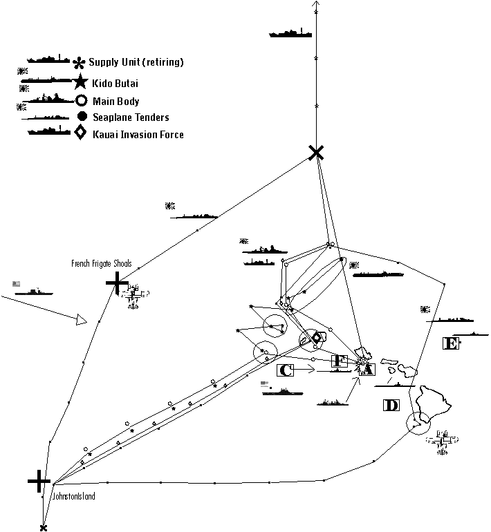
USN Forces
..........CV..........CA..........DD.......SS
A.........0.............1.............1..........0
B.........1.............3.............5..........0 (Lexington)
C.........1.............3.............9..........0 (Enterprise)
D.........0.............0.............0..........1
E.........0.............0.............0..........3
F.........0.............0.............0..........1
G........0.............0..............0..........1
Axis of Attack.
Japan could attack Oahu along two separate lines of advance. The first (historical) is from the north. The second (ahistorical) was an advance from the Marshall Islands. Each option had advantages and drawbacks. The northern route was far more likely to achieve the crucial element of surprise against Oahu, but at the expense of a difficult and stormy route of approach that made the dispatch of an invasion force with the fleet problematical. The southern route was not likely to secure surprise, but it was calmer.
Tinkerbell employs both directions. The requirement for tactical surprise demands an attack from the north to achieve an initial tactical dominance at Hawaii. After this has occurred, the axis of attack then pivots upon the island of Kauai, and adapts the southwestern approach for the duration of the campaign. Part of the tactical plan is designed to ensure this transition from the northern to southern axis in the first few days of the war occurs relatively seamlessly.
Allocation of Strength.
Overcoming the defenses of Oahu required the employment of a large portion of the Japanese fleet. Almost all of the carriers and battleships, over half the heavy cruisers and a sizeable chunk of lighter forces are employed in the effort. Numerous aerial units are also earmarked for the campaign, including elements of three Japanese Air Flotillas.
Tinkerbell uses the Marshall Islands as the functional equivalent to the Staring Bay advanced facility used during the historical southern drive. Preparations in the Marshalls necessary to support a Hawaiian naval campaign are assumed to have been taken in 1941, and an assumption is also made that the IJN's hefty draft of 1.8 million tons was intended to support the fleet in combat from an advanced base, such as was the case at Staring Bay. Some of the battle lessons from Leyte Gulf (a fascinating read in their own right) give an idea of the task at hand,
http://ibiblio.org/hyperwar/USN/rep/Ley ... -78.3.html
Selection of invasion targets and invasion dates.
Invasions required sea control. The IJN's ability to dominate the waters near Hawaii were dependent upon the logistic characteristics of a campaign fought at Hawaii from an advanced base in the Marshall Islands. The IJN lacked an underway ordnance replenishment system (none is assumed for Tinkerbell), although the gist of the account at this site indicates that the IJN certainly could have created one on the fly,
http://www.merchantnavyofficers.com/sparks10.html
Without underway resupply, the IJN could only exert the necessary level of sea control for invasions at Hawaii for a limited time. At the end of this short period, the fleet would have to retreat 2,000 miles to the Marshalls, replenish at a base there, and then return. Because of this, for only about 1 week in 3 could the Japanese secure the necessary conditions to make invasions. These periods correspond to those when the IJN could be at Hawaii:
Period 1: After December 7th
Period 2: After December 30th
Period 3: After January 20th.
Because of the paucity of available invasion windows imposed by this restriction, Tinkerbell synchronizes the invasion schedule with the movements and requirements of the naval campaign.
Phase I (Dec 7th-10th)
The initial period of the campaign would not be favorable for major invasions. First, the attacking fleet is moving in from the stormy North Pacific - which isn't a great highway for a big invasion fleet. Second, in the effort to dominate Oahu and the United States Pacific Fleet, it doesn't follow for the IJN to become diverted into the task of screening major invasion forces at the same time.
The objective of the first invasion is to seize a base of operation to allow Japanese forces to project air power in support of the naval attack. The best target base in the Hawaiian Islands, in terms of lack of defenses, proximity to Oahu, and quality of the installation, was almost certainly Puunene Naval Air Station on Maui. In second place is Barking Sands on Kauai, followed by Homestead Field on Molokai and then airfields in Hawaii.
The focus to switch from the original northern axis to the that of the permanent southern axis (Kwajalein-Oahu) within days of the original attack. This permits either Kauai or Molokai/Maui to be the pivot point. It is not possible for both islands to be selected for invasions during the first phase because Oahu is in between them, and that would mean the IJN would either have to split the fleet to guard both invasion forces, or fail to properly protect one transport fleet or the other. After some thought, the plan selects Kauai as the initial invasion point. Although Barking Sands does not appear to have been as desirable a base as Puunene, it is chosen for the following reasons:
1) Kauai is the only island north of Oahu - this allows it to be approached and invaded the quickest, and allows transports doing so to maintain their distance from Oahu without diverting well to the east to stay outside the 200NM radius of the island prior to the onset of nightfall on the 7th.
2) If poor weather forced the IJN carriers south of Oahu in order to maintain the tempo of the attack, this could be done more quickly and safely west of Kauai rather than by trying to thread the gap between Molokai and Oahu, Maui and Hawaii, or sailing well to the south around the Big Island.
3) If Maui were chosen as the pivot point, the IJN would be forced to fight with the USN Pacific Fleet between it and its bases. By pivoting on Kauai instead, the IJN fights with its bases in its rear, and thereby can evacuate damaged ships more easily.
4) The selection of Kauai allows the IJN's Main Body to quickly transition between a defensive stance (protecting the transports at Kauai) to an offensive one (attacking Oahu) while always remaining between the invasion fleet and Oahu.
5) As Kauai is the only island west of Oahu, its early capture allows the IJN to subsequently concentrate on the eastern islands without the necessity of dividing resources with Oahu in the middle. In contrast, an invasion of Maui would be followed by a dangerous split effort where the simultaneous capture of Hawaii and Kauai would be attempted (it would not be advisable to leave either in American hands). By taking Kauai first, the second phase could concentrate exclusively to the southeast of Oahu without the division of resources.
Phase II (Dec 14th-16th)
The first invasion of Kauai on December 8th uses 11 transports which accompany the fleet across the North Pacific. By using Kauai as the focal point of the attack, it is possible to concentrate the IJN carrier and battle forces in such a way as to be able to simultaneously screen this invasion force and develop powerful attacks aimed at Oahu.
It is from the Marshalls from which the 18 transports of the second invasion wave emerge. Like the original invasion unit, these would be modern, fast ships - they have to be fast merchants to get to Hawaii at the proper time. The main form of protection of this force is its distance from the fighting - by the time it approaches Hawaii, the decisive battle should already have been fought. The convergence upon Johnston Island from east and west on the 10th corresponds with a natural pause in the battle caused by the need to refuel. This chore is arranged so that the IJN can refuel and reorganize for the second phase invasions as these transports come onto the scene. The distance chosen for fueling - over 700nm from Oahu - is excessive by late-war standards.
The second wave of attacks commence with airstrikes on the 14th, followed by invasions on the 15th. Like with Kauai beforehand, considerable efforts are made to ensure that these transports are unloaded as quickly as possible. In the case of the Kauai attack (December 8th), the transport force mimics the historic Japanese attack on Midway in that the force is far below the actual maximum loaded capacity so that the ships can get in and unload very quickly. With Maui, Molokai and Hawaii (December 14th-15th), the debarkation elements of the original invasion (Kauai) are attached to in order to speed up the process. (Note, this trick of re-using empty transports to assist fresh waves is repeated for the attack on Oahu by 16th and 48th ID, and then again for the assault on Honolulu by 2nd Infantry Division. This allows Tinkerbell to keep the total shipping involved at Hawaii to a reasonable level while permitting attacking units plenty of debarkation muscle.)
Fuel logistics.
The attacking force moving across the North Pacific would require a tanker train to supply it over the period of time it took to approach Oahu. But once the attack was underway, it would be awkward for the IJN to invade Kauai, pivot the axis of attack to the south, and shepard this large fleet train towards Johnston Island all at the same time. Tinkerbell eliminates the difficulty of trying to move the tanker fleet to the south of Oahu - it instead sends it back to Japan via the northern route.
Because of this fact, the attack requires a second tanker unit to supply the fleet after the first series of attacks end on December 9th. This train is attached to the Marshall Islands forces, and advances with the rest towards Johnston Island. In the meantime, the first tanker train is scheduled to loop around to Japan, refill, and sail to the Marshall Islands in time to support the second wave invasions scheduled for the end of December. This shuttle service is repeated for the third and fourth phase, which are allocated 170,000 tons of oil each. The oilier cycle to and from Japan (18 days assumed) corresponds with the fleet cycle near Oahu (about 21 days), meaning that the same oilier trains can support the whole 'show' without much additional assistance needed.
Endurance of Japanese Carriers and destroyers.
This AH attack on Oahu places the final refueling point closer to Pearl Harbor, with a final run-in speed slower than was historically the case. This is a trade-off to gain endurance for the fighting near Oahu. Note that if it were possible to be certain of underway battleship -> destroyer refueling in combat conditions, then re-writing the operational order for a faster final dash to target would be logical and desirable.
The first phase of fighting (7th to 9th) is followed by a pause (10th to 13th), reflecting the fuel endurance of the destroyers and the aviation stamina of the carriers in an extended battle. IJN carriers appear, allowing for an attrition rate in the air wings of about 25% in the first 72 hours, to have been good for about 5 days combat operations. With only 5 days available, the operational order calls for each of the first two phases to absorb 2 1/2 days of carrier ops. In both cases, the third day of battle (December 9th and December 16th) feature early morning strikes followed by a retreat. This is a handy way of getting in a day of combat at a 1/2 day rate.
Naval battle plan and fleet doctrine.
To secure victory in a decisive naval battle at Hawaii, the IJN would require reconnaissance superiority in the theater. A fundamental feature of Tinkerbell therefore is to quickly occupy favorable scouting positions - French Frigate Shoals, Kauai, and to the west of the Big Island - and use them to achieve domination in the battle for situational awareness . In addition to these efforts, flying boats of the 24th Air Flotilla fly in and join the battle commencing within hours of the attack on the 7th.
In each phase of the battle, the IJN carriers operate behind a wall of scouting resources far beyond what the USN can muster in reply. During the first days, while Enterprise and Lexington each would have had to divert a large portion of their indigenous air wings to scouting, Kido Butai is, much like spider, sitting deeply in a web of interlocked scouting units, each scouring large tracts of ocean. Given Yamaguchi's inherent strike range advantage, the likelihood is high of his getting in punishing preemptive strikes on the USN carriers. And in this scenario, neither USN carrier is capable of surviving even a single strike by Kido Butai.
During the second phase op (Dec 14th-16th), Kauai and Johnston are already established as forward air bases, such that the movement of ships towards the objectives at Maui and Hawaii are well scouted. Here again, Kido Butai is to operate behind a wall of assets (seaplane tenders, flying boats and cruisers) thrusting a host of search aircraft out to the east, beyond Hawaii towards the West Coast. Unless Lexington and Enterprise had done better than expected, Saratoga's only prudent option would be to stand well clear of the fighting until the arrival of Ranger, Wasp, Hornet and Yorktown by January 5th-10th.
Use of the IJN Battle line.
My personal preference with respect to the IJN's Main Body of battleships would be to thrust this force at Oahu on the afternoon of December 7th. In doing so it invites a catastrophe for the USN should it catch and destroy the fleet and its train in port. Or at sea. Additionally, the expendable battleships would act as 'plane catchers', and absorb most of whatever air effort the defenders made - freeing up the vulnerable carriers from the possibility of harm. However, it does not seem likely that the IJN would have ever considered such a strategy. Because of this, then movements of the Main Body in the operational order are weaker and muted in comparison to the aggressive alternative I suggest.
The operational order guesses at the function of the Main Body in an all-out attack upon Oahu. Unlike at Midway (where Yamamoto was trying to conceal his presence), at Oahu the battleships are placed much nearer to Kido Butai. During the 7th while Yamaguchi is establishing air superiority over Oahu, the Main Body is sheparding the Kauai force into position near Barking Sands. From this location Yamamoto can and will seek a decisive battle, with Yamaguchi in support from dawn of the 8th onwards.
In the early hours of the 8th, Yamamoto descends upon Oahu from the direction of Kauai and fights a battle. The objective is to eliminate any surviving battleships, the USN fleet train of auxiliary vessels, and to destroy the oil reserves at Pearl Harbor such that the Pacific Fleet has no choice but to evacuate Hawaii and fall back to the West Coast to regroup. At the end of this period, the Main Body is scheduled to fall back upon the location of Kido Butai, and withdraw with it on the 9th to the refueling point. The Kauai transport force should already have commenced their withdrawal.
When the second phase commences, most of the fuel oil at Oahu will already have been destroyed by the air/sea attacks on December 8th and 9th. Without adequate tankers available (and several of them probably sunk in the fighting), Kimmel would have no choice but to fall back upon California with the bulk of his fleet prior to the arrival of the 2nd invasion wave on the 14th. Saratoga, if in the area at all, will probably not approach closer to Oahu than necessary to ferry whatever aircraft would be available (it is unlikely Saratoga would send her own airgroup to Oahu).
During this brief period, Kido Butai should be able to dominate and batter Oahu (the majority of the A.A. defenses having retreated with the fleet). With the capture of Maui and Hawaii, the IJN is in position to maintain with land based airpower the control of the air at Hawaii. Bases at Barking Sands, Puunene, and the Big Island would be more than Saratoga alone could tackle, and Sara wouldn't be reinforced until very late December or early January (by which time Yamaguchi has returned). The position established is strong enough to prevent significant reinforcements from reaching Oahu from the West Coast between the retreat of the fleet on the 16th and its return at the end of December.
1) Fixing the axis of attack.
2) Strength allocated.
3) Selection of invasion targets, invasion duration, and invasion dates.
4) Fuel logistics.
5) Combat endurance of Japanese units - particularly aircraft carriers and destroyers.
6) IJN battle doctrine.
USN Forces
..........CV..........CA..........DD.......SS
A.........0.............1.............1..........0
B.........1.............3.............5..........0 (Lexington)
C.........1.............3.............9..........0 (Enterprise)
D.........0.............0.............0..........1
E.........0.............0.............0..........3
F.........0.............0.............0..........1
G........0.............0..............0..........1
Axis of Attack.
Japan could attack Oahu along two separate lines of advance. The first (historical) is from the north. The second (ahistorical) was an advance from the Marshall Islands. Each option had advantages and drawbacks. The northern route was far more likely to achieve the crucial element of surprise against Oahu, but at the expense of a difficult and stormy route of approach that made the dispatch of an invasion force with the fleet problematical. The southern route was not likely to secure surprise, but it was calmer.
Tinkerbell employs both directions. The requirement for tactical surprise demands an attack from the north to achieve an initial tactical dominance at Hawaii. After this has occurred, the axis of attack then pivots upon the island of Kauai, and adapts the southwestern approach for the duration of the campaign. Part of the tactical plan is designed to ensure this transition from the northern to southern axis in the first few days of the war occurs relatively seamlessly.
Allocation of Strength.
Overcoming the defenses of Oahu required the employment of a large portion of the Japanese fleet. Almost all of the carriers and battleships, over half the heavy cruisers and a sizeable chunk of lighter forces are employed in the effort. Numerous aerial units are also earmarked for the campaign, including elements of three Japanese Air Flotillas.
Tinkerbell uses the Marshall Islands as the functional equivalent to the Staring Bay advanced facility used during the historical southern drive. Preparations in the Marshalls necessary to support a Hawaiian naval campaign are assumed to have been taken in 1941, and an assumption is also made that the IJN's hefty draft of 1.8 million tons was intended to support the fleet in combat from an advanced base, such as was the case at Staring Bay. Some of the battle lessons from Leyte Gulf (a fascinating read in their own right) give an idea of the task at hand,
http://ibiblio.org/hyperwar/USN/rep/Ley ... -78.3.html
Selection of invasion targets and invasion dates.
Invasions required sea control. The IJN's ability to dominate the waters near Hawaii were dependent upon the logistic characteristics of a campaign fought at Hawaii from an advanced base in the Marshall Islands. The IJN lacked an underway ordnance replenishment system (none is assumed for Tinkerbell), although the gist of the account at this site indicates that the IJN certainly could have created one on the fly,
http://www.merchantnavyofficers.com/sparks10.html
Without underway resupply, the IJN could only exert the necessary level of sea control for invasions at Hawaii for a limited time. At the end of this short period, the fleet would have to retreat 2,000 miles to the Marshalls, replenish at a base there, and then return. Because of this, for only about 1 week in 3 could the Japanese secure the necessary conditions to make invasions. These periods correspond to those when the IJN could be at Hawaii:
Period 1: After December 7th
Period 2: After December 30th
Period 3: After January 20th.
Because of the paucity of available invasion windows imposed by this restriction, Tinkerbell synchronizes the invasion schedule with the movements and requirements of the naval campaign.
Phase I (Dec 7th-10th)
The initial period of the campaign would not be favorable for major invasions. First, the attacking fleet is moving in from the stormy North Pacific - which isn't a great highway for a big invasion fleet. Second, in the effort to dominate Oahu and the United States Pacific Fleet, it doesn't follow for the IJN to become diverted into the task of screening major invasion forces at the same time.
The objective of the first invasion is to seize a base of operation to allow Japanese forces to project air power in support of the naval attack. The best target base in the Hawaiian Islands, in terms of lack of defenses, proximity to Oahu, and quality of the installation, was almost certainly Puunene Naval Air Station on Maui. In second place is Barking Sands on Kauai, followed by Homestead Field on Molokai and then airfields in Hawaii.
The focus to switch from the original northern axis to the that of the permanent southern axis (Kwajalein-Oahu) within days of the original attack. This permits either Kauai or Molokai/Maui to be the pivot point. It is not possible for both islands to be selected for invasions during the first phase because Oahu is in between them, and that would mean the IJN would either have to split the fleet to guard both invasion forces, or fail to properly protect one transport fleet or the other. After some thought, the plan selects Kauai as the initial invasion point. Although Barking Sands does not appear to have been as desirable a base as Puunene, it is chosen for the following reasons:
1) Kauai is the only island north of Oahu - this allows it to be approached and invaded the quickest, and allows transports doing so to maintain their distance from Oahu without diverting well to the east to stay outside the 200NM radius of the island prior to the onset of nightfall on the 7th.
2) If poor weather forced the IJN carriers south of Oahu in order to maintain the tempo of the attack, this could be done more quickly and safely west of Kauai rather than by trying to thread the gap between Molokai and Oahu, Maui and Hawaii, or sailing well to the south around the Big Island.
3) If Maui were chosen as the pivot point, the IJN would be forced to fight with the USN Pacific Fleet between it and its bases. By pivoting on Kauai instead, the IJN fights with its bases in its rear, and thereby can evacuate damaged ships more easily.
4) The selection of Kauai allows the IJN's Main Body to quickly transition between a defensive stance (protecting the transports at Kauai) to an offensive one (attacking Oahu) while always remaining between the invasion fleet and Oahu.
5) As Kauai is the only island west of Oahu, its early capture allows the IJN to subsequently concentrate on the eastern islands without the necessity of dividing resources with Oahu in the middle. In contrast, an invasion of Maui would be followed by a dangerous split effort where the simultaneous capture of Hawaii and Kauai would be attempted (it would not be advisable to leave either in American hands). By taking Kauai first, the second phase could concentrate exclusively to the southeast of Oahu without the division of resources.
Phase II (Dec 14th-16th)
The first invasion of Kauai on December 8th uses 11 transports which accompany the fleet across the North Pacific. By using Kauai as the focal point of the attack, it is possible to concentrate the IJN carrier and battle forces in such a way as to be able to simultaneously screen this invasion force and develop powerful attacks aimed at Oahu.
It is from the Marshalls from which the 18 transports of the second invasion wave emerge. Like the original invasion unit, these would be modern, fast ships - they have to be fast merchants to get to Hawaii at the proper time. The main form of protection of this force is its distance from the fighting - by the time it approaches Hawaii, the decisive battle should already have been fought. The convergence upon Johnston Island from east and west on the 10th corresponds with a natural pause in the battle caused by the need to refuel. This chore is arranged so that the IJN can refuel and reorganize for the second phase invasions as these transports come onto the scene. The distance chosen for fueling - over 700nm from Oahu - is excessive by late-war standards.
The second wave of attacks commence with airstrikes on the 14th, followed by invasions on the 15th. Like with Kauai beforehand, considerable efforts are made to ensure that these transports are unloaded as quickly as possible. In the case of the Kauai attack (December 8th), the transport force mimics the historic Japanese attack on Midway in that the force is far below the actual maximum loaded capacity so that the ships can get in and unload very quickly. With Maui, Molokai and Hawaii (December 14th-15th), the debarkation elements of the original invasion (Kauai) are attached to in order to speed up the process. (Note, this trick of re-using empty transports to assist fresh waves is repeated for the attack on Oahu by 16th and 48th ID, and then again for the assault on Honolulu by 2nd Infantry Division. This allows Tinkerbell to keep the total shipping involved at Hawaii to a reasonable level while permitting attacking units plenty of debarkation muscle.)
Fuel logistics.
The attacking force moving across the North Pacific would require a tanker train to supply it over the period of time it took to approach Oahu. But once the attack was underway, it would be awkward for the IJN to invade Kauai, pivot the axis of attack to the south, and shepard this large fleet train towards Johnston Island all at the same time. Tinkerbell eliminates the difficulty of trying to move the tanker fleet to the south of Oahu - it instead sends it back to Japan via the northern route.
Because of this fact, the attack requires a second tanker unit to supply the fleet after the first series of attacks end on December 9th. This train is attached to the Marshall Islands forces, and advances with the rest towards Johnston Island. In the meantime, the first tanker train is scheduled to loop around to Japan, refill, and sail to the Marshall Islands in time to support the second wave invasions scheduled for the end of December. This shuttle service is repeated for the third and fourth phase, which are allocated 170,000 tons of oil each. The oilier cycle to and from Japan (18 days assumed) corresponds with the fleet cycle near Oahu (about 21 days), meaning that the same oilier trains can support the whole 'show' without much additional assistance needed.
Endurance of Japanese Carriers and destroyers.
This AH attack on Oahu places the final refueling point closer to Pearl Harbor, with a final run-in speed slower than was historically the case. This is a trade-off to gain endurance for the fighting near Oahu. Note that if it were possible to be certain of underway battleship -> destroyer refueling in combat conditions, then re-writing the operational order for a faster final dash to target would be logical and desirable.
The first phase of fighting (7th to 9th) is followed by a pause (10th to 13th), reflecting the fuel endurance of the destroyers and the aviation stamina of the carriers in an extended battle. IJN carriers appear, allowing for an attrition rate in the air wings of about 25% in the first 72 hours, to have been good for about 5 days combat operations. With only 5 days available, the operational order calls for each of the first two phases to absorb 2 1/2 days of carrier ops. In both cases, the third day of battle (December 9th and December 16th) feature early morning strikes followed by a retreat. This is a handy way of getting in a day of combat at a 1/2 day rate.
Naval battle plan and fleet doctrine.
To secure victory in a decisive naval battle at Hawaii, the IJN would require reconnaissance superiority in the theater. A fundamental feature of Tinkerbell therefore is to quickly occupy favorable scouting positions - French Frigate Shoals, Kauai, and to the west of the Big Island - and use them to achieve domination in the battle for situational awareness . In addition to these efforts, flying boats of the 24th Air Flotilla fly in and join the battle commencing within hours of the attack on the 7th.
In each phase of the battle, the IJN carriers operate behind a wall of scouting resources far beyond what the USN can muster in reply. During the first days, while Enterprise and Lexington each would have had to divert a large portion of their indigenous air wings to scouting, Kido Butai is, much like spider, sitting deeply in a web of interlocked scouting units, each scouring large tracts of ocean. Given Yamaguchi's inherent strike range advantage, the likelihood is high of his getting in punishing preemptive strikes on the USN carriers. And in this scenario, neither USN carrier is capable of surviving even a single strike by Kido Butai.
During the second phase op (Dec 14th-16th), Kauai and Johnston are already established as forward air bases, such that the movement of ships towards the objectives at Maui and Hawaii are well scouted. Here again, Kido Butai is to operate behind a wall of assets (seaplane tenders, flying boats and cruisers) thrusting a host of search aircraft out to the east, beyond Hawaii towards the West Coast. Unless Lexington and Enterprise had done better than expected, Saratoga's only prudent option would be to stand well clear of the fighting until the arrival of Ranger, Wasp, Hornet and Yorktown by January 5th-10th.
Use of the IJN Battle line.
My personal preference with respect to the IJN's Main Body of battleships would be to thrust this force at Oahu on the afternoon of December 7th. In doing so it invites a catastrophe for the USN should it catch and destroy the fleet and its train in port. Or at sea. Additionally, the expendable battleships would act as 'plane catchers', and absorb most of whatever air effort the defenders made - freeing up the vulnerable carriers from the possibility of harm. However, it does not seem likely that the IJN would have ever considered such a strategy. Because of this, then movements of the Main Body in the operational order are weaker and muted in comparison to the aggressive alternative I suggest.
The operational order guesses at the function of the Main Body in an all-out attack upon Oahu. Unlike at Midway (where Yamamoto was trying to conceal his presence), at Oahu the battleships are placed much nearer to Kido Butai. During the 7th while Yamaguchi is establishing air superiority over Oahu, the Main Body is sheparding the Kauai force into position near Barking Sands. From this location Yamamoto can and will seek a decisive battle, with Yamaguchi in support from dawn of the 8th onwards.
In the early hours of the 8th, Yamamoto descends upon Oahu from the direction of Kauai and fights a battle. The objective is to eliminate any surviving battleships, the USN fleet train of auxiliary vessels, and to destroy the oil reserves at Pearl Harbor such that the Pacific Fleet has no choice but to evacuate Hawaii and fall back to the West Coast to regroup. At the end of this period, the Main Body is scheduled to fall back upon the location of Kido Butai, and withdraw with it on the 9th to the refueling point. The Kauai transport force should already have commenced their withdrawal.
When the second phase commences, most of the fuel oil at Oahu will already have been destroyed by the air/sea attacks on December 8th and 9th. Without adequate tankers available (and several of them probably sunk in the fighting), Kimmel would have no choice but to fall back upon California with the bulk of his fleet prior to the arrival of the 2nd invasion wave on the 14th. Saratoga, if in the area at all, will probably not approach closer to Oahu than necessary to ferry whatever aircraft would be available (it is unlikely Saratoga would send her own airgroup to Oahu).
During this brief period, Kido Butai should be able to dominate and batter Oahu (the majority of the A.A. defenses having retreated with the fleet). With the capture of Maui and Hawaii, the IJN is in position to maintain with land based airpower the control of the air at Hawaii. Bases at Barking Sands, Puunene, and the Big Island would be more than Saratoga alone could tackle, and Sara wouldn't be reinforced until very late December or early January (by which time Yamaguchi has returned). The position established is strong enough to prevent significant reinforcements from reaching Oahu from the West Coast between the retreat of the fleet on the 16th and its return at the end of December.
(9) Order of Battle
Phase I Order of Battle
A) Main Body.
Admiral Yamamoto Isoruku commanding (flagship, Nagato). Location at 6 am, December 7th: bearing 345 deg, 240NM of Pearl Harbor with Kauai Invasion Unit.
Flagship: Nagato
Battleship Squadron 1: Nagato (FF) Mutsu
Special Bombardment Squadron 1: Yamato, Fuso, Yamashiro
Bat Squadron 3: Kirishima, Haruna, Kongo, Hiei
Cruiser Squadron 4: Takao, Atago, Chokai, Maya
Cruiser Squadron 7: Mogami, Mikuma
Cruiser Squadron 9: Oi, Kitikami
Cruiser Squadron 16: Nagara, Kuma
DD division leader: CL Tama
Destroyers:
Arashio, Asashio, Michishio, Oshio
Amatsukaze, Hatsukaze, Tokisukaze, Yukikaze
Arare, Kasumi, Minegumo, Asagumo
B) Strike Force (Kido Butai).
VADM Tamon Yamaguchi commanding. Flagship Hiryu. Location at 6am December 7th: 200 NM, bearing 350 degrees of Pearl Harbor
CV Division 1: Akagi, Kaga
CV Division 2: Hiryu, Soryu
CV Division 5: Shokaku, Zuikaku
Air Units:
Akagi: 27 x A6M2 Zero, 18 x Val, 27 x Kate (+6)*
Kaga: 27 x A6M2 Zero, 27 x Val, 27 x Kate (+6)*
Hiryu: 24 x A6M2 Zero, 18 x Val, 18 x Kate (+6)*
Soryu: 27 x A6M2 Zero, 18 x Val, 18 x Kate (+6)*
Zuikaku: 15(3) x A6M2 Zero, 27 x Val, 27 x Kate (+6)*
Shokaku: 15(3) x A6M2 Zero, 27 x Val, 27 x Kate (+6)*
* - Also embarked (being ferried):
18 x B5N1 (Yokosuka Air Group)
12 x A6M2 Zero (22nd Air Flotilla)
6 x A5M4 Claude
Cruiser Squadron 8: Tone, Chikuma
DD Division leader CL: Abukuma
Destroyers:
Hamakaze, Isokaze, Tanikaze, Urakaze
Hayashio, Kuroshio, Natsushio, Oayshio
Kagero, Shiranuhi
C) Kauai Invasion Unit.
Location: The SS group near Kauai. The invasion group is with the Main Body.
SS: 6
Heavy Cruiser: Suzuya (F)
Seaplane Tender: Chitose
Air group: 12 x E13A1, 700 mines.
Light Cruiser: Yura
Destroyers:
Hatsushimo, Hatsuharu, Nenohi, Wakaba, Amagiri, Asagiri, Isonami, Umikaze
Minesweepers: no. 7, no. 19
(These two classes of minesweeper had a range of 4,000 nautical miles after modification).
Transporting Kauai Invasion Force (IJA): Sado Maru, Sagami Maru, Sasago Maru, Awajisan Maru, Aikoku Maru, Akagi Maru (48,342 tons) (Elements, 7th Infantry Division, Hokkaido)
EMBARKED:
Island....Men...MG...Art..AT..AA..Mor..Veh.....Fd..U..Sup...Lds....Tons
Kauai...4,500..80....18....4....6.....12...(57/6)...60..1....1......281..48,342(R)
Notes: Molokai and Kauai force are designed for debarkation on an ASAP basis. Maui and Molokai forces have 1/4 of standard camp allocation
MG = machine guns Art = Artillery AT = 37mm AT guns AA = 37mm AA guns Mor = 60mm and 80mm Mortars. Veh = Vehicles (soft skin/tanks) Fd = food (days), U = units of fire, Lds = Diahatsu loads, Tons = shipping tons (Rapid debarkation, Assault loading or Transport loading)
Transporting Barking Sands Naval Air Base establishment (IJN). Noroshiro Maru (acting as a Daihatsu Carrier, 7,183 tons). Goyo, Hokoku, Keiyo Maru transporting base elements. (24,511 tons) (Total 31,694 tons)
Transporting Kauai Construction Unit (IJA): Kiyosumi Maru
EMBARKED
Men.....Food..Veh......Doz.....Tons........Island
750.......120.....25.......12.....6,182(A)....Kaui
(Doz = Bulldozers)
Reconnaissance Unit.
Section 1:
French Frigate Shoals Force. Location: The SS group at the French Frigate Shoals. The seaplane group is 200 nautical miles northeast of the French Frigate shoals and closing at 24kt.
Submarines: 3 (I-121, I122, I-123)
Seaplane Tender: Mizuho (12 x E13A1 plus 4 F1M2)
Destroyer: Sagiri.
Section 2:
Hawaii Scouting Unit. Location at 0600 Dec 7th - with Main Body.
Seaplane Tender: Chiyoda
Air group: 12 x E13A1, 700 mines.
Destroyer: Shiratsuyu
Supply Unit No 1
Location at 6am, Dec 7th: 577 NM due north of Kauai.
Destroyer Division 24: Kawakaze, Suzukaze
Tankers: Atatuki Maru, Tatekawa Maru, Kenyo Maru, Kurosio Maru, Genyo Maru, Nitiei Maru, Sinkoku Maru, Toei Maru
(8 ships, 88,732 tons)
Johnston/Hawaiian Islands Invasion Force.
Initially consists of: Johnston Invasion Force, Kauai Invasion Force, Hawaii Invasion Force, Fuel Group 4, Fuel Group 5, Maui Base Force 1, Hawaii Construction Unit, Maui Air Base Supply Unit.
Location at 6pm December 6th: 200 miles east of Kwajelien. Rear Admiral Omori Sentaro commanding.
Carrier Division 6:
CVL: Zuiho, Hosho
Zuiho Air Group:
3 x A6M2 Zero (attached from 22nd Air Flotilla)
9 x A5M4 Claude
12 x B5N1
Also Embarked, being ferried to Hawaii: 3 x B5N1 (Yokosuka Air Group) 3 x A5M4 Claude (Zuiho Air Group)
Hosho Air Group:
3 x Zero (22nd Air Flotilla)
8 x A5M4 Claude
4 x A5M4 Claude (24th Air Flotilla)
Also Embarked: 3 x B5N1 (Yokosuka Air Group)
3 x A5M4 (Hosho Air Group)
* - The data I have for Hosho's front and aft elevators are 12.8 x 8.5 metres and 13.7 x 7 meters respectively [from Layman, Before the Aircraft Carrier].
Heavy Cruiser: Kumano
Light Cruiser: Yaburi
Destroyers: Ariake, Ayanami, Shikinami, Uranami, Yamakaze, Fumizuki, Minazuki, Nagatsuki, Satsuki, Yugiri, Yunagi, Oite, Hayate, Asanagi
Oiler Group 2:
Fleet oiler: Shiriya
Civilian conversions: Itsukisima Maru, Nissho Maru, Akebono Maru, Kokuyo Maru, Nippon Maru, Omurosan Maru, Otowasan Maru, Toa Maru, Fujisan, Toho Maru, Teiyo Maru
(11 ships, 114,335 tons plus Shiriya)
Johnston Island Invasion Unit:
Transports (IJN): Brazil Maru (12,752) Transporting Johnston Island seaplane base elements.
Transports (IJA): Awobasan Maru, Asosan Maru (12,718). Transporting Occupation Force (elements, South Seas Force), to Johnston Island.
EMBARKED
Island..Men...MG...Art...AT..AA..Mor..Veh......Fd...U..Sup.Lds....Tons
John...1,500..145...12....6....9......12....(20/4)..120..2...2....183..11,776(A)
Hawaiian Islands Invasion Unit:
Transporting Homestead, Hilo, Kona, Morse Field air base forces. Sankura, Sanuki Maru (IJN). 14,304 tons
Transporting Hawaii (Big Island) invasion force elements (IJA, 7th ID) Asakasan, Azumasan, Argentina, Kyushu, Tozan, Zenyo Maru (50,967).
EMBARKED
Island.....Men..MG...Art...AT..AA..Mor..Veh....Fd...U..Sup...Lds
Hawaii..7,500..138...24.....8...18....24..(210/18).120..1....3...781
50,897 tons (A)
Construction Unit (IJA): Canberra Maru.
EMBARKED
Men.....Food..Veh......Doz.....Tons.........Island
750.......120.....25.......12.....6,182(A)....Hawaii
Additional transports (empty) earmarked for attachment to Hawaiian Invasion unit during Phase II to assist unloading: Sado, Sagami, Aikoku, Sasago, Awajisan, Akagi.
Minesweepers No. 8, 9 (plus No. 7 from Kauai invasion Unit)
Maui Invasion Unit
Transporting Maui invasion force elements (IJA, 7th ID) Arimasan, Atsutasan, Ayatosan, Kwanto Maru (33,609).
EMBARKED
Island.....Men....MG...Art...AT..AA..Mor..Veh........Fd...U..Sup...Lds
Maui......4,500...80....18.....8....12...18....(45/6)....120...1...3.......477
30,570(A) tons
Transporting Puunene NAS air base forces (IJN). Awata, Sakito Maru (14,523)
Molokai Occupation Unit (IJA). Amagisan, Gokoku Maru (17,220 tons). Transporting Molokai Invasion forces.
EMBARKED
Island.....Men....MG...Art...AT..AA..Mor..Veh......Fd..U..Sup....Lds
Molo......1,565...30.....6.....2.....4......8....(35/2)...60...1....1......119
16,125(A) tons
Maui Construction Unit (IJA): Tokyo Maru
EMBARKED
Men.....Food..Veh......Doz.....Tons.........Island
1000.....120.....25.......12.....7,272(A)....Maui/Molokai
Additional transports (empty) to be attached to Maui Invasion Unit during Phase II to assist unloading: Noroshiro (Diahatsu Carrier), Hokoku Maru, Kiyosumi Maru
Minesweepers no. 10, 11 (plus no. 19 from Kauai invasion unit).
Maui Airbase Supply Unit
Transporting Puunene/Maalaa/Molokai Phase II air operations supplies (IJN). Sagara Maru (7,189) (spare room here)
Additional transports (empty) attached to Maui Airbase supply unit to assist unloading: Goyo, Keiyo Maru.
Also proceeding from the Marshalls to Hawaii (may be travelling independent of Johnston Island Force):
Maui Base Force (proceeding independently):
Tama Maru #3
Tama Maru #5
Shonan Maru #7
Shonan Maru #8
Hakuho Maru
Kaiho Maru
Shinkotsu Maru
Subchasers 16,17,18
Minelayers: Okinoshima (500), Hirashima (150), Aotaka (110) Tsugaru (600 mines*)
Netlayer/minelayer: Shirataka (6 nets, 100 mines)
Aux. Netlayers: Kunimitsu Maru, Kotobuki Maru #5, Korei Maru, Fukeui Maru #15
Aux. Mine sweepers: Tamura Maru, Kyo Maru no.2, Senyo Maru no. 2, Chitose Maru, Aoi Maru, Taihei Maru no. 3, Senyo Maru no. 2
IJN Naval Base Force: (5 transports, 28,000 tons)
Base..........Men...DC....MG...150mm....8"..AA...Veh...Fd...U..Sup
Laihaina...1,975.1,000...25........8..........4....12....102..120..1....2
28,081(A) tons
Men - assigned to base and attached CA unit.
DC - Maui Debarkation Command
Oahu Invasion Unit . Proceeding to the Marshall Islands for Phase III invasion operations at end of December, early January.
Destroyers: Asakaze, Harukaze, Hatakaze, Matsukaze, Yayoi, Kisaragi
Transporting 16th and 48th Infantry Divisions. 34 Transports (IJA). (199,012 tons)
Transporting 1st Artillery Regiment. 15 Transports (IJA) (87,436 tons)
Oahu Dai Hatsu transport force (2 ships, travelling with Oahu Invasion Unit):
Shinshu Maru, Model Ko - about 18,000 tons (IJA).
EMBARKED
1st Artillery Regiment.
Men....MG...Art...AT...AA...Mor...Veh...Fd....U...Sup....Lds
7,300...65..102....2....10.....12.....360..120...2....3.......1256
87,436(A) tons
Gun type.....Vehicles per......Men per......Shells per
240mm.............5......................80.................1000
150mm.............4......................79.................1500
105mm.............3......................62.................1500
75mm...............2......................55..................2000
1st Artillery (Historical, range of piece in yards)
24 x Type 96 15 cm (12,910)
16 x Type 92 10 cm (19,910)
24 x Type 41 75mm (11,700)
8 Type 45 240mm (15,300)
8 Type 89 15 cm (21,000)
2 Type 96 240mm (15,300?)
12 15cm mortars (4,840)
16 Type 38 75mm (improved) - (13,000)
20 Type 91 10cm (11,810)
48 Type 38 75mm (improved) (13,000)
1st Artillery (Oahu variant, max range of piece in brackets)
7,300 men.
32 x 75mm Model 38 (13,000)
32 x 105mm Model 92 (19,910)
32 x 155mm Model 89 (21,000)
6 x 240mm Howitzer (15,300)
8 x AA
4 x AT
16th, 48th Infantry Divisions
Men.......MG...Art...AT...AA...Mor...Veh..Hor/Carts..Fd...U..Sup.Lds
29,500..525...48...18....18....54.....300...2000/1000..120..2....2...3233
199,012(A) tons
Phase II Order of Battle
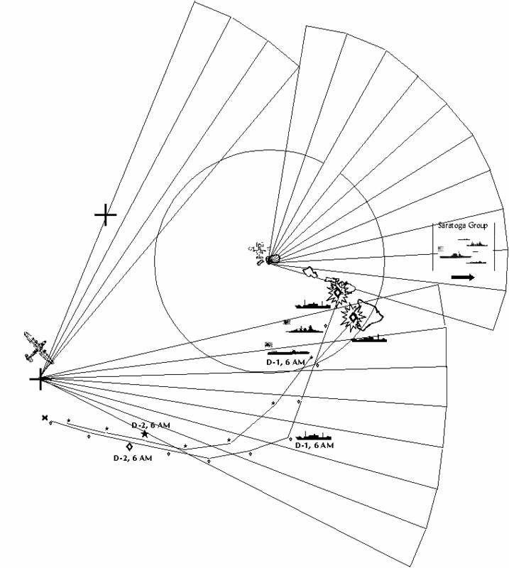
Strike Force
CV Division 1: Akagi, Kaga
CV Division 2: Hiryu, Soryu
CV Division 5: Shokaku, Zuikaku
CV Division 6: Zuiho, Hosho
Cruiser Squadron 8: Tone, Chikuma
DD Division leader CL: Abukuma
Destroyers:
Hamakaze, Isokaze, Tanikaze, Urakaze
Hayashio, Kuroshio, Natsushio, Oayshio
Kagero, Shiranuhi
Distant Cover Force
Bat Squadron 3: Kirishima, Haruna, Kongo, Hiei
Cruiser Squadron 7: Mogami, Mikuma, Kumano
Cruiser Squadron 4: Takao, Atago, Chokai, Maya
Cruiser: Yura, Tama
Destroyers:
Ayanami, Isonami, Shikinami, Uranami, Amagiri, Asagiri, Sagiri, Yugiri
Maui Base Force 1 (proceeding independently): Capt. Miyamoto Sadatomo
Tama Maru #3
Tama Maru #5
Shonan Maru #7
Shonan Maru #8
Hakuho Maru
Kaiho Maru
Shinkotsu Maru
Subchasers 16,17,18
Minelayers: Okinoshima (500), Hirashima (150), Aotaka (110) Tsugaru (600 mines*)
Netlayer/minelayer: Shirataka (6 nets, 100 mines)
Aux. Netlayers: Kunimitsu Maru, Kotobuki Maru #5, Korei Maru, Fukeui Maru #15
Aux. Mine sweepers: Tamura Maru, Kyo Maru no.2, Senyo Maru no. 2, Chitose Maru, Aoi Maru, Taihei Maru no. 3, Senyo Maru no. 2
Maui Invasion Force
VADM Kondo Nobutake commanding
Seaplane Tender: Chitose, Chiyoda
Heavy Cruiser: Suzuya
Light Cruiser: Nagara
Ariake, Shiratsuyu, Arashio, Asashio, Michishio, Oshio, Amatsukaze, Hatsukaze, Tokisukaze
Kiyosumi Maru, Arimasan, Atsutasan, Ayatosan, Kwanto Maru, Awata, Sakito Maru
Debarkation Squadron: Noroshiro (Diahatsu Carrier), Hokoku Maru (empty)
Minesweepers no. 10, 11, 19
Hawaii Invasion Force
Seaplane Tender: Mizuho
Light Cruiser: Kuma
Destroyers: Fumizuki, Minazuki, Nagatsuki, Satsuki, Hatsushimo, Hatsuharu, Nenohi, Wakaba, Arare
Transport: Canberra Maru, Sankura, Sanuki Maru, Asakasan, Azumasan, Argentina, Kyushu, Tozan, Zenyo Maru
Debarkation Squadron (empty transports, attached to Hawaii Invasion Unit): Sado, Sagami, Aikoku, Sasago, Awajisan, Akagi.
Minesweepers no. 7, 8, 9.
Main Body (Retiring to Marshall Islands)
Yamamoto
Special Bombardment Squadron 1: Yamato, Fuso, Hyuga.
Battleship Division 1: Nagato, Mutsu
Cruiser Squadron 9: Oi, Kitikami
Yaburi, Yura
Destroyers: Minegumo, Asagumo, Umikaze, Yamakaze, Asanagi, Hayate, Oite, Yunagi
Tankers: Atatuki Maru, Tatekawa Maru, Kenyo Maru, Kurosio Maru
(4 ships, 40,775 tons).
Tankers: Genyo Maru, Nitiei Maru, Sinkoku Maru, Toei Maru
(47,957 tons)
Oilers: Itsukisima Maru, Nissho Maru, Akebono Maru, Kokuyo Maru
(4 ships, 46,541)
Johnston Island Invasion Unit: (retiriing)
Transports: Brazil Maru, Awobasan Maru, Asosan Maru.
Oiler Unit
DD: Yukikaze, Kasumi
Fuel Group no. 4:
Oilers: Nippon Maru, Omurosan Maru, Otowasan Maru
(3 ships, 28,384 tons)
Fuel Group no. 5:
Oilers: Toa Maru, Fujisan, Toho Maru, Teiyo Maru
(4 ships, 39,410)
Phase III
Phase III OOB, combat forces, would be drawn from units participating in Phase II. The invasion force consists of the 49 transports shuttling the 1st Regiment, 16th and 48th divisions from Japan, plus the 29 transports of the first wave, plus the Daihatsu carrier unit - a grand total of 80 ships.
Phase IV
Fuel Group no. 3:
San Clement, Kiyo, San Pedro, Ogura, Shoyo (5 ships, 36,710)
Honolulu Invasion Unit. Proceeding to Marshall Islands for Phase IV operations.
Destroyers: Asakaze, Harukaze, Hatakaze, Matsukaze, Yayoi, Kisaragi
Transporting 2nd Infantry Division. 16 Transports (94,681 tons)
Transporting 1st Artillery resupply (ammunition): 3 transports (19,391 tons)
Transporting 16th, 48th resupply: 4 ships (25,000 tons).
Embarked
2nd Infantry Division
Men.....MG...Art...AT...AA...Mor...Veh....Fd...U..Sup.Lds
16000...305...32...18....12.....32.....210..120...2...2....1380
94,681(A) tons
1st Artillery (resupply) 19,391 tons
Rounds per gun: 1000 x 240mm, 1500 x 105mm, 1500 x 155mm, 2000 x 75mm
16th, 48th ID (Resupply) 25,000 tons.
Airbase Supply Summary (All Phases)
Phase 1
Base..Men....FTR....Sea....Mav...BmB....Kate....Dai...Truck..Tons
Bark...1863..21/28....8/9.....8/9....18/7.....9/2......673...6465.23,157*(A)
Burns..150.....0/0......0/0....0/0.....0/0......0/0........5........0....1,132(A)
Joh.....1133....0/0.....6/20...6/20...0/0......0/0.......350...3339.11,496(A)
* Tonnage total includes Daihatsu carrier.
FTR = Fighter. Sea = Seaplane. Mav = Mavis. Dai = Daihatsu loads. Truck = Truck loads @ 2 tons per load (1 ton, truck, 1 ton trailer). Trans = Transportation elements attached (1 element = 5 trucks and 5 trailers)
Tons = Tonnage required to lift. (T) = Commercial loading (50 cubic feet per ton). (A) = Assault loading (25 cubic feet per ton). R= Rapid Debarkation (varies, but about 10-15 cubic feet per ton).
Phase 2
Base..Men.....FTR.....Sea....Mav....BmB.....Kate....Dai...Truck...Tons
Puu....1643...18/21....6/21....4/21...18/21....8/21....693..6,692.11,619(T)
Maa.....93......0/16......0/0.....0/0......0/0......0/16.....25....236........438(T)
Molo....93......0/16........0.......0.........0........0/16.....25....236.......438(T)
Haw....1899...18/21....8/21....8/21..18/21.....8/21....873..8467.13,880(T)
Kona....93......0/16.......0........0.........0........0/16....25.....236.......438(T)
Mors....93......0/16.......0........0.........0........0/16....25.....236.......438(T)
General..0......0/576..0/180..0/180..0/378....0/324...374...3,730..4,711(T)
Phase 3
Base..Men......FTR.....Sea....Mav....BmB....Kate...Dai..Truck...Tons
Puu.......0.......0/576...0/192.0/192..0/432...0/288..396...3960...4,133(T)
Bark S..0.......0/432...0/144.0/96....0/432...0/192...303...3030..3,199(T)
Haw......0.......0/432...0/144.0/144..0/432...0/192...335...3350..3,527(T)
Air Supply (with 16th and 48th ID)
Airbase........Men.....GC.....FTR.....Sea.......Mav.....BmB.....Kate...Lds
.......0............0..........0.....48/20....12/20...16/20...48/20....24/20...723
14,692(A) Tons
Intended max. deployment
Puunene/Homestead/Maalaa: 24 FTR, 18 x BMB, 8 x B5N1, 8 x Sea, 8 x Mav.
Barking Sands/Burns: 18 x FTR, 18 x BMB, 8 x B5N1, 4 x Mav, 6 x Sea
Hawaii: 18 x FTR, 18 x BMB, 8 x B5N1, 6 x Mav, 6 x Seaplane
Total: 60 FTR, 54 BMB, 20 Seaplane, 18 Mavis, 24 B5N1
Air Units at Hawaii as of Dec 17th:
Base 1: 18 x Betty, 6 x Zero, 11 x A5M4, 12 x B5N1 (47 A/C)
Base 2: 18 x Betty, 6 x Zero, 11 x A5M4, 12 x B5N1 (47 A/C)
Base 3: 18 x Betty, 6 x Zero, 11 x A5M4, 12 x B5N1 (47 A/C)
Sorties available by type and date.
Base......Date From.....Date to....Kate....FTR...Mav....Sea....BmB
Barking....Dec 8th.......Dec 15th....36......225.....72......72.......126
Burns......Dec 8th.......Dec 15th.....0..........0........0.........0.......0
Johnston..Dec 13th....Jan 30th......0..........0.......120....120......0
Maalaa....Dec 16th....Jan 30th......16.......16........0........0.......0
Molokai....Dec 16th....Jan 30th......16.......16.......0........0........0
Morse......Dec 16th....Jan 30th......16.......16.......0........0........0
Hawaii*...Dec 16th.....Jan 5th........168.....378...126.....126.....378
Bark S....Dec 16th......Jan 5th.......168.....378....84......126....378
Puuene....Dec 16th.....Jan 5th........324....576....180....180.....378
Puunen....Jan 6th........Jan 30th......288....576....192....192....432
Bark S.....Jan 6th........Jan 30th......192....432....144....144....432
Hawaii.....Jan 6th........Jan 30th.......192...432.....144....144....432
A) Main Body.
Admiral Yamamoto Isoruku commanding (flagship, Nagato). Location at 6 am, December 7th: bearing 345 deg, 240NM of Pearl Harbor with Kauai Invasion Unit.
Flagship: Nagato
Battleship Squadron 1: Nagato (FF) Mutsu
Special Bombardment Squadron 1: Yamato, Fuso, Yamashiro
Bat Squadron 3: Kirishima, Haruna, Kongo, Hiei
Cruiser Squadron 4: Takao, Atago, Chokai, Maya
Cruiser Squadron 7: Mogami, Mikuma
Cruiser Squadron 9: Oi, Kitikami
Cruiser Squadron 16: Nagara, Kuma
DD division leader: CL Tama
Destroyers:
Arashio, Asashio, Michishio, Oshio
Amatsukaze, Hatsukaze, Tokisukaze, Yukikaze
Arare, Kasumi, Minegumo, Asagumo
B) Strike Force (Kido Butai).
VADM Tamon Yamaguchi commanding. Flagship Hiryu. Location at 6am December 7th: 200 NM, bearing 350 degrees of Pearl Harbor
CV Division 1: Akagi, Kaga
CV Division 2: Hiryu, Soryu
CV Division 5: Shokaku, Zuikaku
Air Units:
Akagi: 27 x A6M2 Zero, 18 x Val, 27 x Kate (+6)*
Kaga: 27 x A6M2 Zero, 27 x Val, 27 x Kate (+6)*
Hiryu: 24 x A6M2 Zero, 18 x Val, 18 x Kate (+6)*
Soryu: 27 x A6M2 Zero, 18 x Val, 18 x Kate (+6)*
Zuikaku: 15(3) x A6M2 Zero, 27 x Val, 27 x Kate (+6)*
Shokaku: 15(3) x A6M2 Zero, 27 x Val, 27 x Kate (+6)*
* - Also embarked (being ferried):
18 x B5N1 (Yokosuka Air Group)
12 x A6M2 Zero (22nd Air Flotilla)
6 x A5M4 Claude
Cruiser Squadron 8: Tone, Chikuma
DD Division leader CL: Abukuma
Destroyers:
Hamakaze, Isokaze, Tanikaze, Urakaze
Hayashio, Kuroshio, Natsushio, Oayshio
Kagero, Shiranuhi
C) Kauai Invasion Unit.
Location: The SS group near Kauai. The invasion group is with the Main Body.
SS: 6
Heavy Cruiser: Suzuya (F)
Seaplane Tender: Chitose
Air group: 12 x E13A1, 700 mines.
Light Cruiser: Yura
Destroyers:
Hatsushimo, Hatsuharu, Nenohi, Wakaba, Amagiri, Asagiri, Isonami, Umikaze
Minesweepers: no. 7, no. 19
(These two classes of minesweeper had a range of 4,000 nautical miles after modification).
Transporting Kauai Invasion Force (IJA): Sado Maru, Sagami Maru, Sasago Maru, Awajisan Maru, Aikoku Maru, Akagi Maru (48,342 tons) (Elements, 7th Infantry Division, Hokkaido)
EMBARKED:
Island....Men...MG...Art..AT..AA..Mor..Veh.....Fd..U..Sup...Lds....Tons
Kauai...4,500..80....18....4....6.....12...(57/6)...60..1....1......281..48,342(R)
Notes: Molokai and Kauai force are designed for debarkation on an ASAP basis. Maui and Molokai forces have 1/4 of standard camp allocation
MG = machine guns Art = Artillery AT = 37mm AT guns AA = 37mm AA guns Mor = 60mm and 80mm Mortars. Veh = Vehicles (soft skin/tanks) Fd = food (days), U = units of fire, Lds = Diahatsu loads, Tons = shipping tons (Rapid debarkation, Assault loading or Transport loading)
Transporting Barking Sands Naval Air Base establishment (IJN). Noroshiro Maru (acting as a Daihatsu Carrier, 7,183 tons). Goyo, Hokoku, Keiyo Maru transporting base elements. (24,511 tons) (Total 31,694 tons)
Transporting Kauai Construction Unit (IJA): Kiyosumi Maru
EMBARKED
Men.....Food..Veh......Doz.....Tons........Island
750.......120.....25.......12.....6,182(A)....Kaui
(Doz = Bulldozers)
Reconnaissance Unit.
Section 1:
French Frigate Shoals Force. Location: The SS group at the French Frigate Shoals. The seaplane group is 200 nautical miles northeast of the French Frigate shoals and closing at 24kt.
Submarines: 3 (I-121, I122, I-123)
Seaplane Tender: Mizuho (12 x E13A1 plus 4 F1M2)
Destroyer: Sagiri.
Section 2:
Hawaii Scouting Unit. Location at 0600 Dec 7th - with Main Body.
Seaplane Tender: Chiyoda
Air group: 12 x E13A1, 700 mines.
Destroyer: Shiratsuyu
Supply Unit No 1
Location at 6am, Dec 7th: 577 NM due north of Kauai.
Destroyer Division 24: Kawakaze, Suzukaze
Tankers: Atatuki Maru, Tatekawa Maru, Kenyo Maru, Kurosio Maru, Genyo Maru, Nitiei Maru, Sinkoku Maru, Toei Maru
(8 ships, 88,732 tons)
Johnston/Hawaiian Islands Invasion Force.
Initially consists of: Johnston Invasion Force, Kauai Invasion Force, Hawaii Invasion Force, Fuel Group 4, Fuel Group 5, Maui Base Force 1, Hawaii Construction Unit, Maui Air Base Supply Unit.
Location at 6pm December 6th: 200 miles east of Kwajelien. Rear Admiral Omori Sentaro commanding.
Carrier Division 6:
CVL: Zuiho, Hosho
Zuiho Air Group:
3 x A6M2 Zero (attached from 22nd Air Flotilla)
9 x A5M4 Claude
12 x B5N1
Also Embarked, being ferried to Hawaii: 3 x B5N1 (Yokosuka Air Group) 3 x A5M4 Claude (Zuiho Air Group)
Hosho Air Group:
3 x Zero (22nd Air Flotilla)
8 x A5M4 Claude
4 x A5M4 Claude (24th Air Flotilla)
Also Embarked: 3 x B5N1 (Yokosuka Air Group)
3 x A5M4 (Hosho Air Group)
* - The data I have for Hosho's front and aft elevators are 12.8 x 8.5 metres and 13.7 x 7 meters respectively [from Layman, Before the Aircraft Carrier].
Heavy Cruiser: Kumano
Light Cruiser: Yaburi
Destroyers: Ariake, Ayanami, Shikinami, Uranami, Yamakaze, Fumizuki, Minazuki, Nagatsuki, Satsuki, Yugiri, Yunagi, Oite, Hayate, Asanagi
Oiler Group 2:
Fleet oiler: Shiriya
Civilian conversions: Itsukisima Maru, Nissho Maru, Akebono Maru, Kokuyo Maru, Nippon Maru, Omurosan Maru, Otowasan Maru, Toa Maru, Fujisan, Toho Maru, Teiyo Maru
(11 ships, 114,335 tons plus Shiriya)
Johnston Island Invasion Unit:
Transports (IJN): Brazil Maru (12,752) Transporting Johnston Island seaplane base elements.
Transports (IJA): Awobasan Maru, Asosan Maru (12,718). Transporting Occupation Force (elements, South Seas Force), to Johnston Island.
EMBARKED
Island..Men...MG...Art...AT..AA..Mor..Veh......Fd...U..Sup.Lds....Tons
John...1,500..145...12....6....9......12....(20/4)..120..2...2....183..11,776(A)
Hawaiian Islands Invasion Unit:
Transporting Homestead, Hilo, Kona, Morse Field air base forces. Sankura, Sanuki Maru (IJN). 14,304 tons
Transporting Hawaii (Big Island) invasion force elements (IJA, 7th ID) Asakasan, Azumasan, Argentina, Kyushu, Tozan, Zenyo Maru (50,967).
EMBARKED
Island.....Men..MG...Art...AT..AA..Mor..Veh....Fd...U..Sup...Lds
Hawaii..7,500..138...24.....8...18....24..(210/18).120..1....3...781
50,897 tons (A)
Construction Unit (IJA): Canberra Maru.
EMBARKED
Men.....Food..Veh......Doz.....Tons.........Island
750.......120.....25.......12.....6,182(A)....Hawaii
Additional transports (empty) earmarked for attachment to Hawaiian Invasion unit during Phase II to assist unloading: Sado, Sagami, Aikoku, Sasago, Awajisan, Akagi.
Minesweepers No. 8, 9 (plus No. 7 from Kauai invasion Unit)
Maui Invasion Unit
Transporting Maui invasion force elements (IJA, 7th ID) Arimasan, Atsutasan, Ayatosan, Kwanto Maru (33,609).
EMBARKED
Island.....Men....MG...Art...AT..AA..Mor..Veh........Fd...U..Sup...Lds
Maui......4,500...80....18.....8....12...18....(45/6)....120...1...3.......477
30,570(A) tons
Transporting Puunene NAS air base forces (IJN). Awata, Sakito Maru (14,523)
Molokai Occupation Unit (IJA). Amagisan, Gokoku Maru (17,220 tons). Transporting Molokai Invasion forces.
EMBARKED
Island.....Men....MG...Art...AT..AA..Mor..Veh......Fd..U..Sup....Lds
Molo......1,565...30.....6.....2.....4......8....(35/2)...60...1....1......119
16,125(A) tons
Maui Construction Unit (IJA): Tokyo Maru
EMBARKED
Men.....Food..Veh......Doz.....Tons.........Island
1000.....120.....25.......12.....7,272(A)....Maui/Molokai
Additional transports (empty) to be attached to Maui Invasion Unit during Phase II to assist unloading: Noroshiro (Diahatsu Carrier), Hokoku Maru, Kiyosumi Maru
Minesweepers no. 10, 11 (plus no. 19 from Kauai invasion unit).
Maui Airbase Supply Unit
Transporting Puunene/Maalaa/Molokai Phase II air operations supplies (IJN). Sagara Maru (7,189) (spare room here)
Additional transports (empty) attached to Maui Airbase supply unit to assist unloading: Goyo, Keiyo Maru.
Also proceeding from the Marshalls to Hawaii (may be travelling independent of Johnston Island Force):
Maui Base Force (proceeding independently):
Tama Maru #3
Tama Maru #5
Shonan Maru #7
Shonan Maru #8
Hakuho Maru
Kaiho Maru
Shinkotsu Maru
Subchasers 16,17,18
Minelayers: Okinoshima (500), Hirashima (150), Aotaka (110) Tsugaru (600 mines*)
Netlayer/minelayer: Shirataka (6 nets, 100 mines)
Aux. Netlayers: Kunimitsu Maru, Kotobuki Maru #5, Korei Maru, Fukeui Maru #15
Aux. Mine sweepers: Tamura Maru, Kyo Maru no.2, Senyo Maru no. 2, Chitose Maru, Aoi Maru, Taihei Maru no. 3, Senyo Maru no. 2
IJN Naval Base Force: (5 transports, 28,000 tons)
Base..........Men...DC....MG...150mm....8"..AA...Veh...Fd...U..Sup
Laihaina...1,975.1,000...25........8..........4....12....102..120..1....2
28,081(A) tons
Men - assigned to base and attached CA unit.
DC - Maui Debarkation Command
Oahu Invasion Unit . Proceeding to the Marshall Islands for Phase III invasion operations at end of December, early January.
Destroyers: Asakaze, Harukaze, Hatakaze, Matsukaze, Yayoi, Kisaragi
Transporting 16th and 48th Infantry Divisions. 34 Transports (IJA). (199,012 tons)
Transporting 1st Artillery Regiment. 15 Transports (IJA) (87,436 tons)
Oahu Dai Hatsu transport force (2 ships, travelling with Oahu Invasion Unit):
Shinshu Maru, Model Ko - about 18,000 tons (IJA).
EMBARKED
1st Artillery Regiment.
Men....MG...Art...AT...AA...Mor...Veh...Fd....U...Sup....Lds
7,300...65..102....2....10.....12.....360..120...2....3.......1256
87,436(A) tons
Gun type.....Vehicles per......Men per......Shells per
240mm.............5......................80.................1000
150mm.............4......................79.................1500
105mm.............3......................62.................1500
75mm...............2......................55..................2000
1st Artillery (Historical, range of piece in yards)
24 x Type 96 15 cm (12,910)
16 x Type 92 10 cm (19,910)
24 x Type 41 75mm (11,700)
8 Type 45 240mm (15,300)
8 Type 89 15 cm (21,000)
2 Type 96 240mm (15,300?)
12 15cm mortars (4,840)
16 Type 38 75mm (improved) - (13,000)
20 Type 91 10cm (11,810)
48 Type 38 75mm (improved) (13,000)
1st Artillery (Oahu variant, max range of piece in brackets)
7,300 men.
32 x 75mm Model 38 (13,000)
32 x 105mm Model 92 (19,910)
32 x 155mm Model 89 (21,000)
6 x 240mm Howitzer (15,300)
8 x AA
4 x AT
16th, 48th Infantry Divisions
Men.......MG...Art...AT...AA...Mor...Veh..Hor/Carts..Fd...U..Sup.Lds
29,500..525...48...18....18....54.....300...2000/1000..120..2....2...3233
199,012(A) tons
Phase II Order of Battle
Strike Force
CV Division 1: Akagi, Kaga
CV Division 2: Hiryu, Soryu
CV Division 5: Shokaku, Zuikaku
CV Division 6: Zuiho, Hosho
Cruiser Squadron 8: Tone, Chikuma
DD Division leader CL: Abukuma
Destroyers:
Hamakaze, Isokaze, Tanikaze, Urakaze
Hayashio, Kuroshio, Natsushio, Oayshio
Kagero, Shiranuhi
Distant Cover Force
Bat Squadron 3: Kirishima, Haruna, Kongo, Hiei
Cruiser Squadron 7: Mogami, Mikuma, Kumano
Cruiser Squadron 4: Takao, Atago, Chokai, Maya
Cruiser: Yura, Tama
Destroyers:
Ayanami, Isonami, Shikinami, Uranami, Amagiri, Asagiri, Sagiri, Yugiri
Maui Base Force 1 (proceeding independently): Capt. Miyamoto Sadatomo
Tama Maru #3
Tama Maru #5
Shonan Maru #7
Shonan Maru #8
Hakuho Maru
Kaiho Maru
Shinkotsu Maru
Subchasers 16,17,18
Minelayers: Okinoshima (500), Hirashima (150), Aotaka (110) Tsugaru (600 mines*)
Netlayer/minelayer: Shirataka (6 nets, 100 mines)
Aux. Netlayers: Kunimitsu Maru, Kotobuki Maru #5, Korei Maru, Fukeui Maru #15
Aux. Mine sweepers: Tamura Maru, Kyo Maru no.2, Senyo Maru no. 2, Chitose Maru, Aoi Maru, Taihei Maru no. 3, Senyo Maru no. 2
Maui Invasion Force
VADM Kondo Nobutake commanding
Seaplane Tender: Chitose, Chiyoda
Heavy Cruiser: Suzuya
Light Cruiser: Nagara
Ariake, Shiratsuyu, Arashio, Asashio, Michishio, Oshio, Amatsukaze, Hatsukaze, Tokisukaze
Kiyosumi Maru, Arimasan, Atsutasan, Ayatosan, Kwanto Maru, Awata, Sakito Maru
Debarkation Squadron: Noroshiro (Diahatsu Carrier), Hokoku Maru (empty)
Minesweepers no. 10, 11, 19
Hawaii Invasion Force
Seaplane Tender: Mizuho
Light Cruiser: Kuma
Destroyers: Fumizuki, Minazuki, Nagatsuki, Satsuki, Hatsushimo, Hatsuharu, Nenohi, Wakaba, Arare
Transport: Canberra Maru, Sankura, Sanuki Maru, Asakasan, Azumasan, Argentina, Kyushu, Tozan, Zenyo Maru
Debarkation Squadron (empty transports, attached to Hawaii Invasion Unit): Sado, Sagami, Aikoku, Sasago, Awajisan, Akagi.
Minesweepers no. 7, 8, 9.
Main Body (Retiring to Marshall Islands)
Yamamoto
Special Bombardment Squadron 1: Yamato, Fuso, Hyuga.
Battleship Division 1: Nagato, Mutsu
Cruiser Squadron 9: Oi, Kitikami
Yaburi, Yura
Destroyers: Minegumo, Asagumo, Umikaze, Yamakaze, Asanagi, Hayate, Oite, Yunagi
Tankers: Atatuki Maru, Tatekawa Maru, Kenyo Maru, Kurosio Maru
(4 ships, 40,775 tons).
Tankers: Genyo Maru, Nitiei Maru, Sinkoku Maru, Toei Maru
(47,957 tons)
Oilers: Itsukisima Maru, Nissho Maru, Akebono Maru, Kokuyo Maru
(4 ships, 46,541)
Johnston Island Invasion Unit: (retiriing)
Transports: Brazil Maru, Awobasan Maru, Asosan Maru.
Oiler Unit
DD: Yukikaze, Kasumi
Fuel Group no. 4:
Oilers: Nippon Maru, Omurosan Maru, Otowasan Maru
(3 ships, 28,384 tons)
Fuel Group no. 5:
Oilers: Toa Maru, Fujisan, Toho Maru, Teiyo Maru
(4 ships, 39,410)
Phase III
Phase III OOB, combat forces, would be drawn from units participating in Phase II. The invasion force consists of the 49 transports shuttling the 1st Regiment, 16th and 48th divisions from Japan, plus the 29 transports of the first wave, plus the Daihatsu carrier unit - a grand total of 80 ships.
Phase IV
Fuel Group no. 3:
San Clement, Kiyo, San Pedro, Ogura, Shoyo (5 ships, 36,710)
Honolulu Invasion Unit. Proceeding to Marshall Islands for Phase IV operations.
Destroyers: Asakaze, Harukaze, Hatakaze, Matsukaze, Yayoi, Kisaragi
Transporting 2nd Infantry Division. 16 Transports (94,681 tons)
Transporting 1st Artillery resupply (ammunition): 3 transports (19,391 tons)
Transporting 16th, 48th resupply: 4 ships (25,000 tons).
Embarked
2nd Infantry Division
Men.....MG...Art...AT...AA...Mor...Veh....Fd...U..Sup.Lds
16000...305...32...18....12.....32.....210..120...2...2....1380
94,681(A) tons
1st Artillery (resupply) 19,391 tons
Rounds per gun: 1000 x 240mm, 1500 x 105mm, 1500 x 155mm, 2000 x 75mm
16th, 48th ID (Resupply) 25,000 tons.
Airbase Supply Summary (All Phases)
Phase 1
Base..Men....FTR....Sea....Mav...BmB....Kate....Dai...Truck..Tons
Bark...1863..21/28....8/9.....8/9....18/7.....9/2......673...6465.23,157*(A)
Burns..150.....0/0......0/0....0/0.....0/0......0/0........5........0....1,132(A)
Joh.....1133....0/0.....6/20...6/20...0/0......0/0.......350...3339.11,496(A)
* Tonnage total includes Daihatsu carrier.
FTR = Fighter. Sea = Seaplane. Mav = Mavis. Dai = Daihatsu loads. Truck = Truck loads @ 2 tons per load (1 ton, truck, 1 ton trailer). Trans = Transportation elements attached (1 element = 5 trucks and 5 trailers)
Tons = Tonnage required to lift. (T) = Commercial loading (50 cubic feet per ton). (A) = Assault loading (25 cubic feet per ton). R= Rapid Debarkation (varies, but about 10-15 cubic feet per ton).
Phase 2
Base..Men.....FTR.....Sea....Mav....BmB.....Kate....Dai...Truck...Tons
Puu....1643...18/21....6/21....4/21...18/21....8/21....693..6,692.11,619(T)
Maa.....93......0/16......0/0.....0/0......0/0......0/16.....25....236........438(T)
Molo....93......0/16........0.......0.........0........0/16.....25....236.......438(T)
Haw....1899...18/21....8/21....8/21..18/21.....8/21....873..8467.13,880(T)
Kona....93......0/16.......0........0.........0........0/16....25.....236.......438(T)
Mors....93......0/16.......0........0.........0........0/16....25.....236.......438(T)
General..0......0/576..0/180..0/180..0/378....0/324...374...3,730..4,711(T)
Phase 3
Base..Men......FTR.....Sea....Mav....BmB....Kate...Dai..Truck...Tons
Puu.......0.......0/576...0/192.0/192..0/432...0/288..396...3960...4,133(T)
Bark S..0.......0/432...0/144.0/96....0/432...0/192...303...3030..3,199(T)
Haw......0.......0/432...0/144.0/144..0/432...0/192...335...3350..3,527(T)
Air Supply (with 16th and 48th ID)
Airbase........Men.....GC.....FTR.....Sea.......Mav.....BmB.....Kate...Lds
.......0............0..........0.....48/20....12/20...16/20...48/20....24/20...723
14,692(A) Tons
Intended max. deployment
Puunene/Homestead/Maalaa: 24 FTR, 18 x BMB, 8 x B5N1, 8 x Sea, 8 x Mav.
Barking Sands/Burns: 18 x FTR, 18 x BMB, 8 x B5N1, 4 x Mav, 6 x Sea
Hawaii: 18 x FTR, 18 x BMB, 8 x B5N1, 6 x Mav, 6 x Seaplane
Total: 60 FTR, 54 BMB, 20 Seaplane, 18 Mavis, 24 B5N1
Air Units at Hawaii as of Dec 17th:
Base 1: 18 x Betty, 6 x Zero, 11 x A5M4, 12 x B5N1 (47 A/C)
Base 2: 18 x Betty, 6 x Zero, 11 x A5M4, 12 x B5N1 (47 A/C)
Base 3: 18 x Betty, 6 x Zero, 11 x A5M4, 12 x B5N1 (47 A/C)
Sorties available by type and date.
Base......Date From.....Date to....Kate....FTR...Mav....Sea....BmB
Barking....Dec 8th.......Dec 15th....36......225.....72......72.......126
Burns......Dec 8th.......Dec 15th.....0..........0........0.........0.......0
Johnston..Dec 13th....Jan 30th......0..........0.......120....120......0
Maalaa....Dec 16th....Jan 30th......16.......16........0........0.......0
Molokai....Dec 16th....Jan 30th......16.......16.......0........0........0
Morse......Dec 16th....Jan 30th......16.......16.......0........0........0
Hawaii*...Dec 16th.....Jan 5th........168.....378...126.....126.....378
Bark S....Dec 16th......Jan 5th.......168.....378....84......126....378
Puuene....Dec 16th.....Jan 5th........324....576....180....180.....378
Puunen....Jan 6th........Jan 30th......288....576....192....192....432
Bark S.....Jan 6th........Jan 30th......192....432....144....144....432
Hawaii.....Jan 6th........Jan 30th.......192...432.....144....144....432
(10) Air Operations
http://www.ibiblio.org/pha/pha/pt_12/x12-008.html
Carrier OOB's from above web address:
Carrier....Zero.......Val.....Kate
Akagi........27..........18......27
Kaga.........27..........27......27
Soryu........27..........18.....18
Hiryu.........24..........18.....18
Shokaku...15(3).......27.....27
Zuikaku....15(3)........27.....27
Reserve aircraft not included. Zuikaku and Shokaku had 18 Zeros each, 15 in their groups and 3 reserve apiece. According to Sunburst, pg 61, 5th Carrier had and additional 24 reserve aircraft stowed onboard. These aircraft are assumed not to exist.
Mission assignments on the historical raid:
Carrier........Qty..........Type........Role........Raid
Akagi...........15...........Kate.........LB............1
Kaga............15...........Kate.........LB............1
Soryu............10..........Kate.........LB............1
Hiryu.............10..........Kate.........LB............1
Akagi............12..........Kate.........TB............1
Kaga.............12..........Kate.........TB............1
Soryu..............8..........Kate.........TB............1
Hiryu...............8..........Kate.........TB............1
Shokaku........27..........Val...........DB............1
Zuikaku.........27..........Val...........DB.............1
Akagi............10..........Zero..........FT.............1
Kaga.............10..........Zero..........FT.............1
Soryu.............9...........Zero..........FT.............1
Hiryu..............6...........Zero..........FT.............1
Shokaku........6...........Zero...........FT.............1
Zuikaku..........6..........Zero...........FT.............1
Zuikaku.........27.........Kate...........LB.............2
Shokaku........27.........Kate..........LB.............2
Akagi............18..........Val...........DB.............2
Soryu............18..........Val...........DB.............2
Hiryu.............18..........Val...........DB.............2
Kaga.............27..........Val...........DB.............2
Akagi.............9...........Zero.........FT..............2
Kaga.............9............Zero.........FT..............2
Soryu.............9...........Zero.........FT..............2
Hiryu..............9...........Zero..........FT.............2
CAP: All Carriers - 9 Zeros (54 total)
(Pearl Harbor Attack Congressional hearings, Vol 13, 405)
LB = Level bombing
TB = Torpedo bomber
DB= Dive Bomber
FT = Fighter escort
CAP = Combat Air Patrol
This information provides the starting point for an AH. Historically, Nagumo was conducting a surprise attack. He intended to cut and run after inflicting the maximum casualties possible upon the defenders in the quickest possible time. Losses on the Japanese side, while undesirable, were acceptable in order to achieve the most damage possible upon the United States Navy in accordance with Nagumo's intention to flee the battle at first possible opportunity. Since the intention here is not to run, but to stay in the area and fight it out the priorities of the Japanese are quite different in this AH than in the historical case:
1) Maximum effort must be made to suppress air defenses on Oahu.
2) Japanese aircraft casualties must be held to a minimum.
3) The carriers must be in a position to conduct multiple attacks (up to 4 waves) on December 7th.
1) Suppression of air defenses.
Source for IJN information in this post is Yokosuka Naval Air Corp, Air Branch Committee, Battle Lessons Committee Investigations Committee Dai Toa Senso Senko <Koku> (Hawaii Kaisen No Bu) Dai Ichi Hen as contained in The Pearl Harbor Papers.
Historical results of raid by target airfield.
Op = Operational on Dec 7th
Rep = under repair Dec 7th.
Dest/Dam = Destroyed/Damaged
Number of identified IJN aircraft participating is included.
Base.......Type......Op......Rep.......Dest.......Dam......Zero.......Val.......Kate
Hickam....B17........6.........6............4...........4...........27...........9.........27
Hickam....B18.......21........12.........12..........11
Hickam....A20........5.........7...........2............5
Wheeler...P40.......56........31.........39..........27...........8...........25
Wheeler...P26/36..30........23.........24..........19
Ewa.........F4F......11.........0..........11........................27...........?
Ewa.........SB2U....9..........0...........7 (estimate)
Ewa.........SBD.....25.........0..........11 (estimate)
Bellows.....P40......7..........5...........3............3...........9
Bellows.....P26.....2...........2...........2............0
Ford..........PBY....31........4............27..........3..........0.............17..........18
Ford..........F4F......4.........0............4
Ford..........SBD.....3........0.............3
Kanoehe...PBY.....33.......3.............33..........0...........28...........9............9
Note: Congressional hearings (Vol 12, 351-352 and 357-358) give USN losses as:
Location........Type......Av........Op.........Lost
Ewa...............MIS.......7..........6............6
Ewa...............SBD.....25........24.........<18>
Ewa...............SB2U....9..........8..........<18>
Ewa...............F4F......11........10............9
Puunene.........MIS......8..........8.............0
Ford...............F4F......4..........4.............4
Ford...............SBD.....3..........3.............3
Ford...............MIS.....29........28...........18?
SBD, Sb2U losses totalled 18, breakdown not given.
Results of historical raid: IJN post-action claims vs actual kills.
.................Real losses..........Claimed.....Claimed.....Claimed
Base......A/C Destroyed..........Zero.............Val............Kate
Ford................34......................0...............35..............0
Kanohe...........33.....................40................0...............0
Hickam...........18.....................17................7..............13
Wheeler..........63.....................17...............61..............0
Ewa................27.....................60................4...............0
Bellows...........3.......................6.................0...............0
Aloft................9......................10................1*..............0
* - Air to air collision with SBD. Obviously, that guy didn't make it back to claim anything...
The blend of claims by aircraft type vs. actual American losses gives the following performance by aircraft type:
...............Claims vs. Actual Kills............Value of actual kills.
Base.......Zero.......Val.........Kate...........Zero......Val.......Kate
Ford...........0.........100%.......0................0...........34..........0
Kan..........100%......0............0...............33...........0...........0
Hickam.....46%......19%.......35%...........8.27.......3.41......6.32
Wheeler....22%......78%........0%...........13.73.....49.27........0
Ewa..........94%.......6%.........0%...........25.31......1.69........0
Bellows....100%......0%.........0%..............3...........0...........0
Aloft.........100%......0%.........0%..............8...........1...........0
Kill rate per sortie:
Type........Aircraft.Committed........Kills........Kills per sortie
Zero.................79.......................91.50.............1.16
Val...................51.......................89.18.............1.75
Kate.................54.......................6.32..............0.117
2) IJN Casualties
(Note: I've seen claims that the IJN lost 20 aircraft written off in addition to the 29 lost on the raid. I'm interested in any Japanese sourcing verifying this claim.)
Loss summary for the attack was:
First Wave.
Zero - 3
Val - 1
Kate - 5
Second Wave
Zero - 6
Val - 14
Kate - 0
Of these, a total of 27 or 28 were lost near Oahu, and 1 or 2 made it back to the carriers and expired there. Congressional hearings on the Pearl Harbor Attack, Air losses detailed in Vol 13, page 394 - 27 aircraft "failed to return" to IJN carriers).
Losses by carrier:
Akagi: 1 fighter, 4 Val. 1 dead aboard a Kate
Kaga: 4 fighters, 6 dive bombers, 5 Kates. 1 seriously wounded and 3 slightly wounded. 3 fighters, 18 Val, 7 Kate were holed
2nd Carrier: 3 fighters and 4 dive bombers missing. 20 fighters, 23 dive bombers and 3 Kates were holed (identical term to Kaga)
5th Carrier: 1 dive bomber failed to return (more were damaged).
Weather
Numerous sources suggest that there might have been a number of weather related crash landings aboard carriers after the raid. If so, the worst affected would have been the Shokaku Class, both because this division had both the least experienced pilots and the poorest handling ships in bad weather;
Rolling of carriers in heavy weather:
Akagi, Kaga 7 degrees
Hiryu, Soryu 12-13 degrees.
Shokaku, Zuikaku - 15-16 degrees.
(Pg 42, Pearl Harbor Papers)
Operational aircraft availability for 5th Carrier on the morning of December 8th was:
Shokaku: 16 Zero, 25 Val, 25 Kate
Zuikaku: 17 Zero, 26 Val, 26 Kate
(Battlelog, 5th Carrier, Pg 162-163 of Pearl Harbor papers.)
Conclusion: Weather appears to have reduced 5th Carrier's aircraft availability very little or not at all. In all probability, 1st and 2nd Carrier divisions, with better handling ships and more experienced squadrons, were even less degraded by crack-ups despite the heavier damage suffered by their aircraft during the 2nd Wave.
Aircraft losses by cause:
Attacking Ships
..................................Kate (LB)........Kate(TB)......Val(DB)......Zero(FT)
Total..............................49..................40.................78...............0
Lost................................0....................5..................14...............0
Damaged, repairable........5....................8...................54..............0
Damaged, writeoff............0....................1....................0...............0
Attacking Air Bases
..................................Kate (LB)...............Val(DB).................Zero(FT)
Total.............................54.........................51..........................79
Lost...............................0...........................1............................9
Damaged, repairable......13.........................17..........................24
Damaged, writeoff...........1...........................0...........................0
Total - 31 A/C destroyed or written off .
121 damaged.
Losses and damage by altitude of attack:
High Level (103 aircraft):
Lost: 1 (1%)
Damaged: 18 (17.5%)
Low Level (248 aircraft)
Lost: 30 (12%)
Damaged: 103 (41.5%)
3) Multiple attacks.
The first waves must be organised in a way that would allow the recovery, rearmament, and dispatch of a third and fourth wave during the early afternoon of December 7th (in no small part to reduce the total amount of time the carriers spend in the vulnerable re-arming phase). The launch and recovery times of airstrikes by IJN carriers is found in Shattered Sword (SS pages provided where appropriate). For a strike launched at Pearl Harbor from 230 miles:
Time to launch and form up: 20 minutes (SS pp128, 129)
Cruise speed: 125kt (129)
Time to target: 100 minutes
Time over target and reforming for flight home: 55 minutes (201)
Cruise speed (empty): 145kt (derived from map pp191 and operations log, pp509/510)
Time to carriers (at 175 miles): 66 minutes
Time to recover strike: about 35 minutes (pp509/510)
Time to rearm aircraft: 2 hours (page 117 and 127)
Time to spot and launch: 45 minutes (158)
Total time expended: 20+100+55+66+35+120+45 = 7.35 hrs (1st Wave)
Total time expended (2nd Wave) 7.35hr +45 minutes = 8.1 hr
Dawn, Dec 7th: 6:30AM
Sunrise, Dec 7th: 6:56AM
Sunset: 5:49PM
Dusk: 6:12PM
Total Time available strikes, December 7th w/6 am launch (6am to 6:12pm): 12.2 hrs
Total time required for 4 historical-style strikes:
1st and 3rd Waves: 7.35+ 4.6 = 11.95 hrs
2nd and 4th Waves: 8.21 + 4.6 = 12.81 hrs
Using standard tactics, only three daylight waves are possible between 6am and dusk. A fourth wave would return to the carriers as nightfall was coming on and then land in the dark. Since the weather might be bad, this was undesirable if it could be avoided. Speeding up the process to allow the 4th wave a chance to land before dusk must rely on the alteration of one of the following variables:
1) Flight time to and from target.
2) Time over target.
3) Time spent reforming for flight home.
Option no. 1 creates risk by bringing the carriers closer to Oahu, increasing the chance of detection/attack as they approach nearer. This risk diminishes later in the afternoon as darkness approaches. Option 2 is hard to enforce if attacking aircraft are strafing and bombing at low level. Reducing the time alloted for Option 3 might cause additional operational casualties if some attackers didn't make the rendezvous point in a time.
The proposed solution to allow four strikes on December 7th:
1) After launching the fourth wave, the carriers eventually move in the evening to a position about 180 miles distant for recovery.
2) The time over target and time alloted for reformation prior to departure from the target of the 2nd Wave is reduced from 55 minutes to about 30 minutes, such that the 2nd Wave attack departs Oahu at about 9:10AM, or about 20 minutes after the 1st Wave does so.
The sum of these measures will reduce the time expended on the fourth wave as follows:
Early return from first strike: -25 minutes.
Arming: 120 minutes
Spotting: 45 minutes
Departure: 20 minutes
Transit to target (175 miles at 137mph): 76 minutes
Attack and regroup: 55 minutes
Return (150 miles at 160mph): 67 minutes
Landing: 35 minutes:
Total time, 2nd and 4th Waves:
8.21hr - (25 minutes) + 4.03 hr = 11.83 hrs.
Proposed AH strikes.
Deck spot summary, historical
Historical First Wave
Carrier........Deck Spots.............Zero......Val....Kate
Akagi.................36.....................9..........0..........27
Kaga..................36.....................9..........0..........27
Hiryu...................24....................6..........0.........18
Shokaku..............33....................6..........27.........0
Soryu..................27....................9...........0.........18
Zuikaku...............33....................6..........27.........0
Historical Second Wave
Carrier.............Deck Spots.....Zero.......Val........Kate
Akagi...................27................9...........18...........0
Kaga....................36................9...........27...........0
Hiryu....................27................9...........18...........0
Shokaku...............27................0............0...........27
Soryu...................27................9...........18...........0
Zuikaku................27................0............0...........27
The waves give hard data on the maximum deck spot capabilities for each of the carriers, with the likely exception of Zuikaku and Shokaku. For these two carriers, I assume that since these were large ships the 6 fighters committed was a reflection of the desire to keep the other 9 back for combat air patrol and not due to wave size restrictions.
The AH attack uses the more uniform pattern of the Darwin Raid, rather than mixing Kates and Vals.
Darwin Raid (from Samuraï sur Porte-Avions)
Carrier......A6M2........B5N2........D3A1.......Wave
Akagi...........0.............18..............0..............1
Kaga............0.............27..............0..............1
Soryu............9.............18.............0..............1
Hiryu.............9.............18.............0..............1
Akagi............9..............0.............18.............2
Kaga.............9..............0.............18.............2
Soryu.............0.............0..............18............2
Hiryu..............0..............0.............17............2
AH First Wave
Carrier.............Zero.............Val................Kate..........Total Spots
Akagi................9..................0...................27.................36
Kaga.................9.................27...................0..................36
Hiryu.................9.................18...................0..................27
Shokaku............9.................27...................0..................36
Soryu................9.................18...................0..................27
Zuikaku.............9..................27..................0...................36
Total: 198 aircraft. 54 Zero, 117 Val, 27 Kate
CAP: 9 x Zero from each carrier (54 total)
In reserve: 18 x Val dive bomber aboard Akagi.
AH Second Wave
Carrier.............Zero...............Val................Kate...............Spots
Akagi.................9..................0....................0.....................9
Kaga..................9..................0...................27...................36
Hiryu..................6..................0...................18...................24
Shokaku.............0..................0...................27...................27
Soryu.................9..................0...................18...................27
Zuikaku..............0..................0....................27..................27
Total: 150 aircraft. 33 Zero, 117 Kate.
Third AH wave:
Identical to 1st Wave, except that Akagi can use her Val or Kate squadron.
Fourth AH Wave: Identical to 2nd Wave, with the possible exception of Akagi.
The First Wave is augmented to the maximum potential launch capacity of the Strike Force (198, 3 more for Hiryu, Shokaku, Zuikaku). The torpedo bombing element is reduced from 40 Kates to 27, and the level bombers are dispensed with altogether, being replaced in all cases by Val dive bombers.
The 2nd Wave contains no dive bombers. The Zero complement is reduced from 36 to 33 and all Kates are employed in the level bombing role from medium altitude. 2nd Wave will not conduct low level attacks in order to save time, and will depart from Oahu within 30 minutes or less.
Targeting Summary, AH First Wave
Carrier......Type......Qty.................Mission
Akagi........Zero.......9................Airfield attack
Akagi........Kate......27..............Torpedo attack
Kaga.........Zero.......9...............Airfield attack
Kaga.........Val........27..............Airfield attack
Hiryu.........Zero........9..............Airfield attack
Hiryu.........Val........18..............Airfield attack
Soryu........Zero.......9...............Airfield attack
Soryu.........Val.......18..............Airfield attack
Shokaku....Zero.......9..............Airfield attack
Shokaku....Val........27.............Airfield attack
Zuikaku.....Zero........9..............Airfield attack
Zuikaku.....Val.........27.............Airfield attack
Akagi.........Val.......18................In reserve
All.............Zero.......54..................CAP
Targeting Summary, AH Second Wave
Carrier.........Type........Qty.............Mission
Akagi...........Zero..........9............Close Escort
Kaga............Zero..........9............Close Escort
Kaga............Kate.........27...........Shofield Barracks
Hiryu............Zero..........6............Close Escort
Hiryu............Kate........18............Shofield Barracks
Soryu...........Zero..........9............Close escort
Soryu...........Kate........18............Shofield Barracks
Shokaku.......Kate.........27...........Hickam Field
Zuikaku.........Kate........27...........Hickam Field
Expected Results.
Results achieved (1st Wave) against airfields should be about
Zero: 54 committed @ 1.17 kills per sortie = 63
Val: 99 committed @ 1.75 kills per sortie = 173
Val: 18 vs. 16" coastal guns: Results unknown.
Total = 236 aircraft destroyed vs. a historical attack result of 188.
Vs. Shofield Barracks.
63 Kates w/ 1 x 250kg bmb and 6 x 60kg bmb each vs. 490,000 Square yard target.
25lbr equivelents:
250kg: 63 * 16.88 = 1,063
60kg: 702 * 7.14 = 2,699
Total equivelent firepower: 3,762 x 25lbr shells
Projected bombardment density is 77 25 lbr's equivelents per 100 x 100 yard target box at Schofield.
Max casualties vs. troops in the prone position is 11.6% (1/3rd of 34.8%). Estimated max. casualties from raid on troops mustering at Shofield is 2,550 (11.6% of 22,179). Raid has a max. potential damage to 48,816 square yards of buildings (about 10% by base area).
Vs. Hickam.
Hickam is the only base targeted twice, on account of its importance as the premier/only bomber field on Oahu. Raid by 54 Kates has a max damage potential to buildings of 53,622 square yards, and max damage effect zone against aircraft of 282,000 square yards.
Expected losses and strength of 3rd and 4th Waves.
The alterations proposed above have a significant impact upon the projected losses of the 2nd Wave. Because no aircraft fly below 9,000 feet and no aircraft flys near the major A.A. defenses over Pearl Harbor, the major cause of loss and damage during the battle (low level attack during the 2nd Wave) is eliminated.
Extrapolated losses (1st and 2nd Waves) using historical data
Type...............Damaged...........Destroyed..........Total employed
Val.....................39.........................2........................117
Kate (LB)............13.........................1........................117
Kate (T)...............6..........................3.........................27
Zero (Raid 1)........8..........................4.........................54
Zero (Raid 2)........0..........................0.........................33
Total...................65.......................10........................336
Projected losses: 2nd Wave: None. (No interception combat is predicted both due to altitude separation between attackers and USAAF defenders and the increased intensity of the AH airfield attacks).
Assumption: 65% of damaged aircraft of the First wave are unable to fly again on the 7th, plus 15% of 4th wave planes due to late-landing.
3rd Wave, projected strength:
41 Zeros, 95 Val, 0 Kate = 136
4th Wave, projected strength:
28 Zero, 0 Val, 92 Kate = 120
(11) Reconnaissance
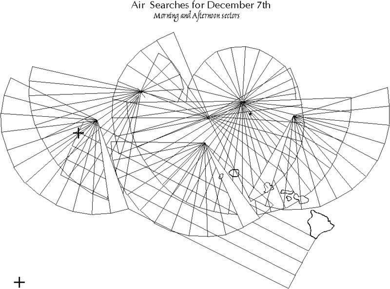
The area surrounding Oahu to a distance of 700 nm is about 1.54 million square miles. The main combat zone would be a radius of about 400NM (502,000 square miles). The side which was able to maintain better reconnaissance coverage in this zone would have obtained a decisive advantage in the fleet action contemplated.
The search plan for Tinkerbell envisions the use of seaplane anchorages at the French Frigate Shoals, and in the Maui/Big Island area to allow seaplane tenders to support search operations in the waters around Hawaii. The seaplane tenders are augmented in capability with the addition of Mavis flying boats staged in from the Marshall Islands, commencing on the morning of December 7th. In addition to these resources, the Strike Force, the Main Body, and seaplanes in other groups would also need to maintain daily and nightly patrols.
Seaplane types and search data:
This is an attempt to quantify various IJN seaplanes and rate their usefulness in scouting.
"Visibility" is average distance in NM that the aircraft can see in any direction due to weather conditions, etc.
"Search" is the area in square miles that one plane will search assuming an organized 360 degree pattern. This is a rough estimate to give an idea of average search capability.
"Search Max" is a rough idea of the area in square miles that one plane can search.
"Max radius" is the greatest length of the outward and inward legs allowable for that aircraft type.
F1M2 (Pete)
Range: 460 miles
Cruise: 138 mph.
Effective search area:
Visibility........Search..........Search Max......Max radius
15..................3,930...............7,920................131
20..................4,840...............9,760................121
25..................5,550..............11,200...............111
Comments: A next to useless aircraft good mainly for spotting gunfire and ASW patrol.
E8N2 (Dave)
Range: 550 miles
Cruise: 110 mph
Effective Radius:
Visibility........Search..........Search Max......Max radius
15..................4,875...............9,810.................162
20..................6,100..............12,280................152
25..................7,125..............14,350................142
While better than Pete, the E8N2 Dave was still inadequate for scouting in 1941 due to its short range.
E7K2 (Alf)
Range: 11.5 hrs
Cruise: About 110 mph
Range: 1100mn
Visibility........Search..........Search Max......Max radius
15..................9,000..............18,060.................300
20.................12,000.............24,080.................300
25.................15,000.............30,100.................300
Too slow, but the better range at least allowed Alfy to make a search to a meaningful distance.
E13A1 (Jake)
Range: 1299 miles
Cruise: 137 mph.
Visibility........Search..........Search Max......Max radius
15..................9,000...............18,060.................300
20.................12,000..............24,080.................300
25.................15,000..............30,100.................300
A much better platform available in too few numbers. Jakes are stripped from other theaters to augment search capability for the decisive battle.
Mavis
Visibility........Search..........Search Max......Max radius*
15..................36,000..............72,060.............1,200
20..................48,000..............96,080.............1,200
25..................60,000.............120,100............1,200
* - the Mavis had an absolute range of about 4,000 miles.
The best recon asset available to the Japanese, directly comparable to the PBY.
IJN doctrine for normal search radius was:
Medium Bomber - 600-660NM, or 700NM if anticipating an action.
Seaplane - 250 to 300NM
Carrier attack aircraft - 350 NM
Flying boats 1,000 to 1,200 NM
(PHA vol 13 no. 639)
IJN recon assets.
Strike Force (Yamaguchi)
Cruisers: Tone, Chikuma, plus 3rd Bat Div (when attached).
6 x E8N2. 4 x E13A1
plus 3rd Bat Div (if/when attached).
6 x E8N2
Carriers: IJN doctrine allowed up to about 10% of striking power to be used for scouting, which gives a max total available for additional searching at about 28 aircraft. When employed, these are drawn mainly from 5th Carrier or Kaga.
Max Search radius: 300 nm
Max Search area: 283,000 nm
Aircraft required (min) for 360 degree search to 300nm
15 mi: 32
20 mi: 24
25 mi: 19
Because Tone and Chikuma only had four aircraft capable of long range search (and 3rd Bat Division none), Yamaguchi's carriers would have had to provide anywhere from 15-28 additional aircraft (300MN) or 8-16 aircraft (200NM) as part of any daily search plan.
Main Body (Yamamoto)
32 x E8N2
7 x F1M2
2 x E13A1
9 x E7K2
Standard Search radius: 160 nm
Standard Search area: 80,420 nm
The Main body would be capable of full situational awareness to a radius of about 160nm. The 11 aircraft embarked which could reach up to 300nm would be good for a long range search along one particular bearing, covering somewhere between 1/3rd and 2/3rds of a full 360 degree search circle.
Seaplane group no. 1 (Maui, Big Island area)
Suzuya: E8N2 x 2, E13A1
Chitose, Chiyoda
24 x E13A1
Yura: E7K2 x 1
Total: 28
Plus: elements of 24th Air flotilla Mavis w/ search capability of 60,000 to 120,000 Sq miles per aircraft.
Max Search radius (not including Mavis): 300 nm
Max Search area: 283,000 nm
Aircraft required for 360 degree search to 300nm
15 mi: 32*
20 mi: 24
25 mi: 19
* - not sufficient aircraft available for 300nm rad search w/15nm average visibility.
Seaplanes taking advantage of the other islands would go a long way to rectifying the advantages to the USN of holding Oahu. While their vulnerability would be make them more likely to be attacked, this "disadvantage" was worth the added ability to find and track any USN carriers at sea.
Seaplane group #2 (French Frigate shoals)
6 x Mavis (24th Air Flotilla).
Mizuho
4 x F1m2
12 x E13A1
The Mizuho's Jakes could cover about a 180 degree sector out to 300NM from the Shoals. The Mavis flying boats would be employed on far longer missions. Mavis and Jake searches could be coordinated to prevent double-up.
USN scouting assets.
Oahu itself would probably not be able to muster a full 360 degree search to 200 or 300 NM on December 8th and maintain a strike reserve.
Lexington Group.
32 x SBD Dauntless.
18 x SB2U Vindicator, embarked Marine Corps. squadron VMSB-231
12 x SOC seaplane
About 18 dive bombers would be required for searches.
Enterprise Group
41 x SBD Dauntless
12 x SOC seaplane
About 18 dive bombers would be required for searches.
Notes on the logistics of using the French Frigate Shoals for recce work.
The Second Attack on Pearl Harbor provides some interesting background on the logistics necessary to use the French Frigate shoals for aerial scouting, quoted at length,
French Frigate Shoals' coral reefs encircle a large lagoon nearly fifteen miles long. La Perouse Pinnacle on its western edge rises 122 feet above sea level, making the atoll easy to spot from a submarine periscope or from an airplane....The atoll had several openings to its kidney shaped lagoon that were deep enough for submarines or small craft to enter. (76)
The Atoll's use as a seaplane launch point was confirmed by a submarine reconnaissance (I-22). This boat examined it and other islands between Kauai and Midway and reported that the Shoals was the most practical location available. Logistic preparations of the submarines were,
"Other preparations included the modification of several of the I-Class submarines to replace their Glen (E14Y) floatplanes with fuel and oil tank storage and fuel pumping equipment in their deck canister-hangers. This modification included four hose connections, hoses, reels, floats, tanks, and compressed air pumps for fuel at high rates of transfer at 53 gallons per minute. Submarines I-15, I-19 and I-26 were selected for the remodeling...All three ships would spend the first two weeks of February 1942 in port in Japan for these alterations." (77)
Avgas capacities,
"I-15 and I-19 were designated as the primary refueling tankers, each to be loaded with 10 tons of aviation gasoline. The I-26 would be on station as the backup tanker, but would remain outside the reef to act as a picket boat when the other two went inside." (81)
Conditions during the refueling:
The wind was more than twenty miles per hour, and was whipping up waves of five feet or more, making the refueling operation tricky and dangerous....Both aircraft carefully taxied astern of the slow moving submarines but did not shut down their engines. To be able to maneuver and maintain their relative positions for refueling, the aircraft had to keep their two outboard engines running in order to maintain their own steering. The plane's speed and the submarine's speed had to be synchronized...
Each submarine deck crew sent out a mooring pendant with a loop at its unattached end that was buoyed up by small floats. The aircraft crews snagged their pendant with a long boat hook and hauled up four specially made lightweight gasoline hoses to reach fuel tank receptacles along the top of the airplane's wings....The brisk winds and moderate swells caused fuel lines to part several times. A great deal of time was consumed in the operation to recover the mooring pendants, maneuver the airplanes back into position, and reconnect the gasoline hoses. In about 2 hours, 3,170 gallons were pumped into each aircraft, adding approximately nineteen thousand pounds of weight.
The wind began to rise. Even inside the atoll's protective reefs, the waves were now six feet high....Lieutenant Hashizume decided that they should prepare for the tricky takeoff immediately."
Logistic summary.
Each submarine could carry about 3,300 gallons of avgas, with the max. loaded capacity of the H6K4 being 2905 gallons. For the direct flight to the Shoals (1605 miles), a Mavis should burn about 1170 gallons. For the planes flying the search legs south of Oahu and then going to the Shoals, the distance flown would be about 2540 miles, for around 1844 gallons consumed.
On hand aboard 6 x Mavis on December 6th: 17,430 gallons
On hand aboard 3 x I-boat: 9,900 gallons
Expended by three direct flights to the Shoals: 1170*3*1.1= 3,861 gallons
Expended by three recon flights south of Oahu and then to the Shoals: 6,072 gallons
Total remaining fuel: 17,397 gallons
Required for return to Marshalls (1500 gallons per plane): 9,000 gallons
Total available for sorties on Dec 7th/8th: 8,397
Required per sortie of 700 miles w/50 mile dogleg: 1,158
Total Mavis recon sorties available from sub force: 7.25 + 3 (flown direct) = 10
Extended operations from the Shoals thus depend upon the ability of the Muzuho to support flights there, as the I-boats will probably be exhausted by December 8th. Muzuho might have come under attack very late on the 7th after Lexington scouts check the Shoals at around 4pm December 7th.
(12) IJA amphibious warfare Doctrine
In April and May 1942, the German Ambassador in Tokyo transmitted to Berlin the most important IJA guidelines for conducting amphibious landings. At that point in time, the Japanese rivaled the USMC for the title of the most competent amphibious force - the USMC had a more comprehensive doctrine, the IJA more experience.
The excerpts are from Assault from the Sea. Italics are the IJA doctrine as summarized by the German ambassador. Bold is the author's comments.
The request that the Japanese landing doctrine be made available was to date denied, with the justification that there was no single document, but only partial summaries. >From the <information that has been?> made available to me, I have made the following resume:
1) General
a) One needs to distinguish naval landings (Wake, Guam), army landings (Malaya, Luzon) and all large landings. Scholl's conjecture to me in Bangkok - that the front ranks of every army landing there are other navy amphibious units which take the coastline - was universally denied during a tour of the front and is inappropriate even after a retreat.
Hawaii would be an IJA operation conducted with IJN support.
b) Virtually total sea and air superiority is necessary at least for the final decisive landing. Therefore the purpose of the first landing was often simply to win airfields (Kota Bharu, Apari, Vigan, etc).
The "final landings" (Oahu) would occur only after the Japanese had wrested land based air superiority over the island chain from the Americans (Lehmann mentions this as "among the most important preconditions of large amphibious operations"). Islands available that could act as advanced airbases were Kauai, Maui, Moloka, Lanai, Hawaii.
c) One should seek to surprise the enemy while he is still unprepared. Apart from surprise at the time of the landing, it is important to camouflage the direction of the amphibious transport fleet (certain transports for the Khota Baru landing were disguised as steaming from Bangkok).
This seems to suggest that, for example, a force originating from the Marshall Islands might approach Hawaii as if it came from the Home Islands instead. The reference to surprise suggests a willingness to take risks to achieve a tactical advantage.
d) Enemy air, naval, and ground forces should be caused to disperse to the greatest degree possible through deceptive maneuvers and through the breadth and comprehensive application of our own forces (Luzon).
Diversions would be made to cause the defenders to guard the island at all points of the compass. Further efforts to weaken at the decisive point could be achieved by making multiple landings, some of a minor character.
e) Troops should be carefully trained in night landings. Equipped as much as possible with bicycles and motorized vehicles to diminish the number of horses required. Especially important is the training of debarkation commandos, which are to be drawn from the amphibious force itself, and guaranteeing their effective cooperation with the landing force.
IJA doctrine accepts the disadvantages of a night landing (disorganization and confusion), but attempts to compensate for the disadvantages by intensive training of all personnel, in particular, the debarkation commandos. (Lehmann mentions that units spent years drilling the required skill set. The debarkation commandos, for instance, were elite units). Losses were to be expected,
"Although the debarkation crews had practiced all aspects of their job for months, there was no way during these operations to avoid the loss of life and equipment, particularly during high seas."
2. Designating the transportation fleet and the landing site.
a) The basis for organizing the transportation fleet and the loading of the individual transports derives from the intended organization of the amphibious units during the landing as well as from the planned sequence of debarkation commandos.
b) Where an attack by enemy aircraft or enemy ships can be expected, staffs and infantry units should be embarked in such a way that the loss of one transport does not mean the complete loss of a single staff or an entire weapons branch (example - the loss of three-quarters of all artillery to be put ashore at Kota Bharu).
This doctrine appears not to have been universally disseminated at the start of the war - there were a number of examples where 'all eggs in one basket' came back to haunt the IJA.
c) The commander of the amphibious force and the commander of the covering naval forces should exchange all planning documents in a timely fashion and should stay in constant radio contact during the approach and landing phases of the operation.
d) The organization of the transports during the approach phase and while at anchor should be adjusted completely to the landing organization of the unit being transported.
Sufficient references to anchoring exist in these telegrams to conclude that this was the method of debarkation in the IJA. With regards to Oahu, there were advantages and disadvantages to anchoring vs. an underway debarkation. This is discussed later.
e) The most favorable time for landing is at night. This means, in particular, that the last hour of the approach phase, the debarkation, and the landing of the first wave takes place by dark.
f) The transports are to approach their anchorages in groups, one or two columns parallel to the coast.
g) Landing zones to be selected in such a way that either no enemy resistance, or minimal resistance, can be expected. Anchorages should be out of range of artillery fire. Navigational and geographic difficulties (a steep coast, for example) should therefore be accommodated if necessary.
The initial landing would probably not have been along the south shore of Oahu. In addition, the transports would not have unloaded where the coastal artillery could reach them. US artillery that had not been neutralized by bombardment would probably have been negated by the tactic of outranging. The easiest method to avoid potential mine fields would have been to stay in deeper water, at least until minesweepers had been employed.
h) Always plan for back-up landing zones to which one can divert if changes prove necessary during the approach phase.
Weather conditions near Oahu probably meant that the final landing site would be in doubt until the last day or two as the transports approached.
i) The landing zone should be determined early, and should be under constant surveillance from the air. Shortly before the arrival of the transports, the commander of the landing force, if at all possible, should view the landing zone from a fast patrol boat.
Clarifies an advantage of securing forward bases as per 1 (b) above. Air superiority could be exploited to ensure adequate intelligence of Oahu's beaches and landing conditions.
j) Landing zones should be subdivided into landing points (e.g. according to the number of battalions in the first wave.)
A number of references in this text suggest that the unit of measure for IJA landings was the battalion. IJA regimental, brigade, or divisional assaults would probably resemble, at first, simultaneous battalion assaults at points spread out along the coast. Landing zones might encompass a large section of coastline.
k) The transports should be anchored in such a way that arrival and departure are easily possible, and so that hte sinking of ships, for example, will not hamper the operation.
l) The means for transports to communicate among one another is necessary.
m) Air cover over the anchorage is the task of the navy.
3. The Japanese landing plan has the following key points.
a) The landing zone, time, and manner of gathering information about the zone.
b) Schedule for approaching by sea and landing.
c) Schedule for the initial phase of landing.
Initial landing could run into delays due to weather.
d) Division of landing zone into landing points, which are then assigned to individual units (generally battalions).
I'm estimating that an IJA battalion would be assigned a landing point roughly 1,000 to 2,000 yards in width. On Corregidor two battalions were committed to a zone of about 600 yards, but given the tiny size of the island, this might have been an exception.
e) Organization of the landing forces and their assignment to individual landing points.
f) Organization of the transportation fleet according to the organization of the landing force.
g) Action by the transportation fleet (real movement, deceptive movement) and protective measures for the fleet.
Deceptive movement seems to imply that the transports (or the escorts) would make diversionary demonstrations along different coasts prior to the moment of landing. This could take the form of a raid (perhaps an SNLF DD), a bombardment, or merely allowing themselves to be sighted.
h) Anchorages for the transportation fleet.
i) Organization of the transportation fleet for anchoring and determining the time for anchoring.
j) Infantry action during the landing.
Initial objectives (points, towns, passes, etc.) of invading infantry units are specified prior to landing.
k) Participation of navy and air force units in support of the landing.
Oblique references here to naval gunfire and aerial support. Estimates in the limitation of IJA/IJN doctrine in this regard are discussed below.
l) Air defense in various phases of the landing.
A USN carrier threat would greatly hinder the ability of the IJN to both pursue a major naval battle and protect a transport fleet during the major landings. The failure of the Japanese to specify the need for near total air superiority during the first landings suggests that smaller transport forces could and would be risked to gain bases.
m) Communications nets during the landing.
n) Resupply.
o) Rescue operations.
4. Debarkation.
a) After anchoring of the transports, the debarkation crews put the landing craft in the water. The landing force, supported by debarkation commandos, enters the boats.
Which, in all fairness, is a better procedure than to put the troops in the water and then place the boats on top of them....
(The Diahatsus were equipped with luminescent paint to assist the debarkation crews while setting the loads into the boats in the darkness.)
b) Together, loaded boats head for the coast after they have gathered in the vicinity of the transports.
This does not specify upon which side of the transports the boats would gather on prior to departure. I would guess shoreside.
c) Approach to the coast in limited profile, the commander's boat in front.
Each battalion deploys in line ahead until nearing the coast, at which point the formation alters to line abreast. The boats were equipped with small stern lights to assist in keeping proper formation. "If necessary, the crews open fire from machine guns and armored personnel carriers."
d) After the landing of the first wave, the debarkation commandos return to the transports without concerning themselves further with the battle on the coast. The second wave is prepared on board the transports.
"Signs with luminescent paint marked the route back to the transports, where a second wave was waiting."
e) If the scheduled debarkation of the second wave can no longer be expected, as a result of boats lost to enemy fire or stranded near the coast or disorientation in trying to locate transports, it is important that all subcommanders can adjust to new circumstances quickly.
Chaos was to be expected. The potential difficulty of boats to locate the transports implies that the ships might have moved in the period between departure and return. The reference to adjusting to circumstance appears to mean that the initial unloading plan may be superceeded by events. i.e., that debarkation of the second wave might degenerate into an ad-hoc affair. For this reason, the first wave was equipped to fight without further assistance in the near future,
"Armored personnel carriers, light field artillery with forward spotters, army engineers, and communications technicians were also part of the first wave. Every unit up to platoon size was trained and equipped in such a way that they could fight independently."
f) Horses go ashore last.
g) Hope to be able to report technical details on landing craft.
5. Japanese debarkation plan contains the following details.
a) Detailing of debarkation commandos.
In all probability, individual Diaz Hatsus would be assigned to individual transports. 4 (e) above suggests that this rule may not apply to the second (and succeeding) waves due to attrition, difficulty in finding assigned ship, etc. Transports probably would have a method to signal boats (any boat) to approach.
b) Preparations, application, and use of landing craft.
Preparation of landing craft for rougher seas probably would mean securing heavy equipment (ie, a light tank or artillery piece) in the Diahatsu prior to lowering it into the water. This tactic would be subject to the specifications of the ship and cranes aboard her, of course. Heavy seas might altogether prevent the invasion force from landing more tanks or artillery in the second wave.
c) Sequence of putting landing craft in the water.
e) Designation of landing zones.
f) Obstacles to be expected on the beach.
g) Any intended camouflaging of the operation with smoke.
The use of smoke to protect transports would be a virtual certainty for an Oahu landing.
h) Communication nets during debarkation.
i) Special orders, if any, for regrouping when ashore.
j) Measures for rescue and assistance: (1) Repair of damaged boats and (2) subsequent resupply of fuel, drinking water, etc.
6. The navy, including the naval air wing, is responsible for protection from enemy air and naval forces during the approach and landing. Under certain circumstances the navy will include light naval forces in the first landing wave to contribute in the attack on the coast.
Possible reference to SNLF DD's here.
7. The attack by the first wave
a) The basis for successful landings is that the coast is taken as quickly as possible. The first landing wave therefore must be as strong as possible. This leads in turn to inclusion of the largest number of landing craft possible aboard transports. Virtually simultaneous landings at least within the landing points, and if at all possible within the landing zones, is a major goal.
The size of the transport unloading zone could be equal to the size of the invasion area being attacked?
b) The first landing wave of infantry, with light armored personnel carriers, artillery, advanced teams, army engineers, and communications corps. The landing infantry are able to fight independently down to platoon level through corresponding outfitting with arms.
This is an attempt to limit the effects of dispersion and confusion inevitable in the selection of night landings. Each DaiHatsu delivers a cohesive fighting force that expects to fight independently, and will assemble into larger units on an ad hoc basis - similiar in concept to airborne troops.
c) For armored personnel carriers incorporated into the first wave, some sharpshooters to accompany and support the landing craft. Armored personnel carriers must be able to shoot from cannon and machine guns during the approach to the coast.
An interesting attempt to add firepower to the landing, when such are opposed.
d) The first landing wave assumes battle organization when it leaves the boats and approaches assigned targets without losing time through reordering of units. Speed, decisiveness, valor by the first wave determines the success of the landing. Once the first goal has been reached, it should not be too close to the coast - ordering of units and intelligence gathering assume priority.
Units are expected to land disorganized. Rather than waste time trying to sort themselves out, the first wave places emphasis on maintaining forward momentum by seeking objectives of some distance from the coast that the advance will not peter out before securing a deep position.
e) Take advantage of any successful surprise using all available means. Once begun, the landing should be continued, even if surprise is not achieved or unexpected developments occur. If the landing force adjusts to circumstances and continues the attack, and the senior force commanders add additional air cover, successful outcome to be expected. With strong air defense, emergency case can develop with first wave pinned down on the beach awaiting arrival of the second wave.
Surprise is recognized as a valuable tactical element, but that sufficient reserves to overcome strong resistance should be available.
f) The first wave cannot count on artillery support for extended period of time. Should therefore apply own weapons immediately. Companies and battalions landing in the first wave need no reserves. The reserves arrive with the newly landed force.
This implies limitations to IJN naval gunfire support. IJA command organization in other battles suggests that no directed naval gunfire would be available below battalion or regimental level, and this assumes that the radios are not disabled by weather conditions as occurred in the Philippines.
IJA tactics commit all available boats to the first wave - none are held back to form an immediate reserve.
8. Action by the subsequent landing wave.
a) Later waves immediately assume contact with force fighting in front of them regardless of previous assignment.
This implies that that any units landing at the wrong beach, or otherwise separated from their parent formations, are to ignore their original orders and instead join the battle directly in front of them.
b) Artillery assumes positions prepared by artillery advance teams or rushes in individual pieces into individual use in the battle zone. Coordination of artillery firing piecemeal as quickly as possible.
IJA artillery support gains strength from the second and succeeding waves. Presumably tanks are employed to help compensate for the lack of artillery in the first attack.
c) Army engineers remove obstacles slowing the landing, both on the beach and in the lanes of approach. Occasionally assistance can be provided by them during landing and refloating of the boats, and while preparing artillery for fire.
9. If there is the need to shift focus during landings, regroup as quickly as possible with the aid of landing craft.
10. Resupply. Landing units carry with them sufficient supplies for approximately ten days. Thereafter, resupply by supply ship.
The ten day rule would have been inadequate for Oahu.
xxxxxxxxxxxxxxEnd of doctrinal summaryxxxxxxxxxxxxxx
Anchoring.
USMC doctrine from 1938 specified that ships conducting an amphibious landing could either choose to anchor or to debark while the formation remained underway. The IJA operational doctrine briefing makes references to anchoring but not to the latter, of unloading while underway. It appears upon further digging that this technique was not employed by Japanese as a rule. For maximum flexibility, an Oahu operation required the ability to use either method. For this thread, it is assumed that transports would have to anchor before debarkation could begin. There were two serious disadvantages with it. First, if experiencing heavy weather, a transport at anchor could turn into the wind, and thereby expose both sides of the ship to heavy seas that hindered unloading. Second, a need to anchor created an additional tactical complication with regard to the selection of a landing site - any such area must have acceptable sea bottom conditions to allow anchoring. Near Oahu, this meant that some form of disadvantage would have been accepted.
The following explanation of anchoring techniques (and the one following on deep water options) is courtesy of Mark Bailey.
Source: Admiralty Manual of Seamanship Val II Chapter 9, Anchors and cables, and Anchor Work.
What holds an anchored ship is NOT the anchor, it is the friction of the cable with the sea floor. The anchor acts to firmly secure the end of the cable.
Merchant ships tended to use cheaper merchant-quality wrought iron cables (liner companies and navies tended to use Admiralty quality forged steel, 40% stronger than wrought iron)
I will use as the example the RN depot ship Forth, 11,000 tons and fitted with merchant quality wrought iron cables.
Anchor 2 x 160cwt Byer's stockless bower anchors
Cable 2.5" wrought iron, composed of 22 shackles and 8 half-shackles. This may confuse. In this sense, shackle means a length of common linked cable plus ONE lugless joining shackle, the length of this shackle of cable being 15 fathoms (90 feet). The lugless joining shackle uses the word in another sense, that of it being a lump of metal that looks like a slightly fattened common link, but it actually is a very strong shackle that is held together by a pin. The lugless joining shackle is a device to join two shackles (15 fm lengths) of cable.
OK, so Forth had 390 fathoms (2340 feet) of cable. The cruiser Tiger (12,000 tons) had 375 fathoms. This sort of length is standard.
Got that so far?
OK, this DOES NOT mean that she could anchor in 2340' of water!
Remember the bit about the ship being held by cable friction? Well, cable in the catenary arc between hawsepipe and sea floor also acts as a shock-absorber.
The golden rule is that you MUST have enough cable out to give a horizontal pull on the anchor (actually it must be less than 5 degrees to give 80% of the holding power of the anchor)
So now we have a LOT of variables like tides, set, current, bottom type, ship yaw, anchor type (A.S.S anchors are less stable on the bottom than Admiralty stockless, for example) wind etc etc. Also, even the best holding ground will vary plus/minus 15% in holding capability.
OK< the formula is:
forged steel cable
n=2 times the square root of d
wrought iron cable
n=3/2 of the square root of d
n= number of shackles on the waterline and d = depth in fathoms
So for 170- fathoms, (1020' of water) on good holding ground, with forged steel cable, HMS Tiger would need 26 shackles on the water line (she had a total of 25shackles), so while she could anchor she would have to take other precautions (such as keeping steam up).
Forth, with 26 shackles of cable, would also be right on the margin. You NEVER use the last shackle of cable in deep water. If you do, the ship can wind up riding on the cable clench - essentially you have no slack and if the weather rises you can wind up unable to retrieve it! This makes CO's really, really unhappy with the cable deck officer and mate of the upper deck, and the XO who are responsible for such things!
Anchoring in over 900' is not often done simply because there is rarely a need to do so, but it is perfectly OK to do so.
I have used the example of Forth because she was basically built, manned and operated exactly as a 11,000 ton merchant ship of the 1940s was when run by a good liner company which insured with Lloyds. Therefore I KNOW that she met Lloyds A1 standards, which was the standard for all ships in liner trades where run by a good-quality company.
On a rock bottom, you cannot anchor. You'll be able to anchor tenuously in calm conditions in deeper depths with 390 fm of cable. SHips have certainly done so.
There are places (Ocean island and Nauru phosphate trades) where you can't anchor, it's too deep. Where there are no deep moorings to secure to (Ocean Island's was in 2 miles of water!) ships will simply drift in the lee of the island or ride to sea-anchors in the lee. Basically, you keep steam up, steam close to the island's lee side (as close as you dare given charts and known depths) and drift. The wind will gradually blow the ship out to sea, then you slowly steam back and repeat the process.
This was the case 1880-1970 at Ocean Island for phosphate ships.
Anchoring near to Oahu poses problems for four reasons
1) The water depth falls off very rapidly.
2) Therefore potential anchorages might be within artillery range of defending batteries.
3) Anchoring places transports in waters where it is more likely there might be minefields.
4) Weather patterns require the ability for transports to provide a lee when unloading. This is impossible for anchored transports, which will swing into the wind.
Except along the north shore, the 200 fathom line for almost the entire island of Oahu is less than 12,000 yards from the shore. The 100 fathom line runs about 6,000-8,000 yards out, except on the west side where it is much closer to the shore. Therefore, a force that anchors before debarking will, if invading in the south, certainly either be within artillery range when making the initial landing or so far away that a second wave is not a credible option. For the other shores, anchoring does not pose as great a problem.
The following response by Mark was prompted by a question as to what ships at anchor do if they suddenly have to get underway. It details several methods by which ships can set up deep water anchors and still have the flexibility to 'bug out' quickly if the needs takes fancy,
Neither, you will break the cable.
If such attack is a strong possibility, instructions will have been issued before hand. There are then two options.
1. Lay Moorings. Ships will cat an anchor (suspend it OUTSIDE the hawse, and probably use an Admiralty stocked mooring anchor) and range cable on deck. The cable will be connected to a mooring buoy. They will have an anchor stopped in the hawse and its cable broken and either secured with a joggle shackle (a scungy merchant ship trick) or more normally secured with a blakeslip or a screwslip, the latter being preferred practice. The broken cable would then be rove through the bullring, led aft outboard (being lashed to support its weight) and connected to the mooring buoy with a mooring swivel and mooring shackle. This shackle can be replaced with a senhouse slip (but then you'd have to man the buoy - bloody dangerous). You'd then do a formation moor, with everyone letting go on a signal and riding to those moorings. Now, doing this means you could lay deep moorings if you wanted in any depth desired. Obviously, we are talking a lot of gear here, and it'd occupy deck space in a big way. The British Phosphate Commissions ships (Triadic, Trienza, Triona, Triaster, Triellis) were all sitted with the extra-powerful derricks and big cable lockers to lay and retrieve such deep moorings, as well as the 3 x 40 ton mushroom anchors in the abyss, but that was an unique commercial operation to require such things - 3 MILES of cable! To go much over 1500' you will start to need very big floatation buoys and mushroom anchors, but down to that a normal merchant ship will handle.
All of this is complex, though, and needs special gear.
2. Slip-and-Buoy. Anchor as normal and have a cable-laid hawser ready. Anchor the ship. Connect the blakeslip and ease strain on to the blakeslip. Break the cable using the lugless joining shackle which connects shackles (15 fm/90' sections) of cable. Reeve the hawser (which is 150% of depth long) outboard then back up the hawsepipe. Connect it 4 links down to the cable using a hard eye made in the end of the hawser (the reason you MUST use a cable-laid hawser) with a lugged joining shackle. The end of this recovery hawser is connected to a buoy (you'll have maybe 100' of hawser, THEN the buoy, for reasons which will become obvious). Also connected to it is a recovery line and a second, smaller buoy. The whole lot is rigged to run outboard unimpeded.
SO, now we have to slip because an emergency has arisen. EASY. One sailor cuts the wire mousing on the Blakeslip pin and pulls out the pin. A second sailor swings his sledge hammer and knocks back the securing yoke, the Blakeslip flicks open and the whole damned lot runs overboard. You steam off. When you come back, a sailor with a grapnel recovers the recovery line. It is rove thru the hawsepipe and the loose end of the hawser recovered. The loose end of the hawser comes up the hawse and 3 turns are put around the capstan and wound in. The Buoy is cut free when it comes out of the water. The cable and is recovered using the recovery hawser and reconnected to the Blakeslip, then eased to it. The recovery gear is then re-rigged for use and is all checked for wear/chafing.
This would be the normal manner of riding to anchor in a deep anchorage where an emergency is expected at little notice - riding in a deep lee to avoid the dangerous quadrant of a cyclone, for example, knowing that you'll have to slip bloody fast when the veer comes, but not knowing when the veer will be.
The advantage is that you are simply using your normal ground tackle and gear. None of this is hard, this is very basic cable work. The mooring option is a little bit fancy, but would present zero problems for any halfway competent merchant crew of the last thousand years.
Conclusion.
1) Sea swell and wind conditions are not predictable in advance. Therefore any landing would have to anticipate the possibility of strong winds and high seas from virtually any point of the compass. Oahu always has at least one shore (north or south and east or west) where landings could take place. But no invasion plan could assure which shore would be available prior to the landing date. Weather conditions change near Oahu so frequently that waiting only a few days might change which beaches were available.
2) Oahu's seabed falls off steeply past the 100 fathom curve. In many instances, if a ship is to anchor within, say, 900 feet of water it must approach to within 8,000 yards of the shore. In places where anchoring is possible further out (north shore, north side of east shore) wind or surf conditions are suboptimal.
Doctrinal Guideline.
.
My interpretation of IJA doctrine leads to the following guidelines. Section and paragraph are cited from the IJA doctrinal briefing.
1) The IJA would first seize outlying islands for the purpose of wresting control of the air. Only when this was established would a landing occur Section 1 (b)
2) The Japanese would make diversionary feignts to lure Oahu's defenders to the wrong beaches and weaken resistance to the main landing. This will include landing small numbers of troops or SNLF's, and diversionary naval bombardments. Section 1 (d) 3 (g)
3) The landing would occur at night. Section 1 (e), 2 (e)
4) The initial landing would be on either of the undefended coasts and not the north or south shore. The invasion would not occur until the IJN had silenced the long range batteries of Barrette and Weaver, which had the range characteristics to interfer with transports at ultra-long ranges. Section 2 (g)
5) Which of the east or west coast was invaded wouldn't be finally decided until the last moments, due to unpredicatable weather. Section 2 (h)
6) Functionally, an IJA assault would be simultaneous battalion-level attacks on beach objectives 1,000-2,000 yards wide spread out across the entire breadth of the target coast. Section 2 (j)
7) The IJA would attempt to improvise in any fashion if the 2nd wave landings experienced difficulty Section 4 (d, e)
8) Smoke would be used to conceal the invasion anchorage. Section 5 (g)
The landing at Kota Bharu and Corregidor demonstrated IJA assault landing capabilities,
http://forum.axishistory.com/viewtopic.php?t=120591
Nogi lost more killed than Takumi’s entire command and the only tactical similarity was that Hill 203 and Kota Baharu were both diversionary attacks. What happened to the first Japanese to step ashore in Malaya had much more in common, though again on a smaller scale, with what the American infantry would suffer some thirty months later on Normandy’s Omaha beach. It was, by any standards, a sanguinary beginning to Japan’s assault on South-East Asia.
For some time, the barbed wire entanglements continued to prove insurmountable and, as they bunched up behind them, so the Japanese losses mounted. Those who tried to get away from the more obvious fixed lines of the Bren guns began to set off the land mines that had been sewn in such profusion. Nearly all the battalion and company commanders were hit though at least two were trying to continue to lead while being carried about on stretchers. Major-General Takumi managed to leave the stricken Awagisan Maru and get ashore with the second wave some time around 3am, arriving with a company whose commander had been killed on deck when one of the Hudsons straffed the ship. Within minutes of getting to the beach the officer who had succeeded him was also killed. Takumi then personally took command of this and another leaderless company and ran and crawled with them towards the wire.
Most contemporary western armies of the day used explosive charges to get through thick barbed wire entanglements. The British, for instance, had developed the Bangalore Torpedo: an alloy pipe about one-and-a-half inches in circumference packed with gun cotton and usually six foot in length though sections could be joined together to clear a way through both entanglements and, it was hoped, mines by detonating those either side of it.
For all their intensive preparation, Takumi’s men do not appear to have had anything like this at their disposal. Instead, using bayonets, helmets and spoons taken from their knapsacks, his soldiers began to burrow their way like turtles into the soft sand under the wire until they were deep enough to crawl beneath it. According to one Japanese account this was done by lines of men lying abreast, “digging the ground frantically and gradually crowding forward”. Behind them the next line of crawling men would deepen the trench the vanguard had excavated beneath wire, gently pulling aside casualties.
Then Sendoi and the other Japanese warships had begun to lay down accurate fire with their heavy guns. Near misses were blowing sand through the loopholes of the pillboxes which, combined with the sweet smelling cordite from the bren guns, made the defenders’ eyes water and stung their faces. Soon the air in these concrete boxes became so bad their defenders started wearing their gas masks. In any case, some of them were already convinced that they were dealing with something more lethal than a cocktail of sand and gunsmoke. “A kind of tear gas,” suspected one of the Dogras’ British officers. Japan had acquired a reputation for occasional chemical warfare in China where neutral observers had accused them of using mustard gas. Whether some of the naval shells that landed on the beaches at Kota Baharu were loaded with gas has never been confirmed. It seems an unlikely tactical risk. The British were not the Chinese. However threadbare their military garrisons east of Suez were, the pre-war obsession with gas attacks was such that perhaps the one thing they were well prepared for was retaliation. Stockpiled in Singapore were almost 12,000 mustard gas shells for 25-pounder field guns plus bombs and cylinders for the RAF to drop or spray like crop dusters.
Gas or no gas, here were men trying to defend pillboxes during a night attack who could now see even less through their thick gas goggles. Nor was this their only setback. Brigadier’s Keys worst fears had come true. Despite the cross fire, armoured landing craft had managed to get between the two spits of sand where a boom might have stopped them but certainly not the Indians’ heaviest weapon, the Boys anti-tank rifle which fired a huge .55 round, kicked like a mule and had acquired a reputation during the German blitzkrieg across France for rarely meeting its trade description.
By daybreak on 8 December, with the war about six hours old, a good many of the Japanese had penetrated the waterways which jigsawed the land behind the beach defences. Japanese walking wounded on their way back to the beach, some of them helped by comrades, were filing past Takuma’s headquarters staff bloody, muddy, soaked to the skin and utterly exhausted.
Gunnery Support.
"However firm and stout pillboxes you may build at the beach, they will be destroyed by bombardment or main armament of the battleships. Power of the American warships and aircraft makes every landing operation possible whatever beachhead they like."
Such was the reality of gunfire support in 1945, after the greatest of navies had learned painstakingly by trial and error over the course of years what did or did not work. My proposal to model what could be expected of IJN/IJA gunfire support in 1941/1942 is to examine the failures that drove this evolutionary process, and assign those weaknesses to the Japanese in the proper proportions. It is my proposal that the IJN and IJA would probably have made the identical errors, and therefore that the fire support which was to be expected would be reflected in the USMC practice at the appropriate level of doctrinal development,
"...in truth, the Imperial Navy was miserably prepared to support a landing against Midway. The Japanese Navy had little in the way of either an established ground attack doctrine for its aircraft, or a tested naval gunfire support doctrine."
Shattered Sword, 487
Shatttered Sword indicates that IJN naval gunfire support doctrine was untested. But was this the case, or are the authors making an erroneous claim?
http://forum.axishistory.com/viewtopic.php?t=117957
This link contains the following description of IJN gunfire support during the Amoy operation of 1938,
After daybreak the deputy commander of the 75th Division personally led the 1st Battalion of the 445 Regiment to reinforce the 3rd Battalion; it suffered over 50% casualties as it came under heavy Japanese naval fire. The remnants of the two battalions held their ground although their postions were virtually obliterated by Japanese bombardments. The 2nd Battalion was summoned to reinforce the Chinese line; incredibly it did not learn what happened to the 1st Battalion and suffered heavy casualties (its commander Yang Yung-shan was severely wounded) from the Japanese naval fire even before it reached the front lines. The supporting naval forces clearly played a key role in this battle and it was responsible for the virtual destruction of the entire 445th Regiment.
By the afternoon of the 7th, the Japanese has circled around the Chinese lines and threatened to encircle the remnants of the 445th Regiment. As night fell, the defenders escaped in small groups, and with no reserve close by, the door to Amoy was open.
At around 0800 on the 11th, the Japanese landed near Pai Shih Fort under the support of 3 destroyers and 2 gunboats. Since the ships were out of range for the guns in the fort, the fort was abandoned. The Japanese then attacked the neighbouring forts at Hu Li Shan and Pan Shi and scattered the defending artillerymen.
Amoy was now virtually defenseless except for some local militia; they were scattered and then gunned down as they tried to escape by jumping into the sea.
Chinese after-action reports showed the effect of the naval bombardment: all bridges, roads, ferries and ships were targeted causing major disruption in communication and heavy personnel losses; one of the reinforcing regiments could not get its orders to move forward because its communication lines were all cut.
This after-action report strongly suggests that IJN gunfire doctrine, whether good bad or indifferent, was indeed used in China, and the implications of it are that near Oahu the IJN would make great efforts to cut American communications, and had the ability to identify and target formations on the move. If Amoy is any guideline, the US Army may not have been able to implement it's strategy of mobilized reserves and rapid counterattack on Oahu.
The shortcomings in IJN doctrine would probably be similiar to the ones with which the USMC went to war with in 1941,
1) Failure to allocate sufficient quantities of ammunition to the task. A tendency to carry too much A.P. in anticipation of a fleet action, and not enough HE for support work ashore,
"The amount of ammunition that could be used for gunfire support was limited. Moreover, the preponderance of any ammunition carried aboard combatant ships must be that tye best suited for attacking other ships, that is, armor piercing, which with its low capacity, is not well suited to bombardment tasks."
Suitability of this error to the IJN 1941/1942 at Oahu: Very High.
2) Too much emphasis on the supposed vulnerability of warships to air and submarine attack. This will cause ships giving fire support to reduce their contribution to the minimum timeframe appropriate to the level of threat.
Suitability to IJN: Moderate to high. Japanese cruisers and destroyers hit at Wake demonstrated a strong tendency to immediately open the range while continuing the combat.
3) "A ship is a fool to fight a fort"
"A ship could not expect to engage or destroy a coast defense battery without risk of being sunk or seriously damaged. Confronted with this risk, fire support ships must confine themselves to delivering fires from long ranges offshore, while steaming at high speed and maneuvering radically - all of which combined to reduce the accuracy and ability of gunfire to pinpoint important targets."
Suitability to IJN: Moderate to high. IJN destroyers acting in the close support role demonstrated a willingness to come in closer in order to lay down effective fire. At Wake, Yubari opened fire at about 8,000 yards and closed the distance from there to 4,500 yards when the defending 5" guns opened fire - there is no reason to suppose that unless engaged, they would not have continued to closer ranges. Larger vessels (heavy cruisers, battleships) would be likely to remain at longer ranges, in excess of 8,000 yards.
To these errors, another must be added - that fewer ships than advisable would be assigned to direct fire support. For the Midway operation, Kurita's Close Support group consisted of four heavy cruisers and two destroyers - doubling or tripling that establishment would have been a good idea.
Limitations in IJN gunfire support.
Rather than outline what would be expected from the IJN, it might be easier to distinguish what was not possible with respect to the far superior USN doctrine developed later in the war:
1) No shore parties. USN support teams excelled in the directing support gunfire onto shore targets in amazingly short periods of time. This technique, which relied on special training for shore teams that the IJN didn't have, special equipment also lacking, and doctrine which didn't exist. At best, the IJN might have mustered one shore/ship communications team per battalion.
2) No precision support. USN ships specialised in being able to peel enemy bunkers, guns and pillboxes off a landing beach with precision-laid gunfire from a single barrel. If, for example, the target were a concrete bunker dug into the sand, a battleship might cruise slowly at close range, firing single shots one after the other. Some might ricochet off into the distance. Others might fail to explode. But most would slam into the sand in front of the enemy position and peel away protective layers of sediment. Eventually, the bunker itself would be exposed, at which point the ship could annihilate it with a final direct hit. On average, each enemy position cost 9 or 10 shells. Japanese ships could offer less of such assistence. Perhaps in close-in work their ships might have been about 1/3 to 1/4 as effective as late war USN ships.
3) Fewer ships devoted to close-in support work. It was not unusual for IJN ships to be assigned near-beach fire support, but if the OOB for Midway is any example, the overall number of vessels earmarked would be fewer than employed by the USN later, and too few for the tasks at hand.
4) No sophisticated forward air control. IJN air support, though plentiful once dawn broke, would be limited to targets of opportunity as seen by loitering pilots. Ground control would be limited to rudimentary communications systems such as flares. Air support might only be about 1/2 or 2/3rds as effective as later war American.
5) No comprehensive pre-bombardment plan. While the IJN could be anticipated to exploit pattern bombardments and deliver pre-landing softening attacks, it is unlikely that their plan would be as comprehensive as what became standard in the USN later.
What the IJN could offer was:
1) Neutralisation of the unfortified coastal batteries by area fire.
2) Some direct fire support, including saturation bombardment of identified and potential US Army positions and attacks on units moving in the open.
3) Counter-battery fire directed by aerial spotting against guns which opened fire (they could see the gunflashes).
4) Area interdiction fire against passes and roadways connecting US reserves in the center with their forces on the east coast.
4) Aerial Spotting.
Prewar USMC training had confirmed that aircraft could be adapted fairly easily to provide fire support,
Spotting.--The technique of spotting naval gunfire on shore targets by ship observers is in every respect similar to that employed in spotting fire against waterborne targets, except that the effect of slope must be taken into consideration when making range changes. - USMC 1938 doctrine manual
The IJN, which emphasized ultra-long range aerial spotted indirect gunnery, therefore possessed the necessary training, tactics and equipment prior to the war to have employed it at Oahu in 1941/1942,
"...by the mid-1930's the Japanese had sufficient confidence in their guns and gunnery that their main force units would outrange those of the US battle fleet by 4,000 to 5,000 meters. With the firepower that the Japanese navy planned to have available, the Naval Staff College estimated that the Japanese could begin to track the enemy at 40,000 meters (21.5 miles) and could...open fire at around 34,000 meters..."
Kaigun, strategy, tactics and technology in the Imperial Japanese Navy, pp262
Errors to be expected on the battlefield would again be identical to those experienced by the Americans,
"Many an air and top spotter experienced difficulty in adjusting fire when the targets were on ridges or reverse slopes, where a small range change produced a shift in the point of impact fire in excess of the change given. The spotter had simply encountered a target on a ridge and his small change sent the salvo over the ridge and far away, frustrating and time consuming as well as wasteful of ammunition."
These problems would also be experienced by the IJN, especially in the mountainous regions of Oahu, because they occurred with the USMC despite training,
"Aircraft...operated from Quantico and Fort Bragg as the pilots learned how to spot targets and adjust fire over rolling terrain - later these same aviators were to handle ship's fire in the North Africa, Sicily, and Salerno operations."
Limitations in spotting vs. camouflaged targets.
An extended quote from the invasion of Saipan seems worthwhile to highlight,
"About two miles inland a long valley running generally parallel to the landing beaches was the scene of feverish Japanese activity. Her about fifty-five pieces of assorted Japanese artillery, including 105mm, were being loaded and fired as fast as human effort could achieve. Smaller valleys closer to the beach concealed mortars that were adding their explosives to those of the cannon. But the landing force was unaware of their location. , not a scrap of intelligence had indicated the presence of these weapons. No ground observer had reached a position to observe these cannon. The landing force was blind. Urgent appeals for the location and silencing of the mortars and artillery went out over all radio channels, command, air and naval gunfire.
In spite of the urgency, there was considerable delay before aerial observers located the tell-tale flashes and were able to direct gunfire and air strikes onto the target. Actually these weapons were not completely eliminated until thenight of D+2, and the Saipan beaches gained the dubious distinction of being the bloodiest in the Central Pacific War - over four thousand were killed and wounded."
This is interesting for a number of reasons. First, it is indicative of the damage that an extended artillery bombardment can cause on a beach head. The 55 guns of the Saipan battery, with what appears to have been ample ammunition for a saturation barrage, were equal to about a divisional artillery park, and inflicted 4,000 casualties in two days.
Second, it shows that even aerial spotting cannot always locate well concealed guns firing in daylight. And since USN efforts to gather intelligence on Saipan will certainly have been more comprehensive and successful than any similar Japanese undertakings at Oahu in 1941/1942, then it can be concluded that the clever use of Oahu's mobile artillery batteries could be quite effective.
Conversely, since the effectiveness of the barrage was dependent upon the inability to offer counterbattery in a timely fashion, another lesson is that IJN / IJA counterbattery would be more effective against the static coastal artillery than against the mobile batteries.
5) Shore Parties.
"Finally, the shore fire control party came...In those naive days these parties were made up of young and "available" naval officers whose knowledge of the landing force was limited to "extended order" drills on Lawrence Field."
The primary question is whether or not there would have been shore parties. Prior to the war, the IJN and IJA had conducted exercises using these tactics, with mixed conclusions. It was found that AP ammunition blew donkey balls for doing ground work (the identical conclusion draw by the USMC) and that communications technology required improvement. Assuming that shore parties would be provided in recognition of pre-war experimentation, the following problems would certainly have been evident,
1) Since doctrine called for the IJN to provide gunfire support, then shore parties would have been non-dedicated naval officers that would repeat all the errors of early USMC teams - they would not be familiar with the units they were attached to, their tactics, and what was expected of them by the IJA.
2) Such teams would be far too few in number - certainly not available below the battalion level.
3) The radio equipment they relied upon could prove temperamental in bad weather. During the invasion of the Philippines, the first waves experienced the loss of radio contact with the fleet because of sea spray contaminating the electronic equipment.
6) Flexibility in fire support.
American capability,
"About thirty Japanese tanks, fortified with a battalion of infantry, sortied from Garapan toward the front lines of the 6th Marine Regiment. The nose of the tanks alerted shore fire control parties....in a matter of minutes the approaching tanks and riflemen were caught as though by daylight. In a short time the tanks were burning the enemy either cut down or withdrawing."
And the Japanese,
Japanese artillery seems to have been unable to deliver fire above battalion level and there do not seem to be any accounts of effective CB fire, at least against British or Australian forces.
Conclusion - Shore parties, and to a lesser extent, aerial spotters employed by the Japanese, if employed at all, would be unlikely to deliver flexible, on call fire support. The primary use of both systems would be for the most part to implement pre-programmed missions against previously detected targets or known (ie, fixed) coastal batteries. This is confirmed by Shattered Sword,
"...it is almost impossible to anticipate any of the landing troops having the ability to communicate with the warships directly - the necessary doctrine and portable radio equipment simply weren't there."
Fire support.
Interdiction Fire.--Characteristic targets for interdiction fire are roads used for moving reserves or supplies and areas where military or naval work is in progress. Suitable points to be fired upon are crossroads, assembly places, detraining points, defiles, bridges, and fords.
Destruction Fire.--Fire for destruction by naval guns requires considerable time, a heavy expenditure of ammunition, and continuous observation. In landing operations, destruction fire by ship guns is usually limited to targets of limited areas which are visible from seaward. Such targets are particularly dangerous machine-gun and antiboat gun emplacements, important bridges, or coast and field artillery weapons, including antiaircraft weapons, located close to the shore
The relatively small magazine capacity aboard ship and the necessity of keeping combatant vessels and aircraft prepared for fleet engagements limit the supply of ammunition for the support of a landing.
Destruction of a major portion of enemy personnel, weapons, and field works by naval gunfire is seldom practicable because of the expenditure of ammunition required. Sufficient fire is provided to cause the enemy to cease firing and to take cover. This fire is maintained long enough to reduce the enemy resistance to the extent that he can be overcome by attacking infantry
Close supporting fire, particularly that delivered immediately prior to the assault, should reach a density equivalent to sixteen 75-mm shells per minute per 100-yard square. Just prior to a landing this density is maintained on the enemy defenses at the beach, and a minimum density equivalent to eight 75-mm shells is extended inland to engage weapons from which direct fire may be expected. In planning close supporting fires, target areas are shown preferably on a map or air photograph.
Air Support.
Although mentioned only in passing above, IJA doctrine considered air superiority a vital pre-condition towards the success of any opposed landing, because this prevented interference with the development of the attack while at the same time permitted the disruption of the defense to great depths behind the fighting front. In particular, any invasion of Oahu would require an ability of Val (and to a lesser extent) Kate bombers to deal with coastal artillery. Shattered Sword's authors gives their verdict on the matter,
"The Navy saw its mission as the destruction of enemy warships, not supporting the landing of Army troops. The practical effect of this, though, was to render distinctly less effective any air support the carriers of Kido Butai might be able to provide. The positions of the US Marines ashore were well sited and emplaced. In some cases, they were equipped with reinforced concrete shelters, which were nearly bomb proof. Even the less well-protected troops were well dug in and protected by sand bags and natural fortifications. The attack by Tomonaga's strike force on the morning of 4 June, while destroying some of the more-visible facilities on the islands, such as oil tanks and barracks, had degraded the real defensive capacity of the Marine defenders hardly at all. Not a single heavy gun or any sort had been put out of commission, and total personnel losses were six KIA. There is no reason to suppose that one or two additional strikes by Japanese carrier aircraft on 5 June and the morning of 6 June would have appreciably altered this basic equation."
To which one would observe that, with respect to coastal artillery, their own map of the Midway strike on page 201 shows clearly that the attackers were focused exclusively upon Midway's ability to conduct air operations. It was impossible that the results of June 4th could have destroyed even a single battery or emplacement, for these were not near the airfield powerstations, runways, hangers, fuel tanks, ramps and buildings destroyed by Tomonaga's aircraft that morning.
There are two examples that I know of where Japanese carrier aircraft were employed against coastal guns and batteries in fortified positions; Wake Island in 1941 and Rabaul in January 1942. In both cases, the use of Val aircraft was sufficient to achieve the destruction of defending artillery,
Wake:
"Around noon, lookouts called Platt to report that a destroyer was moving closer to the shore near the channel and that other ships - including three transports - were also beginning to move in. Landing boats were sighted heading toward the channel.
Platt phoned Lieutenant McAlister and told him to man the five-inch battery and fire on the boats, but when the crews reached the guns, they found both of them irreparably damaged by the morning's air raids. Platt rushed to the battery to examine the guns himself. A few minutes later he inspected the three inch guns and found them permanently out of action also. There was nothing to do but allow the enemy landing craft to land and meet the troops on the beaches."
Rabaul:
Just before 8 am on the 22nd a further attack was launched by forty five fighters and dive bombers. Under sever machine gunning and dive bombing, Captain Appel's company at Vunakanau, inspired and encouraged by their leader, replied with small arms and machine gun fire. The dive bombers then turned to the Praed Point battery, easily located from the air because during its construction all palm trees and tropical undergrowth in the area had been removed, and a wide metalled road ran like a pointer to the emplacements.
The intense bombing and machine gunning that followed had the effect of silencing the coast defense guns. A heavy pall of smoke and dust, so think that it resembled a semi-blackout, hung over Praed Point. Some of the dazed survivors said that the upper gun had been blasted out of the ground, crashing on the lower gun and injuring the commander. Eleven men were killed, including some sheltering in a dugout who were buried alive when it collapsed.
The Japanese Thrust, pp 400.
Since Val dive bombers were very effective in destroying batteries both at Wake and at Rabaul, it is probable to certain that they would have been capable of destroying coastal guns on Oahu as well - dependent upon such things as the intensity of defending A.A. and the ability to detect positions.
In terms of ground support doctrine, 2nd Carrier turned in a brief stint in this role later in December. From Wake Island,
"Over the horizon, the Japanese carriers turned into the wind to launch their planes for a maximum effort strike against Wake. At 7:00 they roared over the islands, pouncing on anything that looked like a defensive position and giving wide berth to the areas defined by Japanese flags."
Ground troops would carry large battle flags to detail the extent of friendly positions. Using this as a guide, attacking aircraft would swarm and strafe anything they could see that was not a Japanese position. Anything they could not see - dug in, etc., would probably escape their attention. It is possible that some arrangements would be made for some on-call air support (2nd Carrier's inclusion at Wake was not originally planned). If so, then this would probably have been little more than an exercise in the techniques of 1918, with flares shot by advancing troops (big battle flags) towards the positions where an effect was desired.
Summary:
Japanese air support would suffer from a lack of ground-air communication, and therefore, like fire support, probably be more effective against identified or known targets. Aircraft could be expected to conduct very determined and accurate attacks (swarming tactics) upon what they could see, but that little in the way of on-call fire support would occur. Friendly fire incidents would be avoided during the first day or two by the Wake method of fixing Japanese positions with large battle flags.
Artillery Support
The web contains a number of sites which record some of the problems with IJA artillery fire support.
Japanese artillery seems to have been unable to deliver fire above battalion level and there do not seem to be any accounts of effective CB fire, at least against British or Australian forces.
http://wwwcgsc.army.mil/carl/download/c ... c3_pt3.pdf
The effect of all this artillery was nonetheless limited. The 5th Artillery Command was largely hamstrung by the weakness of its communications system. Japanese artillery relied on field telephone wire to transmit fire requests. This was the case between regimental observation posts of the 1st Medium Artillery Regiment and its gun emplacements, for example, in whose position, although the distances were not great, wires were left exposed and were not well distributed among different routes.
Wire was also used between infantry battalion headquarters, where fire requests originated, and the 5th Artillery Command in the rear. (Units smaller than battalion had no communication system except messengers.) These wires were frequently cut by American bombardment during the day, forcing infantry needing artillery to rely on coded radio or on foot messengers. Radio transmission in code was slow, and reception was often impossible when senders or receivers were deep in the caves. Runners were extremely slow. The consequence was that an artillery request normally took six hours to fulfill. Therefore there was virtually no close infantry support by the field artillery. There were general bombardments preparatory to the Japanese offensives of 12 April and 4 May, however.
The Japanese never massed their battery fires except for a major offensive, and they were criticized by the Americans for this. There were good reasons why the Japanese did not mass fires, however. Not only did massed fires draw counterfires, they wasted the limited ammunition supply. The 5th Artillery Command had only 1,000 rounds per tube, therefore, saturation fore was out of the question. Lieutenant General Wada had imposed a reasonable working maximum of fifty shells per day per gun.
All in all, Japanese use of artillery was efficiently parsimonious. It was nevertheless flawed by lack of responsiveness to particular needs on the fr
(13) Amphibious assault characteristics of Oahu.
The land battle for Oahu is divided into four separate phases.
1) Initial landing ops (Dec 8th-15th)
2) Period of inactivity (Dec 16th-Jan 4th)
3) Initial invasion of Oahu and general buildup (Jan 5th -Jan 10th)
4) Main battle (Jan 29th onwards)
This projected tempo of operations is based on the expected logistic endurance of the Japanese fleet in the Hawaiian Island area, and the anticipated time it would take to return to the Marshall Islands and replenish. Landing operations could only coincide with the availability of a strong fleet units at Hawaii to protect the transports.
The single most inconvenient aspect to an invasion of Oahu is the loss of momentum that occurs when the fleet retreats from Oahu. For as much as two weeks after this, the enclaves established would be on their own, with the exception of aerial reinforcements. In this period, it may be the case that American efforts to assist Oahu will be more successful than Japanese ones to reinforce their garrisons there unless Japanese land based air is powerful enough to prevent US carriers from approaching. This momentum shift could not have been avoided - the transit time to and from the Marshalls, plus allowances for replenishment, do not allow a shortening of this delay. And it would be preferable to keep the carrier strike force unified rather than to divide it, precluding the tactic of dividing Kido Beta. Only commencing about the 26th, when Kido Butai should again be able to sail for Oahu would the next window for major movement of transports begin.
Where to land?
Oahu has two difficult mountain ranges, Waianae in the west and Koolau in the east, running north to south. These ranges effectively divide Oahu into three separate islands - one accessible from the west coast, a central coastal plain that connects the north and south coasts, and an eastern area again split off from the central plain by difficult terrain. Movement by heavy equipment or vehicles between these three regions is conceivable only by sea, the coastal ring road, or by a select few number of passes dotting the island. On the central plain are all the major military installations, save for Kaneohe NAS and Bellows Field (found on the east coast). Lighter forces on foot should be able to penetrate through more difficult sections of mountain. The defenders will have had the advantage of a knowledge of the island's terrain. The attackers can be credited with better mobility in rough/mountainous terrain.
There are four basic options for an attack upon Oahu, corresponding to the four sides of the island. Each of these coastlines have unique advantages or disadvantages that influence the probability of a successful amphibious assault, and then whether or not the captured beachhead can be exploited to successfully conclude an invasion and cause a capitulation. It is net sum of these characteristics which determine which coast would be best for an invasion.
North Shore.
The north coast stretches almost 23 miles from Kaene Point in the west to Kahuku Point. The western end, running about 6 or 7 miles to Mokuleia Beach is not well suited for landings and has the natural 'grain' of the terrain running directly south into the Waianae mountains and not into the central plain towards the naval base. In the east running about 6 miles from Sunset Beach to the northeast tip is a zone also not attractive for landing, and again with the grain of the terrain melting into the dominating eastern mountains. The beaches in the center of the north shore, though dotted with coral reefs, contains all the suitable points for a landing. Here the central plain narrows from the north coast towards a bottleneck at Schofield, and then expands outwards again to the south coast beyond.
Advantages:
Few coastal gun emplacements within range.
Direct access to the central coastal plain where the most important installations reside.
Disadvantages.
The line of advance narrows to a small chokepoint near Schofield, making an advance difficult to sustain.
Numerous defensive positions allow the defenders to establish multiple lines of defense.
A lack of suitable unloading zones other than over beaches.
Surf/wave characteristics make this coast the most difficult landing zone from a technical standpoint.
Weather characteristics, North Shore
Weather conditions near Oahu were tracked from December 2006 to the end of February 2007 on these websites,
http://www.prh.noaa.gov/hnl/pages/SRF.php
http://magicseaweed.com/Hawaii-MSW-Surf-Charts/51/
December, North Shore.
Number of days tracked: 23
Surf height....Days
1-5..................1
6-9...................3
10-14..............6
15-35.............13
(surf height always in feet)
Total days with acceptable/marginal surf characteristics: 10 (43%)
In all cases wind data is given for only those days where surf conditions would have permitted a landing.
Sea wind speeds for acceptable surf days on north coast, December
4-6kt........1
11-16kt....4
17-21kt....3
22-27kt....2
Average surf height: 16 feet.
Average surf height on minimal days: 9.33 feet
Days meeting minimal surf guidelines: 10 of 23 days
Acceptable surf days that meet minimal wind guidelines: 8 of 10 days
Longest duration of at least marginal conditions: 3 days (13%)
Longest unbroken duration of good landing conditions: 2 days (8.6%)
(December 12th and 13th. 12 foot surf with 11-16kt winds)
Longest duration of unacceptable conditions: 5 days
Possible/not possible daily chart. "-" followed by a number means the total number of consecutive days where a landing could not occur. "+" followed by a number means the total number of consecutive days where a landing could occur.
-1/+2/-6/+2/-3/+3/-2/+1/-3
January (Tracked - 25 days)
Surf height....Days
1-5..................1
6-9..................4
10-14..............12
15-40...............8
Sea wind speed for acceptable surf days on north coast, January.
4-6kt........3
11-16kt....7
13-19kt....2
17-21kt....3
22-27kt....2
Average surf height: 14.68 feet
Average surf height on minimal days: 9.82 feet
Meet minimal surf guidelines: 17 of 25 days
Meet minimal wind guidelines: 15 of 17 days
Longest duration of at least marginal conditions: 6 days
Longest unbroken duration of good landing conditions: 4 days
(Jan 25th - 28th. 10 foot breakers, winds from 4-6kt to 11-16kt)
Longest duration of unacceptable conditions: 3 days
Possible/impossible
-4/+5/-1/+6/-2/+4/-3
February (Tracked - 24 days)
Surf height....Days
1-5..................5
6-9..................5
10-14..............6
16-25..............8
Sea wind speed for acceptable surf days (16) on north coast, February
4-6kt........1
7-10kt......3
11-16kt....5
17-21kt....3
22-27kt....4
Average surf height: 12.2 feet
Average surf height on minimal days: 7.93 feet
Meet minimal surf guidelines: 16 of 24 days
Meet minimal wind guidelines: 12 of 16 days
Longest duration of at least marginal conditions: 7 days
Longest unbroken duration of good landing conditions: 5 days
Feb 23rd-27th. 4-6 foot breakers, 11-16kt winds.
Longest duration of unacceptable conditions: 6 days.
Possible/impossible conditions, duration of streak:
-1/+1/-1/+1/-4/+3/-6/+7
West Coast.
Running almost the entire length of this 20 mile shoreline is the Waianae Mountain range. A narrow pathway - easily covered by army units based at Shofield - connects it with the central plain at Kolekole Pass. The northern section of the west shore - from Kaena to Walanae - is blocked by the mountains and any advance inland leads an attacker further and further into wilderness. The center portion (about 8 miles) from Walaae to Kahe Point also generally leads into the western ridgeline, albiet with at least the potential of Japanese infantry to push forward at narrow points via Kolekole and Pohakea. The island's central plain covers the southernmost 3 miles of the west coast - landings here can advance directly towards Pearl Harbor.
Advantages of West Coast:
Poorly defended - a landing here will avoid the bulk of defending infantry and artillery, and should be able to establish an enclave because of the mountains. (Exception - the southern portion leading to Pearl was strongly defended).
USN radio towers on the west coast could be demolished, interfering with USN communications.
The naval armoury at Lualualei can be captured, leading to the loss of large quantities of ammunition for the defenders.
Surf and wind conditions are often favorable.
Disadvantages:
The mountains block access to the central plain. Except for a number of passes and the coastal road in the north and south, an invasion force has little ability to contest being bottled up by the defenders.
Other than the beaches themselves, there are no natural harbors to facilitate landing operations.
Surf Summary
The west shore is in the lee of the island during the winter. Dominant winds originating from the east or northeast are ignored due to the effect of the mountains. Winds from the north, west, south, or southeast are considered to have an effect. Overall, the west coast scores very highly for weather related suitability for a landing operation.
December, West
Surf...........days.
1-5 feet.....3
6-9 feet.....9
10-14 feet..6
15-24 feet..5
Wind
In the lee: 21 days
4-6kt:1
22-27kt: 1
Average breaker height: 10.34 feet
Average breaker height on minimal days: 8 feet
Meet minimal surf guidelines: 18 of 23 days
Meet minimal wind guidelines: 17 of 18 days
Longest duration of at least marginal conditions: 8 days
Longest unbroken duration of good landing conditions: 8 days
Dec 12th to 20th, 4-8 foot breakers with west coast in the lee of the wind
Longest duration of unacceptable conditions: 2 days.
+5/-1/+2/-1/+8/-1/+2/-2/+1
January, West
Surf...........days.
1-5 feet.....6
6-9 feet.....10
10-14 feet..4
20-25 feet..5
Wind
In the lee: 15 days
4-6kt:1
11-16kt: 5
17-21kt: 2
22-27kt: 2
Average breaker height: 10 feet
Average breaker height on minimal days: 7.75 feet
Meet minimal surf guidelines: 20 of 25 days
Meet minimal wind guidelines: 20 of 20 days
Longest duration of at least marginal conditions: 15 days
Longest unbroken duration of good landing conditions: 15days
(Surf of 4 to 12 feet, in the lee or 11-16kt (2 days)
Longest duration of unacceptable conditions: 2 days.
-1/+15/-2/+4/-2/+1
February, West
Surf...........days.
1-5 feet.....10
6-9 feet.....3
10-14 feet..6
15-25 feet..5
Wind
In the lee: 16 days
4-6kt:1
7-10kt: 1
11-16kt: 3
17-21kt: 2
22-27kt: 1
Average breaker height: 8.7 feet
Average breaker height on minimal days: 6.6 feet
Meet minimal surf guidelines: 19 of 24 days
Meet minimal wind guidelines: 18 of 19 days
Longest duration of at least marginal conditions: 7 days
Longest unbroken duration of good landing conditions: 7 days
(Surf of 4 to 5 feet, sheltered in the lee from the wind)
Longest duration of unacceptable conditions: 2 days.
+2/-1/+1/-1/+1/-1/+4/-2/+3/-1/+7
South Coast.
Much of the roughly 22 miles of the southern shore is suitable territory for an amphibious invasion. This, and the fact that the naval base is located here, led naturally to the defenders posting the heaviest concentrations of firepower. Forts, guns, pillboxes, and other prepared positions dot this area like pimples on a chocolate-pounding teenage blubberhound. At the eastern end of the south coast, beyond Diamond Head towards Koko Head, is a noteworthy terrain feature - the Koolau mountains act as a funnel which transforms the final 9 miles into a peninsula connected to the remainder of the south coast only by Honolulu itself, a narrow strip of land at the base of the Koolauloa range.
Advantages:
A landing here allows direct, immediate access to and control over all of Oahu's most vital strategic points, in particular the entrance to the naval base.
The southern coast is replete with suitable landing zones, flat terrain well suited for combat operations, and here is found the most agreeable surf conditions on Oahu, making an operation here the easiest from a technical standpoint.
Disadvantages.
None, other than the fact it would be suicide. Precisely because it was the best place to land, some of the heaviest defenses in the entire Pacific Ocean were to be found on the south shore of Oahu. An invasion force making an attempt here would have to cope with a level of defending firepower beyond the capability of supporting warships and airpower to deal with.
An additional disadvantage is that a transport force would have to stand much further out to sea to avoid the coastal defenses. Since the south shore rapidly falls off and Japanese seemed to routinely anchor for amphib ops, then a south coast invasion would have to choose one of several unpalatable options.
Surf conditions.
South shore data is presented in block due to the generally favorable landing conditions to be found there during all months.
Surf height....Days
1-5..................69
6-9...................3
10-14..............1
Wind speed
4-6kt........5
7-10kt.....5
9-13kt......3
11-16kt....29
13-19kt....4
17-21kt....16
22-27kt....11
Total days with at least minimal conditions: 62 of 73 days.
+12/-2/+6/-1/+4/-2/+18/-2/+14/-4/+8
East Coast.
Logging in at around 35 miles, the eastern shore was Oahu's longest coastline. It's divided roughly into two parts at Molii Pond on the north side of Kaneohe Bay. From here north, the shoreline is mostly narrow and difficult, rapidly running into the tangled wilderness of the Koolauloas as one marches west. Along this stretch are, perhaps, half a dozen places (such as Kanana Bay and Kualoa Point) that are suitable for landings. South from Molii, from the north end of Kaneohe Bay down Makapuu Point, were a number of good sites and beaches for landings - about 10 miles worth. As some places (Kaneohe Bay), coral reefs dominated the shoreline. At all points along the east coast, the mountain range hinders communications into the interior. In the north this interference is severe, in the south along a section between Kaneohe and Honolulu, there were a number of passes (easily bottled) connecting the eastern and southern zones.
Advantages:
The length of the coastline on the east side allows an attacker to land at multiple and widely separated points from north to south, including two of the best swimming beaches on Oahu; Kailua and Waimanalo.
The east coast is a friendly shores in December, technically far less difficult than the north. It does not have nearly as many debilitating coral reefs blocking easy access to beaches, as does the west coast.
Two military facilities (Kaneohe NAS and Bellows Field) can be captured.
The only non-south shore deep water unloading pier on Oahu is located at Kaneohe Bay, connected to the Pacific Ocean by way of a shipping channel dredged in 1940, as shown here on page 6,
http://www.hawaii.gov/dlnr/land/kbaypie ... 13-D32.pdf
From 1939 to 1940, the US navy also dredged a ship channel that extends the length of the bay and connects the Kaneohe Marine Corps base - Hawaii with the Mokolii Channel to provide deep draft ships access between the Bay and the open ocean
The east coast is the nearest to the Lahaina Roads and Molokai, making it the best of the four shores with regard to communications with the main Japanese base.
Disadvantages.
As with landings in the west, a force based out of Kaneohe has difficulty reaching the central plain because of poor communications through the mountains.
Landings on the beaches south of Kaneohe can be reached by long range artillery fire from the Honolulu area, making it a hotter zone than on the west coast.
East Coast Surf Summary.
The east coast is on the windward side, and therefore normally fully exposed to the trade winds. Surf conditions tend to be moderate (more similar to the south shore than the north shore). The east shore tends to usually have at least marginal conditions for a landing, but rarely optimal conditions.
December
Surf...........days.
1-5 feet.......9
6-9 feet.......11
10-14 feet..3
Wind
4-6kt:1
9-13kt: 3
11-16kt: 9
13-19kt: 1
17-21kt: 6
22-27kt: 3
Average breaker height: 5.91 feet
Average breaker height on minimal days: 5.36 feet
Meet minimal surf guidelines: 23 of 23 days
Meet minimal wind guidelines: 20 of 23 days
Longest duration of at least marginal conditions: 12 days
Longest unbroken duration of good landing conditions: 5 days
Longest duration of unacceptable conditions: 2 days.
+12/-2/+6/-1/+2
January, East Coast.
Surf...........days.
1-5 feet.....10
6-9 feet.....11
10-14 feet..4
Wind
In the lee: 2 days
4-6kt:3
7-10kt: 1
11-16kt: 10
13-19kt: 3
17-21kt: 3
22-27kt: 3
Average breaker height: 6.36 feet
Average breaker height on minimal days: 6.27 feet
Meet minimal surf guidelines: 25 of 25 days
Meet minimal wind guidelines: 22 of 25 days
Longest duration of at least marginal conditions: 18 days
Longest unbroken duration of good landing conditions:7 days
Starting Jan 22nd, 4-6 foot surf, 4-16kt wind
Longest duration of unacceptable conditions: 2 days.
+2/-2/+18/-1/+2
February, East Coast.
Surf...........days.
1-5 feet.....13
6-9 feet.....10
10-14 feet..1
Wind
In the lee: 3 days
4-6kt:1
7-10kt: 4
11-16kt: 9
17-21kt: 4
22-27kt: 3
Average breaker height: 5.54 feet
Average breaker height on minimal days: 5.14 feet
Meet minimal surf guidelines: 24 of 24 days
Meet minimal wind guidelines: 21 of 24 days
Longest duration of at least marginal conditions: 13 days
Longest unbroken duration of good landing conditions: 5 days
Feb 5th - 3 foot breakers, 4-16kt winds
Longest duration of unacceptable conditions: days.
+13/-3/+8
(14) Modeling amphibious assaults.
"Debarkation units (Yorikutai) were cargo handling troops stationed at major frontline bases. All but one of the fifteen debarkation units created by the Imperial Army saw duty in the Philippines, the East Indies, or the Solomons-New Guinea area. Although both of a debarkation unit's companies theoretically contained construction and combat platoons, in fact, the majority of the approximately 1,100 men serving in each unit were unskilled laborers who hefted cargo. The Japanese bought, rented, or appropriated antying afloat to fill their tables of organisation, so debarkation units were liable to have quite a menagerie of small craft for unloading. The 3rd Debarkation Unit, for example, had collected eleven large and two special large steel barges, thirteen sizable wooden landing craft, a small barge, ten powered sampans, and eight pontoon boats by February 1944. The 7th Debarkation Unit, on the other hand, had twenty-nine powered sampans along with a handful of barges.
Sea duty companies (Suijo Kimmu Chutai) were quite similar to debarkation units, though only about half the size. They consisted of three platoons of three fifty man squads each, sometimes with a construction or medical section added. Like their brethren in the debarkation units, they used whatever small craft they could lay their hands on to ferry cargo ashore in spots where no unloading facilites were available.
Since the function of debarkation units and sea duty was over-the-side ship unloading in combat zones, these units frequently had to battle darkness, the surf, the clock, or all three to complete the discharge of cargo before daylight brought detection and air strikes. It was a cumbersome process, for even with seven barges, a 7,000 ton freighter required 33 hours for unloading."
The Japanese Merchant Marine in World War II, PP 178-179
Pg 179 of this book shows a typical unloading barge (Type B) - a craft about 25 feet long and 8 feet wide with a flat bottom and a crew of three. Each freighter would carry a certain number of boats. In addition, Japanese practices suggest that they would rapidly purchase, rent or steal just about every floating hull they could lay their hands on around Molokai, Maui, Kauai and Hawaii.
At this link,
http://www.fischer-tropsch.org/primary_ ... -01-10.pdf
" A typical force to land 20,000 men consisted of 40 transports of 3,000 to 6,000 tons, a special Dai Hatsu carrier of from 6,000 to 10,000 tons, four to six minesweepers and an escort consisting of one cruiser and 12 destroyers....no special types of craft were used for support purposes at such landings."
Pg 15
Each Dai Hatsu could unload:
70 men (assumed to be 50 for assaults)
1 tank
10 Horses
10 tons of cargo
Unloading requirements for each wave are calculated in units of Dai Hatsu carrying capacity. (Though in actual fact, an invasion would be a mishmash of all sorts of boats captured, sailed in, and carried). In the example provided from The Japanese Merchant Marine, the 7 barges (assumed to be Dai Hatsus) would unload a 7,000 ton ship (maybe 210,000 cubic feet of cargo) in 33 hours. This translates into each barge delivering at a rate of 909 cubic feet of material per hour. An unloading unit is its equivelent measure in Dai Hatsu trips is:
70 men or
1 tank or
1 truck (counted at 75% of normal volume to account for the ability to load supplies on it) or
10 horses or
1,000 cubic feet of cargo volume (= ten tons).
Example:
A force of 1,000 men, 100 LMG's, 12 105mm guns, 16 tanks and 12 trucks, 150 horses plus some supplies:
1,000 men = 14.28 loads
150 horses = 15 loads
16 tanks = 16 loads
12 trucks = 12 * .75 = 9 loads
100 x LMG = .1 load
12 x 105mm = 9.68 loads
1 month of food (men and horses) = 20.82 loads
1 unit of fire = 22.85 loads
1 month of lubricants = 3.10 loads
Total Dai Hatsu loads required to land is: 110.83
Total time needed assuming 15 Dai Hatsu equivelents available =
110.83/15= 7.38 one hour trips per Dai Hatsu* = 8 hours to unload.
(* - one hour is assumed to be a fast turn around time obtainable only while in port. Assault turn-around times are much longer.)
The number of Dai Hatsu craft built for the Japanese armed forces is at this link (6,000)
http://www3.plala.or.jp/takihome/daihatsu.html
The smaller, earlier version (Shohatsu) had a production run of about 1,000 units. 3 Shohatsu = 1 Dai Hatsu
http://www3.plala.or.jp/takihome/shohatsu.html
Assumptions for A/H.
1) Specially designated Dai Hatsu carriers carry 25 or 15 landing craft each.
http://www3.plala.or.jp/takihome/Tokushusen.html
http://www3.plala.or.jp/takihome/Shinshu.html
It's capacity is 29 Dai Hatsu, 25 Shohatsu, and 4 AB-Tei (this last one is a rather pudgy looking little gunboat to support landing ops).
2) All other transports can carry 5 Dai Hatsu equivelents each on their decks.
3) Units landing in Maui will commission captured Dai Hatsu substitutes, though these are not modelled.
Sea and weather conditions and their effect on landing conditions.
Weather conditions in Hawaii during the month of December aren't favorable for amphibious forces with delusions of granduer. This site gives a good summary of the conditions desirable for an amphibious force when conducting landings,
http://www.globalsecurity.org/military/ ... TM#Fig11-1
The most important considerations as to whether a given beach is or is not suitable for landings is the height of the 'significant breakers' arriving at the shoreline, whether the waves are plunging (the leading edge of the wave outruns the bottom of the wave and suddenly crashes down), surging (the wave reaches the beach still with considerable kinetic energy and so sweeps violently up the beach) or spilling (the wave gradually loses its height as it nears the shore), the speed and direction of the wind, litorial currents, and the angle at which breakers reach the shore.
'Significant breakers' are defined as the average height of the highest 1/3rd of waves. Assuming a reported breaker height of 6 feet, this breaks out as:
Average wave = .64 (66% of all waves, 3.84 feet high)
Significant = 1 (33% of all waves, 6 feet and higher)
Highest 10% = 1.29 (10% of all waves, 7.74 feet and higher)
Highest = 1.87 (about 1% of all waves, 11.22 feet)
The surf forcast for the coasts of Oahu are available via the national weather service at this website, including wind speed and significant breaker height for all four shores.
http://www.prh.noaa.gov/hnl/pages/SRF.php
At this website here is found two other pieces of important information, the wave period for the Hawaiian islands throughout the day and the wind speed and direction (note - I've used the NWS for breaker height and wind speed, magicseaweed for wave period and wind direction. This is because I found each site easier and more precise for the information gathered there).
http://magicseaweed.com/Hawaii-MSW-Surf-Charts/51/
Additional information of interest about beach conditions is to be found by googling surfing and swimming beaches around Oahu. Here's a typical one,
http://www.surfguidehawaii.com/sandy-beach.htm
Generally speaking, good surfing beaches probably make poor amphibious assault points. Swimming beaches probably make good objectives.
Landing craft - tolerances.
The most common Japanese landing ship of 1941(85% of all boats) was the 14 meter Dai Hatsu landing craft, pictured here.
http://navalhistory.flixco.info/H/26146 ... 330/a0.htm
The USN equivelent (in terms of size) was the LCM,
http://www.ussrankin.org/id40.htm
The USN equivelent (in terms of weight) was LCVP,
http://www.ussrankin.org/id41.htm
USMC doctrine allowed a certain tolerance in beach conditions when conducting training exercises. Within this allowance it was expected that unloading could be achieved without any accidents or casualties. Beyond this limit an increasing amount of damage to men and material was to be expected as a matter of course. The index for surf tolerences for each USMC landing craft are here:
http://www.oc.nps.navy.mil/oc4213/modsi2.jpg
with better explanation and background here,
http://www.metocwx.quantico.usmc.mil/me ... ntSurf.pdf
The values given are the sum of all adverse conditions of landing. USMC craft most analogous to the Japanese Dai Hatsu were expected to be able to operate on beaches with training crews at a sum total of 6 or 8 points without suffering damage or casualties.
The consequences (ie, accidents) for units in training beyond this surf limit are to be found at this site on page 34 of the article,
http://usmc.boats.dt.navy.mil/smCraft/p ... 840_1b.pdf
Note that these are training accidents - the crews were not elite. Here it is referenced that experience could allow crews to successfully complete their assigned tasks in breakers of up to 14' in height,
http://www.history.navy.mil/library/onl ... kill-6.htm
"The LCVP, handled by an expert, can cope with a twelve to fifteen foot surf, but a six to eight foot surf is high enough to cause plenty of trouble, especially for the beginner."
IMO, night time conditions with fully loaded Daihatsus would be more than adequate compensation for the fact that Japanese debarkation commandos were an elite and therefore better than trainees. I'll use the tables 'as is'.
At this site,
http://www.tpub.com/content/aerographer ... 270_94.htm
is found the tables that are to be used when calculating landing tolerances of the Dai Hatsu equivelent in daylight conditions. Over the course of the winter months, when not surfing for porn or saving the world from evil, I've been monitoring via the weather sites the conditions on Oahu on all four of the shorelines, and have used this to project a rough USMC value for Dia Hatsu landing conditions. Using the surf/beach websites as a general guide, I have characterised the West and North shores as constituting maybe 70% plunging breakers and the south and east shores as 70% spilling breakers on the basis of the locations of the best surfing/swimming beaches on Oahu (west and north coast for surfing, south and east coast for swimming).
Second Wave calculation
High surf conditions, winds, swell, navigational hazards and errors, etc., all combine to reduce the ability of an invasion force to move its second wave material and men from the transports to the beach in a timely and organised fashion. Here are the efficiency ratings I will use. They are broken out by beach and month.
December
Shore......Points.....Poss...Rating...Infanty......Light..........Heavy
North.........7.77.........23.......0.34.....0.69.........0.23...........0.09
West........15.17........23.......0.66.....0.96.........0.96...........0.96
South........22.48.......23.......0.98.....0.80.........0.45...........0.34
East..........21.09.......23.......0.92.....0.69.........0.23...........0.09
(For example, the North Shore scored 7.77 points of a possible 23 (23 meaning perfect landing conditions for 23 days). During periods where invasion was possible, infantry would debark at an average of 69% efficiency, light weapons at 23% efficiency and heavy weapons at 9% of optimum efficiency).
January
Shore......Points.....Poss...Rating...Infanty......Light..........Heavy
North.........13.09......25......0.52.......0.80........0.45..........0.37
West..........17.41.....25......0.70.......0.89........0.79..........0.76
South..........24.94....25......0.99........0.76........0.77.........0.41
East............22.53....25......0.90........0.75........0..39........0.25
February
Shore......Points.....Poss...Rating...Infanty......Light..........Heavy
North..........13.09....24........0.55......0.72........0.38............0.27
West...........16.88....24.......0.70.......0.9...........0.77..........0.73
South...........23.61...24.......0.98.......0.72.........0.44..........0.34
East.............22.54...24.......0.93.......0.77........0.44...........0.32
Notes:
1) "Rating" is the overall efficiency of transfer on eligible landing days only, where unloading in daylight in optimal weather = 1.
2) Infantry, Light Weapons and Heavy Weapons differ in their resistance to weather conditions while unloading. Infantry units are able to debark normally up to 11-16kt winds, then with greatly decreasing efficiency in wind conditions up to 22-27kt. Heavy weapons (tanks, heavy artillery) fall off very rapidly in loading efficiency as weather worstens, with unloading becoming impossible past 11-16kt. Light weapons (mortars, small cannons, etc) fall in between these two extremes.
(15) Oahu invasion plan
Operational objectives of a landing.
The purpose in landing on Oahu would be to exacerbate the effects of a blockade conducted mainly by airpower from the other islands. Airpower on its own could not prevent the flow of material from the continent to the embattled island, and it is probable that the combination of existing stores on Oahu and those that could be delivered (albeit, at heavy loss in Allied transports) would suffice to prevent a surrender. The most effective means by which this final lifeline could be cut would be to land troops on Oahu and physically occupy positions which would prevent the resupply of the garrison and the civilians on the island.
The deep water ports by which Oahu could be supplied would be Pearl Harbor, Honolulu, and Kaneohe Bay. Should these windpipes be captured or cut, then the the only recourse remaining to the defenders would be to attempt a resupply effort under hostile skies for an army corps and 300,000 people over whatever beaches remained -an impossible task once the existing stockpiles were depleted.
The purpose of a landing would be to achieve the physical occupation or interdiction of, Kaneohe Bay, Honolulu and Pearl Harbor.
Selection of the initial landing site.
Oahu's four shores were not created equal in their usefulness towards facilitating the capture or interdiction of the three Oahu ports. The north shore is the most easily dismissed as a potential landing site. Weather conditions are unrealizable at best and suicidal at worst. The north shore is not anywhere near Kaneohe, Pearl or Honolulu and the route of march via Schofield is easily blocked. It also has a dedicated divisional defense backed by plenty of artillery.
The south shore is also out for the initial landing. While moving in here gains direct access to the entrance to Pearl Harbor and Honolulu, and the weather conditions tend towards superlative, the defenses deployed to contest a landing here were so fearsome that even a division-level assault would probably fail. Furthermore, the available anchorages on the south shore were not such that transports could disembark outside the range of coastal artillery.
The west coast was attractive for a landing on a number of levels. The weather here was the best available, on average (south excepted). The defenses along the west shore weren't of a sufficient strength to prevent a landing. But while the Japanese could undoubtedly get ashore, it is questionable whether they could break out of the difficult mountains that isolate it from the central plain. Without a breakout onto the central plain, the tactical objectives necessary to fulfill the operational conditions of a surrender could not be met - all three harbors on Oahu would still be in American hands and available to unload supplies.
By process of elimination, the invasion occurs on the east coast. The weather, while not as good as along the south, is acceptable. The defenses on the east coast were insufficient to prevent a division-scale landing. An important operational objective could be captured immediately at Kaneohe Bay (with Bellows Field thrown in as an additional bonus). Finally, a second operational objective (Honolulu) was close at hand to the east shore.
Tactics.
Honolulu is the key to the island because from Honolulu communications to and from Pearl Harbor can be interdicted. Because of a quirk of geography, Oahu's premier city and important source of supplies is positioned on the peninsula on the southeast corner of the island. This peninsula in turn is dominated by the Koolau range mountains, which in turn are accessible from sparsely defended Kaneohe Bay. If the Japanese could occupy Honolulu via Kaneohe, then the civilians and garrison of Oahu would be thrown back onto the central plain, largely cut off from the sea with the loss of much of the supplies housed in the city. From Honolulu entry of supply ships into Pearl Harbor could then be prevented, meaning that the conditions necessary for a surrender - the dislocation of the defenders from their base of supply and access to overseas resupply - would have been achieved.
The enclave at Kaneohe, however, is on the wrong side of the Koolau Range, meaning that the attackers would have to traverse very difficult terrain in order to make an approach on Honolulu. In contrast, the defenders could access positions to block this movement more easily, via the landlink that connects Honolulu to Pearl Harbor. It is more likely than not that a fighting front would stabilize short of Honolulu. As predicted by the American army before the war, it is probable that the mountain barrier, so useful to the Japanese in their initial landing, would prevent the capture of Honolulu.
The proposed tactical solution to the problem of the mountain barrier blocking access to Honolulu, Pearl Harbor, and the other bases is to land the IJA 1st Artillery Regiment at Kaneohe with about 105 long range guns and plenty of ammunition, such that all positions on Oahu (except Ewa) could be pounded via saturation artillery barrages from the east side of the island using spotters situated in the mountains and aided by aerial reconnaissance operating from the other islands.
Noteworthy IJA artillery types for the OOB of the 1st Regiment:
www3.plala.or.jp/takihome/artillery.htm
Type.......................Calibre.....Range.....Qty.....Weight......Tar
Model 95(1935)........75mm.....11,700.....261......2,450..........1
Model 90(1930)........75mm.....15,310.....786......3,100..........1
Model 91(1931).......105mm....11,810....1100.....3,300..........1
Model 92(1932).......105mm....19,910.....180......8,220..........2
Model 96(1936).......150mm....12,910.....440......9,130..........1
Model 89(1929).......150mm....21,000.....150......23,000........2
24cm......................240mm...15,310......80.......83,900........1
(Tar - targets are all bases can be reached by this weapon.)
1 = Koko Head to Honolulu plus Aliamanu Crater
2 = All targets in no. 1 plus Wheeler, Schofield, Naval Base, Hickam, Ford
The initial allocation of ammunition for 1st Artillery Regiment's artillery offensive in Tinkerbell is in the order of 185,000 75mm-240mm shells. In comparison to other Japanese island campaigns, this was a heavy commitment (3 times that of the Philippines and 53 times greater than the trickle that reached Guadalcanal),
http://www3.plala.or.jp/takihome/artillery_history.html
Japanese shell usage vs. allocation for Tinkerbell (Phase I).
Type...............Philippines.........Guadalcanal....Oahu (Phase I)
75mm..............24,996......................1,520.............80,000
100/105mm......14,749.......................742...............48,000
155mm............19,736......................1,129.............48,000
240mm.............4,042..........................0.................6,000
Sequence.
The initial landings by the 16th and 48th I.D. secure beach heads on the east coast of the island, capture the deepwater port at Kaneohe, and attempt to cross the mountains to attack Honolulu. The heavy guns of the 1st Artillery Regiment would then be landed at points along the east shore to conduct an artillery offensive aimed at destroying the bases in the interior. The coastal defenses protecting Honolulu would be destroyed by a protracted air and artillery barrage over the course of weeks. With these defenses removed, 2nd I.D. then makes a direct assault on Honolulu with 16th and 48th in support. If successful, then 1st Artillery can re-deploy elements to Honolulu and bombard Pearl Harbor. Four divisions (16th, 48th, 2nd, 7th) are available to continue the offensive onto Hickam and into the naval base.
Landing at Kaneohe
The landing force attacking Kaneohe consists of 29,500 men, 86 artillery pieces, 54 mortars and 300 vehicles, plus some rough-terrain pack mules and supplies. A total of 3,233 Diahatsu equivalents is required to land everything. This force is transported from Japan to the Marshall on 34 transports with an inherent unloading capability of 245 Diahatsu equivalents per run (34*5 = 170 Diahatsu equivalents).
In addition, the 1st Artillery Regiment of 1,256 Diahatsu loads aboard 14 transports (70 Diahatsu equivalents) awaits landing as reinforcements.
Tinkerbell increases the 'punch' of the landing forces by means of attaching the now empty first-wave transports to the invasion forces while all are laying over in the Marshall Islands awaiting the replenishment of the carriers after December 22nd, and also by way of a specialized Diahatsu carrier force. The Hawaii transports (29 ships) add another 145 Diahatsu equivalents (max) to the landing force, plus another 52 in the Diahatsu carrier force - for a grand total of 437 Diahatsu equivalents aboard 80 transport ships. In addition, 7th Infantry will have assembled more transportation assets commandeered from the local economy. The transport force requires 10.27 loads per Daihatsu equivalent to completely disembark the two divisions and the artillery regiment.
From the weather landing tables (see unloading), the average east coast conditions are:
Infantry: 75% efficiency
Light artillery: 39% efficiency
Heavy equipment: 25% efficiency
Load/unload times are budgeted at 30/30 minutes under normal conditions. This is higher than the USMC doctrine,
Time to Load.--The loading times in the tables are based upon debarking under average conditions, using cargo nets over the side of the transports in place of ladders and gangways. An allowance of about 50 percent has been made for delays which are expected under war conditions. the time given includes delays incident to placing the boat alongside transports. The time of loading a boat will carry according to the relative amount of personnel and materiel comprising the load, the facilities of the transport for discharging, the training of the personnel, and the condition of the sea...
http://www.ibiblio.org/hyperwar/USA/ref ... 31-5-1.htm
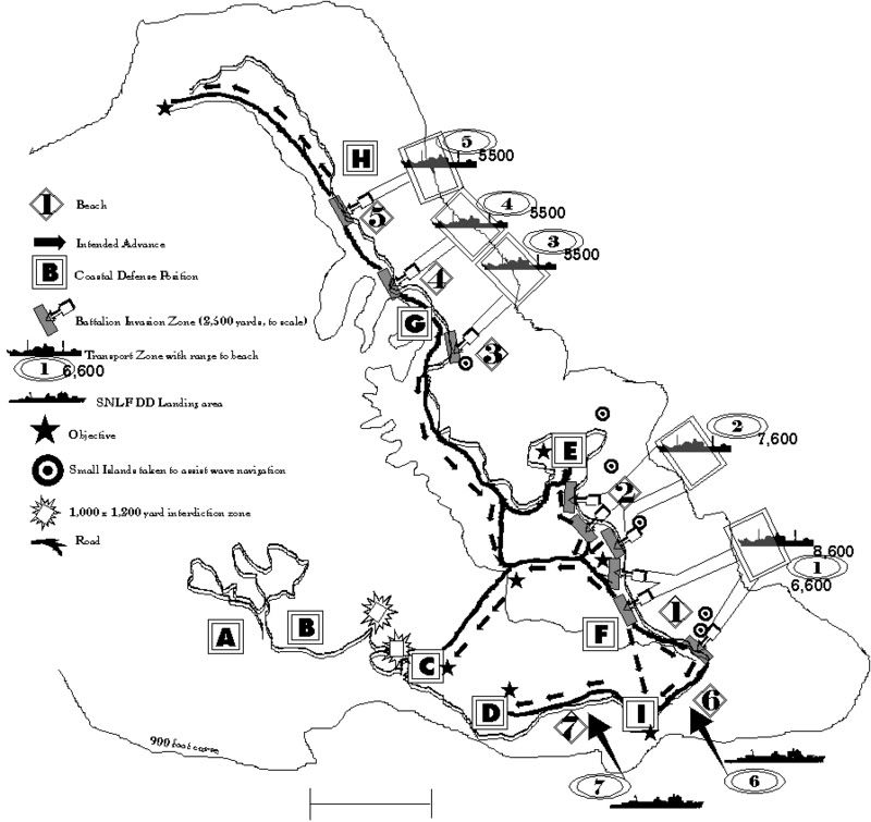
Landing Plan.
Prepatory aerial bombardments commence several weeks prior to invasion (22nd, 23rd, 24th Air Flotillas). Attacks will be dispersed across entire island. Pre-landing bombardments commence 48 hrs prior to landing.
Invasion fleet will demonstrate to the south of Oahu, then pass close to Molokai and travel northwest into designated anchorages off east coast. 16th and 48th Division will land in the Kaneohe Bay region at about 0100 with an initial landing force of around 9 battalions (over 10,000 men). 2/3rds of the force will land south of Kaneohe NAS, 1/3rd north of it. Battalion landing zones are 2,500 yards wide, to disperse defending artillery.
Advanced infantry elements will rapidly penetrate inland, seeking the mountain passes to the southwest, with the ultimate objective of Honolulu. Unit organization at this point would be problematical above the company level, improving as time went on. Despite the seizure navigational reference points, it is expected that attack units will make errors and intermingle. When such navigational problems occur, units will adapt the mission appropriate to their landing location, not their original orders.
Transports will remain outside the 600 foot depth curve until waters closer to shore have been swept of mines.
Transports in south will maintain 40,000+ yard separation from batteries Williston and Hatch from daylight (if these are operational), such that they can rapidly draw out of range if they come under fire. Anticipated range to coastal batteries are:
Williston/Hatch (16") - 35,000 - 39,000 yards.
Closson (12") - 25,000
Randolph, Granger (14"/8" ) - 21,000 / 22,000 yards.
Transport anchorage will be screened at night by smoke.
If the long range guns are already destroyed, then this restriction does not apply, and transports can approach to the 600 foot curve.
Navy SNLF patrol boats will make diversionary landings:
2 (450 men) on Oahu, west coast.
1 (225 men) on Oahu, south coast
1 (225 men) on Oahu, north coast
Remaining Navy SNLF patrol boats will attack in southern sector of east coast near Koko Head.
Battalions in first wave: 9, plus 2,250 SNLF troops = 13,050.
IJA battalion composition: 1,200 men, 70MG, 2 tanks, 18 artillery pieces/mortars, 4 AT guns, 35 x 50mm knee mortars, 5 flamethrowers, 6 vehicles, ammunition, food.
Prepatory Missions.
Unit: Kido Butai.
Date: Commencing X-2.
Mission: Bombardment.
Primary targets: Land based air power. Naval power.
Secondary targets: Coastal defenses. Communications.
Landing day assignment: Counterbattery. Fire support. Deep interdiction.
Unit: Surface naval forces.
Period: Commencing X-2.
Mission: Bombardment
Primary targets: Coastal defenses, Communications choke points and infrastructure. Enemy reserve positions.
Secondary targets: Land based air power. Naval power.
Landing day assignment: Counterybattery. Fire support. Deep interdiction. Force protection.
Interdiction mission is to prevent main defending forces from interfering with the attack on Honolulu. See bombardment zones depicted on map.
Unit: 7th Infantry Division.
Period: X Day or X-1.
Mission: Capture several small islands off east coast of Oahu. Prepare these to function as navigational reference points for subsequent invasion waves.
Unit: 24th, 22nd, 23rd Air Flotillas.
Period: Commencing X-21
Mission:
Reconnaissance: Provide targeting information on Oahu's coastal defenses, defensive positions, aerial forces, supply bases, communications, power generation.
Bombardment: Coastal defenses, air bases, naval base, defensive positions, supply bases, communications, power generation.
Blockade: Maintain surveillance towards United States west coast. Identify and attack reinforcements attempting to contest blockade.
Unit: 6th Fleet (submarines).
Mission: Blockade, surveillance.
Period: Commencing mid December.
Using forward base of operation established at Maui, commence deep patrols off US West Coast (primary target: aircraft carriers). Maintain blockade (local patrols).
Duration.
Preliminary bombardment: 2 days.
Landing: 3 days.
Contingency: If weather conditions prevent the total debarkation of invasion force at Oahu, then residual elements will unload at Maui, and then these elements will stage to Oahu via Molokai. Prior to departure, transport force will provide any addition resources necessary to lift from Molokai to Oahu.
Landing details.
http://www.soest.hawaii.edu/coasts/data ... photo.html
Beach 1
Kailua Beach, Bellows Beach, Waimanalo Beach (a stretch of about 8 miles)
http://www.soest.hawaii.edu/coasts/data ... es/112_wai
manalo_beach.jpg
http://www.soest.hawaii.edu/coasts/data ... es/113_wai
manalo_beach.jpg
Landing force:
4 battalions (4,800 men), plus supporting equipment.
160 Diahatsu equivalents.
Approach to beach: 8,600 yards.
Time to/from beach: .9 hr
2nd Wave arrival time:
Infantry: 3.8 hours
Light artillery: 7.5 hours
Heavy artillery: 11.8 hours
Navigational markers occupied to assist wave navigation.
Small islands Kaohikaipu and Manana
http://www.soest.hawaii.edu/coasts/data ... ana_is.jpg
Objectives:
1) Capture Bellows Field
2) Advance on Koko Point to make contact with SNLF forces landed there.
3) Advance inland towards Honolulu.
Beach 2:
http://www.soest.hawaii.edu/coasts/data ... kailua.jpg
Landing force:
2 battalions (2,400 men), plus supporting equipment.
80 Diahatsu equivalents.
Approach to beach: 7,600 yards.
Time to/from beach: .75 hr
Objectives:
1) Capture Kaneohe Bay Naval Air Station
2) Advance inland and capture high passes.
2nd Wave arrival time:
Infantry: 3.3 hours
Light artillery: 6.4 hours
Heavy artillery: 10 hours
Navigational markers occupied to assist main waves:
Small island: Mokulua, Mokomanu
http://www.soest.hawaii.edu/coasts/data ... slands.jpg
http://www.soest.hawaii.edu/coasts/data ... anu_is.jpg
Beach 3, 4, 5
Beach 3:
http://www.soest.hawaii.edu/coasts/data ... io_pts.jpg
Beach 4:
http://www.soest.hawaii.edu/coasts/data ... na_bay.jpg
Beach 5:
http://www.soest.hawaii.edu/coasts/data ... aluula.jpg
Landing force:
3 battalions (360 men), plus supporting equipment.
120 Diahatsu equivalents.
Approach to beach: about 5,500 yards.
Time to/from beach: about .55hr
Objectives:
1) Advance south of Kaneohe Bay and capture high passes inland.
2) Assist in capture of Kaneohe Bay NAS.
3) Advance north, west along coast as far as possible.
Beach 6
Landing force: 4 SNLF patrol boats (900 men)
Objectives: Capture Koko Head. Advance towards Honolulu.
2nd Wave arrival time: None.
Beach 7
Landing force: 2 SNLF patrol boats (450 men)
Objective: Advance towards Diamond Head.
2nd Wave arrival time: None.
The purpose in landing on Oahu would be to exacerbate the effects of a blockade conducted mainly by airpower from the other islands. Airpower on its own could not prevent the flow of material from the continent to the embattled island, and it is probable that the combination of existing stores on Oahu and those that could be delivered (albeit, at heavy loss in Allied transports) would suffice to prevent a surrender. The most effective means by which this final lifeline could be cut would be to land troops on Oahu and physically occupy positions which would prevent the resupply of the garrison and the civilians on the island.
The deep water ports by which Oahu could be supplied would be Pearl Harbor, Honolulu, and Kaneohe Bay. Should these windpipes be captured or cut, then the the only recourse remaining to the defenders would be to attempt a resupply effort under hostile skies for an army corps and 300,000 people over whatever beaches remained -an impossible task once the existing stockpiles were depleted.
The purpose of a landing would be to achieve the physical occupation or interdiction of, Kaneohe Bay, Honolulu and Pearl Harbor.
Selection of the initial landing site.
Oahu's four shores were not created equal in their usefulness towards facilitating the capture or interdiction of the three Oahu ports. The north shore is the most easily dismissed as a potential landing site. Weather conditions are unrealizable at best and suicidal at worst. The north shore is not anywhere near Kaneohe, Pearl or Honolulu and the route of march via Schofield is easily blocked. It also has a dedicated divisional defense backed by plenty of artillery.
The south shore is also out for the initial landing. While moving in here gains direct access to the entrance to Pearl Harbor and Honolulu, and the weather conditions tend towards superlative, the defenses deployed to contest a landing here were so fearsome that even a division-level assault would probably fail. Furthermore, the available anchorages on the south shore were not such that transports could disembark outside the range of coastal artillery.
The west coast was attractive for a landing on a number of levels. The weather here was the best available, on average (south excepted). The defenses along the west shore weren't of a sufficient strength to prevent a landing. But while the Japanese could undoubtedly get ashore, it is questionable whether they could break out of the difficult mountains that isolate it from the central plain. Without a breakout onto the central plain, the tactical objectives necessary to fulfill the operational conditions of a surrender could not be met - all three harbors on Oahu would still be in American hands and available to unload supplies.
By process of elimination, the invasion occurs on the east coast. The weather, while not as good as along the south, is acceptable. The defenses on the east coast were insufficient to prevent a division-scale landing. An important operational objective could be captured immediately at Kaneohe Bay (with Bellows Field thrown in as an additional bonus). Finally, a second operational objective (Honolulu) was close at hand to the east shore.
Tactics.
Honolulu is the key to the island because from Honolulu communications to and from Pearl Harbor can be interdicted. Because of a quirk of geography, Oahu's premier city and important source of supplies is positioned on the peninsula on the southeast corner of the island. This peninsula in turn is dominated by the Koolau range mountains, which in turn are accessible from sparsely defended Kaneohe Bay. If the Japanese could occupy Honolulu via Kaneohe, then the civilians and garrison of Oahu would be thrown back onto the central plain, largely cut off from the sea with the loss of much of the supplies housed in the city. From Honolulu entry of supply ships into Pearl Harbor could then be prevented, meaning that the conditions necessary for a surrender - the dislocation of the defenders from their base of supply and access to overseas resupply - would have been achieved.
The enclave at Kaneohe, however, is on the wrong side of the Koolau Range, meaning that the attackers would have to traverse very difficult terrain in order to make an approach on Honolulu. In contrast, the defenders could access positions to block this movement more easily, via the landlink that connects Honolulu to Pearl Harbor. It is more likely than not that a fighting front would stabilize short of Honolulu. As predicted by the American army before the war, it is probable that the mountain barrier, so useful to the Japanese in their initial landing, would prevent the capture of Honolulu.
The proposed tactical solution to the problem of the mountain barrier blocking access to Honolulu, Pearl Harbor, and the other bases is to land the IJA 1st Artillery Regiment at Kaneohe with about 105 long range guns and plenty of ammunition, such that all positions on Oahu (except Ewa) could be pounded via saturation artillery barrages from the east side of the island using spotters situated in the mountains and aided by aerial reconnaissance operating from the other islands.
Noteworthy IJA artillery types for the OOB of the 1st Regiment:
www3.plala.or.jp/takihome/artillery.htm
Type.......................Calibre.....Range.....Qty.....Weight......Tar
Model 95(1935)........75mm.....11,700.....261......2,450..........1
Model 90(1930)........75mm.....15,310.....786......3,100..........1
Model 91(1931).......105mm....11,810....1100.....3,300..........1
Model 92(1932).......105mm....19,910.....180......8,220..........2
Model 96(1936).......150mm....12,910.....440......9,130..........1
Model 89(1929).......150mm....21,000.....150......23,000........2
24cm......................240mm...15,310......80.......83,900........1
(Tar - targets are all bases can be reached by this weapon.)
1 = Koko Head to Honolulu plus Aliamanu Crater
2 = All targets in no. 1 plus Wheeler, Schofield, Naval Base, Hickam, Ford
The initial allocation of ammunition for 1st Artillery Regiment's artillery offensive in Tinkerbell is in the order of 185,000 75mm-240mm shells. In comparison to other Japanese island campaigns, this was a heavy commitment (3 times that of the Philippines and 53 times greater than the trickle that reached Guadalcanal),
http://www3.plala.or.jp/takihome/artillery_history.html
Japanese shell usage vs. allocation for Tinkerbell (Phase I).
Type...............Philippines.........Guadalcanal....Oahu (Phase I)
75mm..............24,996......................1,520.............80,000
100/105mm......14,749.......................742...............48,000
155mm............19,736......................1,129.............48,000
240mm.............4,042..........................0.................6,000
Sequence.
The initial landings by the 16th and 48th I.D. secure beach heads on the east coast of the island, capture the deepwater port at Kaneohe, and attempt to cross the mountains to attack Honolulu. The heavy guns of the 1st Artillery Regiment would then be landed at points along the east shore to conduct an artillery offensive aimed at destroying the bases in the interior. The coastal defenses protecting Honolulu would be destroyed by a protracted air and artillery barrage over the course of weeks. With these defenses removed, 2nd I.D. then makes a direct assault on Honolulu with 16th and 48th in support. If successful, then 1st Artillery can re-deploy elements to Honolulu and bombard Pearl Harbor. Four divisions (16th, 48th, 2nd, 7th) are available to continue the offensive onto Hickam and into the naval base.
Landing at Kaneohe
The landing force attacking Kaneohe consists of 29,500 men, 86 artillery pieces, 54 mortars and 300 vehicles, plus some rough-terrain pack mules and supplies. A total of 3,233 Diahatsu equivalents is required to land everything. This force is transported from Japan to the Marshall on 34 transports with an inherent unloading capability of 245 Diahatsu equivalents per run (34*5 = 170 Diahatsu equivalents).
In addition, the 1st Artillery Regiment of 1,256 Diahatsu loads aboard 14 transports (70 Diahatsu equivalents) awaits landing as reinforcements.
Tinkerbell increases the 'punch' of the landing forces by means of attaching the now empty first-wave transports to the invasion forces while all are laying over in the Marshall Islands awaiting the replenishment of the carriers after December 22nd, and also by way of a specialized Diahatsu carrier force. The Hawaii transports (29 ships) add another 145 Diahatsu equivalents (max) to the landing force, plus another 52 in the Diahatsu carrier force - for a grand total of 437 Diahatsu equivalents aboard 80 transport ships. In addition, 7th Infantry will have assembled more transportation assets commandeered from the local economy. The transport force requires 10.27 loads per Daihatsu equivalent to completely disembark the two divisions and the artillery regiment.
From the weather landing tables (see unloading), the average east coast conditions are:
Infantry: 75% efficiency
Light artillery: 39% efficiency
Heavy equipment: 25% efficiency
Load/unload times are budgeted at 30/30 minutes under normal conditions. This is higher than the USMC doctrine,
Time to Load.--The loading times in the tables are based upon debarking under average conditions, using cargo nets over the side of the transports in place of ladders and gangways. An allowance of about 50 percent has been made for delays which are expected under war conditions. the time given includes delays incident to placing the boat alongside transports. The time of loading a boat will carry according to the relative amount of personnel and materiel comprising the load, the facilities of the transport for discharging, the training of the personnel, and the condition of the sea...
http://www.ibiblio.org/hyperwar/USA/ref ... 31-5-1.htm
Landing Plan.
Prepatory aerial bombardments commence several weeks prior to invasion (22nd, 23rd, 24th Air Flotillas). Attacks will be dispersed across entire island. Pre-landing bombardments commence 48 hrs prior to landing.
Invasion fleet will demonstrate to the south of Oahu, then pass close to Molokai and travel northwest into designated anchorages off east coast. 16th and 48th Division will land in the Kaneohe Bay region at about 0100 with an initial landing force of around 9 battalions (over 10,000 men). 2/3rds of the force will land south of Kaneohe NAS, 1/3rd north of it. Battalion landing zones are 2,500 yards wide, to disperse defending artillery.
Advanced infantry elements will rapidly penetrate inland, seeking the mountain passes to the southwest, with the ultimate objective of Honolulu. Unit organization at this point would be problematical above the company level, improving as time went on. Despite the seizure navigational reference points, it is expected that attack units will make errors and intermingle. When such navigational problems occur, units will adapt the mission appropriate to their landing location, not their original orders.
Transports will remain outside the 600 foot depth curve until waters closer to shore have been swept of mines.
Transports in south will maintain 40,000+ yard separation from batteries Williston and Hatch from daylight (if these are operational), such that they can rapidly draw out of range if they come under fire. Anticipated range to coastal batteries are:
Williston/Hatch (16") - 35,000 - 39,000 yards.
Closson (12") - 25,000
Randolph, Granger (14"/8" ) - 21,000 / 22,000 yards.
Transport anchorage will be screened at night by smoke.
If the long range guns are already destroyed, then this restriction does not apply, and transports can approach to the 600 foot curve.
Navy SNLF patrol boats will make diversionary landings:
2 (450 men) on Oahu, west coast.
1 (225 men) on Oahu, south coast
1 (225 men) on Oahu, north coast
Remaining Navy SNLF patrol boats will attack in southern sector of east coast near Koko Head.
Battalions in first wave: 9, plus 2,250 SNLF troops = 13,050.
IJA battalion composition: 1,200 men, 70MG, 2 tanks, 18 artillery pieces/mortars, 4 AT guns, 35 x 50mm knee mortars, 5 flamethrowers, 6 vehicles, ammunition, food.
Prepatory Missions.
Unit: Kido Butai.
Date: Commencing X-2.
Mission: Bombardment.
Primary targets: Land based air power. Naval power.
Secondary targets: Coastal defenses. Communications.
Landing day assignment: Counterbattery. Fire support. Deep interdiction.
Unit: Surface naval forces.
Period: Commencing X-2.
Mission: Bombardment
Primary targets: Coastal defenses, Communications choke points and infrastructure. Enemy reserve positions.
Secondary targets: Land based air power. Naval power.
Landing day assignment: Counterybattery. Fire support. Deep interdiction. Force protection.
Interdiction mission is to prevent main defending forces from interfering with the attack on Honolulu. See bombardment zones depicted on map.
Unit: 7th Infantry Division.
Period: X Day or X-1.
Mission: Capture several small islands off east coast of Oahu. Prepare these to function as navigational reference points for subsequent invasion waves.
Unit: 24th, 22nd, 23rd Air Flotillas.
Period: Commencing X-21
Mission:
Reconnaissance: Provide targeting information on Oahu's coastal defenses, defensive positions, aerial forces, supply bases, communications, power generation.
Bombardment: Coastal defenses, air bases, naval base, defensive positions, supply bases, communications, power generation.
Blockade: Maintain surveillance towards United States west coast. Identify and attack reinforcements attempting to contest blockade.
Unit: 6th Fleet (submarines).
Mission: Blockade, surveillance.
Period: Commencing mid December.
Using forward base of operation established at Maui, commence deep patrols off US West Coast (primary target: aircraft carriers). Maintain blockade (local patrols).
Duration.
Preliminary bombardment: 2 days.
Landing: 3 days.
Contingency: If weather conditions prevent the total debarkation of invasion force at Oahu, then residual elements will unload at Maui, and then these elements will stage to Oahu via Molokai. Prior to departure, transport force will provide any addition resources necessary to lift from Molokai to Oahu.
Landing details.
http://www.soest.hawaii.edu/coasts/data ... photo.html
Beach 1
Kailua Beach, Bellows Beach, Waimanalo Beach (a stretch of about 8 miles)
http://www.soest.hawaii.edu/coasts/data ... es/112_wai
manalo_beach.jpg
http://www.soest.hawaii.edu/coasts/data ... es/113_wai
manalo_beach.jpg
Landing force:
4 battalions (4,800 men), plus supporting equipment.
160 Diahatsu equivalents.
Approach to beach: 8,600 yards.
Time to/from beach: .9 hr
2nd Wave arrival time:
Infantry: 3.8 hours
Light artillery: 7.5 hours
Heavy artillery: 11.8 hours
Navigational markers occupied to assist wave navigation.
Small islands Kaohikaipu and Manana
http://www.soest.hawaii.edu/coasts/data ... ana_is.jpg
Objectives:
1) Capture Bellows Field
2) Advance on Koko Point to make contact with SNLF forces landed there.
3) Advance inland towards Honolulu.
Beach 2:
http://www.soest.hawaii.edu/coasts/data ... kailua.jpg
Landing force:
2 battalions (2,400 men), plus supporting equipment.
80 Diahatsu equivalents.
Approach to beach: 7,600 yards.
Time to/from beach: .75 hr
Objectives:
1) Capture Kaneohe Bay Naval Air Station
2) Advance inland and capture high passes.
2nd Wave arrival time:
Infantry: 3.3 hours
Light artillery: 6.4 hours
Heavy artillery: 10 hours
Navigational markers occupied to assist main waves:
Small island: Mokulua, Mokomanu
http://www.soest.hawaii.edu/coasts/data ... slands.jpg
http://www.soest.hawaii.edu/coasts/data ... anu_is.jpg
Beach 3, 4, 5
Beach 3:
http://www.soest.hawaii.edu/coasts/data ... io_pts.jpg
Beach 4:
http://www.soest.hawaii.edu/coasts/data ... na_bay.jpg
Beach 5:
http://www.soest.hawaii.edu/coasts/data ... aluula.jpg
Landing force:
3 battalions (360 men), plus supporting equipment.
120 Diahatsu equivalents.
Approach to beach: about 5,500 yards.
Time to/from beach: about .55hr
Objectives:
1) Advance south of Kaneohe Bay and capture high passes inland.
2) Assist in capture of Kaneohe Bay NAS.
3) Advance north, west along coast as far as possible.
Beach 6
Landing force: 4 SNLF patrol boats (900 men)
Objectives: Capture Koko Head. Advance towards Honolulu.
2nd Wave arrival time: None.
Beach 7
Landing force: 2 SNLF patrol boats (450 men)
Objective: Advance towards Diamond Head.
2nd Wave arrival time: None.